STS062-113-148
| NASA Photo ID | STS062-113-148 |
| Focal Length | 250mm |
| Date taken | 1994.03.17 |
| Time taken | 04:47:29 GMT |
Resolutions offered for this image:
3904 x 3904 pixels 639 x 639 pixels 5700 x 6000 pixels 500 x 526 pixels 640 x 480 pixels
3904 x 3904 pixels 639 x 639 pixels 5700 x 6000 pixels 500 x 526 pixels 640 x 480 pixels

Cloud masks available for this image:
Spacecraft nadir point: 30.8° S, 145.9° E
Photo center point: 30.5° S, 145.0° E
Photo center point by machine learning:
Photo center point: 30.5° S, 145.0° E
Photo center point by machine learning:
Nadir to Photo Center: West
Spacecraft Altitude: 136 nautical miles (252km)
Country or Geographic Name: | AUSTRALIA-Q |
Features: | DARLING R. VA., WARREGO R |
| Features Found Using Machine Learning: | |
Cloud Cover Percentage: | 0 (no clouds present) |
Sun Elevation Angle: | 45° |
Sun Azimuth: | 304° |
Camera: | Hasselblad |
Focal Length: | 250mm |
Camera Tilt: | 23 degrees |
Format: | VELVI: Fuji, natural color positive, Velvia 50, CS 135-36, ASA 32, standard base |
Film Exposure: | Normal |
| Additional Information | |
| Width | Height | Annotated | Cropped | Purpose | Links |
|---|---|---|---|---|---|
| 3904 pixels | 3904 pixels | No | No | Earth From Space collection | Download Image |
| 639 pixels | 639 pixels | No | No | Earth From Space collection | Download Image |
| 5700 pixels | 6000 pixels | No | No | Download Image | |
| 500 pixels | 526 pixels | No | No | Download Image | |
| 640 pixels | 480 pixels | No | No | Download Image |
Download Packaged File
Download a Google Earth KML for this Image
View photo footprint information
Download a GeoTIFF for this photo
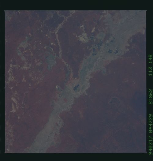
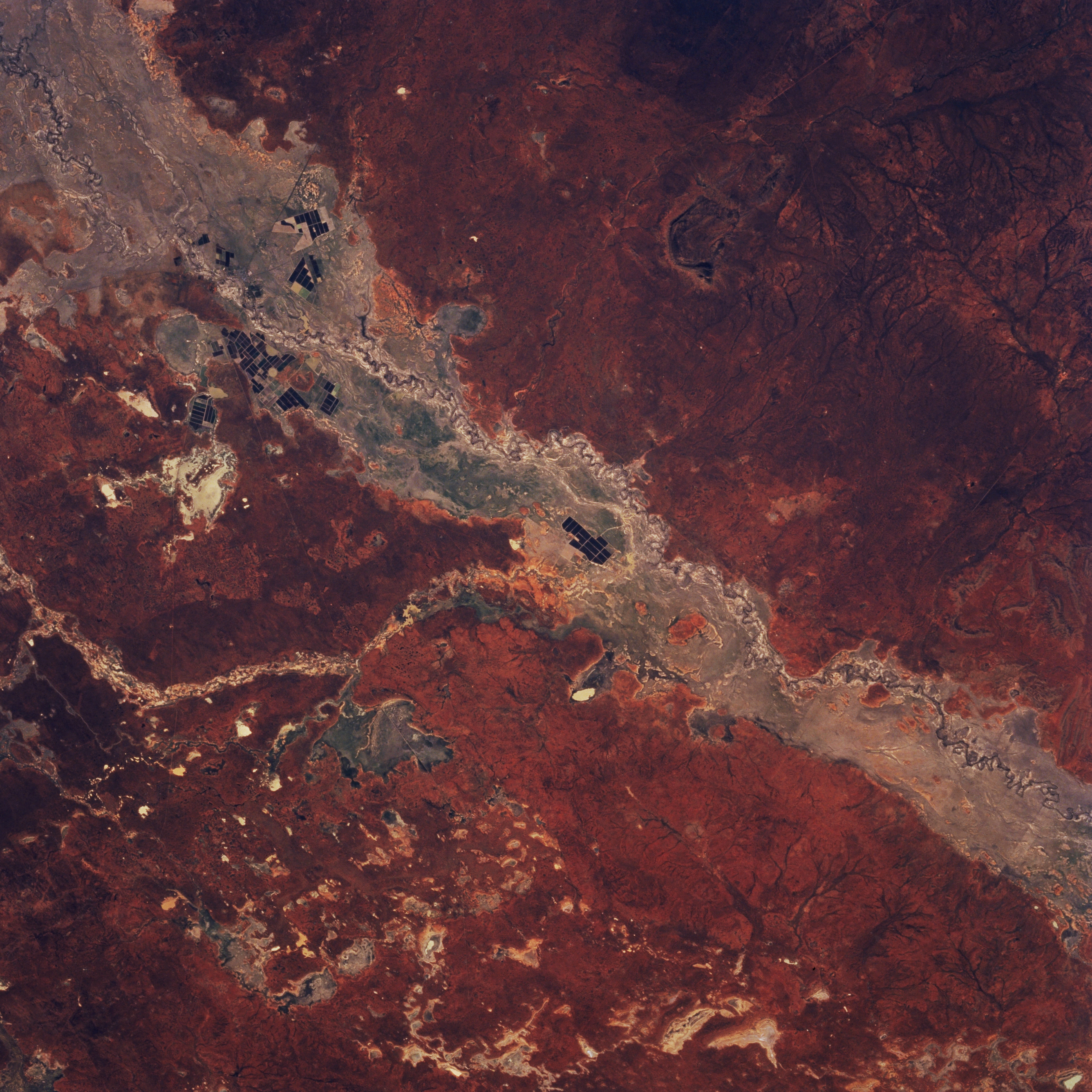
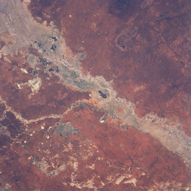
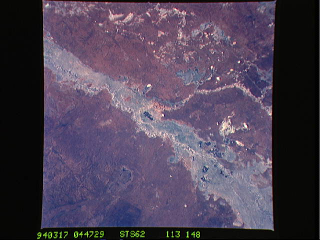
Image Caption: STS062-113-148 Darling River, New South Wales, Australia March 1994
A small section of the Darling River and its broad floodplain is visible in this northeast view of north central New South Wales. The Darling is the longest river (1700 miles--2736 kilometers) in Australia. On this picture the south draining Warrego (the more narrow floodplain) enters the southwesterly flowing Darling near the center of the picture. The small, dark, rectangular patterns on the Darling floodplain are irrigated croplands, producing mainly citrus fruits and cotton. Overall the region is a semiarid plain, although Mount Gunderbooka (dark feature) at 1629 feet (497 meters) is barely visible southeast of the Darling River (upper right corner). Most of the land elevations range between 350 to 450 feet (107 to 137 meters) above sea level. Several very small dry lake beds (lighter-colored features) can be seen scattered across the terrain north of the Darling.
A small section of the Darling River and its broad floodplain is visible in this northeast view of north central New South Wales. The Darling is the longest river (1700 miles--2736 kilometers) in Australia. On this picture the south draining Warrego (the more narrow floodplain) enters the southwesterly flowing Darling near the center of the picture. The small, dark, rectangular patterns on the Darling floodplain are irrigated croplands, producing mainly citrus fruits and cotton. Overall the region is a semiarid plain, although Mount Gunderbooka (dark feature) at 1629 feet (497 meters) is barely visible southeast of the Darling River (upper right corner). Most of the land elevations range between 350 to 450 feet (107 to 137 meters) above sea level. Several very small dry lake beds (lighter-colored features) can be seen scattered across the terrain north of the Darling.
