STS062-104-9

| NASA Photo ID | STS062-104-9 |
| Focal Length | 250mm |
| Date taken | 1994.03.07 |
| Time taken | 14:19:14 GMT |
Resolutions offered for this image:
3904 x 3904 pixels 639 x 639 pixels 5700 x 5900 pixels 500 x 518 pixels 640 x 480 pixels
3904 x 3904 pixels 639 x 639 pixels 5700 x 5900 pixels 500 x 518 pixels 640 x 480 pixels


Cloud masks available for this image:
Spacecraft nadir point: 32.0° N, 100.9° W
Photo center point: 31.5° N, 100.5° W
Photo center point by machine learning:
Photo center point: 31.5° N, 100.5° W
Photo center point by machine learning:
Nadir to Photo Center: Southeast
Spacecraft Altitude: 160 nautical miles (296km)
Country or Geographic Name: | USA-TEXAS |
Features: | SAN ANGELO |
| Features Found Using Machine Learning: | |
Cloud Cover Percentage: | 0 (no clouds present) |
Sun Elevation Angle: | 15° |
Sun Azimuth: | 106° |
Camera: | Hasselblad |
Focal Length: | 250mm |
Camera Tilt: | 13 degrees |
Format: | 5048: Kodak, natural color positive, Lumiere 100x/5048, ASA 100x, standard base |
Film Exposure: | Normal |
| Additional Information | |
| Width | Height | Annotated | Cropped | Purpose | Links |
|---|---|---|---|---|---|
| 3904 pixels | 3904 pixels | No | No | Earth From Space collection | Download Image |
| 639 pixels | 639 pixels | No | No | Earth From Space collection | Download Image |
| 5700 pixels | 5900 pixels | No | No | Download Image | |
| 500 pixels | 518 pixels | No | No | Download Image | |
| 640 pixels | 480 pixels | No | No | Download Image |
Download Packaged File
Download a Google Earth KML for this Image
View photo footprint information
Download a GeoTIFF for this photo
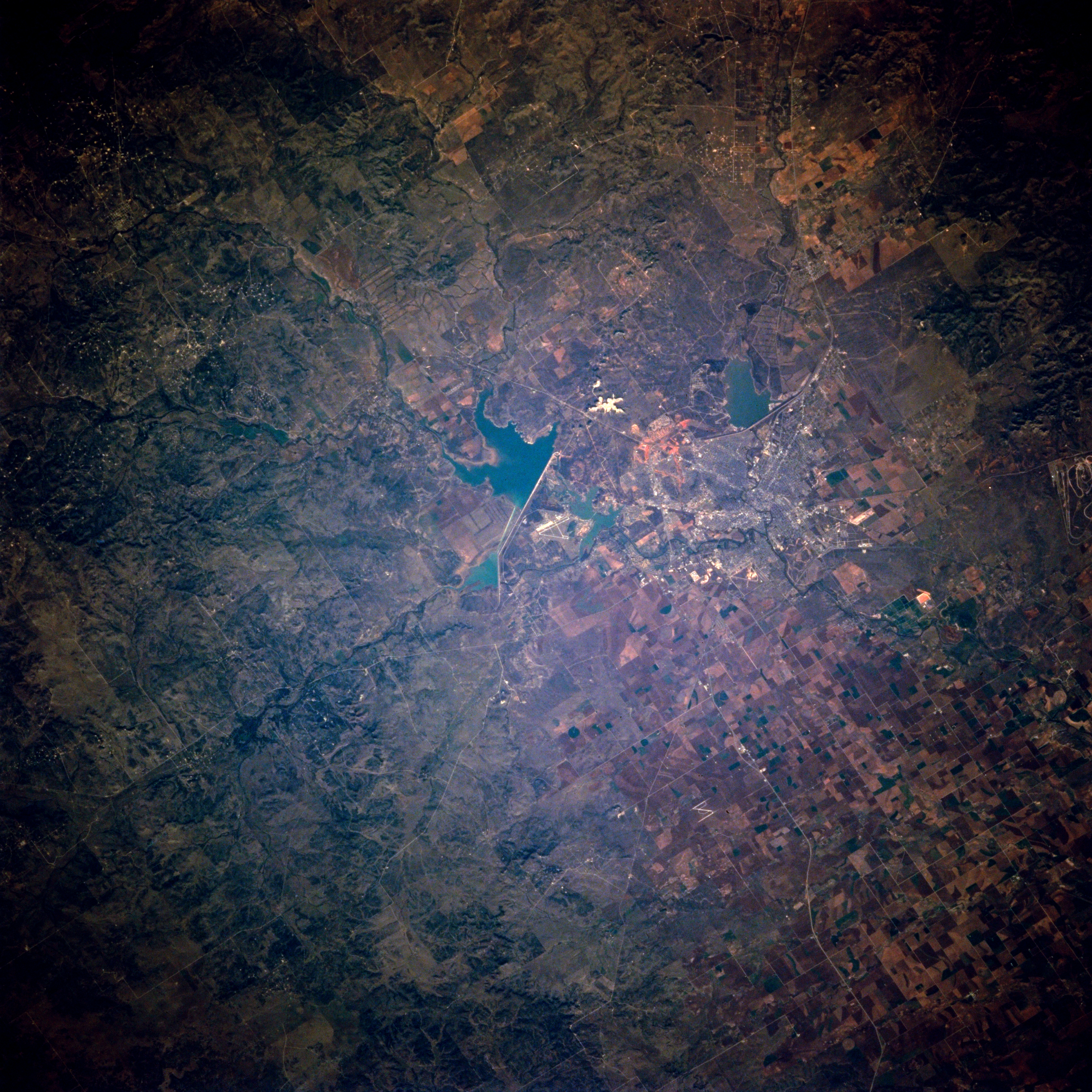
Image Caption: STS062-104-009 San Angelo, Texas, U.S.A. March 1994
Situated between large Twin Buttes Reservoir and smaller O. C. Fisher Lake is San Angelo, a west-central Texas city on the Edwards Plateau. Visible are numerous streams that feed Twin Buttes Reservoir; the dam, which appears as a white linear feature on the northeast side of the reservoir; and numerous cultivated fields east of San Angelo within the Concho River drainage basin.
Situated between large Twin Buttes Reservoir and smaller O. C. Fisher Lake is San Angelo, a west-central Texas city on the Edwards Plateau. Visible are numerous streams that feed Twin Buttes Reservoir; the dam, which appears as a white linear feature on the northeast side of the reservoir; and numerous cultivated fields east of San Angelo within the Concho River drainage basin.
