STS062-103-40

| NASA Photo ID | STS062-103-40 |
| Focal Length | 250mm |
| Date taken | 1994.03.15 |
| Time taken | 15:12:33 GMT |
Resolutions offered for this image:
3904 x 3904 pixels 639 x 639 pixels 5700 x 5900 pixels 500 x 518 pixels 640 x 480 pixels
3904 x 3904 pixels 639 x 639 pixels 5700 x 5900 pixels 500 x 518 pixels 640 x 480 pixels
Cloud masks available for this image:
Spacecraft nadir point: 26.1° N, 82.3° W
Photo center point: 26.0° N, 80.0° W
Photo center point by machine learning:
Photo center point: 26.0° N, 80.0° W
Photo center point by machine learning:
Nadir to Photo Center: East
Spacecraft Altitude: 140 nautical miles (259km)
Country or Geographic Name: | USA-FLORIDA |
Features: | FORT LAUDERDALE |
| Features Found Using Machine Learning: | |
Cloud Cover Percentage: | 5 (1-10)% |
Sun Elevation Angle: | 45° |
Sun Azimuth: | 123° |
Camera: | Hasselblad |
Focal Length: | 250mm |
Camera Tilt: | 45 degrees |
Format: | 5048: Kodak, natural color positive, Lumiere 100x/5048, ASA 100x, standard base |
Film Exposure: | Normal |
| Additional Information | |
| Width | Height | Annotated | Cropped | Purpose | Links |
|---|---|---|---|---|---|
| 3904 pixels | 3904 pixels | No | No | Earth From Space collection | Download Image |
| 639 pixels | 639 pixels | No | No | Earth From Space collection | Download Image |
| 5700 pixels | 5900 pixels | No | No | Download Image | |
| 500 pixels | 518 pixels | No | No | Download Image | |
| 640 pixels | 480 pixels | No | No | Download Image |
Download Packaged File
Download a Google Earth KML for this Image
View photo footprint information
Download a GeoTIFF for this photo
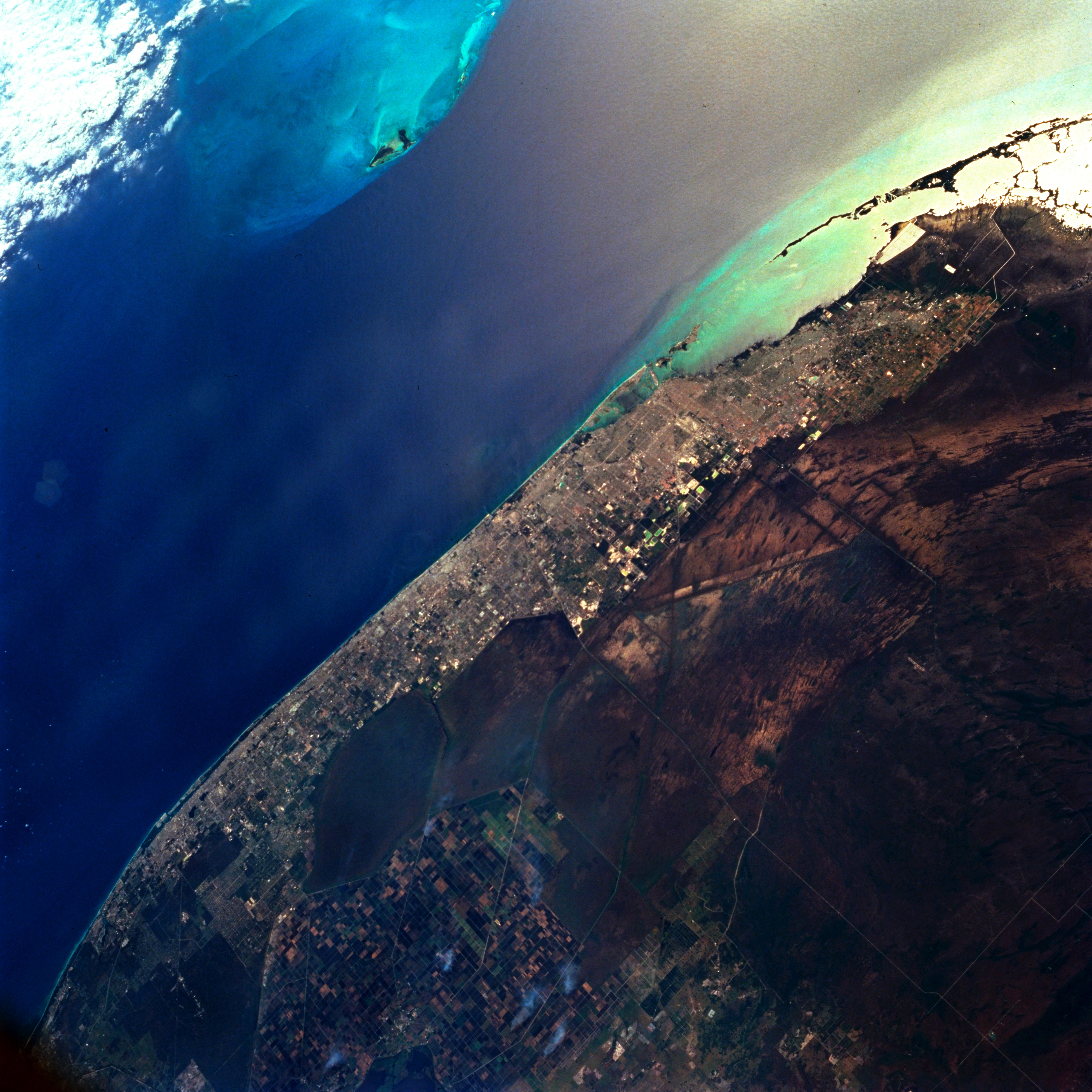
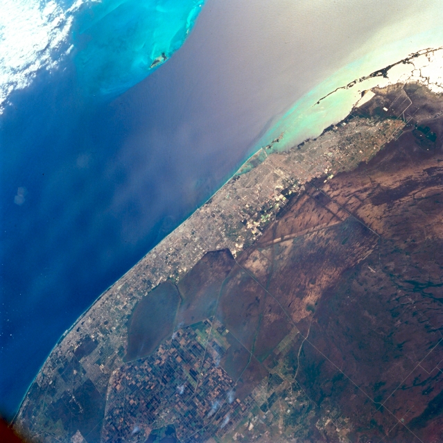
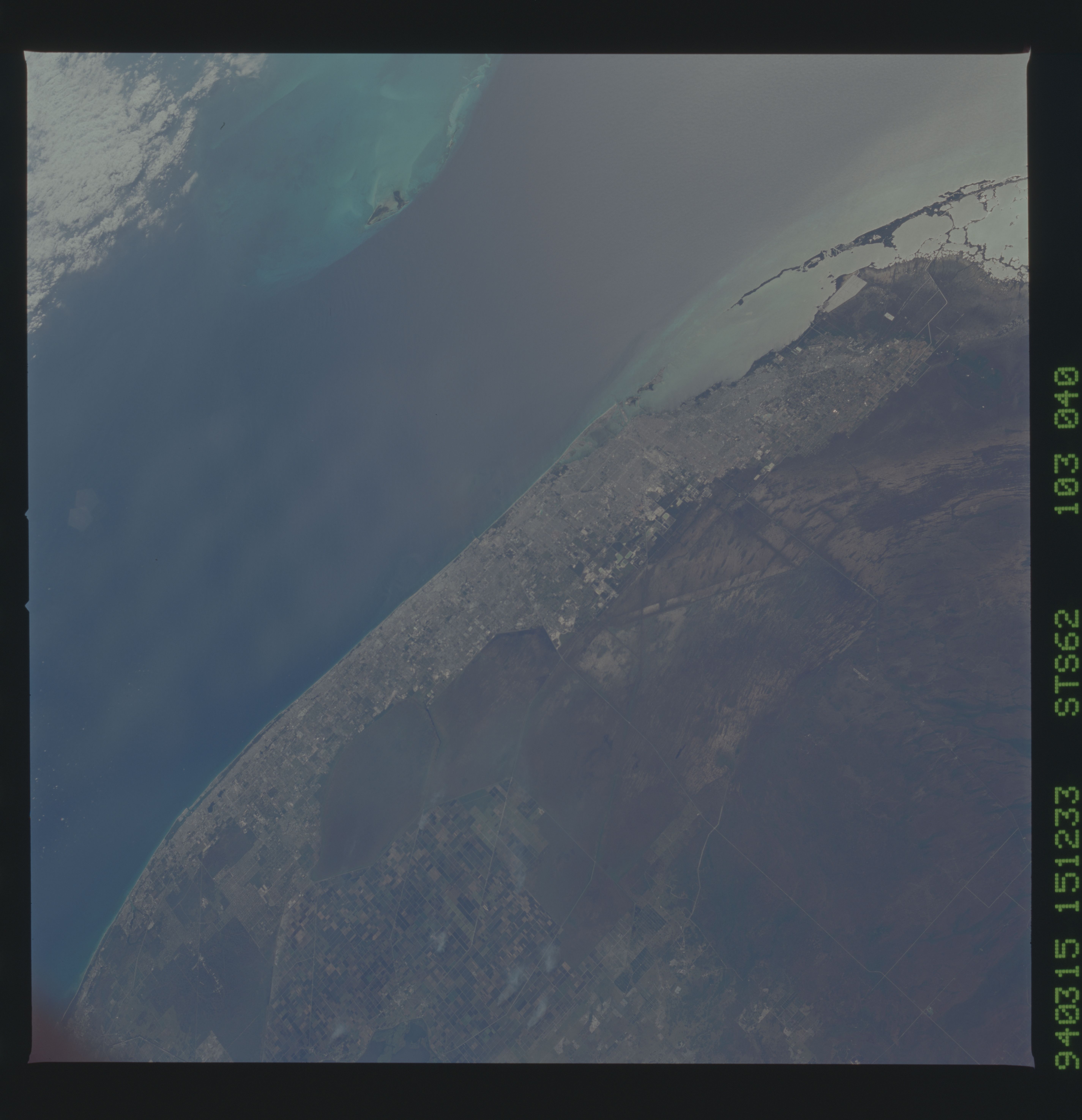
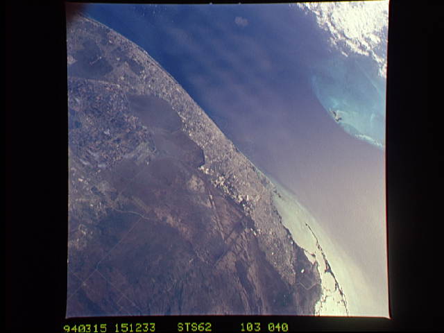
Image Caption: STS062-103-040 Southeast Florida, U.S.A. March 1994
A dramatic visual difference exists between the densely populated (highly reflective) coastal area of southeast Florida and the natural swamp environment of The Everglades west of the urban corridor. The direction of surface water flow through the saw grass and hardwood hammocks of The Everglades (generally north-northeast to south-southwest) can be determined by observing the alignment of scattered hardwood stands (darker streaks) throughout The Everglades. The angular, uniform area east of the smoke palls (bottom center) shows the outline of the Arthur R. Marshall-Loxahatchee National Wildlife Refuge. The small dark spots in the light, shallow water (near top center) are the Bimini Islands of The Bahamas; the darker, deeper water shows the north-flowing Gulf Stream. Sunglint appears in the upper right corner.
A dramatic visual difference exists between the densely populated (highly reflective) coastal area of southeast Florida and the natural swamp environment of The Everglades west of the urban corridor. The direction of surface water flow through the saw grass and hardwood hammocks of The Everglades (generally north-northeast to south-southwest) can be determined by observing the alignment of scattered hardwood stands (darker streaks) throughout The Everglades. The angular, uniform area east of the smoke palls (bottom center) shows the outline of the Arthur R. Marshall-Loxahatchee National Wildlife Refuge. The small dark spots in the light, shallow water (near top center) are the Bimini Islands of The Bahamas; the darker, deeper water shows the north-flowing Gulf Stream. Sunglint appears in the upper right corner.
