STS062-101-34
| NASA Photo ID | STS062-101-34 |
| Focal Length | 250mm |
| Date taken | 1994.03.14 |
| Time taken | 06:47:02 GMT |
Resolutions offered for this image:
3936 x 3840 pixels 639 x 624 pixels 5700 x 5900 pixels 500 x 518 pixels 640 x 480 pixels
3936 x 3840 pixels 639 x 624 pixels 5700 x 5900 pixels 500 x 518 pixels 640 x 480 pixels
Cloud masks available for this image:
Spacecraft nadir point: 32.8° S, 143.9° E
Photo center point: 32.5° S, 142.5° E
Photo center point by machine learning:
Photo center point: 32.5° S, 142.5° E
Photo center point by machine learning:
Nadir to Photo Center: West
Spacecraft Altitude: 163 nautical miles (302km)
Country or Geographic Name: | AUSTRALIA-NSW |
Features: | TANDAU & MININDEE LAKES |
| Features Found Using Machine Learning: | |
Cloud Cover Percentage: | 0 (no clouds present) |
Sun Elevation Angle: | 24° |
Sun Azimuth: | 283° |
Camera: | Hasselblad |
Focal Length: | 250mm |
Camera Tilt: | 28 degrees |
Format: | 5048: Kodak, natural color positive, Lumiere 100x/5048, ASA 100x, standard base |
Film Exposure: | Normal |
| Additional Information | |
| Width | Height | Annotated | Cropped | Purpose | Links |
|---|---|---|---|---|---|
| 3936 pixels | 3840 pixels | No | No | Earth From Space collection | Download Image |
| 639 pixels | 624 pixels | No | No | Earth From Space collection | Download Image |
| 5700 pixels | 5900 pixels | No | No | Download Image | |
| 500 pixels | 518 pixels | No | No | Download Image | |
| 640 pixels | 480 pixels | No | No | Download Image |
Download Packaged File
Download a Google Earth KML for this Image
View photo footprint information
Download a GeoTIFF for this photo
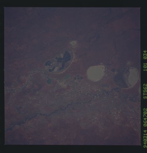
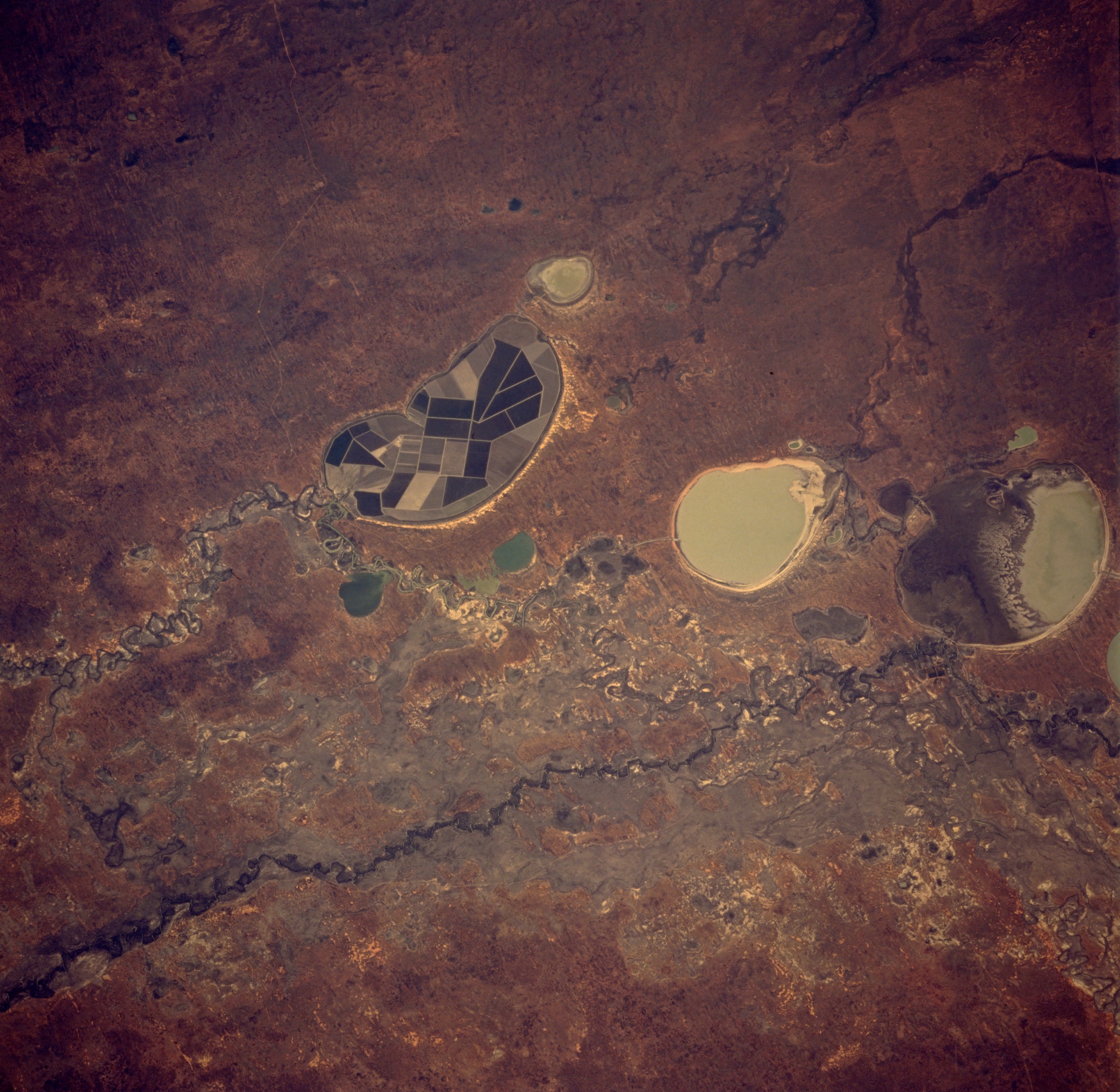
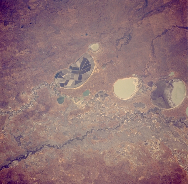
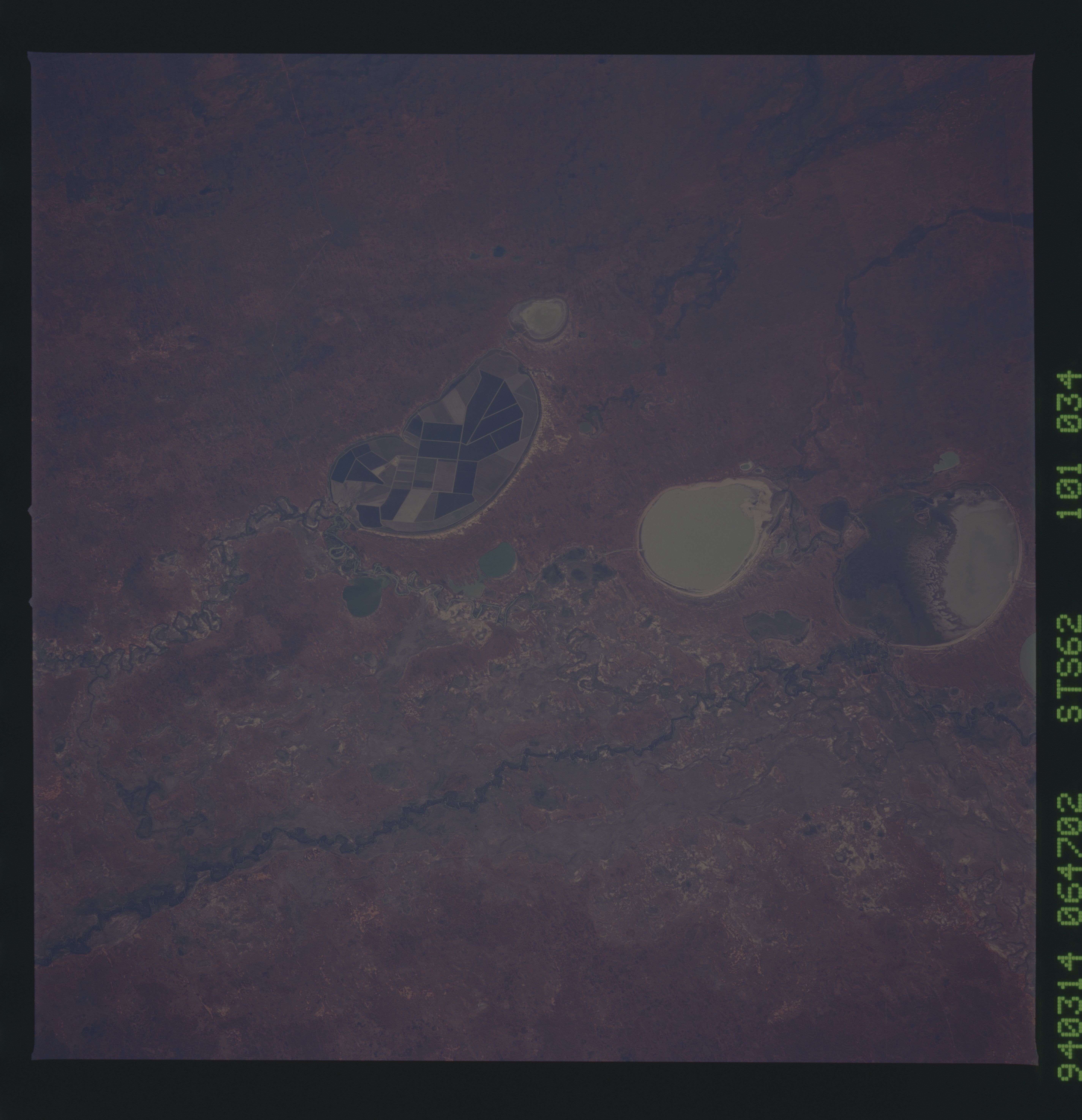
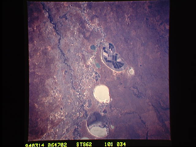
Image Caption: STS062-101-034 Lake Tandou, New South Wales, Australia March 1994
Located in the Darling River drainage basin, Lake Tandou (formerly a dry lake bed) is an important agricultural site in this semiarid environment of west central New South Wales. Notice that Lake Tandou has a number of discreet field patterns across the entire extent of the former dry lake bed. This lake is being used to grow a variety of crops, such as cotton, cereal grains, and sunflowers by applying pioneering, sophisticated fertigation techniques. The technique combines intensive irrigation and enhanced fertilizers and involves the drip method of irrigation. Clearly this food-production system is important in water deficient farming areas and in this situation the water used by the project is continuously recycled. The dark winding feature that traverses the bottom of the picture is the Darling River and it's densely vegetated banks. The other two large, oval-shaped lakes are Lake Cawndilla and Menindee Lake (northernmost lake). Several smaller, generally oval-shaped lakes are also visible.
Located in the Darling River drainage basin, Lake Tandou (formerly a dry lake bed) is an important agricultural site in this semiarid environment of west central New South Wales. Notice that Lake Tandou has a number of discreet field patterns across the entire extent of the former dry lake bed. This lake is being used to grow a variety of crops, such as cotton, cereal grains, and sunflowers by applying pioneering, sophisticated fertigation techniques. The technique combines intensive irrigation and enhanced fertilizers and involves the drip method of irrigation. Clearly this food-production system is important in water deficient farming areas and in this situation the water used by the project is continuously recycled. The dark winding feature that traverses the bottom of the picture is the Darling River and it's densely vegetated banks. The other two large, oval-shaped lakes are Lake Cawndilla and Menindee Lake (northernmost lake). Several smaller, generally oval-shaped lakes are also visible.
