STS061-93-12
| NASA Photo ID | STS061-93-12 |
| Focal Length | 40mm |
| Date taken | 1993.12.04 |
| Time taken | 06:24:43 GMT |
Resolutions offered for this image:
5700 x 5900 pixels 500 x 518 pixels 640 x 480 pixels 3994 x 3994 pixels 1902 x 1181 pixels 3994 x 3994 pixels 540 x 335 pixels
5700 x 5900 pixels 500 x 518 pixels 640 x 480 pixels 3994 x 3994 pixels 1902 x 1181 pixels 3994 x 3994 pixels 540 x 335 pixels


Cloud masks available for this image:
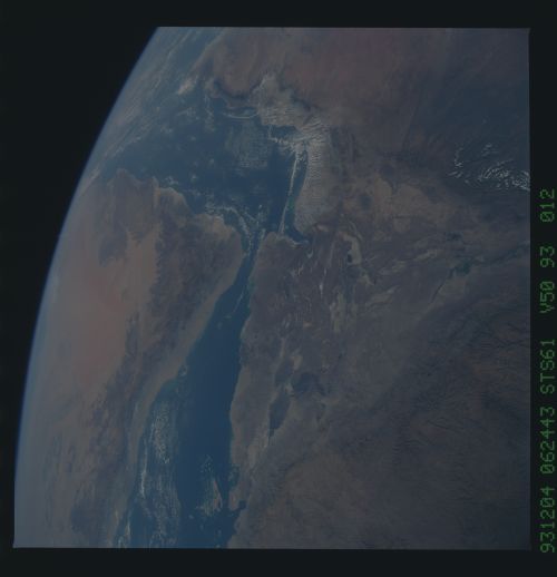
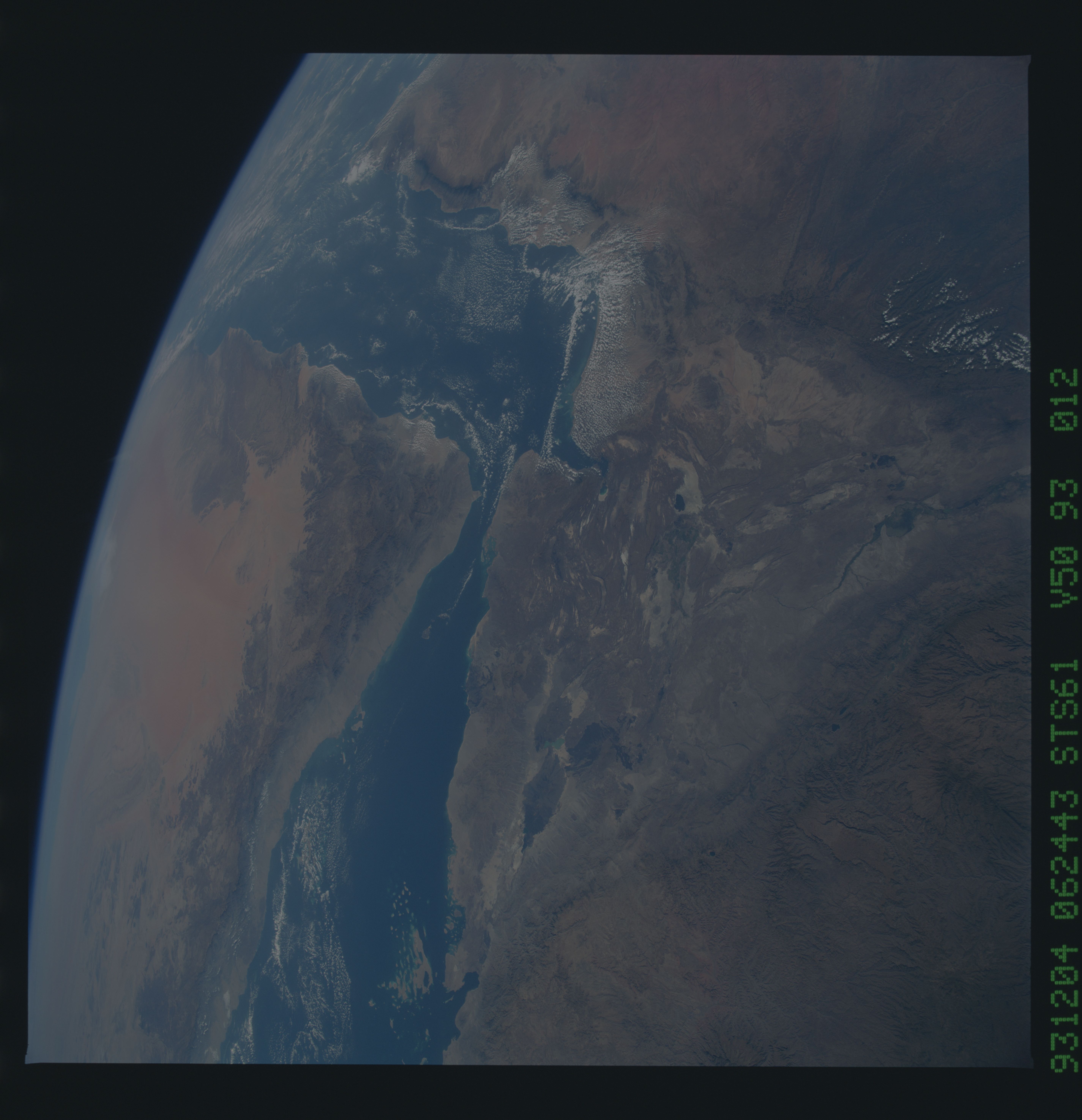
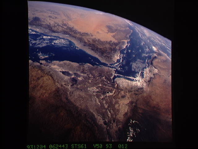
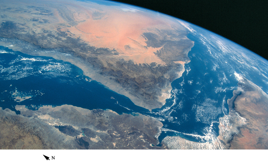
Spacecraft nadir point: 9.7° N, 40.3° E
Photo center point: 13.0° N, 42.0° E
Photo center point by machine learning:
Photo center point: 13.0° N, 42.0° E
Photo center point by machine learning:
Nadir to Photo Center: Northeast
Spacecraft Altitude: 314 nautical miles (582km)
Country or Geographic Name: | ETHIOPIA |
Features: | ETHIOPIAN PLT., RED SEA |
| Features Found Using Machine Learning: | |
Cloud Cover Percentage: | 5 (1-10)% |
Sun Elevation Angle: | 39° |
Sun Azimuth: | 129° |
Camera: | Hasselblad |
Focal Length: | 40mm |
Camera Tilt: | High Oblique |
Format: | VELVI: Fuji, natural color positive, Velvia 50, CS 135-36, ASA 32, standard base |
Film Exposure: | Normal |
| Additional Information | |
| Width | Height | Annotated | Cropped | Purpose | Links |
|---|---|---|---|---|---|
| 5700 pixels | 5900 pixels | No | No | Download Image | |
| 500 pixels | 518 pixels | No | No | Download Image | |
| 640 pixels | 480 pixels | No | No | Download Image | |
| 3994 pixels | 3994 pixels | No | No | Coral Reef Atlas Publication | Download Image |
| 1902 pixels | 1181 pixels | Yes | Yes | Publisher Request | Download Image |
| 3994 pixels | 3994 pixels | No | No | Download Image | |
| 540 pixels | 335 pixels | Yes | Yes | Publisher Request | Download Image |
Download Packaged File
Download a Google Earth KML for this Image
View photo footprint information
Download a GeoTIFF for this photo
Image Caption: The southern Red Sea, including the narrow straits of Bab el Mandeb, with the Gulf of Aden [STS061-93-12, 1993].
