STS060-93-82
| NASA Photo ID | STS060-93-82 |
| Focal Length | 250mm |
| Date taken | 1994.02.09 |
| Time taken | 21:17:38 GMT |
Resolutions offered for this image:
3872 x 3936 pixels 629 x 639 pixels 5700 x 5900 pixels 500 x 518 pixels 640 x 480 pixels
3872 x 3936 pixels 629 x 639 pixels 5700 x 5900 pixels 500 x 518 pixels 640 x 480 pixels


Cloud masks available for this image:
Spacecraft nadir point: 30.0° N, 113.6° W
Photo center point: 32.5° N, 114.5° W
Photo center point by machine learning:
Photo center point: 32.5° N, 114.5° W
Photo center point by machine learning:
Nadir to Photo Center: North
Spacecraft Altitude: 192 nautical miles (356km)
Country or Geographic Name: | USA-ARIZONA |
Features: | YUMA AREA |
| Features Found Using Machine Learning: | |
Cloud Cover Percentage: | 0 (no clouds present) |
Sun Elevation Angle: | 41° |
Sun Azimuth: | 209° |
Camera: | Hasselblad |
Focal Length: | 250mm |
Camera Tilt: | 40 degrees |
Format: | 5017: Kodak, natural color positive, Ektachrome, X Professional, ASA 64, standard base |
Film Exposure: | Normal |
| Additional Information | |
| Width | Height | Annotated | Cropped | Purpose | Links |
|---|---|---|---|---|---|
| 3872 pixels | 3936 pixels | No | No | Earth From Space collection | Download Image |
| 629 pixels | 639 pixels | No | No | Earth From Space collection | Download Image |
| 5700 pixels | 5900 pixels | No | No | Download Image | |
| 500 pixels | 518 pixels | No | No | Download Image | |
| 640 pixels | 480 pixels | No | No | Download Image |
Download Packaged File
Download a Google Earth KML for this Image
View photo footprint information
Download a GeoTIFF for this photo
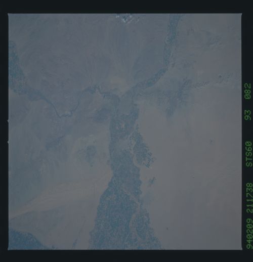
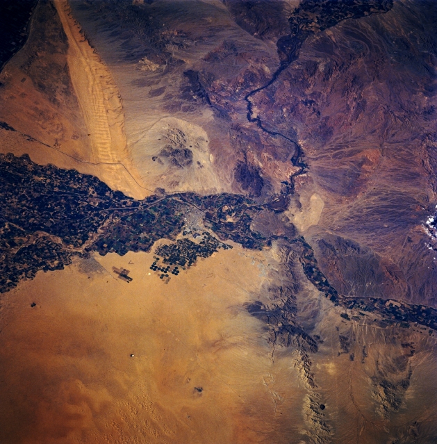
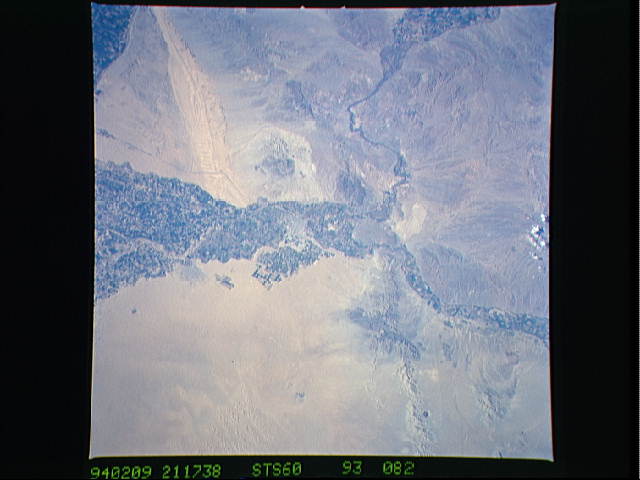
Image Caption: STS060-093-082 Yuma, Arizona, U.S.A. February 1994
This photograph of part of the Sonoran Desert, which includes southeastern California, southwestern Arizona, and a small section of Mexico, shows the great extent of crop irrigation in the floodplains of the Colorado and Gila Rivers. The outline of the small desert city of Yuma and some circular center-pivot irrigated fields to its south are discernible near the center of the photograph. Several natural features are visible--the elongated northwest-southeast-trending Sand Hills in southeast California; the merging east of Yuma of the west-flowing Gila River and the south-flowing Colorado River; and the low, heavily mined Gila Mountains southeast of Yuma.
This photograph of part of the Sonoran Desert, which includes southeastern California, southwestern Arizona, and a small section of Mexico, shows the great extent of crop irrigation in the floodplains of the Colorado and Gila Rivers. The outline of the small desert city of Yuma and some circular center-pivot irrigated fields to its south are discernible near the center of the photograph. Several natural features are visible--the elongated northwest-southeast-trending Sand Hills in southeast California; the merging east of Yuma of the west-flowing Gila River and the south-flowing Colorado River; and the low, heavily mined Gila Mountains southeast of Yuma.
