STS060-84-56
| NASA Photo ID | STS060-84-56 |
| Focal Length | 250mm |
| Date taken | 1994.02.__ |
| Time taken | GMT |
Resolutions offered for this image:
4096 x 4096 pixels 640 x 640 pixels 5700 x 5900 pixels 500 x 518 pixels 640 x 480 pixels 2633 x 2511 pixels 2663 x 2551 pixels 1902 x 1181 pixels 6867 x 6858 pixels 5111 x 5141 pixels 540 x 335 pixels
4096 x 4096 pixels 640 x 640 pixels 5700 x 5900 pixels 500 x 518 pixels 640 x 480 pixels 2633 x 2511 pixels 2663 x 2551 pixels 1902 x 1181 pixels 6867 x 6858 pixels 5111 x 5141 pixels 540 x 335 pixels


Cloud masks available for this image:
Spacecraft nadir point:
Photo center point: 19.0° N, 73.0° W
Photo center point by machine learning:
Photo center point: 19.0° N, 73.0° W
Photo center point by machine learning:
Nadir to Photo Center:
Spacecraft Altitude: nautical miles (0km)
Country or Geographic Name: | HAITI |
Features: | GULF, ISLAND OF GONAVE |
| Features Found Using Machine Learning: | |
Cloud Cover Percentage: | 5 (1-10)% |
Sun Elevation Angle: | ° |
Sun Azimuth: | ° |
Camera: | Hasselblad |
Focal Length: | 250mm |
Camera Tilt: | Low Oblique |
Format: | 5046: Kodak, natural color positive, Lumiere 100/5046, ASA 100, standard base |
Film Exposure: | Normal |
| Additional Information | |
| Width | Height | Annotated | Cropped | Purpose | Links |
|---|---|---|---|---|---|
| 4096 pixels | 4096 pixels | No | No | Earth From Space collection | Download Image |
| 640 pixels | 640 pixels | No | No | Earth From Space collection | Download Image |
| 5700 pixels | 5900 pixels | No | No | Download Image | |
| 500 pixels | 518 pixels | No | No | Download Image | |
| 640 pixels | 480 pixels | No | No | Download Image | |
| 2633 pixels | 2511 pixels | No | Yes | ReefBase 1 | Download Image |
| 2663 pixels | 2551 pixels | No | No | ReefBase 1 | Download Image |
| 1902 pixels | 1181 pixels | Yes | Yes | Publisher Request | Download Image |
| 6867 pixels | 6858 pixels | No | No | Download Image | |
| 5111 pixels | 5141 pixels | No | No | Download Image | |
| 540 pixels | 335 pixels | Yes | Yes | Publisher Request | Download Image |
Download Packaged File
Download a Google Earth KML for this Image
View photo footprint information
Download a GeoTIFF for this photo
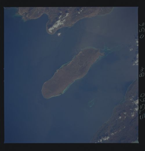
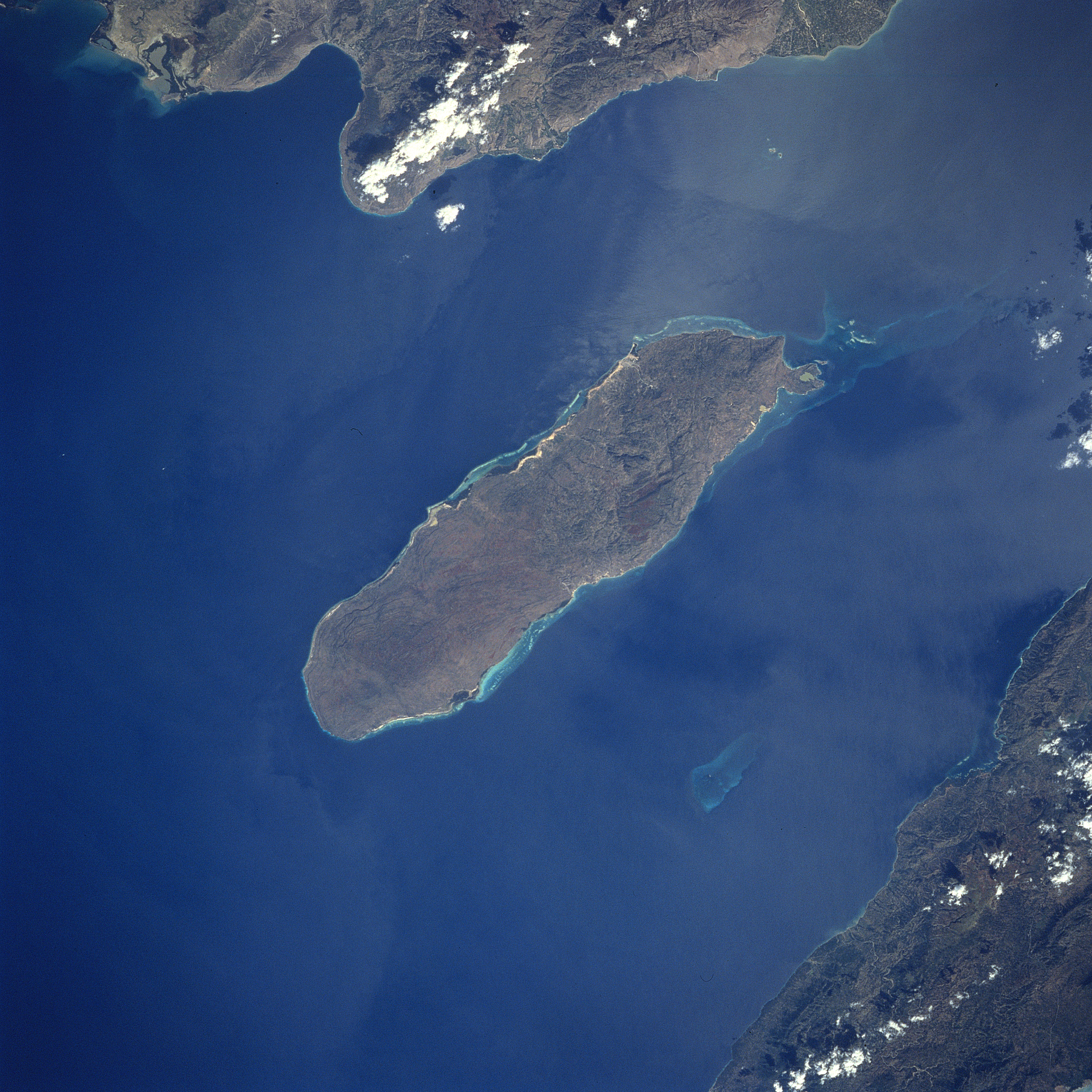
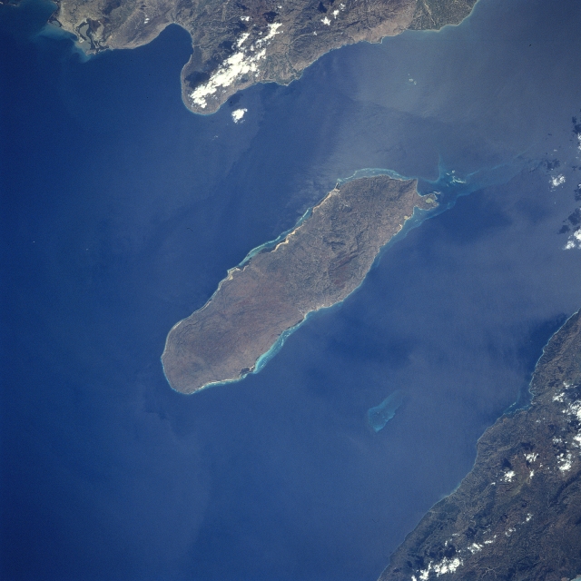
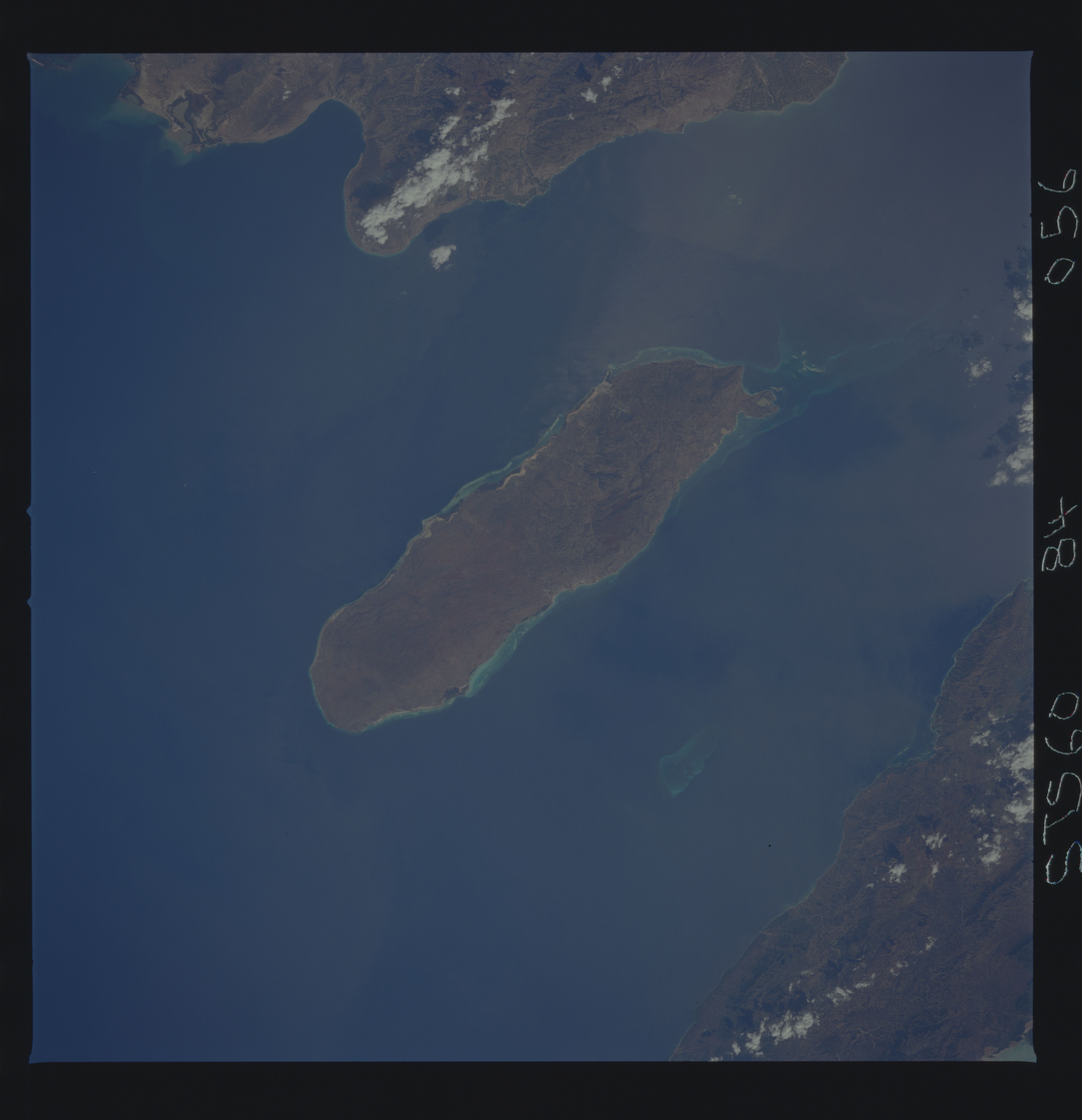
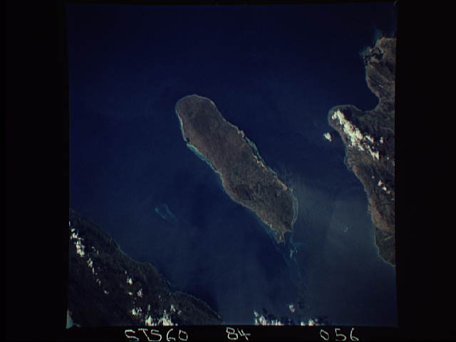
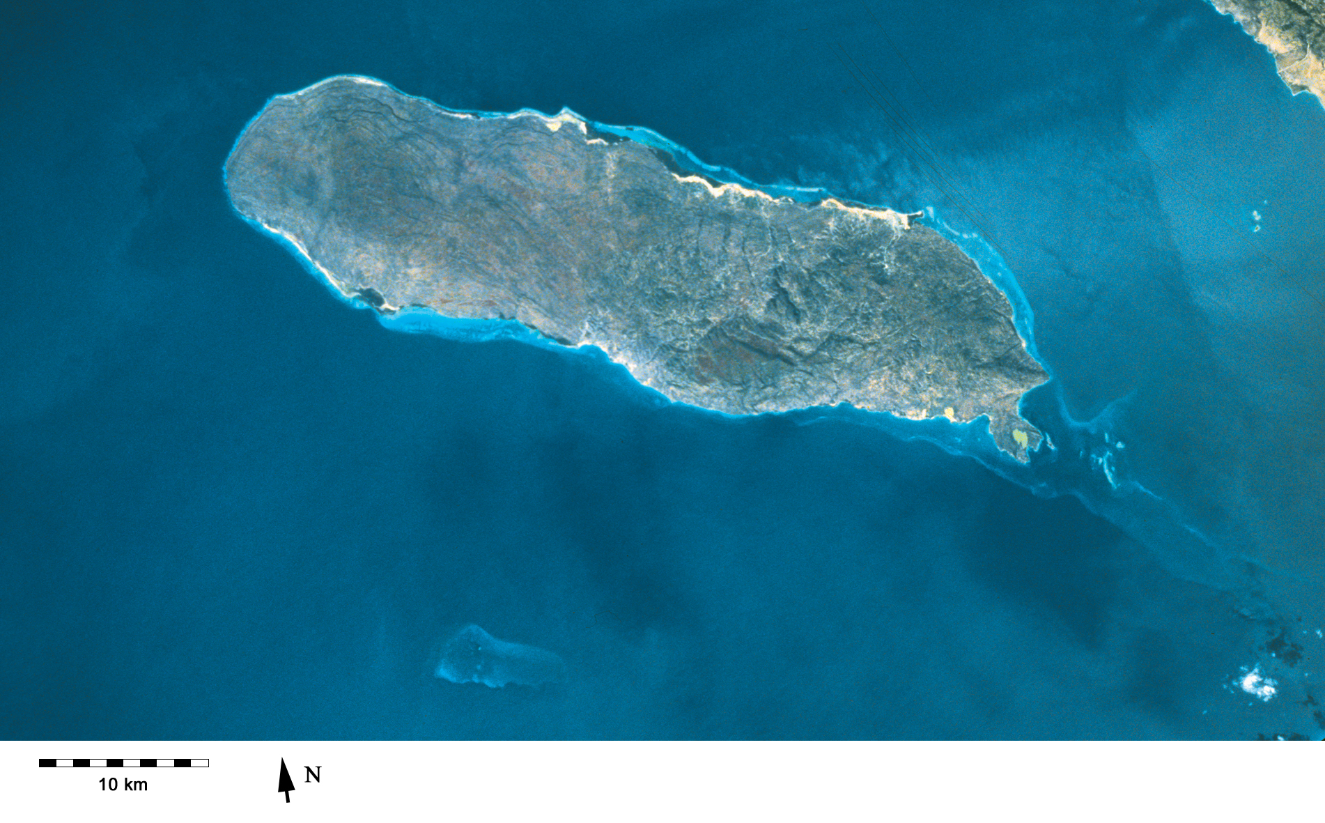
Image Caption: STS060-84-56 Gonave Island, Haiti February 1994
Located to the west-northwest of Port Au-Prince, Haiti in the Gulf of Gonave, the reef- fringed island of Gonave can be seen in this near-nadir looking view. Made up of mostly limestone, the island of Gonave is 37 miles (60 km) long and 9 miles (15 km) wide and covers an area of 287 sq. miles (743 sq. km). The island is mostly barren and hilly with the highest point reaching 984 feet (300 meters). The rugged, barren, dry landscape prevents the cultivation of the land for agriculture and human population on the island is scarce. The island was once used as a base for pirates.
Located to the west-northwest of Port Au-Prince, Haiti in the Gulf of Gonave, the reef- fringed island of Gonave can be seen in this near-nadir looking view. Made up of mostly limestone, the island of Gonave is 37 miles (60 km) long and 9 miles (15 km) wide and covers an area of 287 sq. miles (743 sq. km). The island is mostly barren and hilly with the highest point reaching 984 feet (300 meters). The rugged, barren, dry landscape prevents the cultivation of the land for agriculture and human population on the island is scarce. The island was once used as a base for pirates.
