STS060-83-5
| NASA Photo ID | STS060-83-5 |
| Focal Length | 250mm |
| Date taken | 1994.02.10 |
| Time taken | 20:09:00 GMT |
Resolutions offered for this image:
5167 x 5167 pixels 639 x 639 pixels 5700 x 5900 pixels 500 x 518 pixels 640 x 480 pixels
5167 x 5167 pixels 639 x 639 pixels 5700 x 5900 pixels 500 x 518 pixels 640 x 480 pixels
Cloud masks available for this image:
Spacecraft nadir point: 37.5° N, 109.5° W
Photo center point: 36.0° N, 112.0° W
Photo center point by machine learning:
Photo center point: 36.0° N, 112.0° W
Photo center point by machine learning:
Nadir to Photo Center: Southwest
Spacecraft Altitude: 191 nautical miles (354km)
Country or Geographic Name: | USA-ARIZONA |
Features: | GRAND CANYON, KAIBAB PLAT |
| Features Found Using Machine Learning: | |
Cloud Cover Percentage: | 5 (1-10)% |
Sun Elevation Angle: | 38° |
Sun Azimuth: | 191° |
Camera: | Hasselblad |
Focal Length: | 250mm |
Camera Tilt: | 43 degrees |
Format: | 5046: Kodak, natural color positive, Lumiere 100/5046, ASA 100, standard base |
Film Exposure: | Normal |
| Additional Information | |
| Width | Height | Annotated | Cropped | Purpose | Links |
|---|---|---|---|---|---|
| 5167 pixels | 5167 pixels | No | No | Earth From Space collection | Download Image |
| 639 pixels | 639 pixels | No | No | Earth From Space collection | Download Image |
| 5700 pixels | 5900 pixels | No | No | Download Image | |
| 500 pixels | 518 pixels | No | No | Download Image | |
| 640 pixels | 480 pixels | No | No | Download Image |
Download Packaged File
Download a Google Earth KML for this Image
View photo footprint information
Download a GeoTIFF for this photo
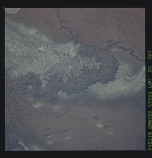
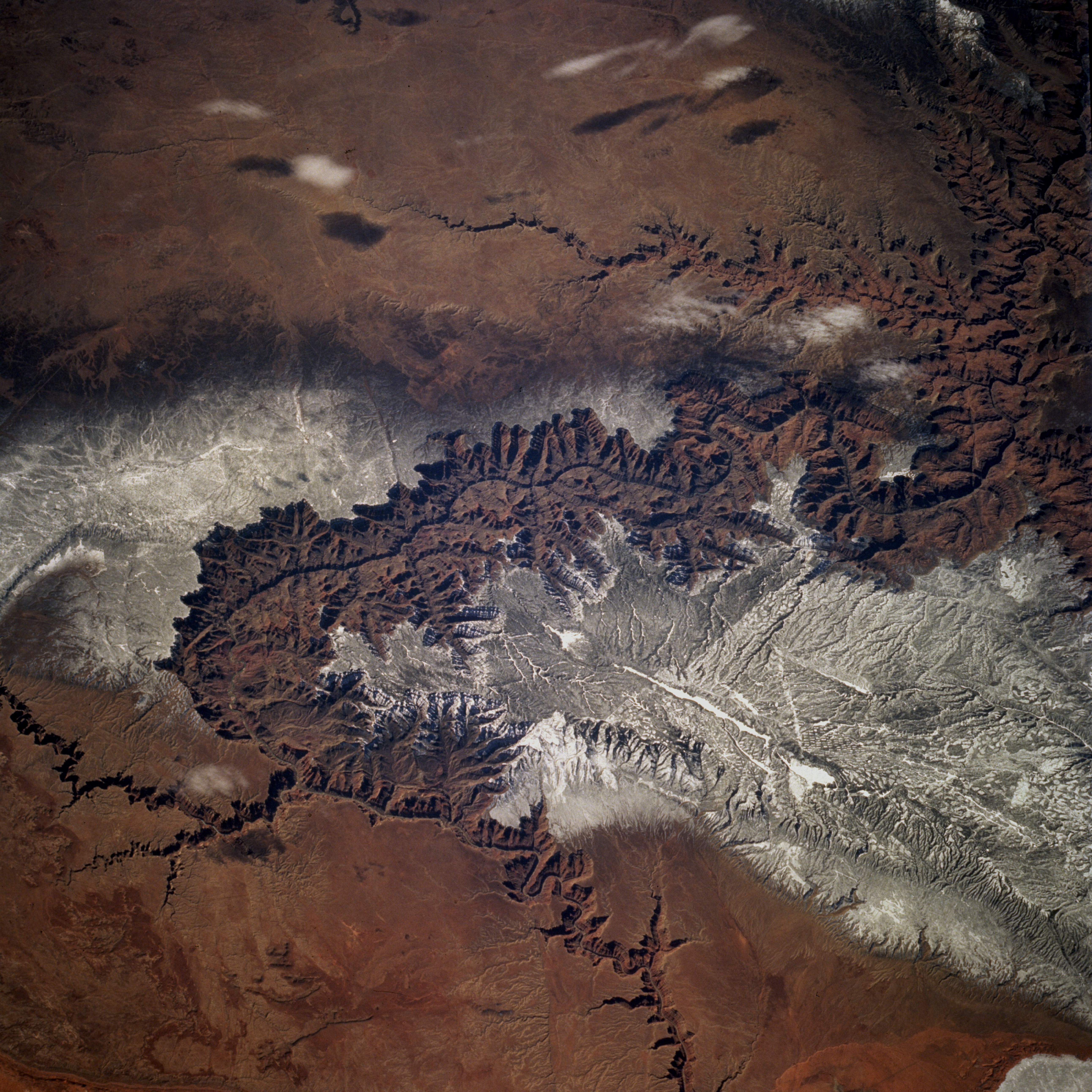
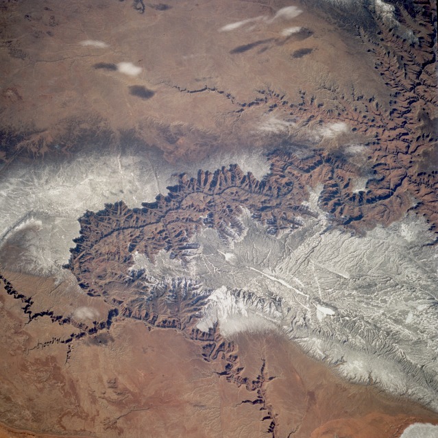
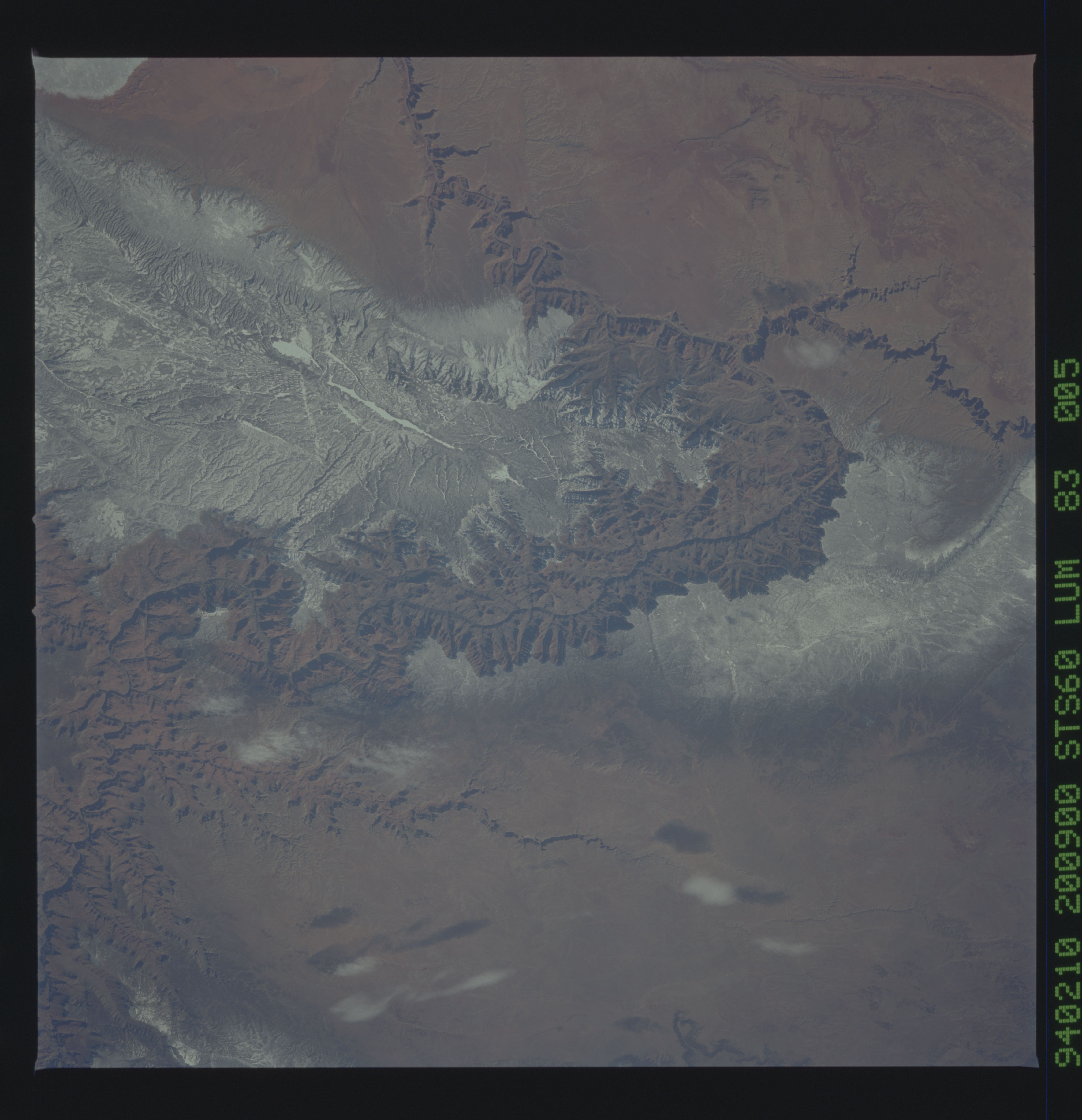
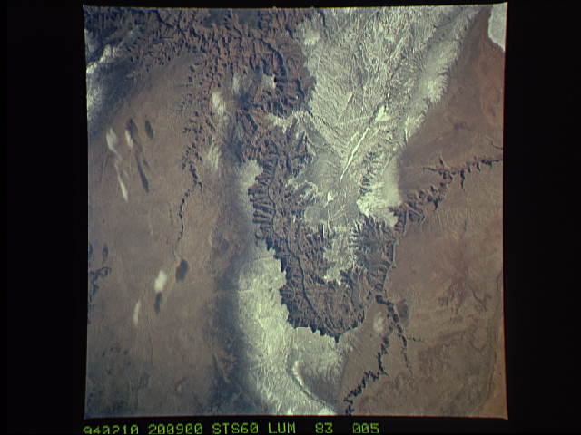
Image Caption: STS060-083-005 Grand Canyon, Arizona, U.S.A. February 1994
The Grand Canyon, one of the deepest canyons in the world with a depth of 1 mile (1.6 kilometers), can be seen in this spectacular, west-looking, low-oblique photograph. The Colorado River cut through rocks billions of years old to create this canyon. The Grand Canyon is 277 miles (466 kilometers) long and averages nearly 10 miles (16 kilometers) in width. The snow-covered, forested Kaibab Plateau (north of the canyon) and the Coconino Plateau (south of the canyon) are visible. The western portions of the Painted Desert can be seen east of the canyon where the Little Colorado River joins the Colorado River.
The Grand Canyon, one of the deepest canyons in the world with a depth of 1 mile (1.6 kilometers), can be seen in this spectacular, west-looking, low-oblique photograph. The Colorado River cut through rocks billions of years old to create this canyon. The Grand Canyon is 277 miles (466 kilometers) long and averages nearly 10 miles (16 kilometers) in width. The snow-covered, forested Kaibab Plateau (north of the canyon) and the Coconino Plateau (south of the canyon) are visible. The western portions of the Painted Desert can be seen east of the canyon where the Little Colorado River joins the Colorado River.
