STS060-83-4
| NASA Photo ID | STS060-83-4 |
| Focal Length | 250mm |
| Date taken | 1994.02.10 |
| Time taken | 20:08:53 GMT |
Resolutions offered for this image:
5700 x 5900 pixels 500 x 518 pixels 640 x 480 pixels 2570 x 2526 pixels
5700 x 5900 pixels 500 x 518 pixels 640 x 480 pixels 2570 x 2526 pixels
Cloud masks available for this image:
Spacecraft nadir point: 37.8° N, 109.8° W
Photo center point: 36.0° N, 112.0° W
Photo center point by machine learning:
Photo center point: 36.0° N, 112.0° W
Photo center point by machine learning:
Nadir to Photo Center: Southwest
Spacecraft Altitude: 191 nautical miles (354km)
Country or Geographic Name: | USA-ARIZONA |
Features: | GRAND CANYON, KAIBAB PLAT |
| Features Found Using Machine Learning: | |
Cloud Cover Percentage: | 5 (1-10)% |
Sun Elevation Angle: | 38° |
Sun Azimuth: | 191° |
Camera: | Hasselblad |
Focal Length: | 250mm |
Camera Tilt: | 42 degrees |
Format: | 5046: Kodak, natural color positive, Lumiere 100/5046, ASA 100, standard base |
Film Exposure: | Normal |
| Additional Information | |
| Width | Height | Annotated | Cropped | Purpose | Links |
|---|---|---|---|---|---|
| 5700 pixels | 5900 pixels | No | No | Download Image | |
| 500 pixels | 518 pixels | No | No | Download Image | |
| 640 pixels | 480 pixels | No | No | Download Image | |
| 2570 pixels | 2526 pixels | Earth From Space phase 2 | Download Image |
Download Packaged File
Download a Google Earth KML for this Image
View photo footprint information
Download a GeoTIFF for this photo
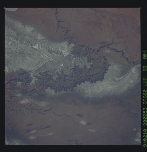
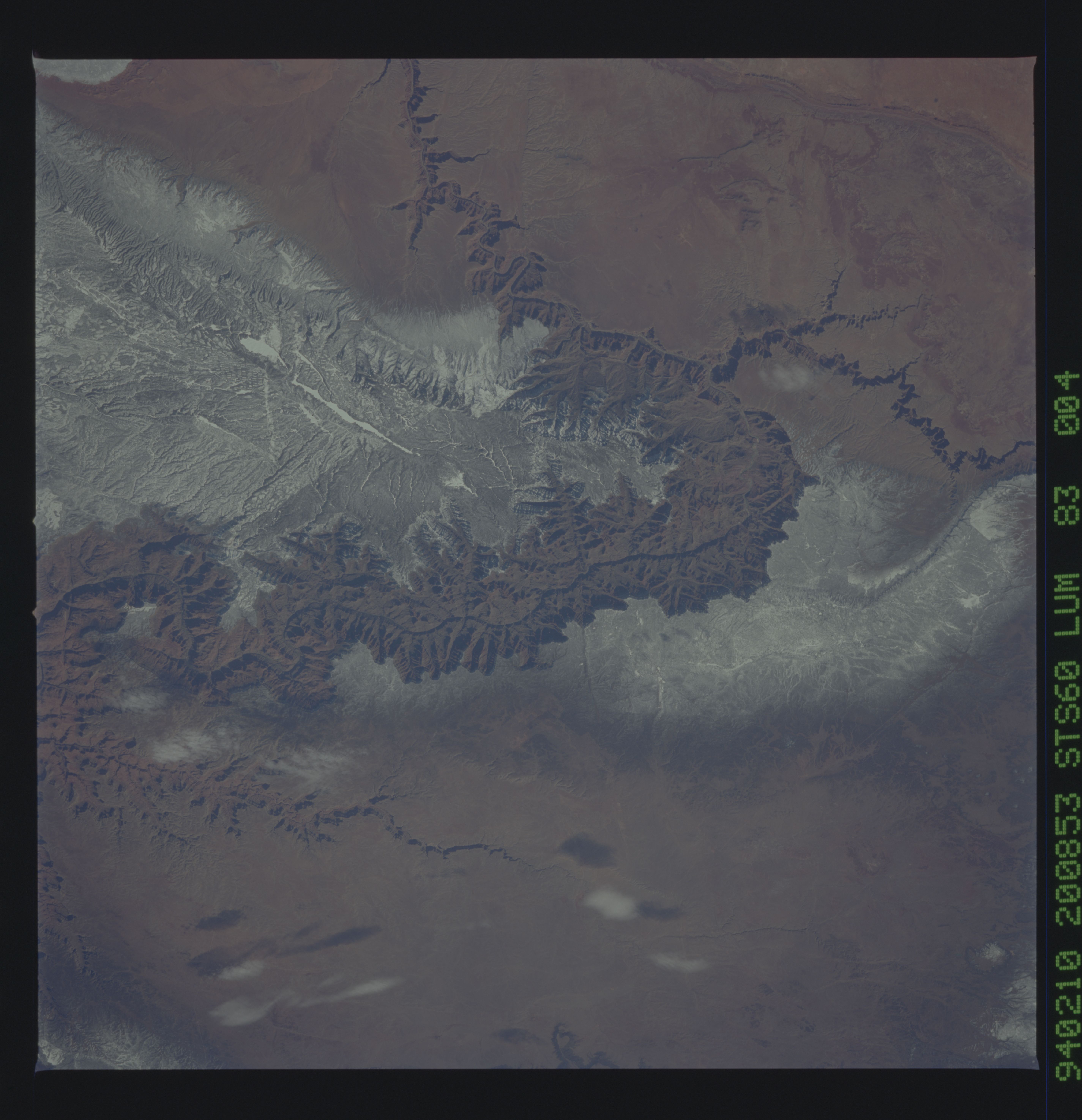
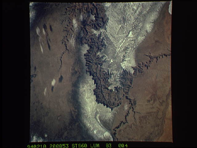
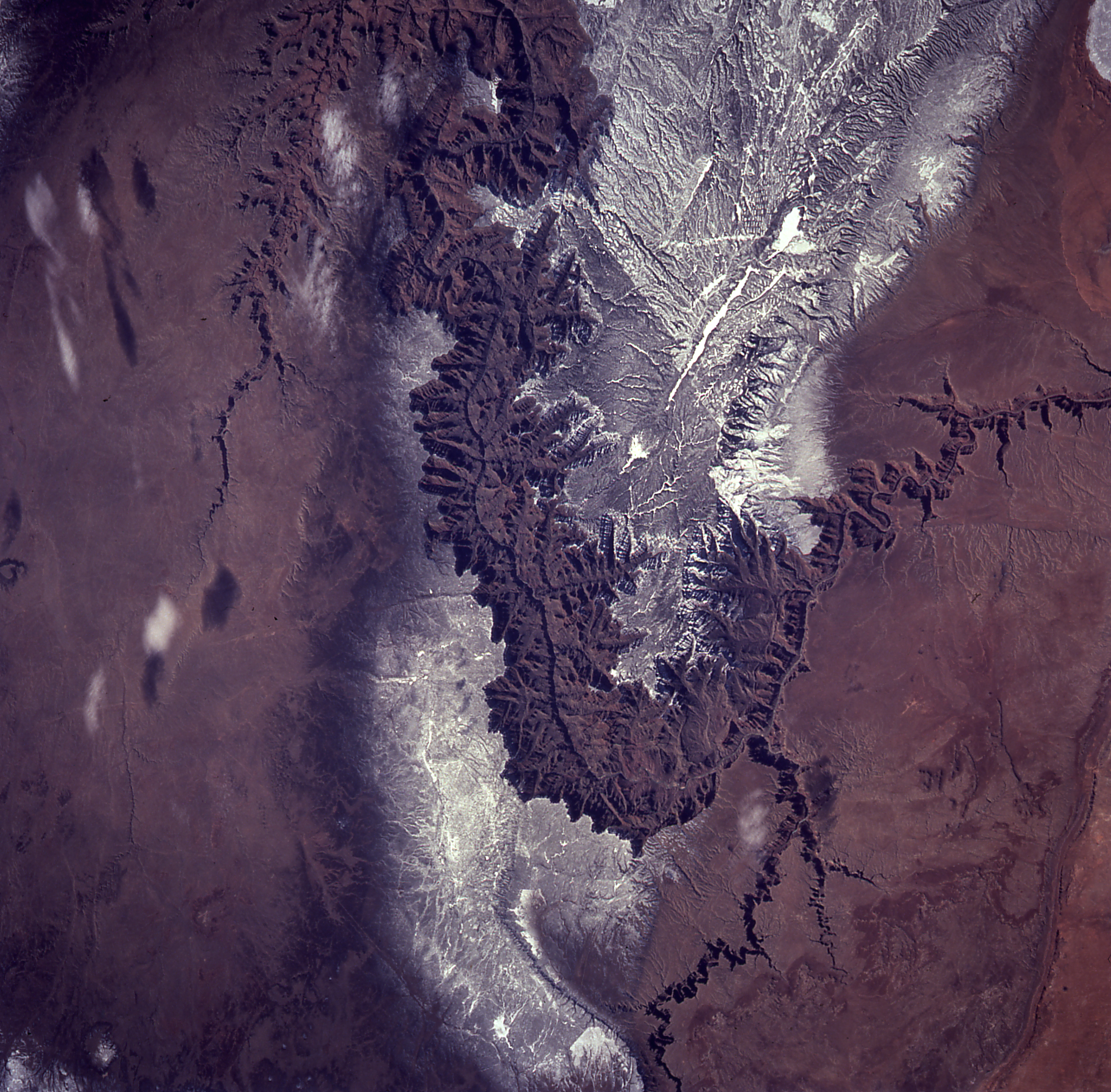
Image Caption: The Grand Canyon dusted with snow.
In this winter scene of the Grand Canyon of Arizona, the canyon is particularly well revealed because snow lies on the rims. The Little Colorado River enters from the left, joining the Colorado just upstream of its big bend. The most heavily snow covered area is the highest, reaching more than 9,000 feet (bottom right). The zone of dark color running parallel to the snow line is all that can be seen of the pine forest on the south flanks of the Plateau.
In this winter scene of the Grand Canyon of Arizona, the canyon is particularly well revealed because snow lies on the rims. The Little Colorado River enters from the left, joining the Colorado just upstream of its big bend. The most heavily snow covered area is the highest, reaching more than 9,000 feet (bottom right). The zone of dark color running parallel to the snow line is all that can be seen of the pine forest on the south flanks of the Plateau.
