STS060-83-1
| NASA Photo ID | STS060-83-1 |
| Focal Length | 250mm |
| Date taken | 1994.02.10 |
| Time taken | 20:08:33 GMT |
Resolutions offered for this image:
3939 x 3904 pixels 640 x 634 pixels 5700 x 5900 pixels 500 x 518 pixels 640 x 480 pixels
3939 x 3904 pixels 640 x 634 pixels 5700 x 5900 pixels 500 x 518 pixels 640 x 480 pixels


Cloud masks available for this image:
Spacecraft nadir point: 38.7° N, 110.9° W
Photo center point: 37.0° N, 111.0° W
Photo center point by machine learning:
Photo center point: 37.0° N, 111.0° W
Photo center point by machine learning:
Nadir to Photo Center: South
Spacecraft Altitude: 191 nautical miles (354km)
Country or Geographic Name: | USA-UTAH |
Features: | LAKE POWELL, NAVAJO MT. |
| Features Found Using Machine Learning: | |
Cloud Cover Percentage: | 5 (1-10)% |
Sun Elevation Angle: | 37° |
Sun Azimuth: | 189° |
Camera: | Hasselblad |
Focal Length: | 250mm |
Camera Tilt: | 28 degrees |
Format: | 5046: Kodak, natural color positive, Lumiere 100/5046, ASA 100, standard base |
Film Exposure: | Normal |
| Additional Information | |
| Width | Height | Annotated | Cropped | Purpose | Links |
|---|---|---|---|---|---|
| 3939 pixels | 3904 pixels | No | No | Earth From Space collection | Download Image |
| 640 pixels | 634 pixels | No | No | Earth From Space collection | Download Image |
| 5700 pixels | 5900 pixels | No | No | Download Image | |
| 500 pixels | 518 pixels | No | No | Download Image | |
| 640 pixels | 480 pixels | No | No | Download Image |
Download Packaged File
Download a Google Earth KML for this Image
View photo footprint information
Download a GeoTIFF for this photo
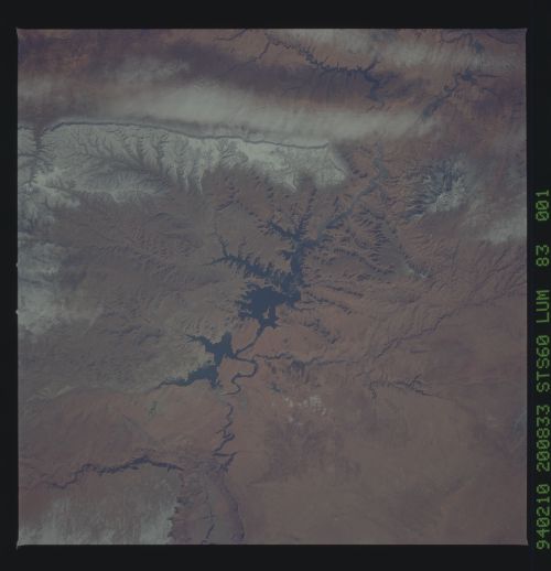
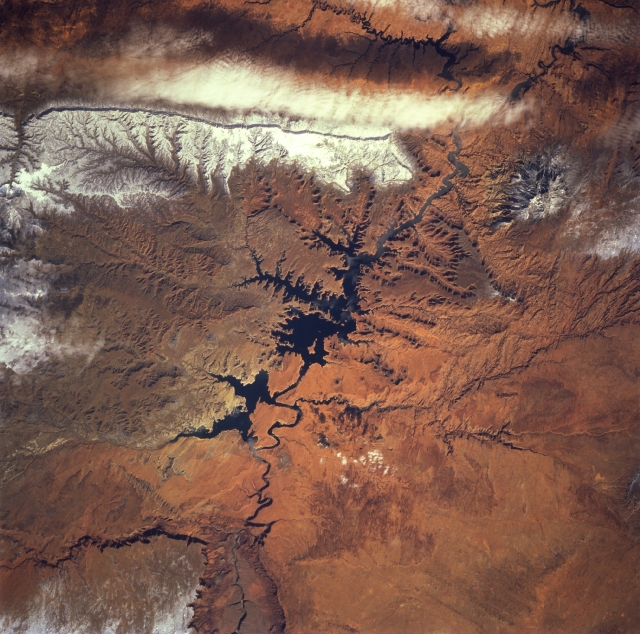
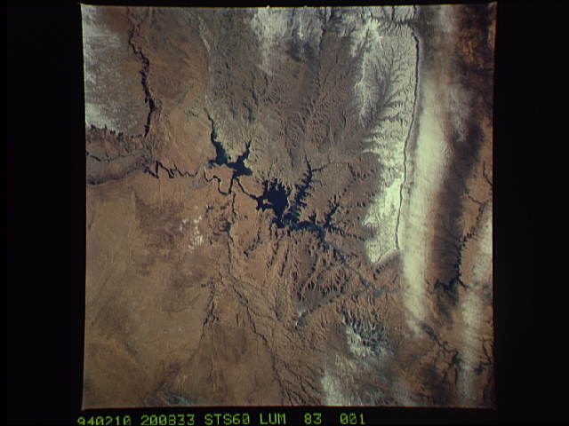
Image Caption: STS060-083-001 Lake Powell and Kaiparowits Plateau, Utah and Arizona, U.S.A. February 1994
The southern portion of Lake Powell in Glen Canyon National Recreation Area is featured in this northeast-looking, low-oblique photograph. Rugged, snow-covered Navajo Mountain (near the upper right corner of the photograph) lies east of Lake Powell. Lake Powell covers approximately 252 square miles (653 square kilometers) and is used primarily for recreation and irrigation. Apparent are the Paria Plateau escarpment in northern Arizona (bottom left) and the Kaiparowits Plateau discernible west of the lake.
The southern portion of Lake Powell in Glen Canyon National Recreation Area is featured in this northeast-looking, low-oblique photograph. Rugged, snow-covered Navajo Mountain (near the upper right corner of the photograph) lies east of Lake Powell. Lake Powell covers approximately 252 square miles (653 square kilometers) and is used primarily for recreation and irrigation. Apparent are the Paria Plateau escarpment in northern Arizona (bottom left) and the Kaiparowits Plateau discernible west of the lake.
