STS060-73-11
| NASA Photo ID | STS060-73-11 |
| Focal Length | 100mm |
| Date taken | 1994.02.04 |
| Time taken | 13:02:48 GMT |
Resolutions offered for this image:
4060 x 4060 pixels 639 x 639 pixels 5700 x 5900 pixels 500 x 518 pixels 640 x 480 pixels
4060 x 4060 pixels 639 x 639 pixels 5700 x 5900 pixels 500 x 518 pixels 640 x 480 pixels

Cloud masks available for this image:
Spacecraft nadir point: 42.6° N, 24.8° E
Photo center point: 41.5° N, 24.0° E
Photo center point by machine learning:
Photo center point: 41.5° N, 24.0° E
Photo center point by machine learning:
Nadir to Photo Center: Southwest
Spacecraft Altitude: 190 nautical miles (352km)
Country or Geographic Name: | GREECE |
Features: | AEGEAN SEACOAST AREA |
| Features Found Using Machine Learning: | |
Cloud Cover Percentage: | 0 (no clouds present) |
Sun Elevation Angle: | 22° |
Sun Azimuth: | 219° |
Camera: | Hasselblad |
Focal Length: | 100mm |
Camera Tilt: | 23 degrees |
Format: | 5017: Kodak, natural color positive, Ektachrome, X Professional, ASA 64, standard base |
Film Exposure: | Normal |
| Additional Information | |
| Width | Height | Annotated | Cropped | Purpose | Links |
|---|---|---|---|---|---|
| 4060 pixels | 4060 pixels | No | No | Earth From Space collection | Download Image |
| 639 pixels | 639 pixels | No | No | Earth From Space collection | Download Image |
| 5700 pixels | 5900 pixels | No | No | Download Image | |
| 500 pixels | 518 pixels | No | No | Download Image | |
| 640 pixels | 480 pixels | No | No | Download Image |
Download Packaged File
Download a Google Earth KML for this Image
View photo footprint information
Download a GeoTIFF for this photo
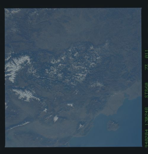
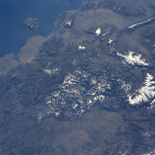
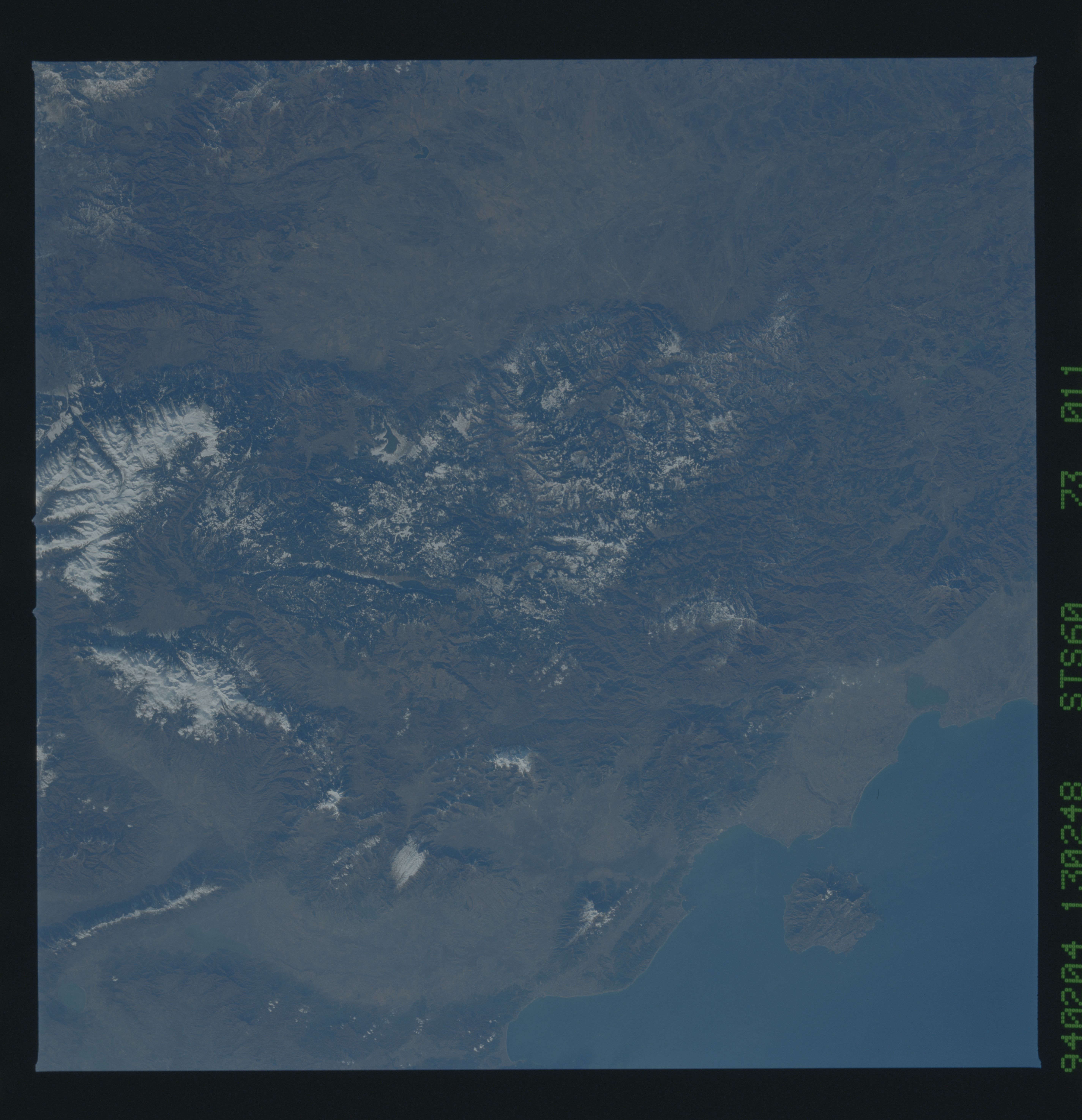
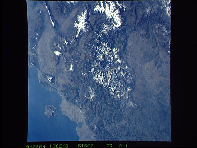
Image Caption: STS060-073-011 Rhodope Mountains, Bulgaria February, 1994
Extending 200 miles (320 km) along the border of Bulgaria (bottom of the image), and Macedonia, Greece (south or toward the top of the image), the Rhodope Mountains can be seen in this southwest-looking view. With the higher peaks of the Rhodope Mountains covered with snow, the rugged range has few passes. The range lies between the Balkan Mountains to the north (bottom right) and the Aegean Sea (upper left) to the south. Near the bottom center of the view, the Maritsa River Valley can be identified. In the upper left portion of the image, the Greek island of Thasos can be seen.
Extending 200 miles (320 km) along the border of Bulgaria (bottom of the image), and Macedonia, Greece (south or toward the top of the image), the Rhodope Mountains can be seen in this southwest-looking view. With the higher peaks of the Rhodope Mountains covered with snow, the rugged range has few passes. The range lies between the Balkan Mountains to the north (bottom right) and the Aegean Sea (upper left) to the south. Near the bottom center of the view, the Maritsa River Valley can be identified. In the upper left portion of the image, the Greek island of Thasos can be seen.
