STS060-103-55
| NASA Photo ID | STS060-103-55 |
| Focal Length | 100mm |
| Date taken | 1994.02.04 |
| Time taken | 09:51:51 GMT |
Cloud masks available for this image:
Spacecraft nadir point: 56.7° N, 29.8° E
Photo center point: 60.0° N, 31.0° E
Photo center point by machine learning:
Photo center point: 60.0° N, 31.0° E
Photo center point by machine learning:
Nadir to Photo Center: North
Spacecraft Altitude: 190 nautical miles (352km)
Country or Geographic Name: | RUSSIAN FEDERATION |
Features: | ST. PETERSBURG, SMOKE, RIVER |
| Features Found Using Machine Learning: | |
Cloud Cover Percentage: | 0 (no clouds present) |
Sun Elevation Angle: | 17° |
Sun Azimuth: | 174° |
Camera: | Hasselblad |
Focal Length: | 100mm |
Camera Tilt: | 48 degrees |
Format: | 5017: Kodak, natural color positive, Ektachrome, X Professional, ASA 64, standard base |
Film Exposure: | Normal |
| Additional Information | |
| Width | Height | Annotated | Cropped | Purpose | Links |
|---|---|---|---|---|---|
| 5700 pixels | 5900 pixels | No | No | Download Image | |
| 500 pixels | 518 pixels | No | No | Download Image | |
| 640 pixels | 480 pixels | No | No | Download Image |
Download Packaged File
Download a Google Earth KML for this Image
View photo footprint information
Download a GeoTIFF for this photo
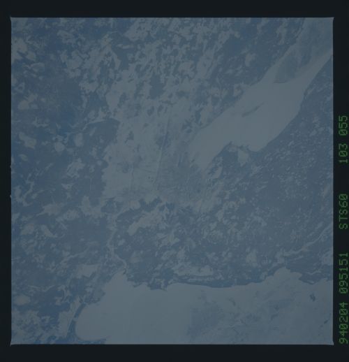
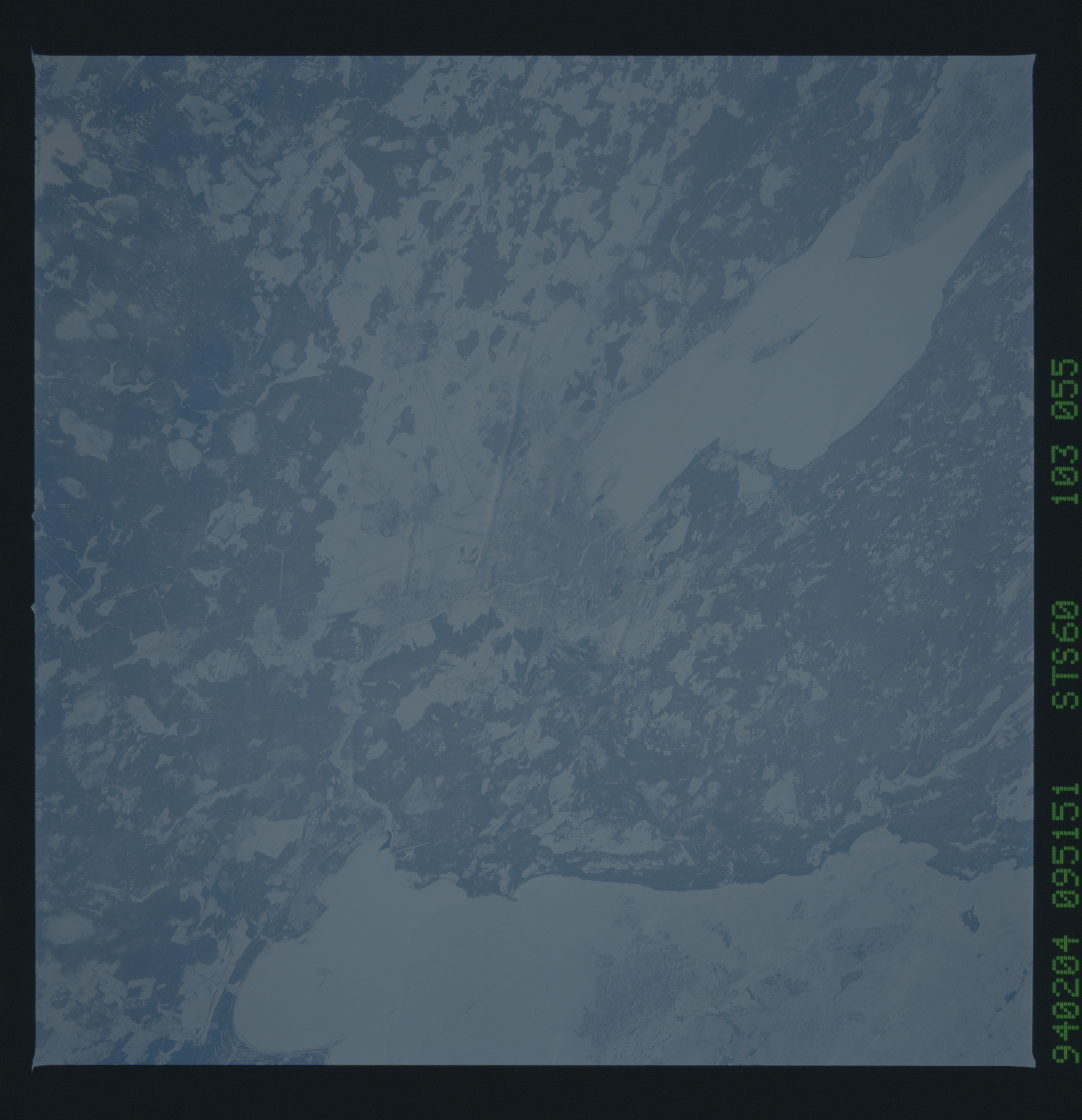
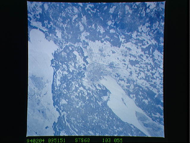
Image Caption: This wintertime photograph shows the large city of St. Petersburg, Russia at the head of the Gulf of Finland. The city, built by Peter the Great, is situated in the former swampy delta of the Neva River which connects the large Lake Ladoga (the frozen white surface on the edge of the photograph) to the Gulf of Finland. An interesting feature of St. Petersburg which can be discerned in this photograph is the new storm surge barrier built from both sides of the Gulf of Finland out to the island of Kronstadt in the middle. Also visible as a thin line between Kronstadt and St. Petersburg is the ice-free shipping channel kept open much of the winter. Power plant plumes are also visible on the frame.
