STS060-101-38
| NASA Photo ID | STS060-101-38 |
| Focal Length | 250mm |
| Date taken | 1994.02.05 |
| Time taken | 22:40:44 GMT |
Resolutions offered for this image:
3936 x 3904 pixels 639 x 634 pixels 5700 x 5900 pixels 7272 x 7227 pixels 500 x 518 pixels 640 x 480 pixels 1258 x 1264 pixels 426 x 426 pixels
3936 x 3904 pixels 639 x 634 pixels 5700 x 5900 pixels 7272 x 7227 pixels 500 x 518 pixels 640 x 480 pixels 1258 x 1264 pixels 426 x 426 pixels


Cloud masks available for this image:
Spacecraft nadir point: 32.4° N, 115.1° W
Photo center point: 33.0° N, 115.5° W
Photo center point by machine learning:
Photo center point: 33.0° N, 115.5° W
Photo center point by machine learning:
Nadir to Photo Center: Northwest
Spacecraft Altitude: 190 nautical miles (352km)
Country or Geographic Name: | USA-CALIFORNIA |
Features: | IMPERIAL VALLEY, DUNES |
| Features Found Using Machine Learning: | |
Cloud Cover Percentage: | 5 (1-10)% |
Sun Elevation Angle: | 28° |
Sun Azimuth: | 226° |
Camera: | Hasselblad |
Focal Length: | 250mm |
Camera Tilt: | 13 degrees |
Format: | 2443: Kodak Aerochrome 2443, color IR, thin base, EA-5 process thru June 1999, E-6 process afterward |
Film Exposure: | Normal |
| Additional Information | |
| Width | Height | Annotated | Cropped | Purpose | Links |
|---|---|---|---|---|---|
| 3936 pixels | 3904 pixels | No | No | Earth From Space collection | Download Image |
| 639 pixels | 634 pixels | No | No | Earth From Space collection | Download Image |
| 5700 pixels | 5900 pixels | No | No | Download Image | |
| 7272 pixels | 7227 pixels | No | No | Scientist Request | Download Image |
| 500 pixels | 518 pixels | No | No | Download Image | |
| 640 pixels | 480 pixels | No | No | Download Image | |
| 1258 pixels | 1264 pixels | No | No | Download Image | |
| 426 pixels | 426 pixels | No | No | Download Image |
Download Packaged File
Download a Google Earth KML for this Image
View photo footprint information
Download a GeoTIFF for this photo
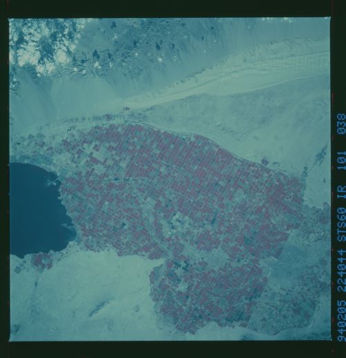
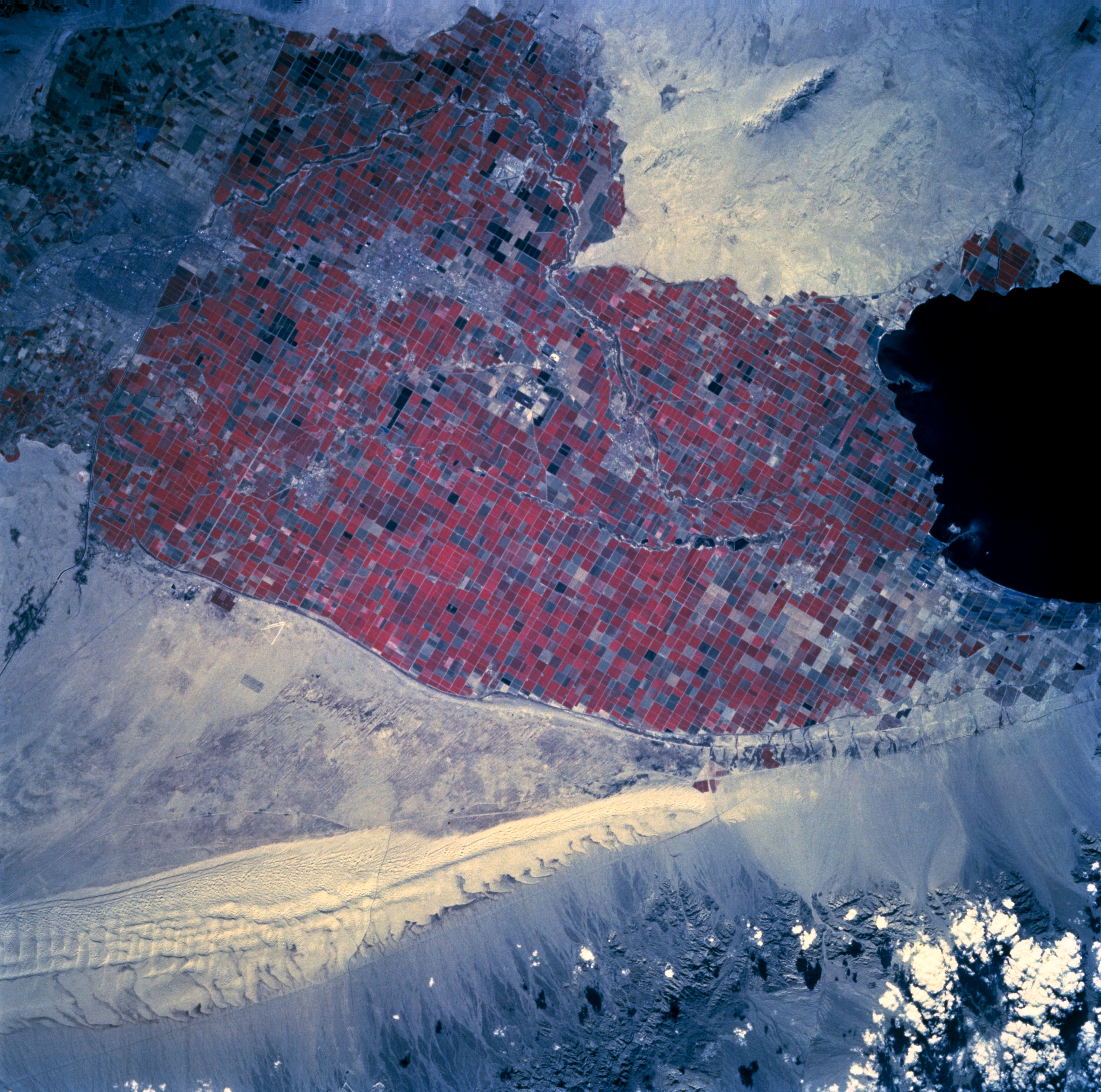
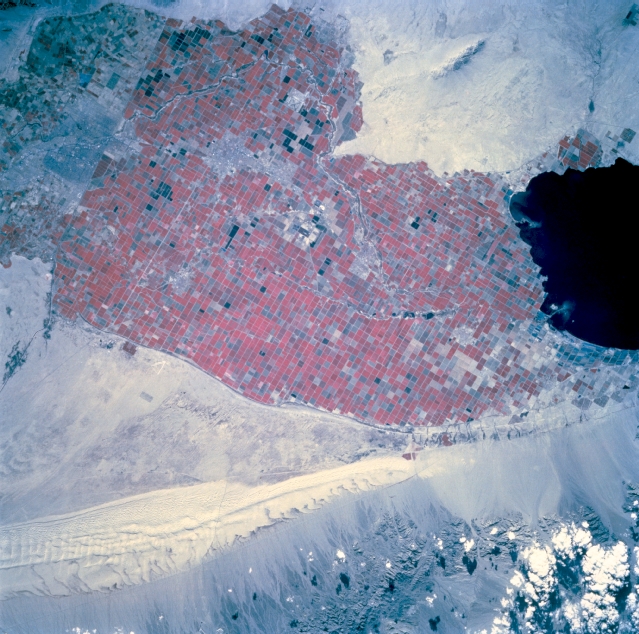
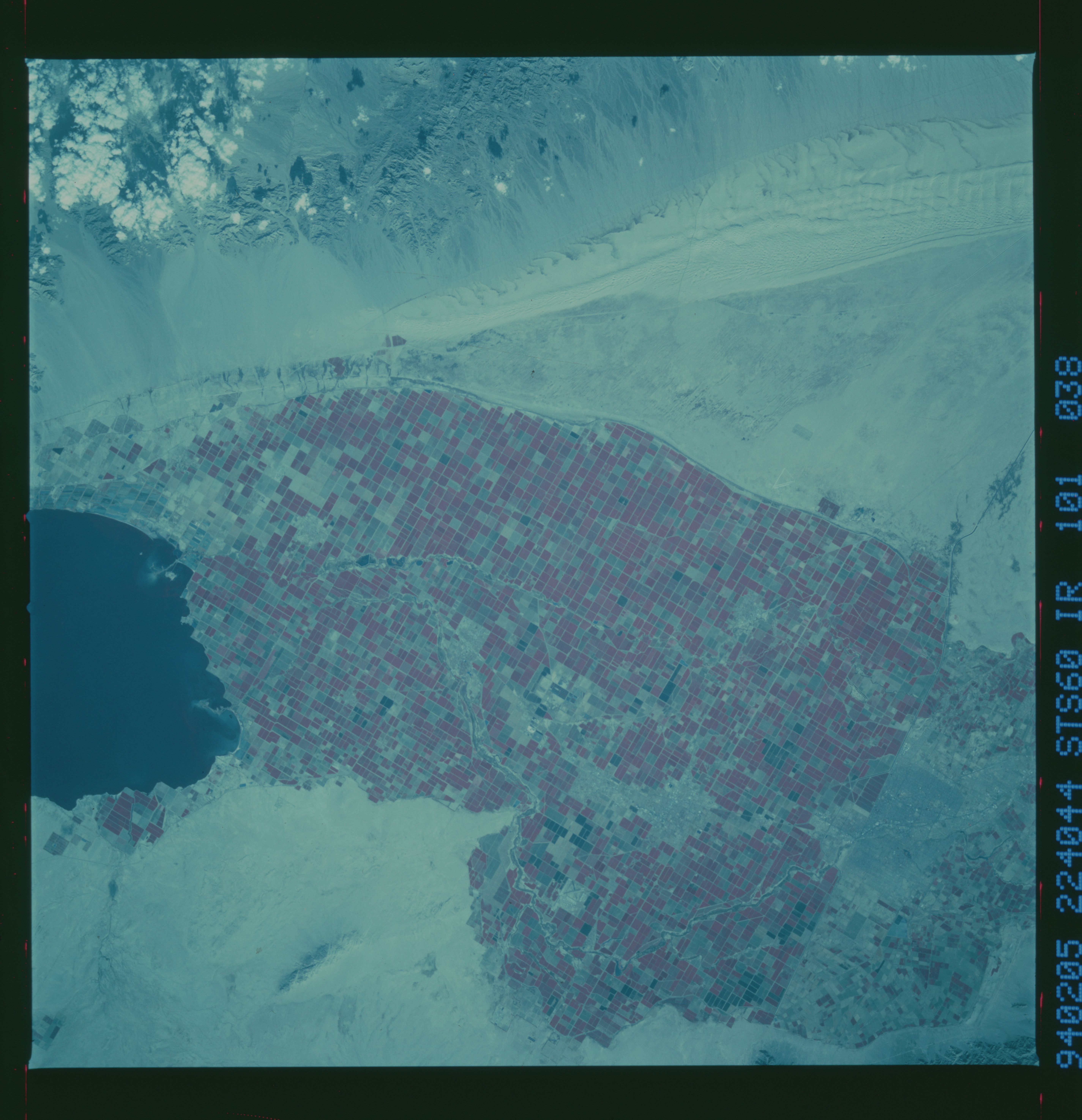
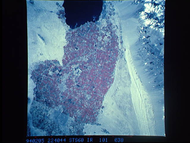
Image Caption: STS060-101-38 Imperial Valley, California, U.S.A. February 1994
This color infrared photograph of the Imperial Valley in southern California features a well-organized and well-managed crop producing landscape, shown by the large amount of red, which, on infrared film, denotes green foliage. The angular field patterns are interrupted by canals, small cities, and towns. The easily recognized field patterns stop abruptly at the U.S.-Mexico border. Visible are the Sand Hills, a lighter landform that parallels the Chocolate Mountains just east of the Sand Hills, and the Salton Sea, the black feature at the top of the photograph. (Refer to STS-060-105-38, a photograph of this same area taken with Russian film.)
This color infrared photograph of the Imperial Valley in southern California features a well-organized and well-managed crop producing landscape, shown by the large amount of red, which, on infrared film, denotes green foliage. The angular field patterns are interrupted by canals, small cities, and towns. The easily recognized field patterns stop abruptly at the U.S.-Mexico border. Visible are the Sand Hills, a lighter landform that parallels the Chocolate Mountains just east of the Sand Hills, and the Salton Sea, the black feature at the top of the photograph. (Refer to STS-060-105-38, a photograph of this same area taken with Russian film.)
