STS059-L17-31

| NASA Photo ID | STS059-L17-31 |
| Focal Length | 90mm |
| Date taken | 1994.04.14 |
| Time taken | 05:31:00 GMT |
Cloud masks available for this image:
Spacecraft nadir point: 45.5° N, 94.8° E
Photo center point: 49.0° N, 91.5° E
Photo center point by machine learning:
Photo center point: 49.0° N, 91.5° E
Photo center point by machine learning:
Nadir to Photo Center: Northwest
Spacecraft Altitude: 116 nautical miles (215km)
Country or Geographic Name: | MONGOLIA |
Features: | PAN-VALLEY OF THE LAKES |
| Features Found Using Machine Learning: | |
Cloud Cover Percentage: | 20 (11-25)% |
Sun Elevation Angle: | 54° |
Sun Azimuth: | 176° |
Camera: | Linhof |
Focal Length: | 90mm |
Camera Tilt: | High Oblique |
Format: | 5046: Kodak, natural color positive, Lumiere 100/5046, ASA 100, standard base |
Film Exposure: | Normal |
| Additional Information | |
| Width | Height | Annotated | Cropped | Purpose | Links |
|---|---|---|---|---|---|
| 5181 pixels | 4050 pixels | No | No | Earth From Space collection | Download Image |
| 640 pixels | 500 pixels | No | No | Earth From Space collection | Download Image |
| 640 pixels | 480 pixels | No | No | ISD 1 | Download Image |
Download Packaged File
Download a Google Earth KML for this Image
View photo footprint information
Download a GeoTIFF for this photo
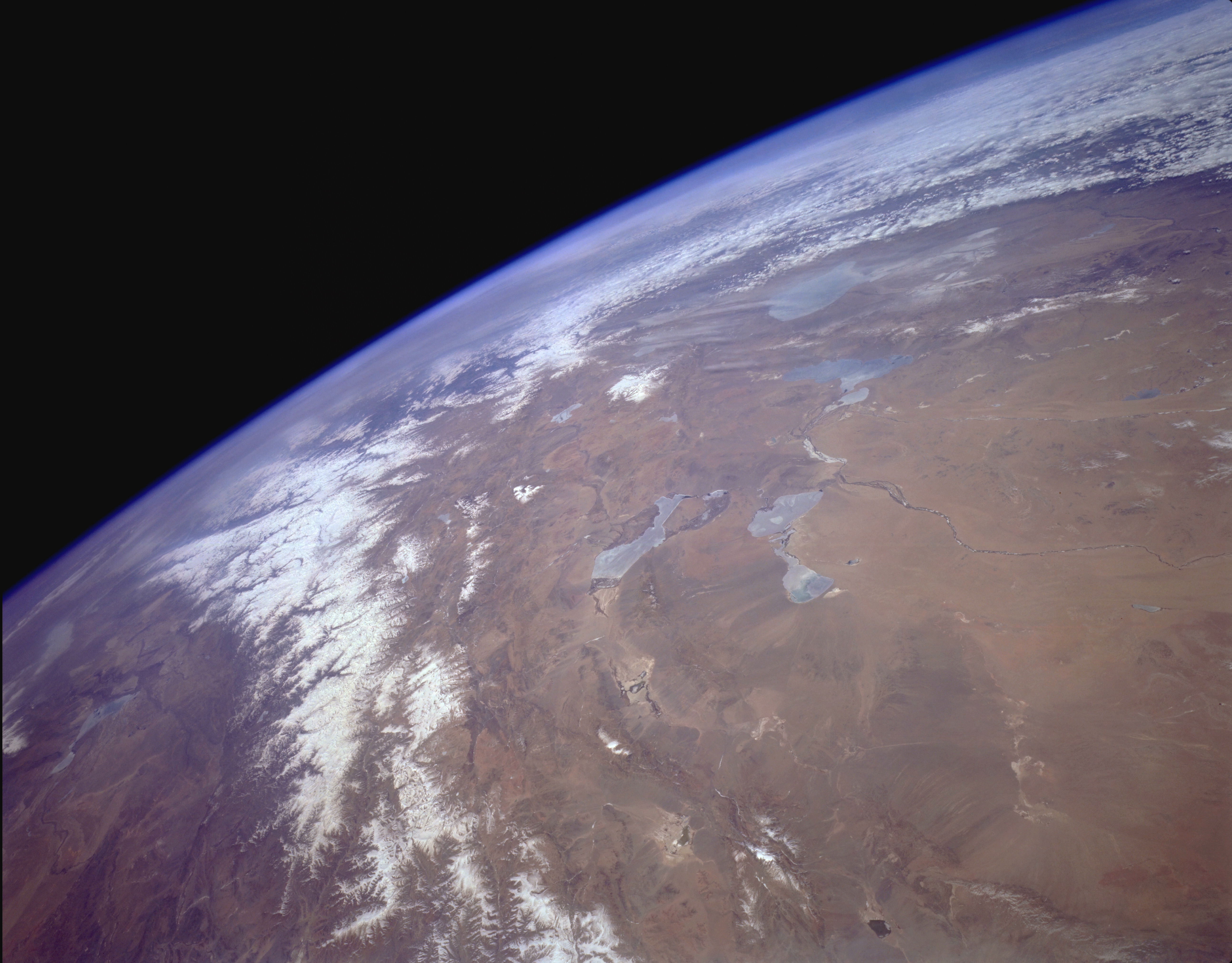
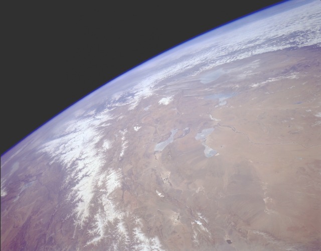
Image Caption: STS059-L17-031 Valley of The Lakes, Western Mongolia April 1994
The snow-covered Altai Mountain system, trending northwest-southeast, straddles the border between western Mongolia and extreme northwest China. The Altai Mountains separate two very large, desert, sparsely inhabited regions--the Valley of the Lakes in western Mongolia and the Dzungarian Basin in northwestern China. The brownish intermontane basin of the Valley of the Lakes region shows an assortment of desert landforms--alluvial fans, inland river deltas, intermittently flowing streams, and dry lakebeds. The four larger lakes captured in this photograph are Uvs (the northernmost lake partially obscured by cirrus clouds); Hyargas (immediately south of Uvs); Hara and Doroo (south of Hyagas); and Har Us (west of Hara). Each of these lakes is fed by the runoff from glaciers and snowmelt from mountains. When this photograph was taken, most of these lakes were partially covered with ice. The intermittently flowing Dzavhan River, which runs generally east to west toward three of these lakes, is a very narrow watercourse that dramatically stands out against an otherwise barren landscape. Two sizable Chinese lakes are visible southwest of the Altai Mountains.
The snow-covered Altai Mountain system, trending northwest-southeast, straddles the border between western Mongolia and extreme northwest China. The Altai Mountains separate two very large, desert, sparsely inhabited regions--the Valley of the Lakes in western Mongolia and the Dzungarian Basin in northwestern China. The brownish intermontane basin of the Valley of the Lakes region shows an assortment of desert landforms--alluvial fans, inland river deltas, intermittently flowing streams, and dry lakebeds. The four larger lakes captured in this photograph are Uvs (the northernmost lake partially obscured by cirrus clouds); Hyargas (immediately south of Uvs); Hara and Doroo (south of Hyagas); and Har Us (west of Hara). Each of these lakes is fed by the runoff from glaciers and snowmelt from mountains. When this photograph was taken, most of these lakes were partially covered with ice. The intermittently flowing Dzavhan River, which runs generally east to west toward three of these lakes, is a very narrow watercourse that dramatically stands out against an otherwise barren landscape. Two sizable Chinese lakes are visible southwest of the Altai Mountains.
