STS059-L17-117

| NASA Photo ID | STS059-L17-117 |
| Focal Length | 90mm |
| Date taken | 1994.04.14 |
| Time taken | 10:01:54 GMT |

Cloud masks available for this image:
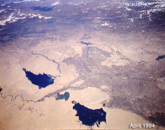
Spacecraft nadir point: 32.3° N, 43.0° E
Photo center point: 33.5° N, 44.0° E
Photo center point by machine learning:
Photo center point: 33.5° N, 44.0° E
Photo center point by machine learning:
Nadir to Photo Center: Northeast
Spacecraft Altitude: 117 nautical miles (217km)
Country or Geographic Name: | IRAQ |
Features: | EUPHRATES R, RESERVOIRS |
| Features Found Using Machine Learning: | |
Cloud Cover Percentage: | 10 (1-10)% |
Sun Elevation Angle: | 64° |
Sun Azimuth: | 212° |
Camera: | Linhof |
Focal Length: | 90mm |
Camera Tilt: | 39 degrees |
Format: | 5046: Kodak, natural color positive, Lumiere 100/5046, ASA 100, standard base |
Film Exposure: | Normal |
| Additional Information | |
| Width | Height | Annotated | Cropped | Purpose | Links |
|---|---|---|---|---|---|
| 565 pixels | 446 pixels | Photographic Highlights | Download Image | ||
| 540 pixels | 426 pixels | Photographic Highlights | Download Image | ||
| 640 pixels | 480 pixels | No | No | ISD 1 | Download Image |
Download Packaged File
Download a Google Earth KML for this Image
View photo footprint information
Download a GeoTIFF for this photo
Image Caption: none
