STS059-L15-2
| NASA Photo ID | STS059-L15-2 |
| Focal Length | 90mm |
| Date taken | 1994.04.15 |
| Time taken | 18:29:54 GMT |
Cloud masks available for this image:
Spacecraft nadir point: 43.6° N, 105.7° W
Photo center point: 42.5° N, 107.0° W
Photo center point by machine learning:
Photo center point: 42.5° N, 107.0° W
Photo center point by machine learning:
Nadir to Photo Center: Southwest
Spacecraft Altitude: 114 nautical miles (211km)
Country or Geographic Name: | USA-WYOMING |
Features: | N PLATTE R., BIG HORN R. |
| Features Found Using Machine Learning: | |
Cloud Cover Percentage: | 5 (1-10)% |
Sun Elevation Angle: | 56° |
Sun Azimuth: | 165° |
Camera: | Linhof |
Focal Length: | 90mm |
Camera Tilt: | 42 degrees |
Format: | 5046: Kodak, natural color positive, Lumiere 100/5046, ASA 100, standard base |
Film Exposure: | Normal |
| Additional Information | |
| Width | Height | Annotated | Cropped | Purpose | Links |
|---|---|---|---|---|---|
| 5056 pixels | 3929 pixels | No | No | Earth From Space collection | Download Image |
| 640 pixels | 497 pixels | No | No | Earth From Space collection | Download Image |
| 640 pixels | 480 pixels | No | No | ISD 1 | Download Image |
Download Packaged File
Download a Google Earth KML for this Image
View photo footprint information
Download a GeoTIFF for this photo
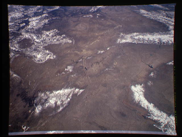
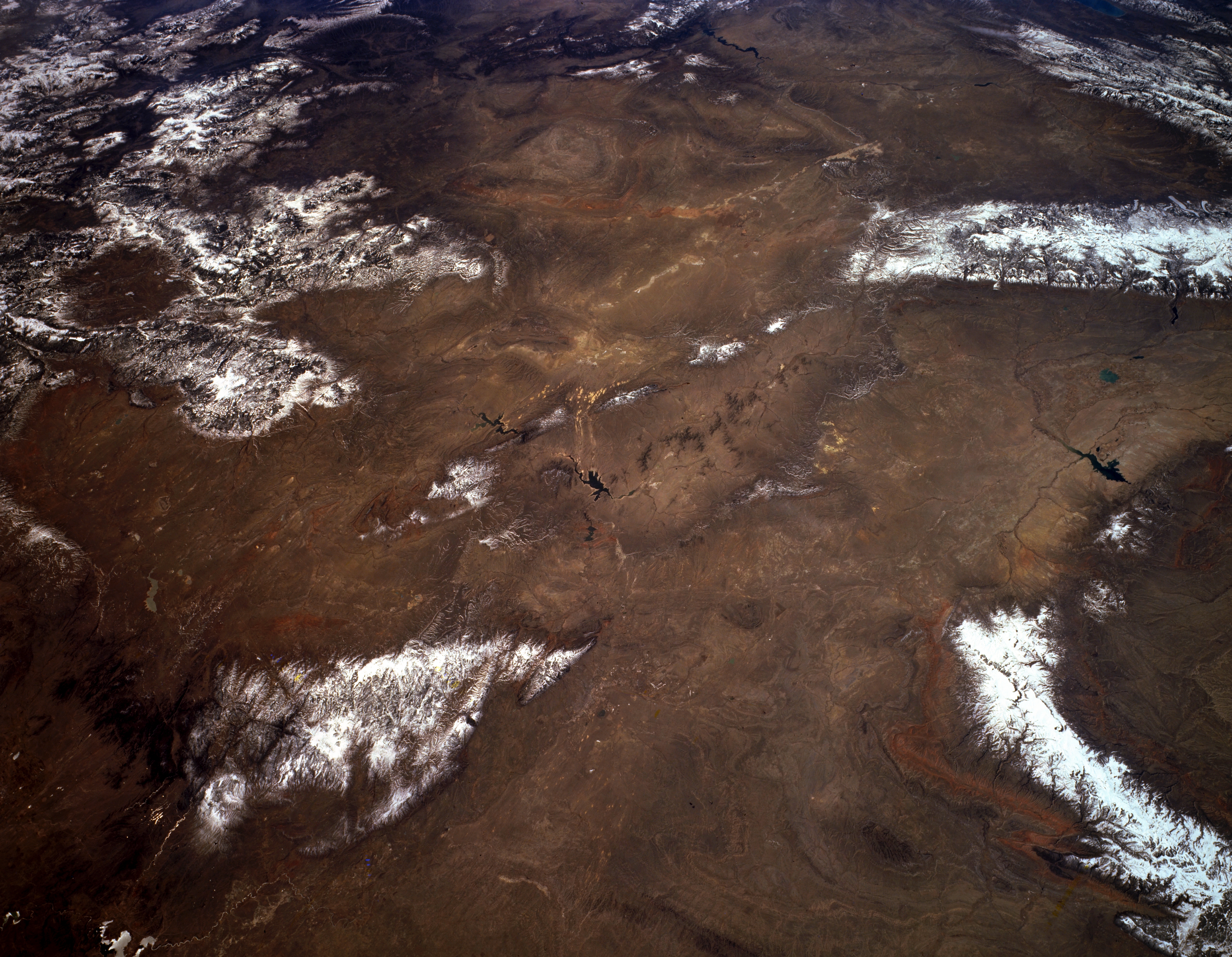
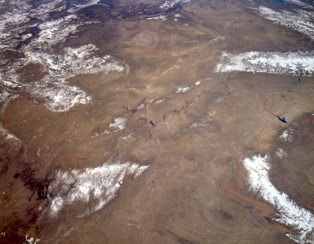
Image Caption: STS059-L15-002 Great Divide Basin and Laramie and Bighorn Mountains, Wyoming, U.S.A. April 1994
This panoramic, southwest-looking, low-oblique photograph features most of southern and southwestern Wyoming. Visible clockwise from the top are the Uinta Mountains of northern Utah and elongated Flaming Gorge Reservoir; the southern portion of the Wyoming Range and the Wind River Range; and the Bighorn Basin, Boysen Reservoir, Bighorn Mountains, southern Powder River Basin, and Teapot Dome. Barely discernible (bottom left) are the Glendo Reservoir and the Laramie Mountains, a prong of the northern Colorado Front Range. Extending into Wyoming from northern Colorado, southwest of the Laramie Mountains, are the Medicine Bow Mountains, named by the Indians because of the abundance of ash wood from which to make bows and arrows for hunting, and the Sierra Madre, noted for deposits of copper. Barely discernible (center of photograph) are Pathfinder Reservoir and, to its south, smaller Seminoe Reservoir.
This panoramic, southwest-looking, low-oblique photograph features most of southern and southwestern Wyoming. Visible clockwise from the top are the Uinta Mountains of northern Utah and elongated Flaming Gorge Reservoir; the southern portion of the Wyoming Range and the Wind River Range; and the Bighorn Basin, Boysen Reservoir, Bighorn Mountains, southern Powder River Basin, and Teapot Dome. Barely discernible (bottom left) are the Glendo Reservoir and the Laramie Mountains, a prong of the northern Colorado Front Range. Extending into Wyoming from northern Colorado, southwest of the Laramie Mountains, are the Medicine Bow Mountains, named by the Indians because of the abundance of ash wood from which to make bows and arrows for hunting, and the Sierra Madre, noted for deposits of copper. Barely discernible (center of photograph) are Pathfinder Reservoir and, to its south, smaller Seminoe Reservoir.
