STS059-L14-170

| NASA Photo ID | STS059-L14-170 |
| Focal Length | 250mm |
| Date taken | 1994.04.19 |
| Time taken | 03:55:28 GMT |

Cloud masks available for this image:
Spacecraft nadir point: 15.5° N, 120.8° E
Photo center point: 15.0° N, 120.5° E
Photo center point by machine learning:
Photo center point: 15.0° N, 120.5° E
Photo center point by machine learning:
Nadir to Photo Center: Southwest
Spacecraft Altitude: 114 nautical miles (211km)
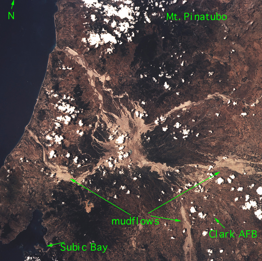
Country or Geographic Name: | PHILIPPINES |
Features: | LUZON, MT. PINATUBO |
| Features Found Using Machine Learning: | |
Cloud Cover Percentage: | 10 (1-10)% |
Sun Elevation Angle: | 86° |
Sun Azimuth: | 178° |
Camera: | Linhof |
Focal Length: | 250mm |
Camera Tilt: | 17 degrees |
Format: | 5048: Kodak, natural color positive, Lumiere 100x/5048, ASA 100x, standard base |
Film Exposure: | Normal |
| Additional Information | |
| Width | Height | Annotated | Cropped | Purpose | Links |
|---|---|---|---|---|---|
| 640 pixels | 480 pixels | No | No | ISD 1 | Download Image |
| 903 pixels | 900 pixels | COSS | Download Image |
Download Packaged File
Download a Google Earth KML for this Image
View photo footprint information
Download a GeoTIFF for this photo
Image Caption: Mount Pinatubo, north of Manilla, Philippines Islands, exploded in 1991. Ash flows still run down the valleys after every rain.
