STS059-L06-13
| NASA Photo ID | STS059-L06-13 |
| Focal Length | 90mm |
| Date taken | 1994.04.15 |
| Time taken | 05:33:15 GMT |
Resolutions offered for this image:
5106 x 4059 pixels 639 x 508 pixels 640 x 480 pixels 960 x 815 pixels
5106 x 4059 pixels 639 x 508 pixels 640 x 480 pixels 960 x 815 pixels

Cloud masks available for this image:
Spacecraft nadir point: 27.3° S, 149.1° E
Photo center point: 28.5° S, 148.0° E
Photo center point by machine learning:
Photo center point: 28.5° S, 148.0° E
Photo center point by machine learning:
Nadir to Photo Center: Southwest
Spacecraft Altitude: 116 nautical miles (215km)
Camera: | Linhof |
Focal Length: | 90mm |
Camera Tilt: | 40 degrees |
Format: | 5046: Kodak, natural color positive, Lumiere 100/5046, ASA 100, standard base |
Film Exposure: | Normal |
| Additional Information | |
| Width | Height | Annotated | Cropped | Purpose | Links |
|---|---|---|---|---|---|
| 5106 pixels | 4059 pixels | No | No | Earth From Space collection | Download Image |
| 639 pixels | 508 pixels | No | No | Earth From Space collection | Download Image |
| 640 pixels | 480 pixels | No | No | ISD 1 | Download Image |
| 960 pixels | 815 pixels | COSS | Download Image |
Download Packaged File
Download a Google Earth KML for this Image
View photo footprint information
Download a GeoTIFF for this photo
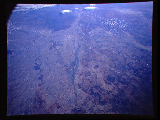
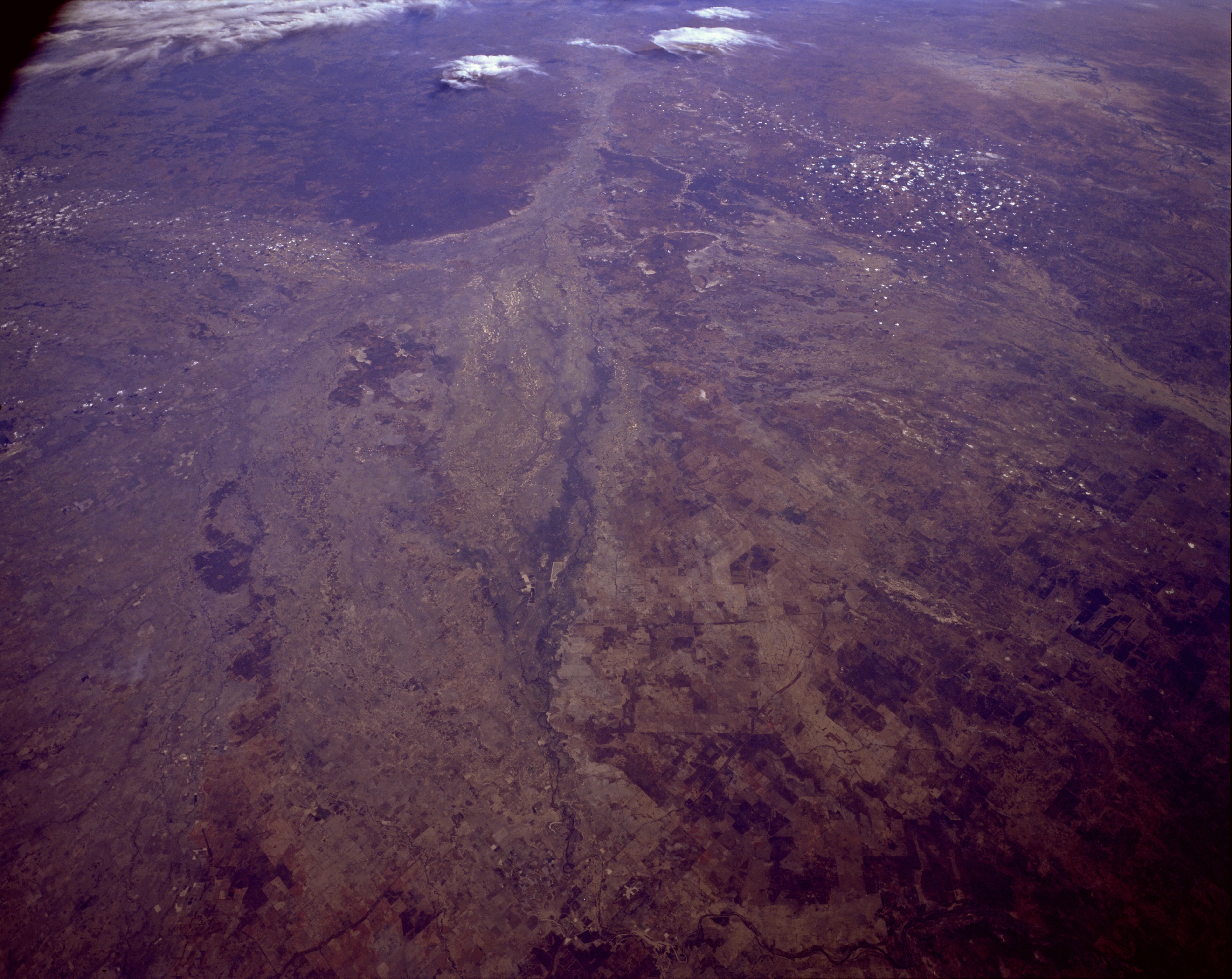
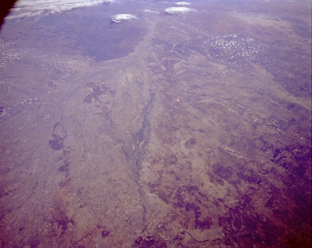
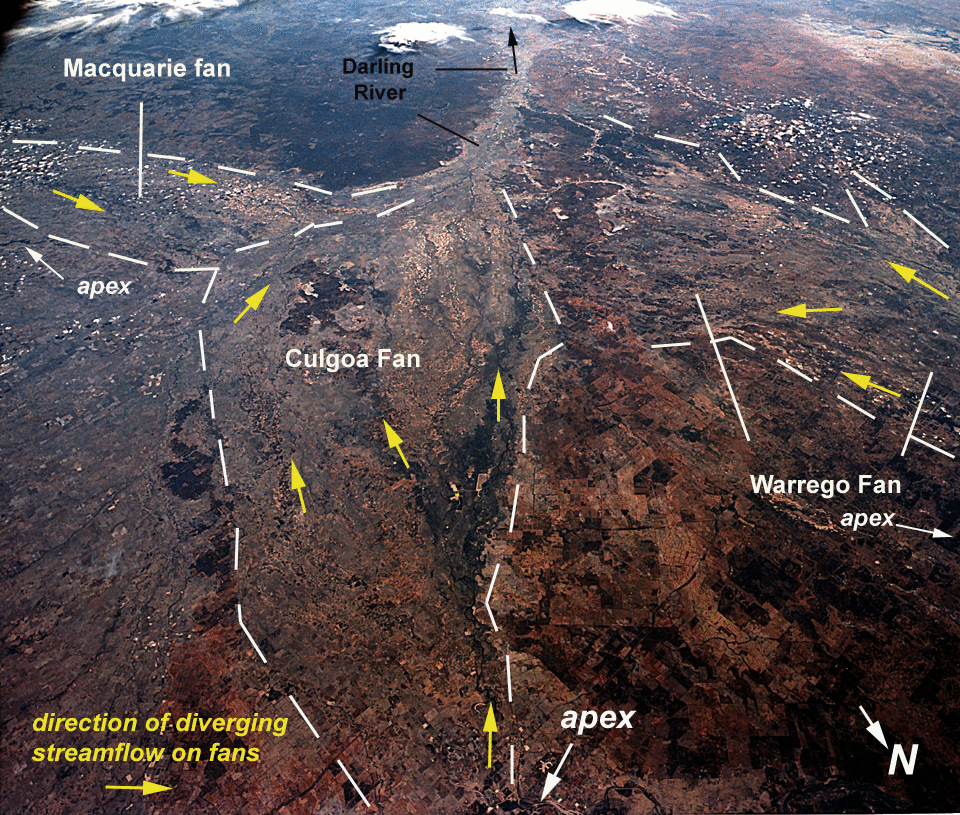
Image Caption: STS059-L06-013 The Darling (Barwon) River, New South Wales, Australia April 1994
The Darling River Basin is visible in this unique, low-oblique, southwest-looking photograph. The Darling River, the longest river in Australia and the major tributary to Australia's principal river, the Murray, is approximately 1700 miles (2730 kilometers) long and is an important source of water for irrigated agricultural crop production in the southeast region of Australia. This photograph captures a portion of the Darling as it flows southwest from Bourke through Wilcannia. The river continues to Wentworth where it enters the Murray, which eventually flows into Lake Alexandrina.
The Darling River Basin is visible in this unique, low-oblique, southwest-looking photograph. The Darling River, the longest river in Australia and the major tributary to Australia's principal river, the Murray, is approximately 1700 miles (2730 kilometers) long and is an important source of water for irrigated agricultural crop production in the southeast region of Australia. This photograph captures a portion of the Darling as it flows southwest from Bourke through Wilcannia. The river continues to Wentworth where it enters the Murray, which eventually flows into Lake Alexandrina.
