STS059-91-29
| NASA Photo ID | STS059-91-29 |
| Focal Length | 250mm |
| Date taken | 1994.04.10 |
| Time taken | 21:43:32 GMT |
Resolutions offered for this image:
5255 x 5255 pixels 639 x 639 pixels 2422 x 2400 pixels 5700 x 5900 pixels 500 x 518 pixels 640 x 480 pixels
5255 x 5255 pixels 639 x 639 pixels 2422 x 2400 pixels 5700 x 5900 pixels 500 x 518 pixels 640 x 480 pixels
Cloud masks available for this image:
Spacecraft nadir point: 20.5° N, 101.8° W
Photo center point: 21.5° N, 103.0° W
Photo center point by machine learning:
Photo center point: 21.5° N, 103.0° W
Photo center point by machine learning:
Nadir to Photo Center: Northwest
Spacecraft Altitude: 120 nautical miles (222km)
Country or Geographic Name: | MEXICO |
Features: | CHAPALA L., OCCIDENTAL |
| Features Found Using Machine Learning: | |
Cloud Cover Percentage: | 10 (1-10)% |
Sun Elevation Angle: | 46° |
Sun Azimuth: | 260° |
Camera: | Hasselblad |
Focal Length: | 250mm |
Camera Tilt: | 38 degrees |
Format: | 5046: Kodak, natural color positive, Lumiere 100/5046, ASA 100, standard base |
Film Exposure: | Normal |
| Additional Information | |
| Width | Height | Annotated | Cropped | Purpose | Links |
|---|---|---|---|---|---|
| 5255 pixels | 5255 pixels | No | No | Earth From Space collection | Download Image |
| 639 pixels | 639 pixels | No | No | Earth From Space collection | Download Image |
| 2422 pixels | 2400 pixels | No | No | NASA's Earth Observatory web site | Download Image |
| 5700 pixels | 5900 pixels | No | No | Download Image | |
| 500 pixels | 518 pixels | No | No | Download Image | |
| 640 pixels | 480 pixels | No | No | Download Image |
Download Packaged File
Download a Google Earth KML for this Image
View photo footprint information
Download a GeoTIFF for this photo
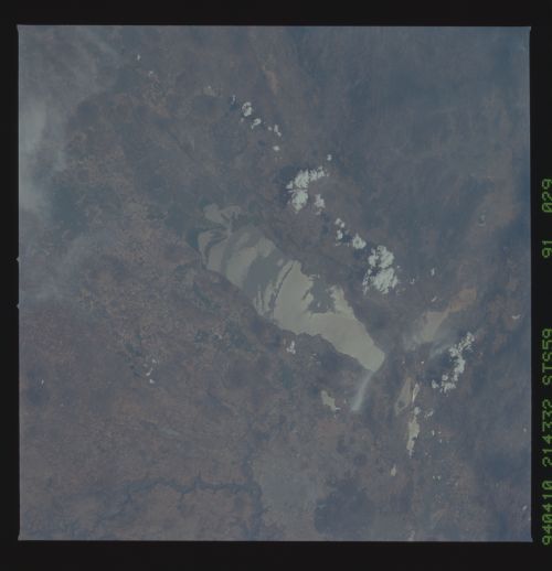
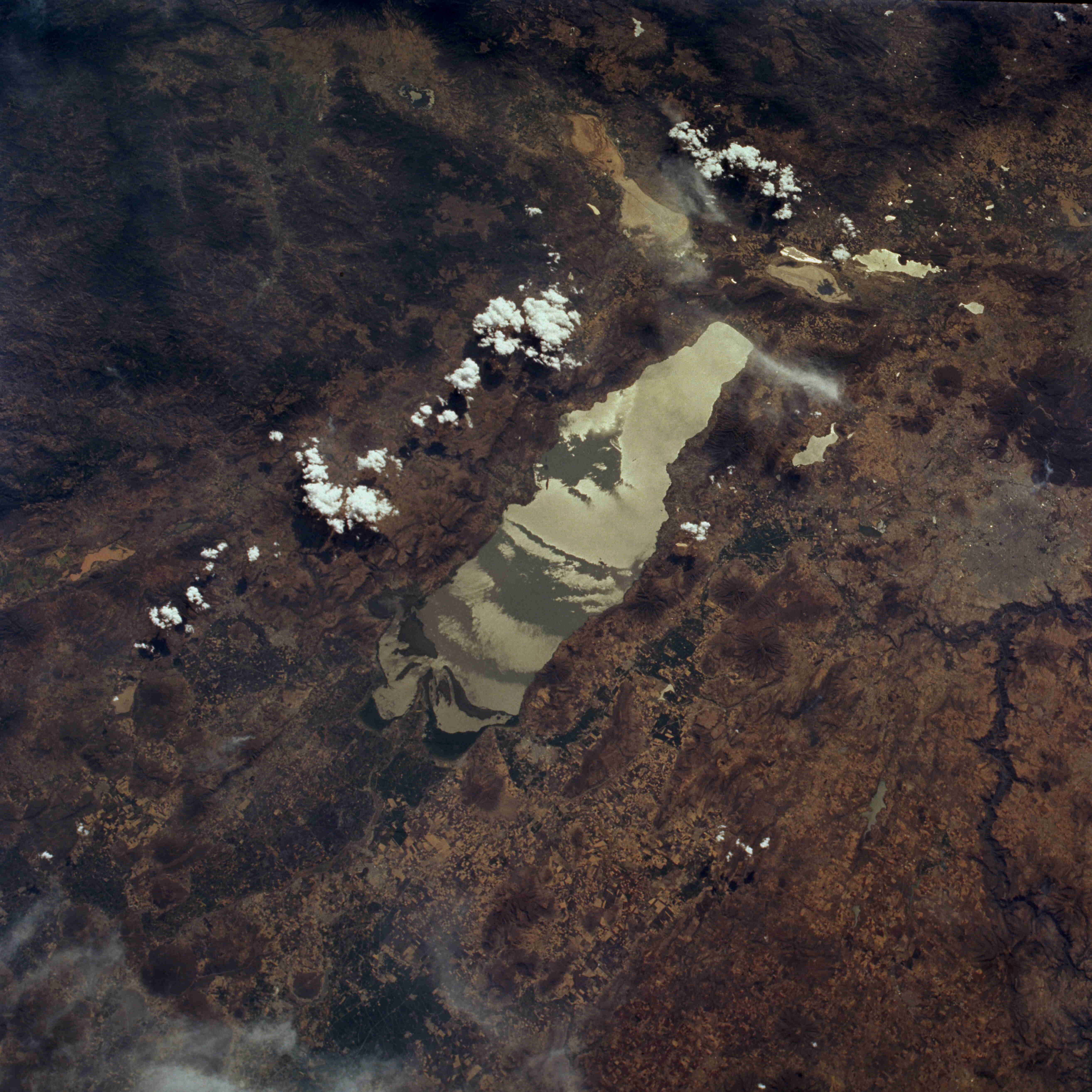
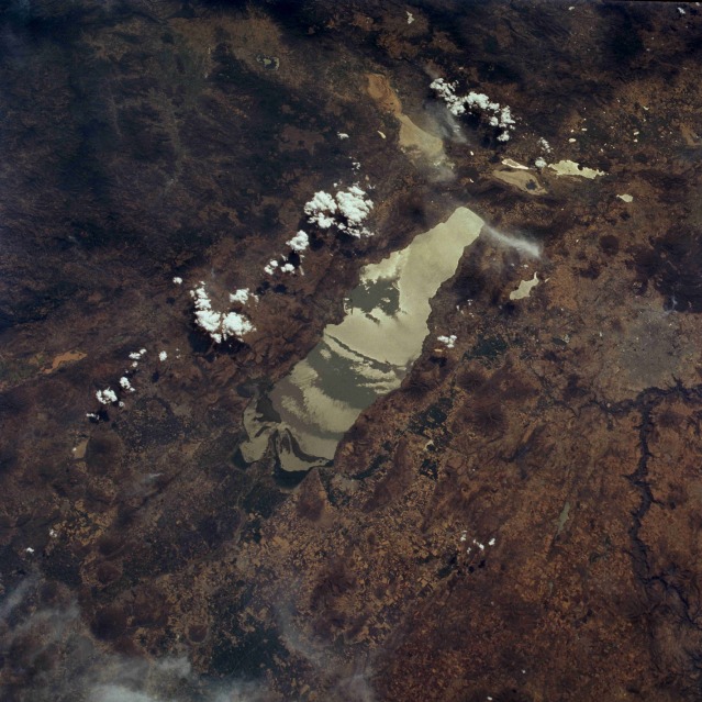
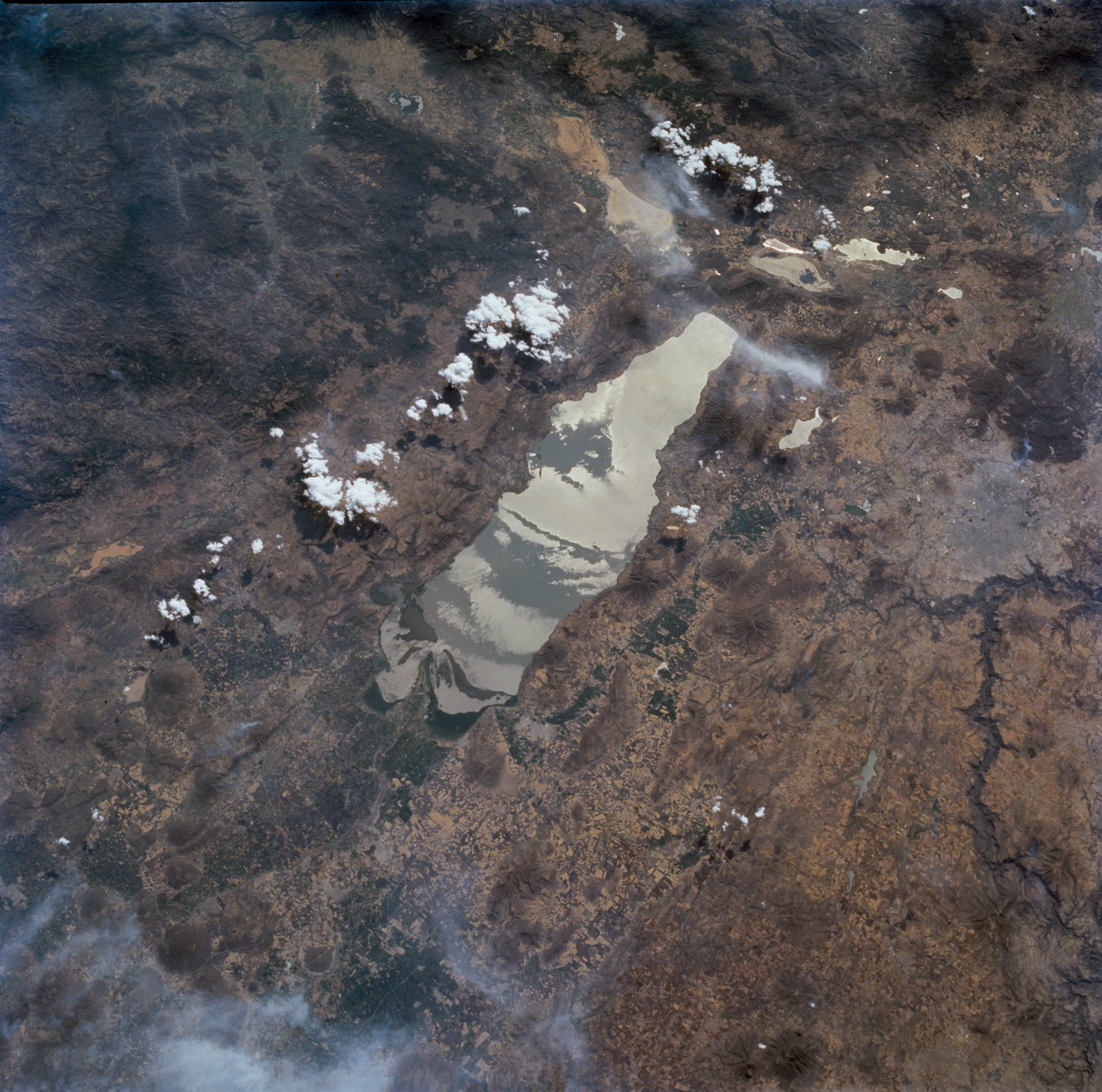
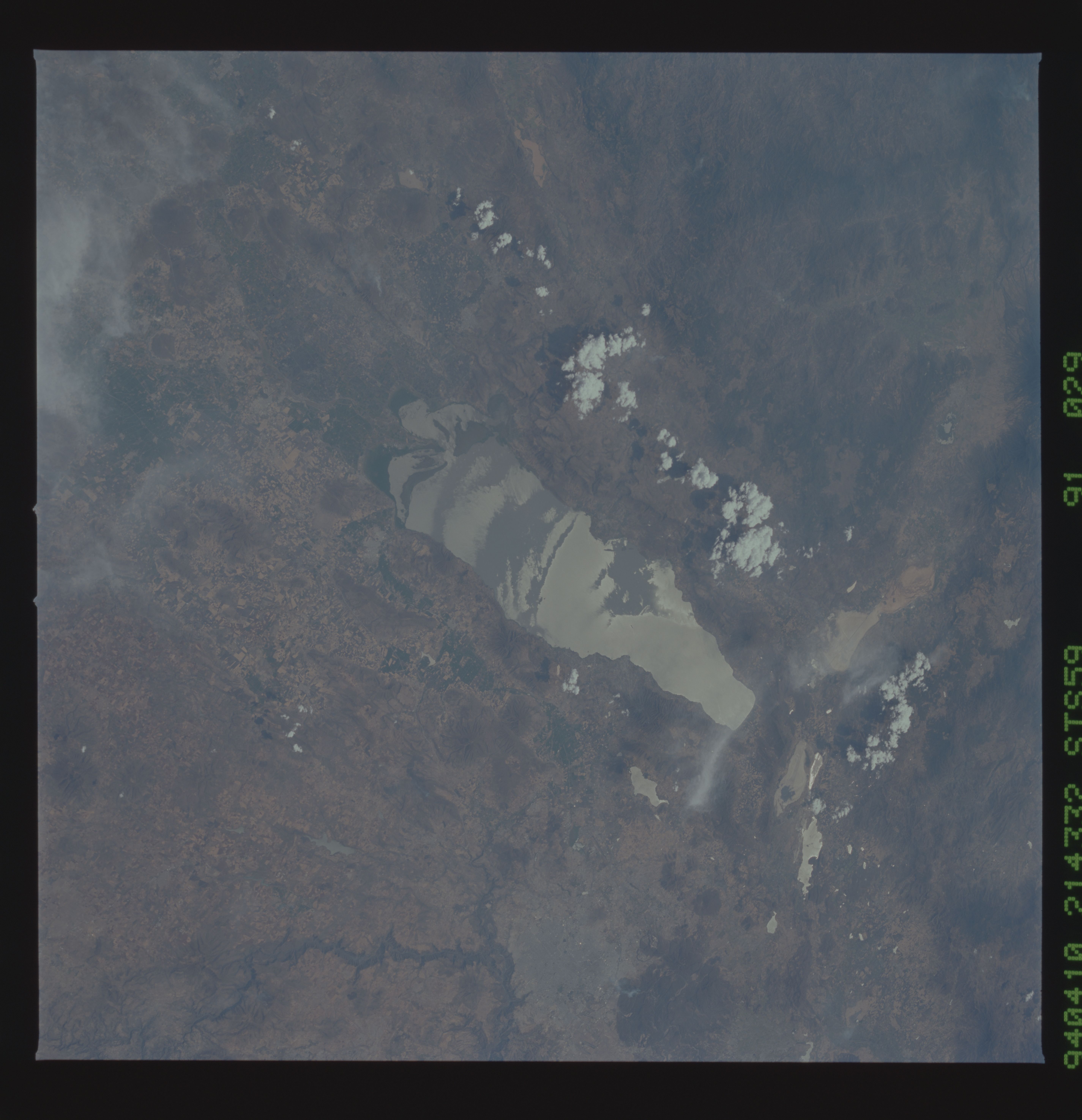
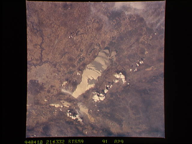
Image Caption: STS059-91-29 Lake Chapala, Mexico April 1994
Lake Chapala, the largest lake in Mexico, is visible (center of photograph) in this low-oblique, southwest-looking photograph. The lake, set in a shallow depression in Mexico's central plateau, covers 650 square miles (1684 square kilometers), is 50 miles (80 kilometers) long, and is 8 miles (13 kilometers) wide. Lake Chapala is fed by the Lerma River, which enters the east end of the lake (point of land extending into the lake), and is drained by the Grand Santiago River (not visible in the photograph). In the past, Lake Chapala was a popular scenic resort area and fishing center. Since the early 1950s, the water levels in the lake have been receding at an alarming rate because of increased industrial use, agriculture in the surrounding valley (field patterns visible in the photograph), and a decreased flow of water into the lake from the Lerma River caused by field irrigation upstream. Over the last three decades, runoff from fertilizers and pesticides used on agricultural fields and discharges into the lake from chemical plants, oil refineries, and industrial plants have heavily polluted the lake. Guadalajara (gray area north of the western end of the lake) and small lakes (west of the lake) are visible.
Lake Chapala, the largest lake in Mexico, is visible (center of photograph) in this low-oblique, southwest-looking photograph. The lake, set in a shallow depression in Mexico's central plateau, covers 650 square miles (1684 square kilometers), is 50 miles (80 kilometers) long, and is 8 miles (13 kilometers) wide. Lake Chapala is fed by the Lerma River, which enters the east end of the lake (point of land extending into the lake), and is drained by the Grand Santiago River (not visible in the photograph). In the past, Lake Chapala was a popular scenic resort area and fishing center. Since the early 1950s, the water levels in the lake have been receding at an alarming rate because of increased industrial use, agriculture in the surrounding valley (field patterns visible in the photograph), and a decreased flow of water into the lake from the Lerma River caused by field irrigation upstream. Over the last three decades, runoff from fertilizers and pesticides used on agricultural fields and discharges into the lake from chemical plants, oil refineries, and industrial plants have heavily polluted the lake. Guadalajara (gray area north of the western end of the lake) and small lakes (west of the lake) are visible.
