STS059-89-31
| NASA Photo ID | STS059-89-31 |
| Focal Length | 250mm |
| Date taken | 1994.04.10 |
| Time taken | 20:06:05 GMT |
Resolutions offered for this image:
3904 x 3904 pixels 639 x 639 pixels 5700 x 5900 pixels 500 x 518 pixels 640 x 480 pixels
3904 x 3904 pixels 639 x 639 pixels 5700 x 5900 pixels 500 x 518 pixels 640 x 480 pixels

Cloud masks available for this image:
Spacecraft nadir point: 46.4° N, 105.7° W
Photo center point: 48.0° N, 103.5° W
Photo center point by machine learning:
Photo center point: 48.0° N, 103.5° W
Photo center point by machine learning:
Nadir to Photo Center: Northeast
Spacecraft Altitude: 119 nautical miles (220km)
Country or Geographic Name: | USA-MONTANA |
Features: | YELLOWSTONE RIVER |
| Features Found Using Machine Learning: | |
Cloud Cover Percentage: | 0 (no clouds present) |
Sun Elevation Angle: | 50° |
Sun Azimuth: | 204° |
Camera: | Hasselblad |
Focal Length: | 250mm |
Camera Tilt: | 54 degrees |
Format: | 5046: Kodak, natural color positive, Lumiere 100/5046, ASA 100, standard base |
Film Exposure: | Normal |
| Additional Information | |
| Width | Height | Annotated | Cropped | Purpose | Links |
|---|---|---|---|---|---|
| 3904 pixels | 3904 pixels | No | No | Earth From Space collection | Download Image |
| 639 pixels | 639 pixels | No | No | Earth From Space collection | Download Image |
| 5700 pixels | 5900 pixels | No | No | Download Image | |
| 500 pixels | 518 pixels | No | No | Download Image | |
| 640 pixels | 480 pixels | No | No | Download Image |
Download Packaged File
Download a Google Earth KML for this Image
View photo footprint information
Download a GeoTIFF for this photo
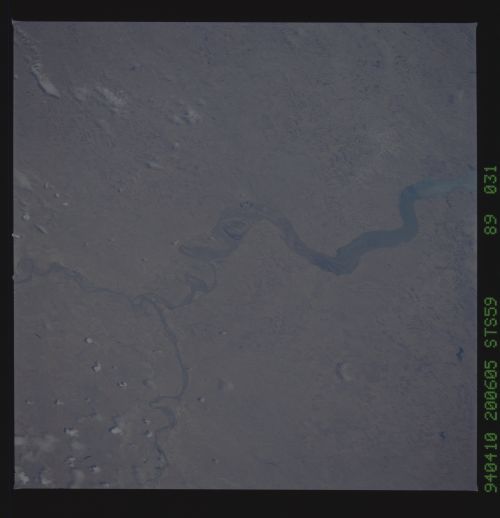
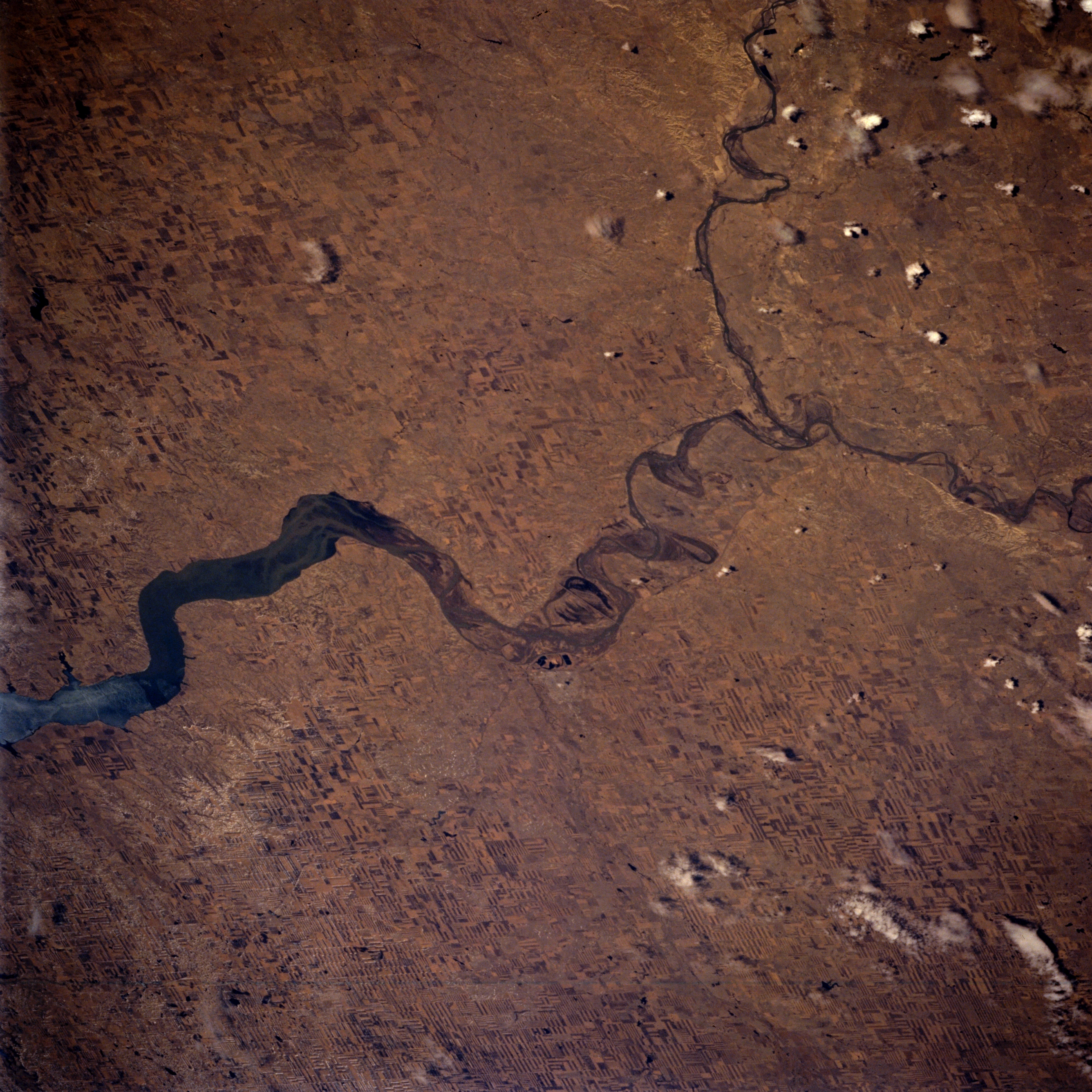
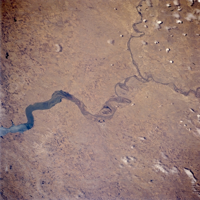
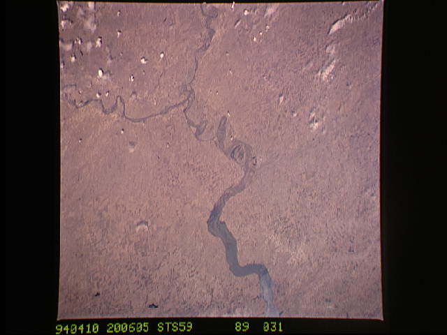
Image Caption: STS059-089-031 Missouri River and Yellowstone River, North Dakota, U.S.A. April 1994
The Yellowstone River, one of the main tributaries of the upper Missouri River, is visible entering the Missouri River near the North Dakota-Montana border in this south-looking, low-oblique photograph. During the ice age, the Missouri River was the boundary between glaciers to the north and ice-free land to the south. Apparent in the photograph are the western end of Lake Sakakawea [200 miles (322 kilometers) long] and scattered agricultural field patterns. With the discovery of rich oil reserves nearby in 1951, the small city of Williston on the north side of the Missouri River (barely discernible in the center of the photograph) increased in importance. It is a trade, processing, and shipping center for the agricultural region and has an oil refinery, stockyards, grain elevators, and dairy processing plants. The area has large reserves of lignite, natural gas, salt, and leonite.
The Yellowstone River, one of the main tributaries of the upper Missouri River, is visible entering the Missouri River near the North Dakota-Montana border in this south-looking, low-oblique photograph. During the ice age, the Missouri River was the boundary between glaciers to the north and ice-free land to the south. Apparent in the photograph are the western end of Lake Sakakawea [200 miles (322 kilometers) long] and scattered agricultural field patterns. With the discovery of rich oil reserves nearby in 1951, the small city of Williston on the north side of the Missouri River (barely discernible in the center of the photograph) increased in importance. It is a trade, processing, and shipping center for the agricultural region and has an oil refinery, stockyards, grain elevators, and dairy processing plants. The area has large reserves of lignite, natural gas, salt, and leonite.
