STS059-76-17
| NASA Photo ID | STS059-76-17 |
| Focal Length | 100mm |
| Date taken | 1994.04.10 |
| Time taken | 08:28:54 GMT |
Resolutions offered for this image:
4064 x 4064 pixels 639 x 639 pixels 5700 x 5900 pixels 500 x 518 pixels 640 x 480 pixels 521 x 517 pixels
4064 x 4064 pixels 639 x 639 pixels 5700 x 5900 pixels 500 x 518 pixels 640 x 480 pixels 521 x 517 pixels

Cloud masks available for this image:
Spacecraft nadir point: 3.8° N, 111.6° E
Photo center point: 2.0° N, 111.0° E
Photo center point by machine learning:
Photo center point: 2.0° N, 111.0° E
Photo center point by machine learning:
Nadir to Photo Center: South
Spacecraft Altitude: 118 nautical miles (219km)
Country or Geographic Name: | MALAYSIA |
Features: | BATANG R. DELTA, SED. |
| Features Found Using Machine Learning: | |
Cloud Cover Percentage: | 40 (26-50)% |
Sun Elevation Angle: | 32° |
Sun Azimuth: | 277° |
Camera: | Hasselblad |
Focal Length: | 100mm |
Camera Tilt: | 44 degrees |
Format: | 5046: Kodak, natural color positive, Lumiere 100/5046, ASA 100, standard base |
Film Exposure: | Normal |
| Additional Information | |
| Width | Height | Annotated | Cropped | Purpose | Links |
|---|---|---|---|---|---|
| 4064 pixels | 4064 pixels | No | No | Earth From Space collection | Download Image |
| 639 pixels | 639 pixels | No | No | Earth From Space collection | Download Image |
| 5700 pixels | 5900 pixels | No | No | Download Image | |
| 500 pixels | 518 pixels | No | No | Download Image | |
| 640 pixels | 480 pixels | No | No | Download Image | |
| 521 pixels | 517 pixels | Download Image |
Download Packaged File
Download a Google Earth KML for this Image
View photo footprint information
Download a GeoTIFF for this photo
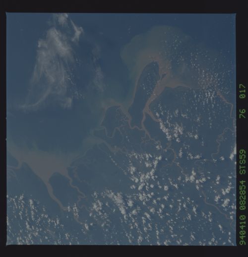
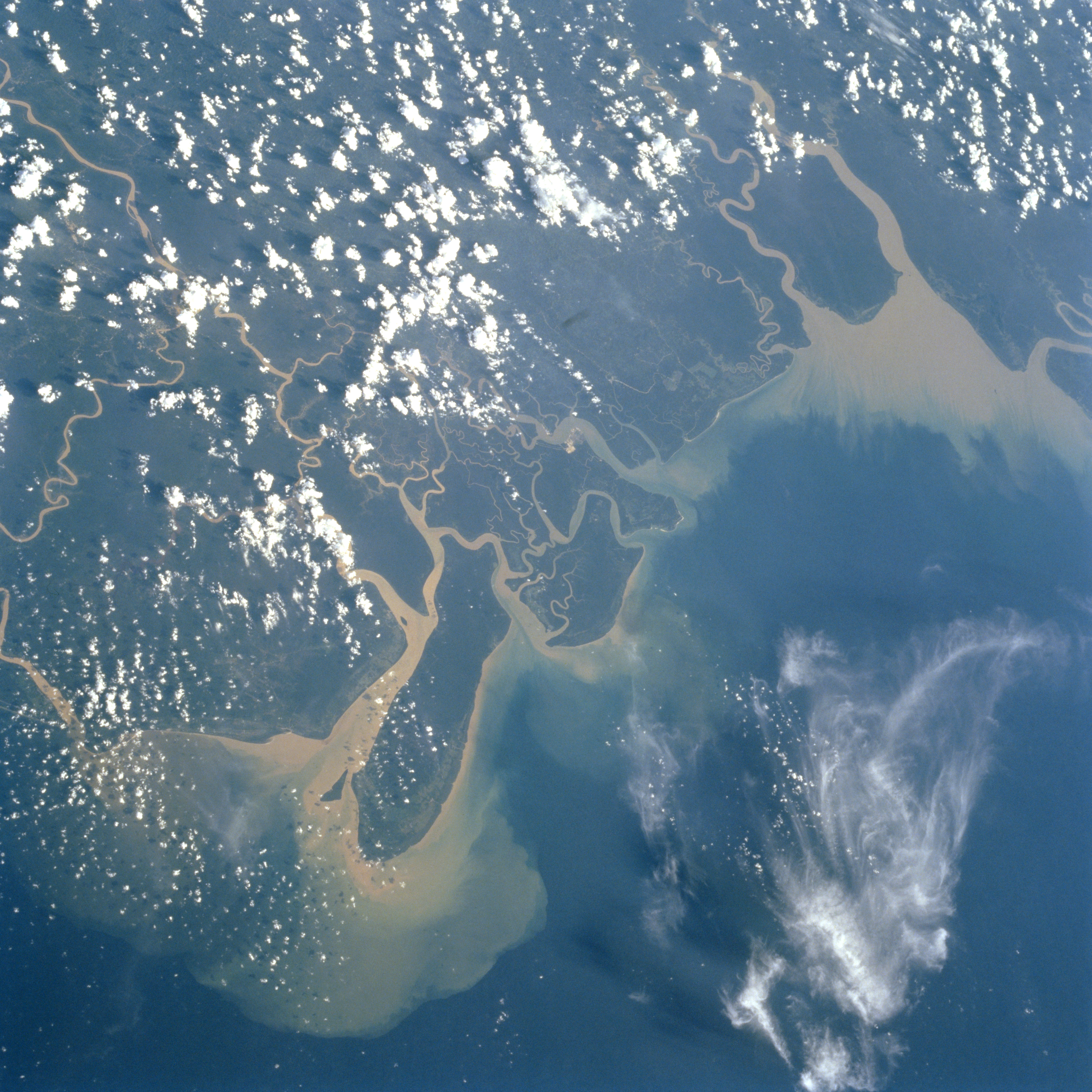
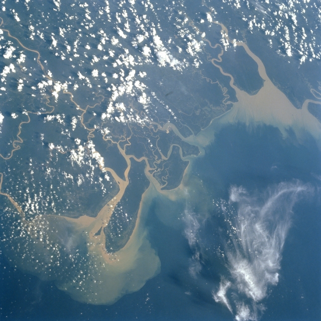
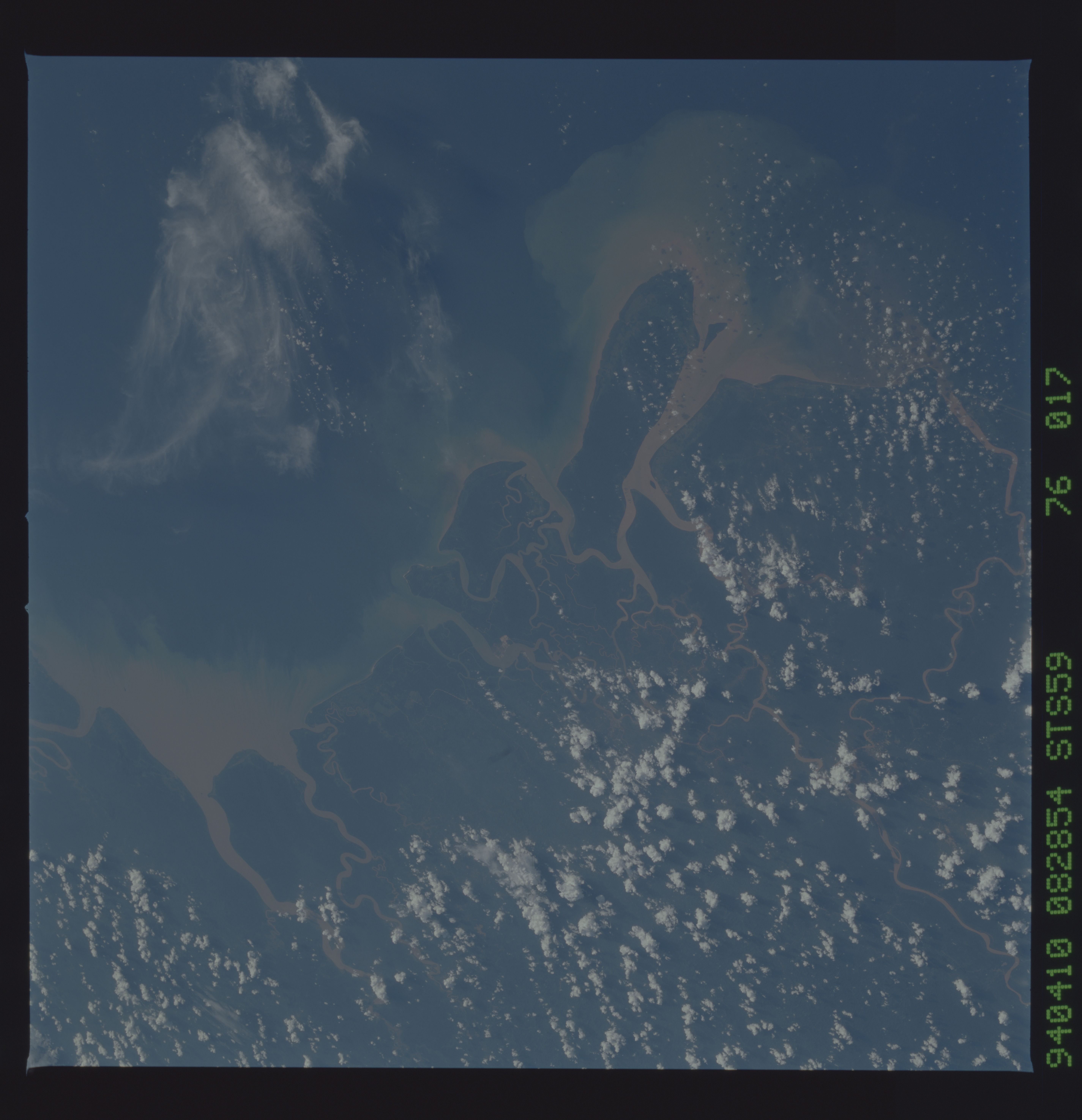
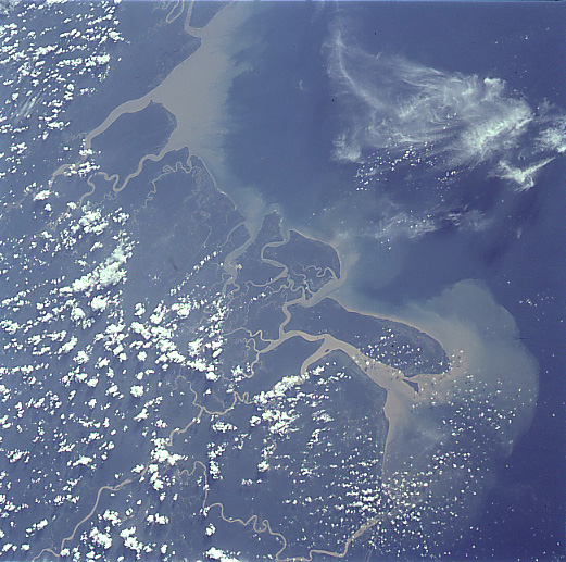
Image Caption: STS059-076-017 Rajang River Delta, Malaysia April 1994
The wide delta of the Rajang River in eastern Malaysia can be seen in this south-southwest-looking view. The Rajang, the largest river system in eastern Malaysia has a drainage area covering 19686 sq. miles (51000 sq. km) and the river is 350 miles (564 km) long. The river is navigable by shallow-draft boats for nearly 150 miles (242 km) inland from its mouth on the South China Sea (right portion of image). Numerous mangrove swamps and mudflats make up the coastal portions of the Rajang's wide delta. Further inland are the Nyka Swamps, which are associated with mangrove forests and brackish water. Fresh water swamps lie further inland from the coast. Rivers like the Rajang provide a means of communication and transportation from coastal areas to the interior. Just to the right of the center of the image is the coastal island of Beruit. In the upper left portion of the image, the mouth of the Lupar River is visible.
The wide delta of the Rajang River in eastern Malaysia can be seen in this south-southwest-looking view. The Rajang, the largest river system in eastern Malaysia has a drainage area covering 19686 sq. miles (51000 sq. km) and the river is 350 miles (564 km) long. The river is navigable by shallow-draft boats for nearly 150 miles (242 km) inland from its mouth on the South China Sea (right portion of image). Numerous mangrove swamps and mudflats make up the coastal portions of the Rajang's wide delta. Further inland are the Nyka Swamps, which are associated with mangrove forests and brackish water. Fresh water swamps lie further inland from the coast. Rivers like the Rajang provide a means of communication and transportation from coastal areas to the interior. Just to the right of the center of the image is the coastal island of Beruit. In the upper left portion of the image, the mouth of the Lupar River is visible.
