STS059-239-9
| NASA Photo ID | STS059-239-9 |
| Focal Length | 250mm |
| Date taken | 1994.04.17 |
| Time taken | 17:50:20 GMT |
Resolutions offered for this image:
3904 x 3904 pixels 639 x 639 pixels 5700 x 5900 pixels 500 x 518 pixels 640 x 480 pixels
3904 x 3904 pixels 639 x 639 pixels 5700 x 5900 pixels 500 x 518 pixels 640 x 480 pixels
Cloud masks available for this image:
Spacecraft nadir point: 36.5° N, 97.8° W
Photo center point: 35.5° N, 97.5° W
Photo center point by machine learning:
Photo center point: 35.5° N, 97.5° W
Photo center point by machine learning:
Nadir to Photo Center: South
Spacecraft Altitude: 113 nautical miles (209km)
Country or Geographic Name: | USA-OKLAHOMA |
Features: | OKLAHOMA CITY, RES., RIV. |
| Features Found Using Machine Learning: | |
Cloud Cover Percentage: | 0 (no clouds present) |
Sun Elevation Angle: | 63° |
Sun Azimuth: | 158° |
Camera: | Hasselblad |
Focal Length: | 250mm |
Camera Tilt: | 29 degrees |
Format: | 5046: Kodak, natural color positive, Lumiere 100/5046, ASA 100, standard base |
Film Exposure: | Normal |
| Additional Information | |
| Width | Height | Annotated | Cropped | Purpose | Links |
|---|---|---|---|---|---|
| 3904 pixels | 3904 pixels | No | No | Earth From Space collection | Download Image |
| 639 pixels | 639 pixels | No | No | Earth From Space collection | Download Image |
| 5700 pixels | 5900 pixels | No | No | Download Image | |
| 500 pixels | 518 pixels | No | No | Download Image | |
| 640 pixels | 480 pixels | No | No | Download Image |
Download Packaged File
Download a Google Earth KML for this Image
View photo footprint information
Download a GeoTIFF for this photo
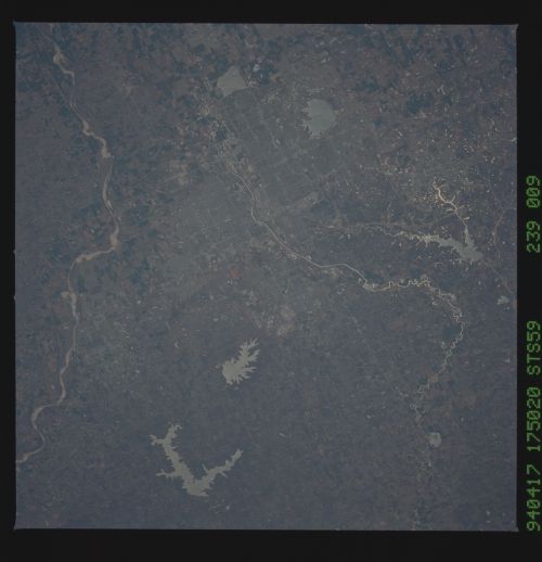
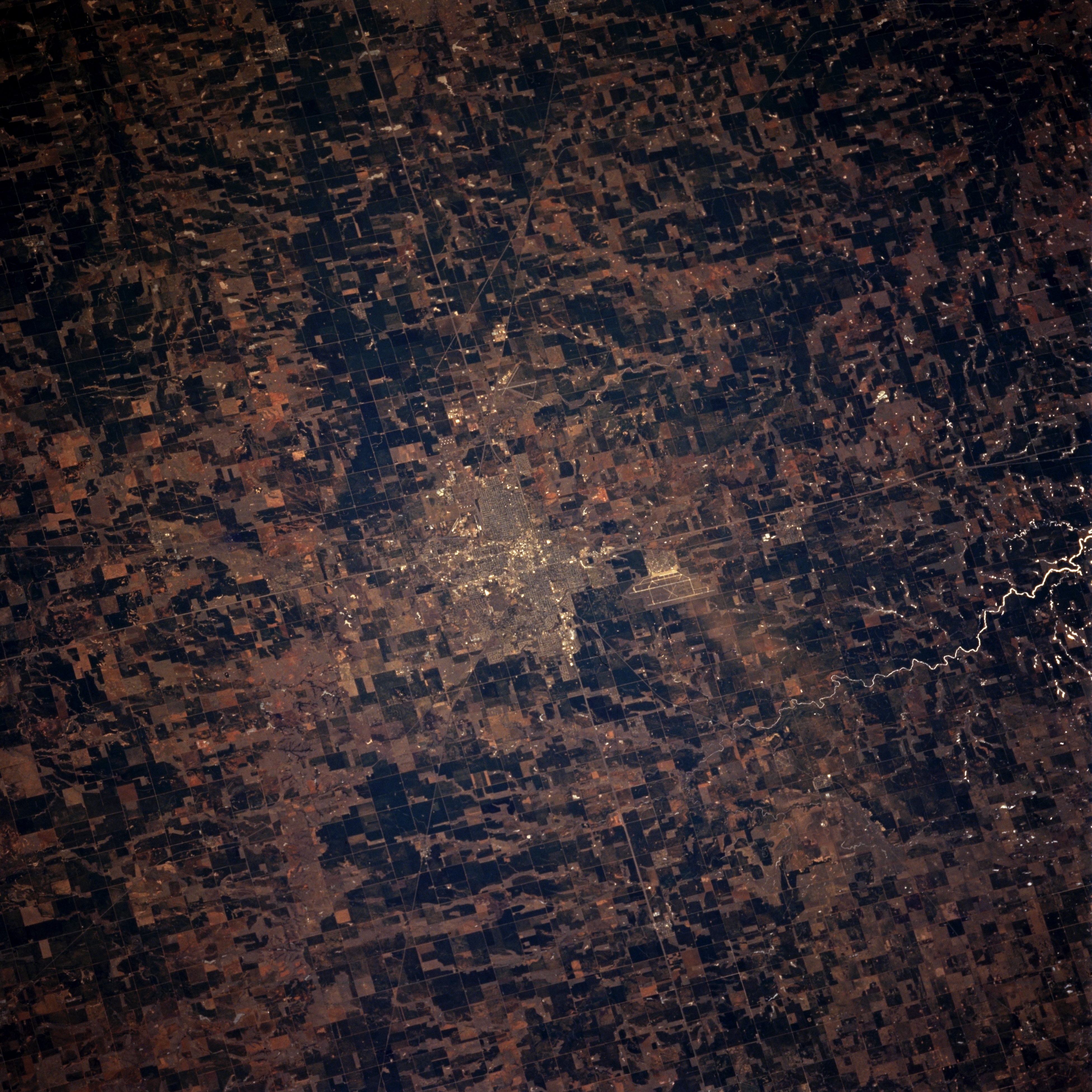
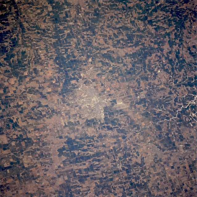
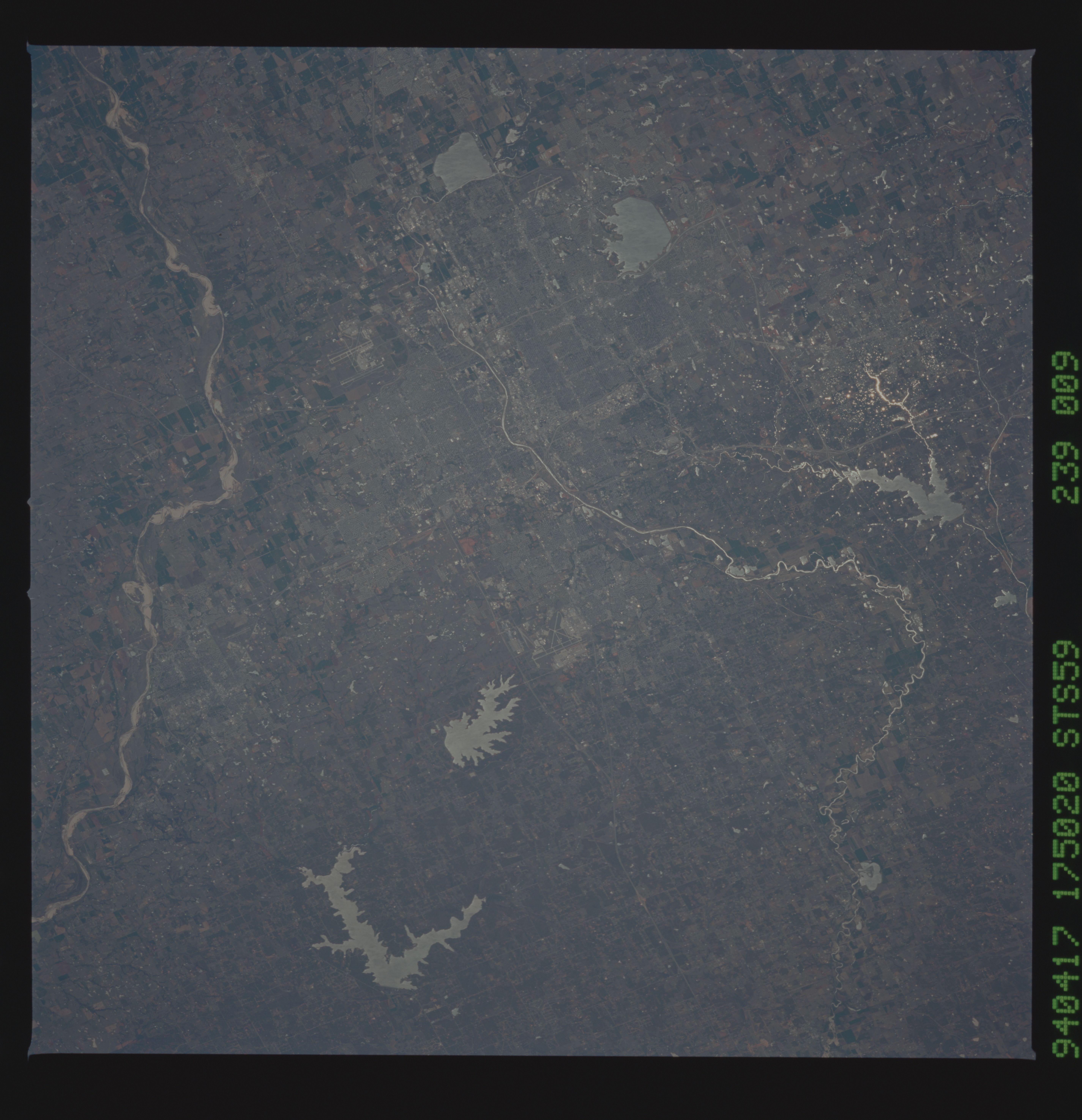
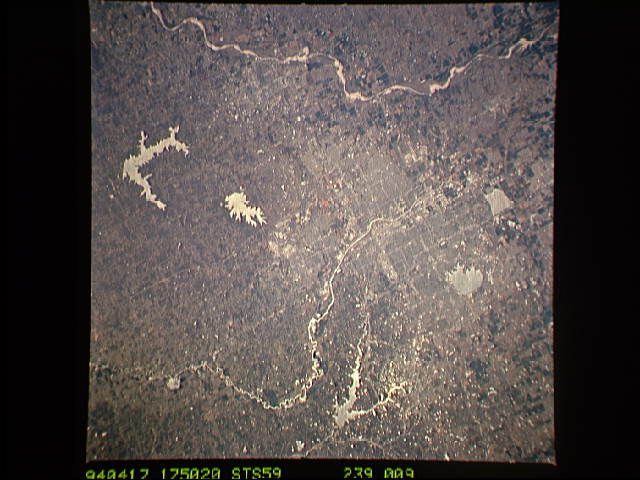
Image Caption: STS059-239-009 Enid, Oklahoma, U.S.A. April 1994
Enid, 68 miles (109 kilometers) north-northwest of Oklahoma City, is apparent in this east-southeast-looking, low-oblique photograph. An important trade and processing center, Enid sits in an agricultural area rich in the production of wheat, dairy products, and poultry. Other industries include meat packing, grain elevators, agricultural machinery, and oil refineries. The runways of Vance Air Force Base are visible south-southwest of the city.
Enid, 68 miles (109 kilometers) north-northwest of Oklahoma City, is apparent in this east-southeast-looking, low-oblique photograph. An important trade and processing center, Enid sits in an agricultural area rich in the production of wheat, dairy products, and poultry. Other industries include meat packing, grain elevators, agricultural machinery, and oil refineries. The runways of Vance Air Force Base are visible south-southwest of the city.
