STS059-227-42

| NASA Photo ID | STS059-227-42 |
| Focal Length | 100mm |
| Date taken | 1994.04.15 |
| Time taken | 18:38:00 GMT |
Resolutions offered for this image:
1536 x 1536 pixels 639 x 639 pixels 5700 x 5900 pixels 500 x 518 pixels 640 x 480 pixels 5059 x 5026 pixels 640 x 480 pixels 800 x 612 pixels
1536 x 1536 pixels 639 x 639 pixels 5700 x 5900 pixels 500 x 518 pixels 640 x 480 pixels 5059 x 5026 pixels 640 x 480 pixels 800 x 612 pixels


Cloud masks available for this image:
Spacecraft nadir point: 18.5° N, 82.3° W
Photo center point: 19.0° N, 81.0° W
Photo center point by machine learning:
Photo center point: 19.0° N, 81.0° W
Photo center point by machine learning:
Nadir to Photo Center: East
Spacecraft Altitude: 115 nautical miles (213km)
Country or Geographic Name: | CAYMAN ISLANDS |
Features: | GRAND CAYMAN ISLAND |
| Features Found Using Machine Learning: | |
Cloud Cover Percentage: | 0 (no clouds present) |
Sun Elevation Angle: | 71° |
Sun Azimuth: | 245° |
Camera: | Hasselblad |
Focal Length: | 100mm |
Camera Tilt: | 36 degrees |
Format: | 5048: Kodak, natural color positive, Lumiere 100x/5048, ASA 100x, standard base |
Film Exposure: | Normal |
| Additional Information | |
| Width | Height | Annotated | Cropped | Purpose | Links |
|---|---|---|---|---|---|
| 1536 pixels | 1536 pixels | No | No | Earth From Space collection | Download Image |
| 639 pixels | 639 pixels | No | No | Earth From Space collection | Download Image |
| 5700 pixels | 5900 pixels | No | No | Download Image | |
| 500 pixels | 518 pixels | No | No | Download Image | |
| 640 pixels | 480 pixels | No | No | Download Image | |
| 5059 pixels | 5026 pixels | Reef RS | Download Image | ||
| 640 pixels | 480 pixels | ReefBase pilot | Download Image | ||
| 800 pixels | 612 pixels | Download Image |
Download Packaged File
Download a Google Earth KML for this Image
View photo footprint information
Download a GeoTIFF for this photo
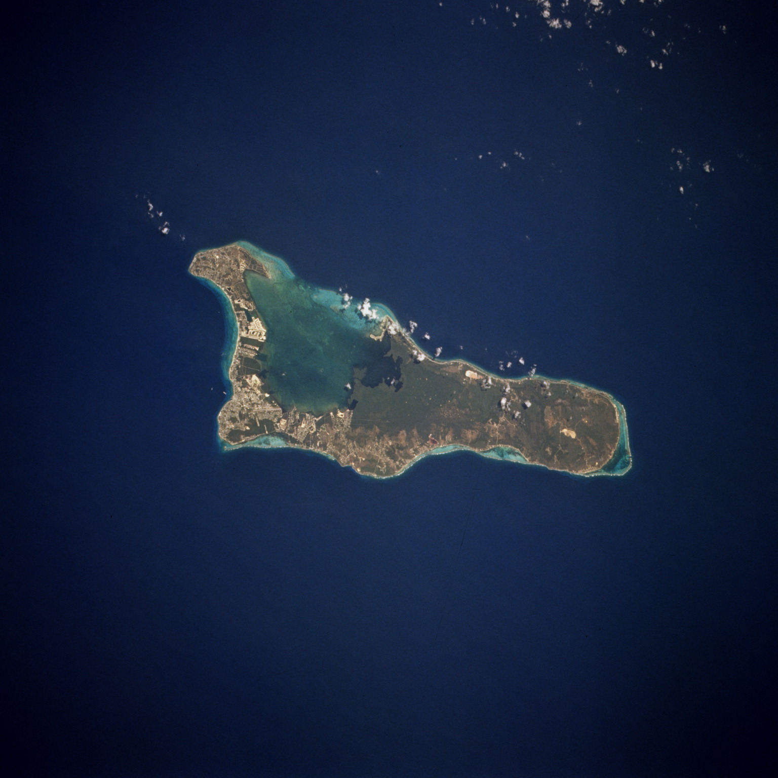
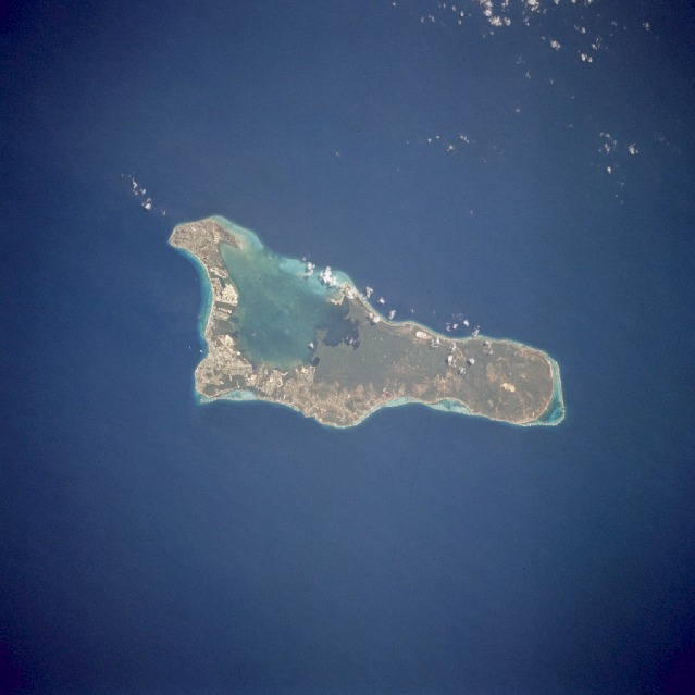
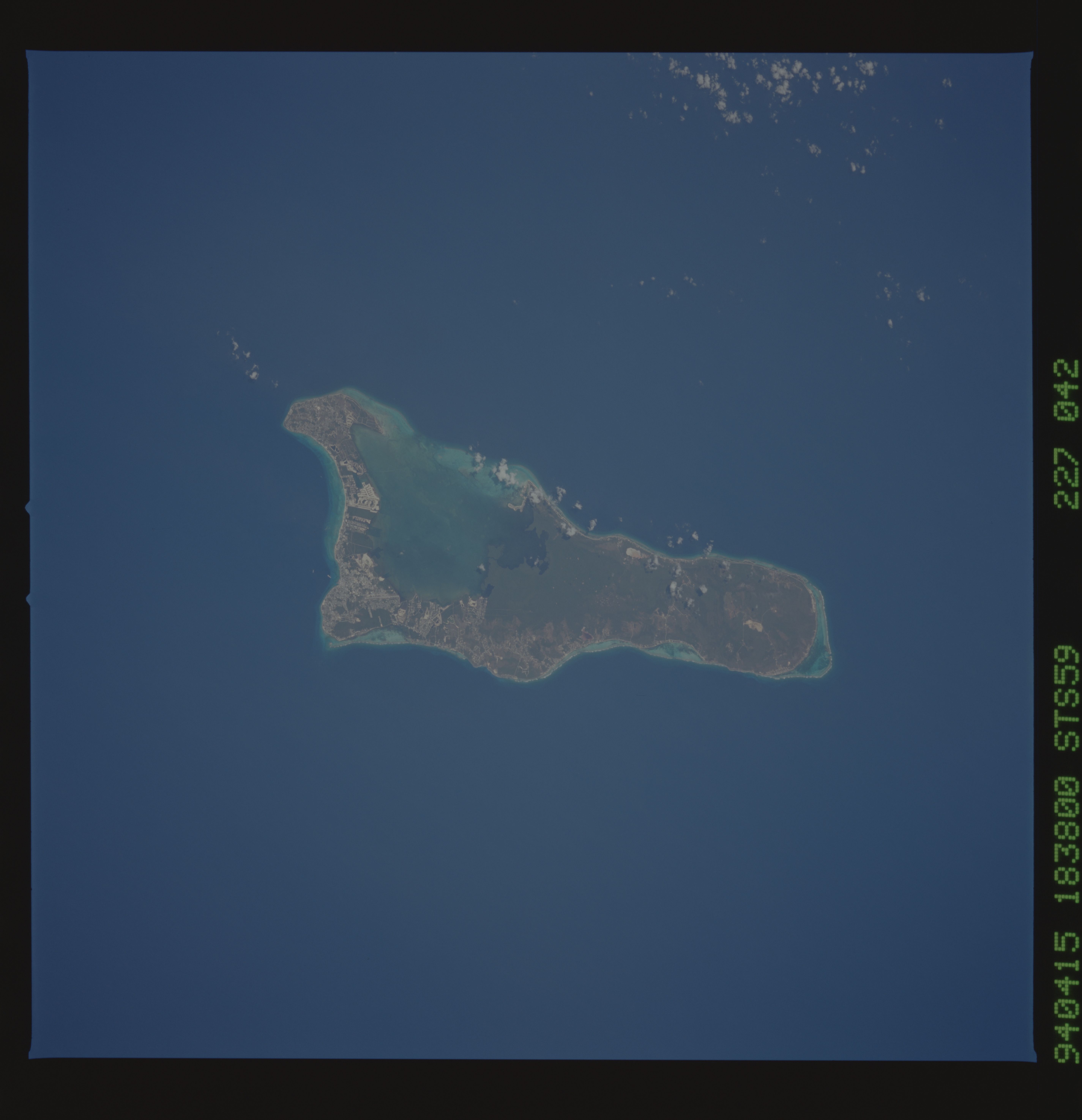
Image Caption: STS059-227-042 Grand Cayman, Cayman Islands April 1994
The island of Grand Cayman, a British dependency that covers 76 square miles (197 square kilometers) in the northwest Caribbean Sea, is visible in this near-vertical photograph. Geologically similar to The Bahamas, Grand Cayman is a low-lying, limestone island located on top of a submarine ridge. The city of George Town, the capital and chief port of the Cayman Islands, can be seen at the southwest end of the island. Grand Cayman was discovered in 1503 by Christopher Columbus but was never occupied by Spain. The island was settled in 1734 by English colonists from the island of Jamaica, approximately 200 miles (320 kilometers) to the southeast. The word "Cayman" is derived from the Carib Indian word for alligator, apparently because early British visitors saw large lizards (probably iguanas), which they mistook for alligators. Grand Cayman's 7-mile beach can be seen on the western side of the island. With exotic coral reefs off its shores, Grand Cayman is a mecca for divers. Today, tourism is the major industry of the island.
The island of Grand Cayman, a British dependency that covers 76 square miles (197 square kilometers) in the northwest Caribbean Sea, is visible in this near-vertical photograph. Geologically similar to The Bahamas, Grand Cayman is a low-lying, limestone island located on top of a submarine ridge. The city of George Town, the capital and chief port of the Cayman Islands, can be seen at the southwest end of the island. Grand Cayman was discovered in 1503 by Christopher Columbus but was never occupied by Spain. The island was settled in 1734 by English colonists from the island of Jamaica, approximately 200 miles (320 kilometers) to the southeast. The word "Cayman" is derived from the Carib Indian word for alligator, apparently because early British visitors saw large lizards (probably iguanas), which they mistook for alligators. Grand Cayman's 7-mile beach can be seen on the western side of the island. With exotic coral reefs off its shores, Grand Cayman is a mecca for divers. Today, tourism is the major industry of the island.
