STS059-226-12
| NASA Photo ID | STS059-226-12 |
| Focal Length | 100mm |
| Date taken | 1994.04.16 |
| Time taken | 16:37:25 GMT |
Resolutions offered for this image:
3962 x 3970 pixels 638 x 639 pixels 5700 x 5900 pixels 500 x 518 pixels 640 x 480 pixels
3962 x 3970 pixels 638 x 639 pixels 5700 x 5900 pixels 500 x 518 pixels 640 x 480 pixels

Cloud masks available for this image:
Spacecraft nadir point: 50.8° N, 97.2° W
Photo center point: 50.0° N, 97.0° W
Photo center point by machine learning:
Photo center point: 50.0° N, 97.0° W
Photo center point by machine learning:
Nadir to Photo Center: South
Spacecraft Altitude: 113 nautical miles (209km)
Country or Geographic Name: | CANADA-M |
Features: | WINNIPEG |
| Features Found Using Machine Learning: | |
Cloud Cover Percentage: | 0 (no clouds present) |
Sun Elevation Angle: | 44° |
Sun Azimuth: | 141° |
Camera: | Hasselblad |
Focal Length: | 100mm |
Camera Tilt: | 24 degrees |
Format: | 5048: Kodak, natural color positive, Lumiere 100x/5048, ASA 100x, standard base |
Film Exposure: | Normal |
| Additional Information | |
| Width | Height | Annotated | Cropped | Purpose | Links |
|---|---|---|---|---|---|
| 3962 pixels | 3970 pixels | No | No | Earth From Space collection | Download Image |
| 638 pixels | 639 pixels | No | No | Earth From Space collection | Download Image |
| 5700 pixels | 5900 pixels | No | No | Download Image | |
| 500 pixels | 518 pixels | No | No | Download Image | |
| 640 pixels | 480 pixels | No | No | Download Image |
Download Packaged File
Download a Google Earth KML for this Image
View photo footprint information
Download a GeoTIFF for this photo
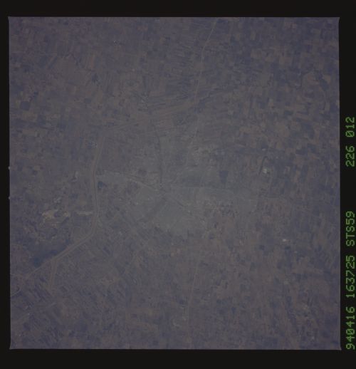
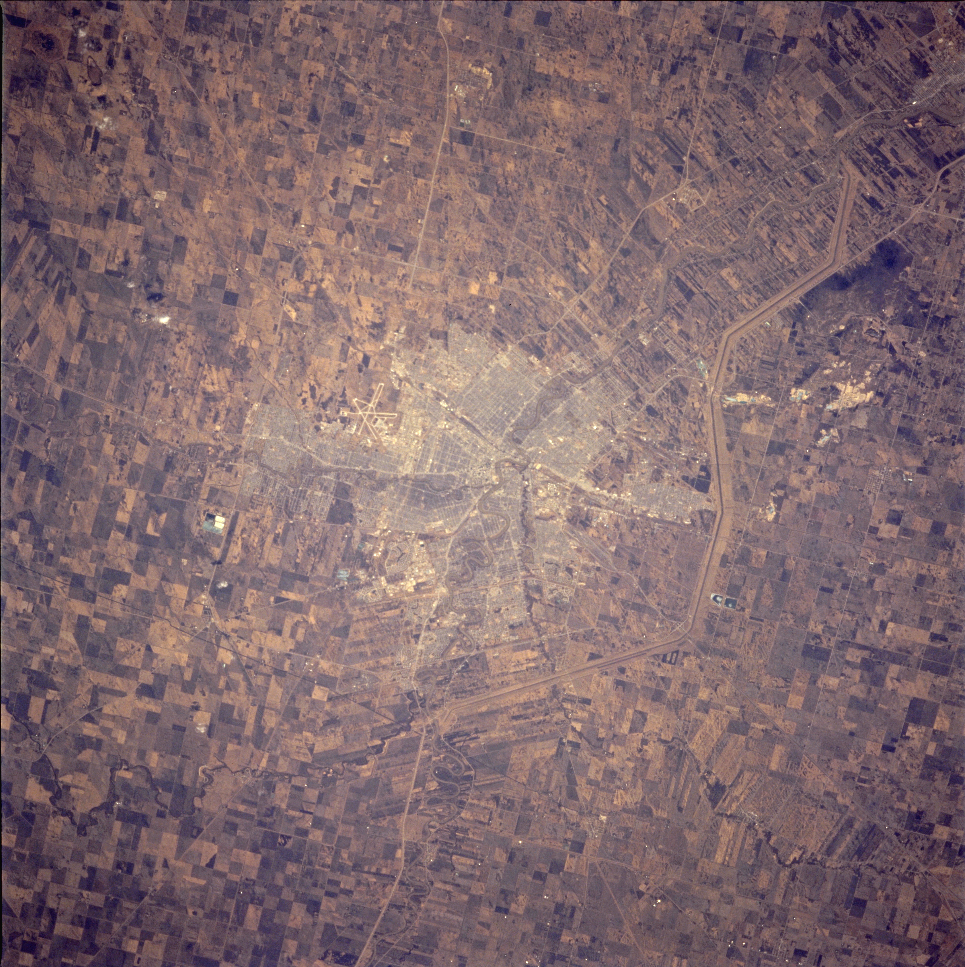
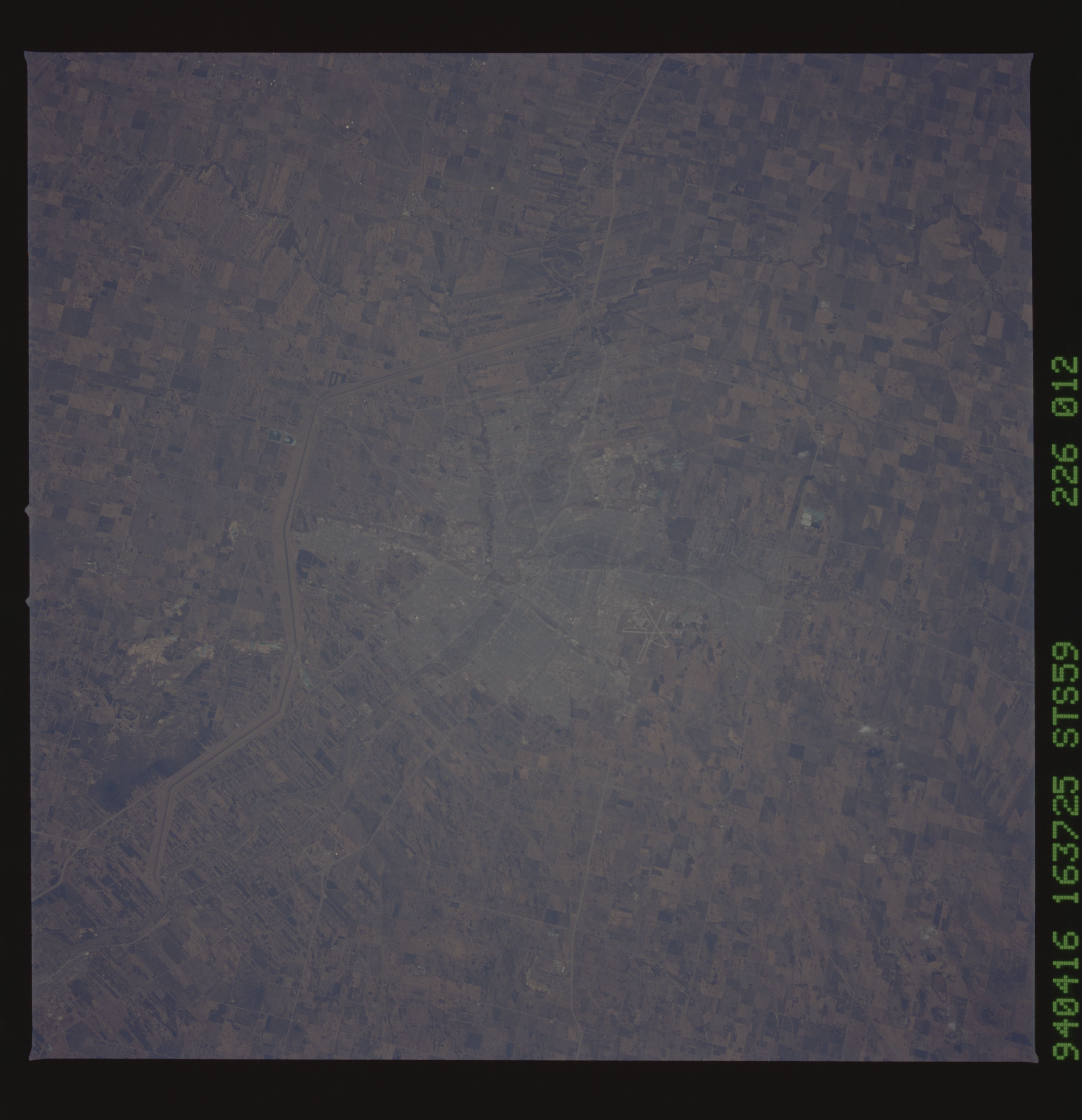
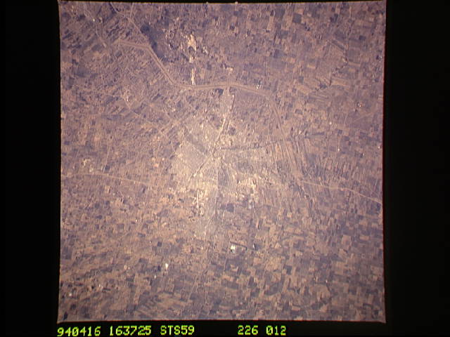
Image Caption: STS059-226-012 Winnipeg, Manitoba, Canada April 1994
Winnipeg, a city of more than a half million people in southeastern Manitoba approximately 60 miles (95 kilometers) due north of the North Dakota-Minnesota boundary, is a major grain market and distribution center for the prairie provinces of western Canada (Manitoba, Saskatchewan, and Alberta) and serves as the gateway to eastern Canada. Bordering the eastern edge of the Great Plains of North America, the region produces tremendous spring wheat crops, which is visually confirmed by the density of cultivated field patterns in this photograph. Some characteristics of the 1700s when the French and British were competing for control of the area are noted. French-influenced "long lots," the narrow rectangular farms perpendicular to the rivers, allow each farm access to the waterway. These "long lots" are found along the Red River, and to a lesser extent along the Seine (southeast of Winnipeg). The Assiniboine River (barely visible) joins the Red River in downtown Winnipeg. Visible are several prominent linear features--the Red River floodway to the east, which was constructed to alleviate flooding in the city; numerous highways and roads radiating from the core of the city; the street network within the city; and the runways of Winnipeg International Airport west-northwest of the central business district.
Winnipeg, a city of more than a half million people in southeastern Manitoba approximately 60 miles (95 kilometers) due north of the North Dakota-Minnesota boundary, is a major grain market and distribution center for the prairie provinces of western Canada (Manitoba, Saskatchewan, and Alberta) and serves as the gateway to eastern Canada. Bordering the eastern edge of the Great Plains of North America, the region produces tremendous spring wheat crops, which is visually confirmed by the density of cultivated field patterns in this photograph. Some characteristics of the 1700s when the French and British were competing for control of the area are noted. French-influenced "long lots," the narrow rectangular farms perpendicular to the rivers, allow each farm access to the waterway. These "long lots" are found along the Red River, and to a lesser extent along the Seine (southeast of Winnipeg). The Assiniboine River (barely visible) joins the Red River in downtown Winnipeg. Visible are several prominent linear features--the Red River floodway to the east, which was constructed to alleviate flooding in the city; numerous highways and roads radiating from the core of the city; the street network within the city; and the runways of Winnipeg International Airport west-northwest of the central business district.
