STS059-225-72
| NASA Photo ID | STS059-225-72 |
| Focal Length | 250mm |
| Date taken | 1994.04.18 |
| Time taken | 15:59:01 GMT |
Cloud masks available for this image:
Spacecraft nadir point: 39.8° N, 79.3° W
Photo center point: 38.5° N, 78.5° W
Photo center point by machine learning:
Photo center point: 38.5° N, 78.5° W
Photo center point by machine learning:
Nadir to Photo Center: Southeast
Spacecraft Altitude: 113 nautical miles (209km)
Country or Geographic Name: | USA-VIRGINIA |
Features: | ALLEGHENY MTS. |
| Features Found Using Machine Learning: | |
Cloud Cover Percentage: | 0 (no clouds present) |
Sun Elevation Angle: | 57° |
Sun Azimuth: | 144° |
Camera: | Hasselblad |
Focal Length: | 250mm |
Camera Tilt: | 39 degrees |
Format: | 5048: Kodak, natural color positive, Lumiere 100x/5048, ASA 100x, standard base |
Film Exposure: | Normal |
| Additional Information | |
| Width | Height | Annotated | Cropped | Purpose | Links |
|---|---|---|---|---|---|
| 5700 pixels | 5900 pixels | No | No | Download Image | |
| 500 pixels | 518 pixels | No | No | Download Image | |
| 640 pixels | 480 pixels | No | No | Download Image |
Download Packaged File
Download a Google Earth KML for this Image
View photo footprint information
Download a GeoTIFF for this photo
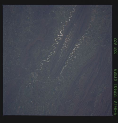
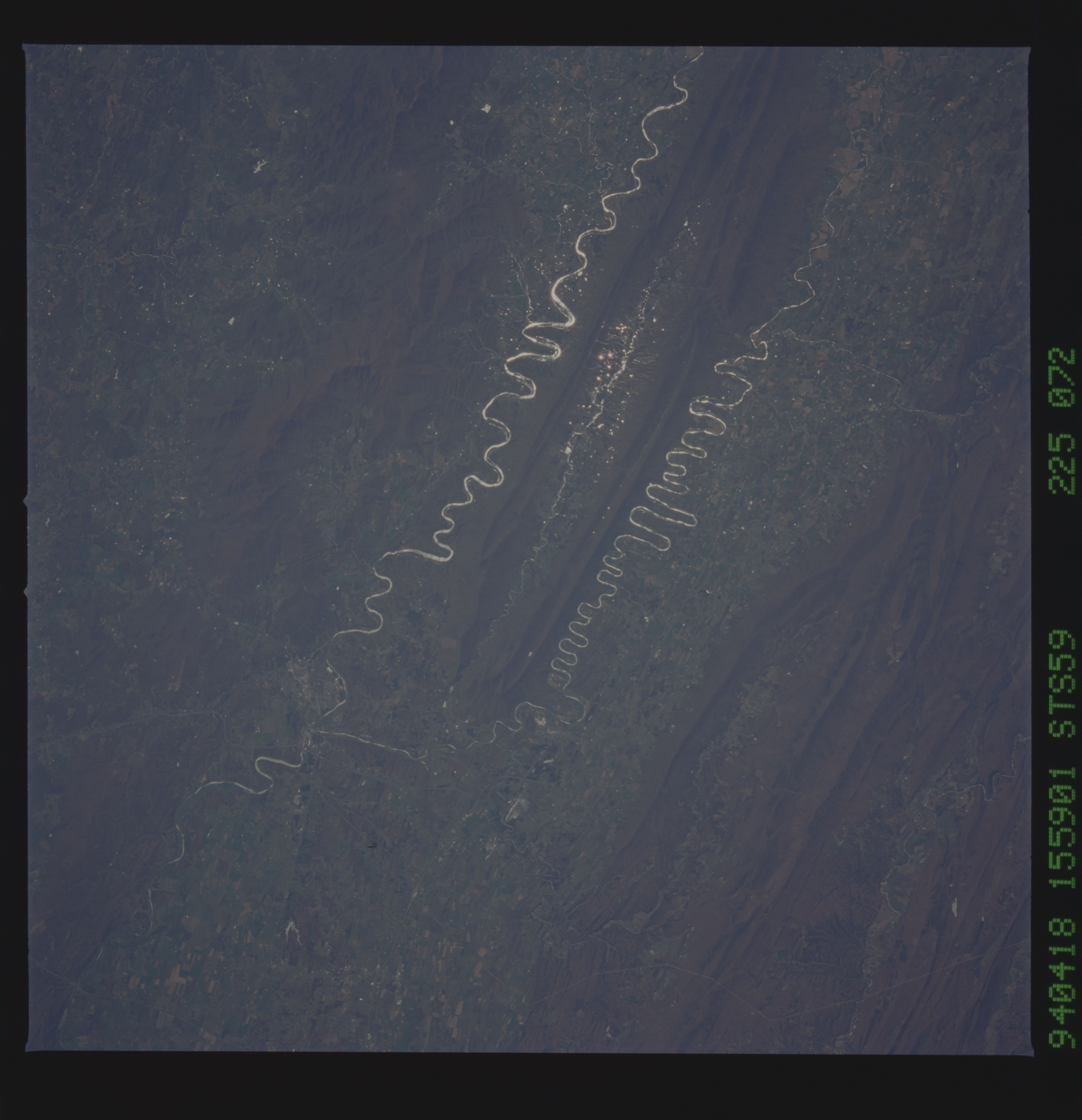
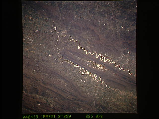
Image Caption: North and south Forks of the Shenandoah River.
Orient with the tuning fork away from the viewer (sunglint is always south of the spacecraft at this latitude). Then the South Fork (left) and the North Fork (right) of the Shenandoah meet in the foreground; Front Royal, Virginia is just to the left of the combined rivers at the junction. Massanutten Mountain, covered by reddish-brown fallen leaves of the George Washington National Forest, separates the river forks.
Orient with the tuning fork away from the viewer (sunglint is always south of the spacecraft at this latitude). Then the South Fork (left) and the North Fork (right) of the Shenandoah meet in the foreground; Front Royal, Virginia is just to the left of the combined rivers at the junction. Massanutten Mountain, covered by reddish-brown fallen leaves of the George Washington National Forest, separates the river forks.
