STS059-223-65
| NASA Photo ID | STS059-223-65 |
| Focal Length | 40mm |
| Date taken | 1994.04.18 |
| Time taken | 06:59:23 GMT |
Resolutions offered for this image:
3955 x 3985 pixels 635 x 639 pixels 5700 x 5900 pixels 500 x 518 pixels 640 x 480 pixels
3955 x 3985 pixels 635 x 639 pixels 5700 x 5900 pixels 500 x 518 pixels 640 x 480 pixels


Cloud masks available for this image:
Spacecraft nadir point: 56.0° N, 17.1° E
Photo center point: 56.0° N, 17.0° E
Photo center point by machine learning:
Photo center point: 56.0° N, 17.0° E
Photo center point by machine learning:
Nadir to Photo Center: West
Spacecraft Altitude: 112 nautical miles (207km)
Country or Geographic Name: | SWEDEN |
Features: | NORTH SEA, BALTIC SEA |
| Features Found Using Machine Learning: | |
Cloud Cover Percentage: | 10 (1-10)% |
Sun Elevation Angle: | 27° |
Sun Azimuth: | 111° |
Camera: | Hasselblad |
Focal Length: | 40mm |
Camera Tilt: | High Oblique |
Format: | 5048: Kodak, natural color positive, Lumiere 100x/5048, ASA 100x, standard base |
Film Exposure: | Normal |
| Additional Information | |
| Width | Height | Annotated | Cropped | Purpose | Links |
|---|---|---|---|---|---|
| 3955 pixels | 3985 pixels | No | No | Earth From Space collection | Download Image |
| 635 pixels | 639 pixels | No | No | Earth From Space collection | Download Image |
| 5700 pixels | 5900 pixels | No | No | Download Image | |
| 500 pixels | 518 pixels | No | No | Download Image | |
| 640 pixels | 480 pixels | No | No | Download Image |
Download Packaged File
Download a Google Earth KML for this Image
View photo footprint information
Download a GeoTIFF for this photo
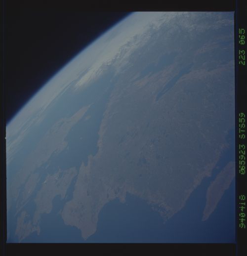
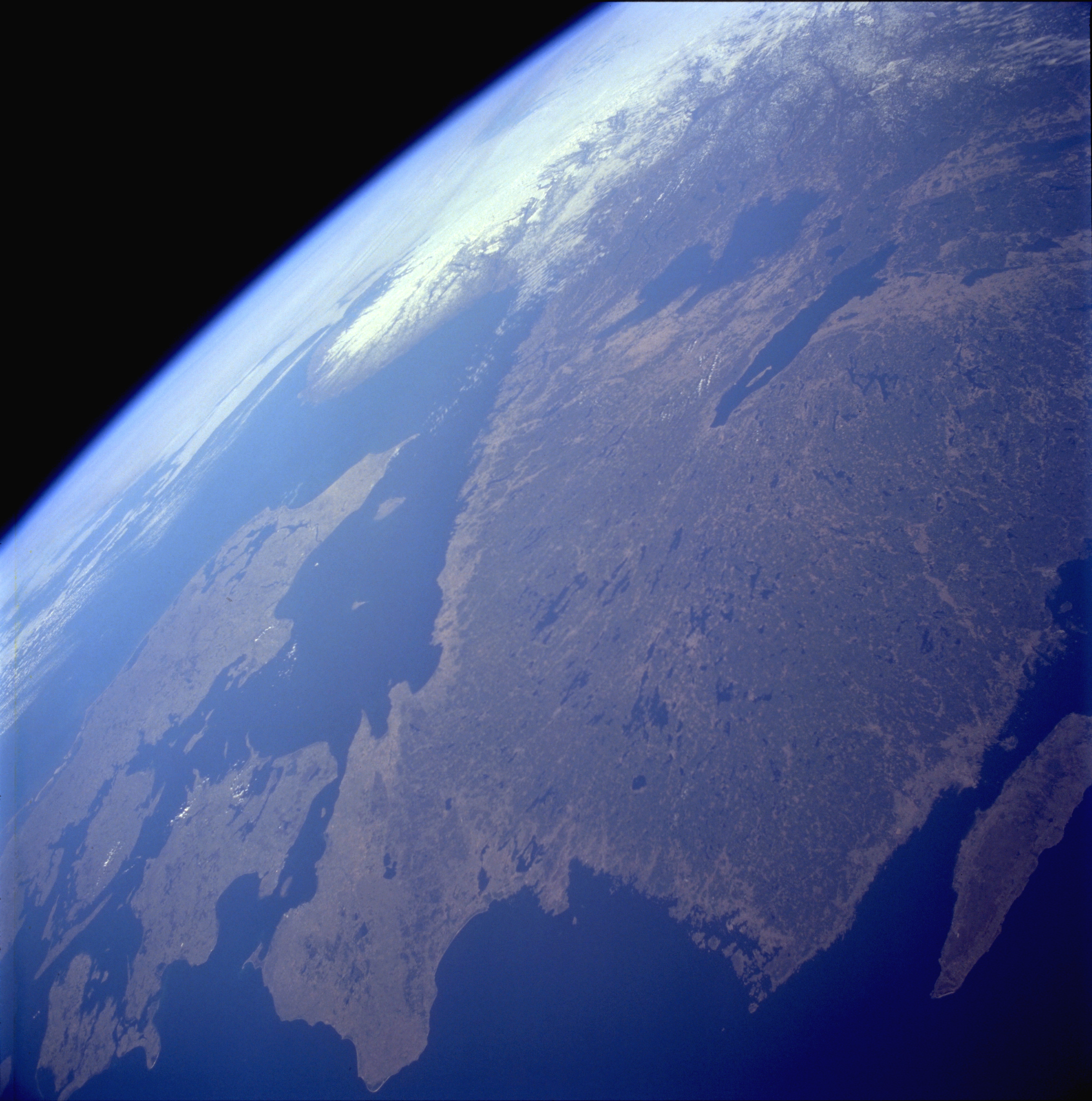
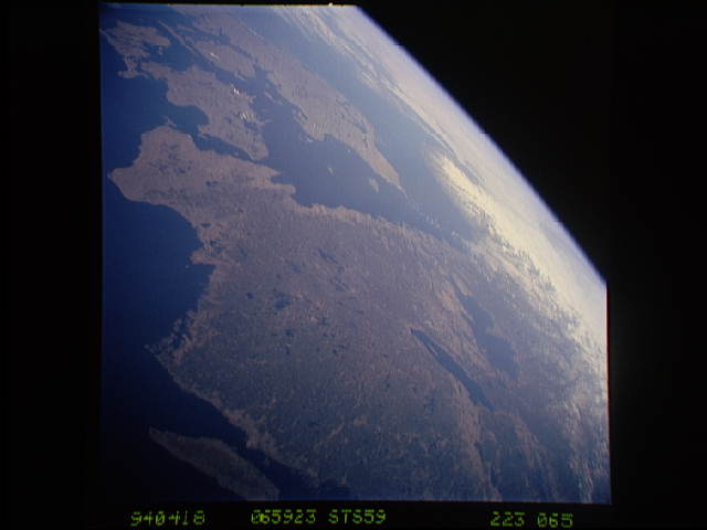
Image Caption: STS059-223-065 Southern Sweden April 1994
Southern Sweden, with its plethora of lakes, is visible in this west-looking, high-oblique photograph. The lakes were created when the continental glaciers scoured this area and then receded, allowing the countless depressions to fill with water. In addition to numerous smaller lakes that are generally aligned in a north-south orientation, two large lakes--larger Lake Vänern and Lake Vättern--can be seen toward the northern edge of the photograph. The dark green area inland from the coast is forested lands. A small part of the Baltic Sea is pictured off the southeast coast of Sweden, and the Skagerrak and Kattegat, the waterway entrance into the Baltic Sea, are shown off the southwest coast of Sweden. Although no specific details can be ascertained at this scale, the four main landforms of Denmark (viewing west to east)--a peninsula (Jylland) and three islands (Fyn, Sjelland, and Lolland)--can be seen along the southern edge of the photograph.
Southern Sweden, with its plethora of lakes, is visible in this west-looking, high-oblique photograph. The lakes were created when the continental glaciers scoured this area and then receded, allowing the countless depressions to fill with water. In addition to numerous smaller lakes that are generally aligned in a north-south orientation, two large lakes--larger Lake Vänern and Lake Vättern--can be seen toward the northern edge of the photograph. The dark green area inland from the coast is forested lands. A small part of the Baltic Sea is pictured off the southeast coast of Sweden, and the Skagerrak and Kattegat, the waterway entrance into the Baltic Sea, are shown off the southwest coast of Sweden. Although no specific details can be ascertained at this scale, the four main landforms of Denmark (viewing west to east)--a peninsula (Jylland) and three islands (Fyn, Sjelland, and Lolland)--can be seen along the southern edge of the photograph.
