STS059-217-79
| NASA Photo ID | STS059-217-79 |
| Focal Length | 250mm |
| Date taken | 1994.04.14 |
| Time taken | 17:24:00 GMT |
Resolutions offered for this image:
3904 x 3904 pixels 639 x 639 pixels 5700 x 5900 pixels 500 x 518 pixels 640 x 480 pixels
3904 x 3904 pixels 639 x 639 pixels 5700 x 5900 pixels 500 x 518 pixels 640 x 480 pixels


Cloud masks available for this image:
Spacecraft nadir point: 37.2° N, 74.5° W
Photo center point: 38.0° N, 75.5° W
Photo center point by machine learning:
Photo center point: 38.0° N, 75.5° W
Photo center point by machine learning:
Nadir to Photo Center: Northwest
Spacecraft Altitude: 115 nautical miles (213km)
Country or Geographic Name: | USA-MARYLAND |
Features: | CHINCOTEAGUE BAY AREA |
| Features Found Using Machine Learning: | |
Cloud Cover Percentage: | 0 (no clouds present) |
Sun Elevation Angle: | 62° |
Sun Azimuth: | 193° |
Camera: | Hasselblad |
Focal Length: | 250mm |
Camera Tilt: | Near Vertical |
Format: | 5048: Kodak, natural color positive, Lumiere 100x/5048, ASA 100x, standard base |
Film Exposure: | Normal |
| Additional Information | |
| Width | Height | Annotated | Cropped | Purpose | Links |
|---|---|---|---|---|---|
| 3904 pixels | 3904 pixels | No | No | Earth From Space collection | Download Image |
| 639 pixels | 639 pixels | No | No | Earth From Space collection | Download Image |
| 5700 pixels | 5900 pixels | No | No | Download Image | |
| 500 pixels | 518 pixels | No | No | Download Image | |
| 640 pixels | 480 pixels | No | No | Download Image |
Download Packaged File
Download a Google Earth KML for this Image
View photo footprint information
Download a GeoTIFF for this photo
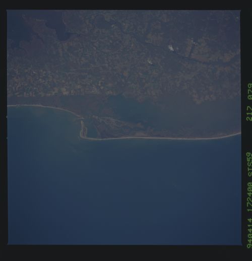
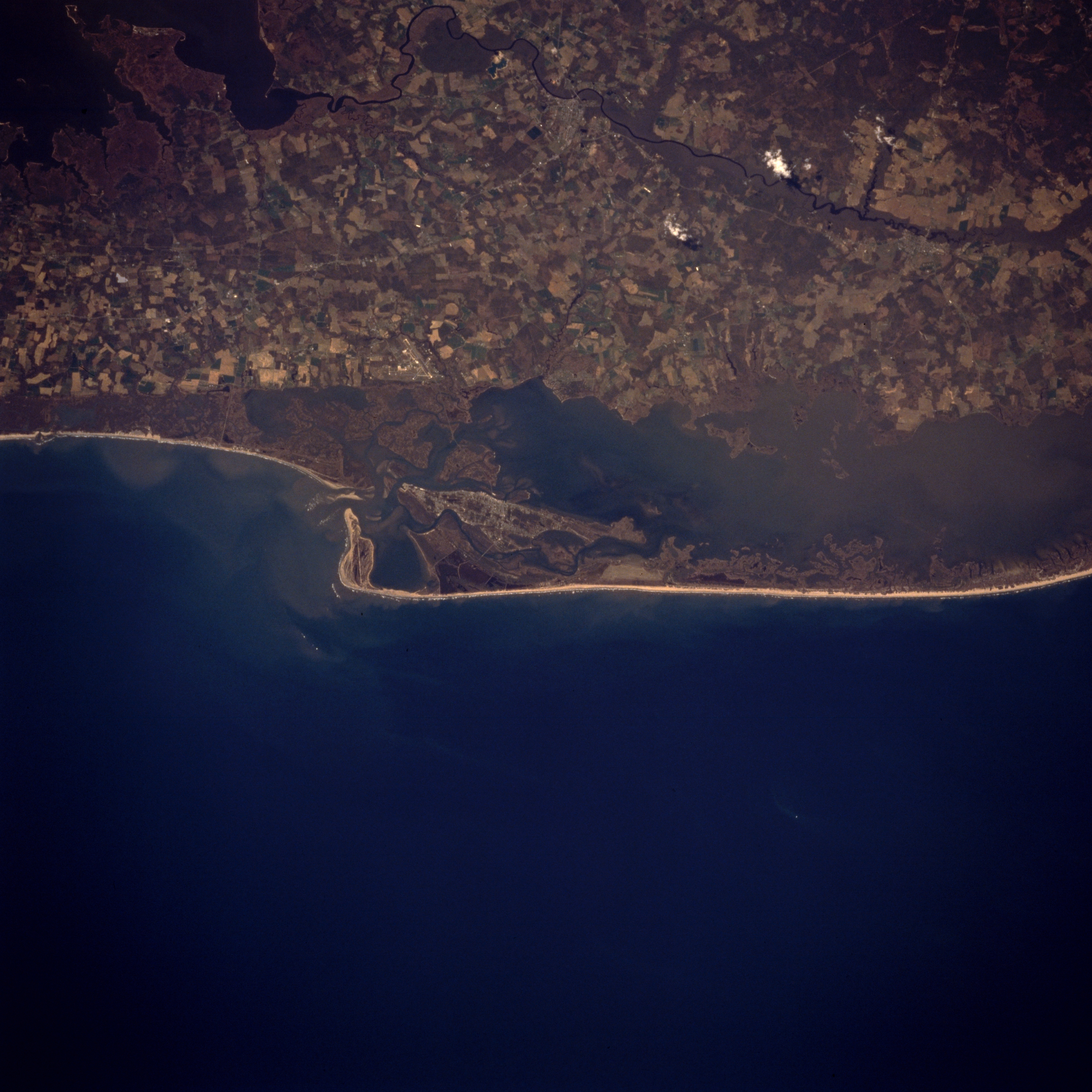
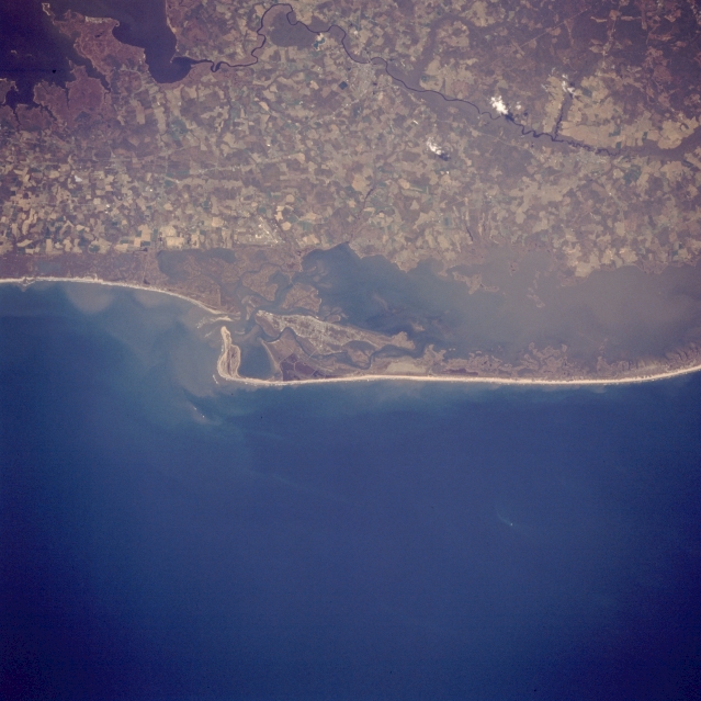
Image Caption: STS059-217-079 ASSATEAGUE ISLAND, CHINCOTEAGUE BAY, MARYLAND/VIRGINIA APRIL, 1993
Assateague Island, a national seashore 37 miles (58 km) long, can be seen in this west-looking low-oblique view. Assateague is a barrier island. A wildlife refuge makes up part of the island and is home to the famed Chincoteague wild ponies. The island is mostly uninhabited by human beings. Near the upper left portion of the image is the Pocomoke River. The mainland area seen in the upper third of the image is part of the Delmarva Peninsula.
Assateague Island, a national seashore 37 miles (58 km) long, can be seen in this west-looking low-oblique view. Assateague is a barrier island. A wildlife refuge makes up part of the island and is home to the famed Chincoteague wild ponies. The island is mostly uninhabited by human beings. Near the upper left portion of the image is the Pocomoke River. The mainland area seen in the upper third of the image is part of the Delmarva Peninsula.
