STS059-210-33
| NASA Photo ID | STS059-210-33 |
| Focal Length | 250mm |
| Date taken | 1994.04.12 |
| Time taken | 04:47:51 GMT |
Resolutions offered for this image:
4042 x 4042 pixels 640 x 640 pixels 5700 x 5900 pixels 500 x 518 pixels 640 x 480 pixels
4042 x 4042 pixels 640 x 640 pixels 5700 x 5900 pixels 500 x 518 pixels 640 x 480 pixels


Cloud masks available for this image:
Spacecraft nadir point: 25.1° N, 141.0° E
Photo center point: 25.0° N, 141.0° E
Photo center point by machine learning:
Photo center point: 25.0° N, 141.0° E
Photo center point by machine learning:
Nadir to Photo Center: South
Spacecraft Altitude: 120 nautical miles (222km)
Country or Geographic Name: | PACIFIC OCEAN I(S). |
Features: | IWO JIMA |
| Features Found Using Machine Learning: | |
Cloud Cover Percentage: | 5 (1-10)% |
Sun Elevation Angle: | 55° |
Sun Azimuth: | 248° |
Camera: | Hasselblad |
Focal Length: | 250mm |
Camera Tilt: | 3 degrees |
Format: | 5048: Kodak, natural color positive, Lumiere 100x/5048, ASA 100x, standard base |
Film Exposure: | Normal |
| Additional Information | |
| Width | Height | Annotated | Cropped | Purpose | Links |
|---|---|---|---|---|---|
| 4042 pixels | 4042 pixels | No | No | Earth From Space collection | Download Image |
| 640 pixels | 640 pixels | No | No | Earth From Space collection | Download Image |
| 5700 pixels | 5900 pixels | No | No | Download Image | |
| 500 pixels | 518 pixels | No | No | Download Image | |
| 640 pixels | 480 pixels | No | No | Download Image |
Download Packaged File
Download a Google Earth KML for this Image
View photo footprint information
Download a GeoTIFF for this photo
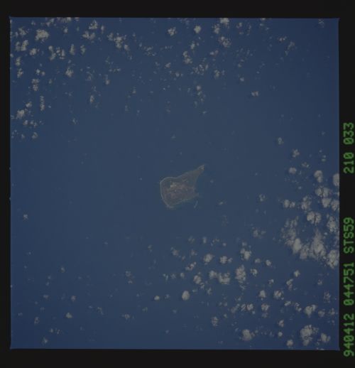
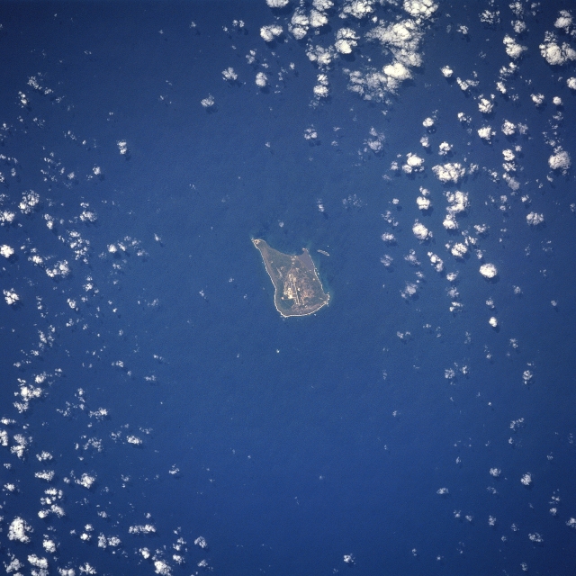
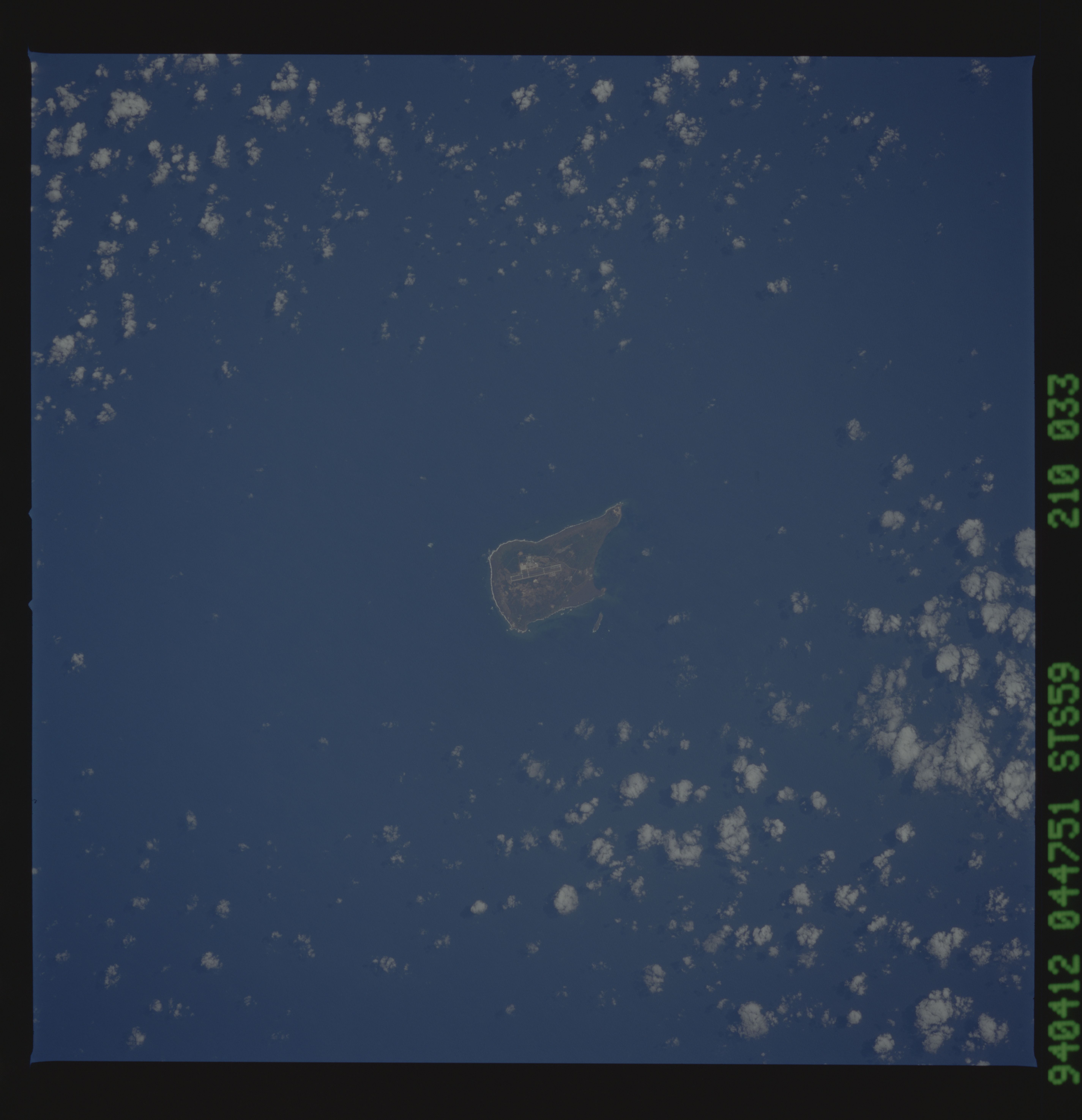
Image Caption: STS059-210-033 Iwo Jima, Volcano Islands April 1994
The largest of three Volcano Islands, Iwo Jima can be seen in this south-looking view. Iwo Jima is nearly 5 miles (9km) long, and 2 miles (4 km) wide and covers an area of 8 sq. miles (21 sq. km). Mount Suribachi, 546 feet (167 meters) high, on the south side of the island, is an extinct volcano. The main industries are sulfur mining and sugar refining. Iwo Jima was the scene for one of the severest battle campaigns in United States history during World War II. The battle began on February 19, 1945 against a Japanese force of over 22000 troops, who were well fortified in the numerous caves that make up the island topography. Casualties were high on both sides. The island was completely taken by United States forces on March 15, 1945. The photograph acquired of the United States flag being raised by U.S. Marines on the top of Mount Suribachi is one of the most famous photographs ever taken and inspired a memorial being built near Washington, D.C. honoring the United Stated Marine Corps.
The largest of three Volcano Islands, Iwo Jima can be seen in this south-looking view. Iwo Jima is nearly 5 miles (9km) long, and 2 miles (4 km) wide and covers an area of 8 sq. miles (21 sq. km). Mount Suribachi, 546 feet (167 meters) high, on the south side of the island, is an extinct volcano. The main industries are sulfur mining and sugar refining. Iwo Jima was the scene for one of the severest battle campaigns in United States history during World War II. The battle began on February 19, 1945 against a Japanese force of over 22000 troops, who were well fortified in the numerous caves that make up the island topography. Casualties were high on both sides. The island was completely taken by United States forces on March 15, 1945. The photograph acquired of the United States flag being raised by U.S. Marines on the top of Mount Suribachi is one of the most famous photographs ever taken and inspired a memorial being built near Washington, D.C. honoring the United Stated Marine Corps.
