STS059-154-165
| NASA Photo ID | STS059-154-165 |
| Focal Length | 250mm |
| Date taken | 1994.04.11 |
| Time taken | 21:20:17 GMT |
Cloud masks available for this image:
Spacecraft nadir point: 35.8° N, 115.5° W
Photo center point: 35.0° N, 116.5° W
Photo center point by machine learning:
Photo center point: 35.0° N, 116.5° W
Photo center point by machine learning:
Nadir to Photo Center: Southwest
Spacecraft Altitude: 119 nautical miles (220km)
Country or Geographic Name: | USA-CALIFORNIA |
Features: | BARSTOW, MOJAVE DES, AGR |
| Features Found Using Machine Learning: | |
Cloud Cover Percentage: | 0 (no clouds present) |
Sun Elevation Angle: | 55° |
Sun Azimuth: | 225° |
Camera: | Linhof |
Focal Length: | 250mm |
Camera Tilt: | Near Vertical |
Format: | 5046: Kodak, natural color positive, Lumiere 100/5046, ASA 100, standard base |
Film Exposure: | Normal |
| Additional Information | |
| Width | Height | Annotated | Cropped | Purpose | Links |
|---|---|---|---|---|---|
| 5088 pixels | 4000 pixels | No | No | Earth From Space collection | Download Image |
| 640 pixels | 503 pixels | No | No | Earth From Space collection | Download Image |
| 640 pixels | 480 pixels | No | No | ISD 1 | Download Image |
Download Packaged File
Download a Google Earth KML for this Image
View photo footprint information
Download a GeoTIFF for this photo
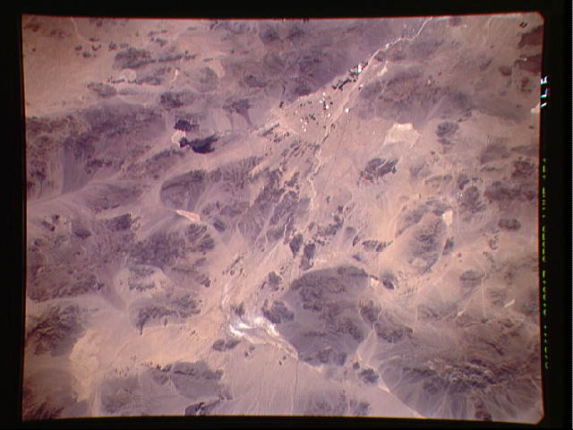
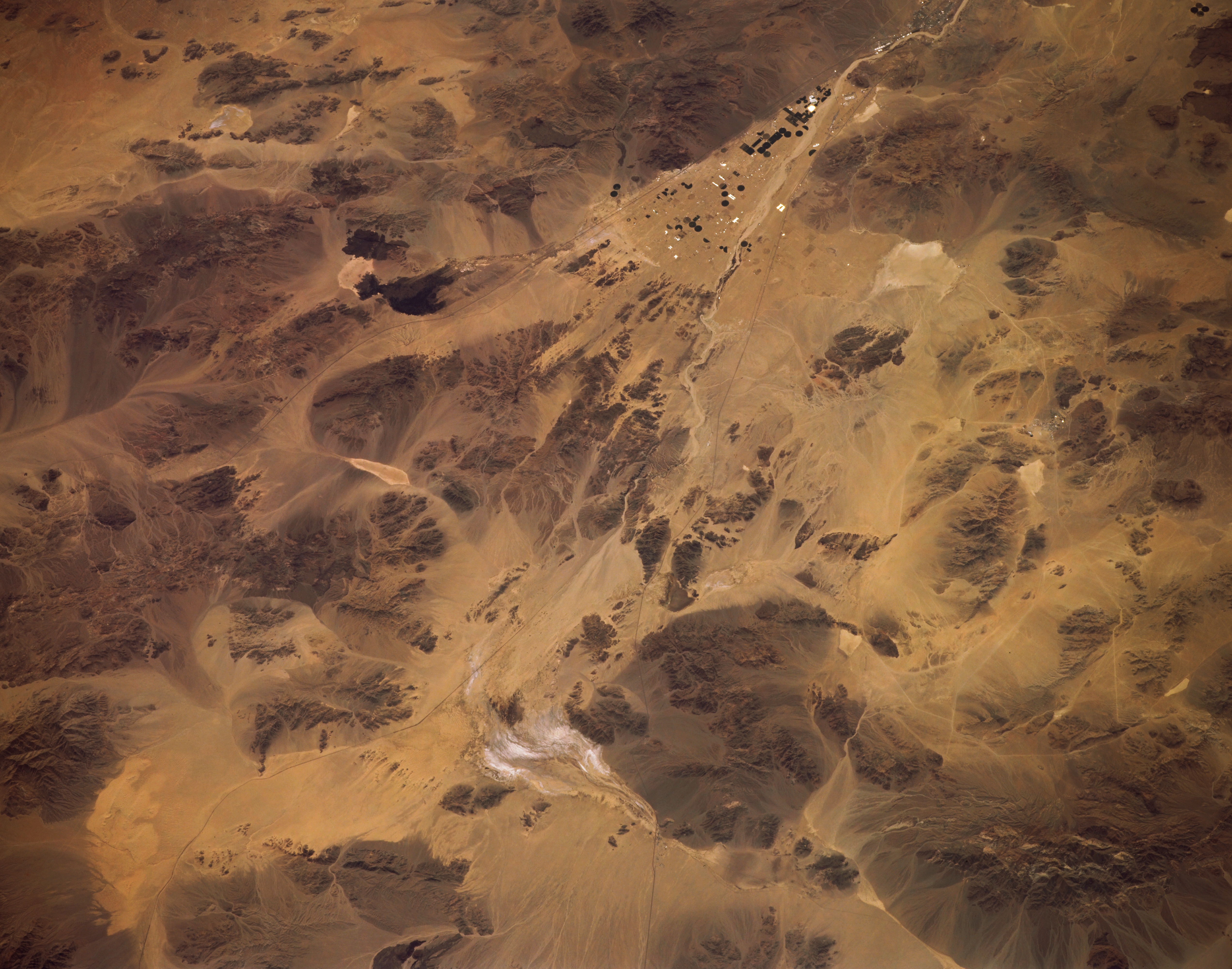
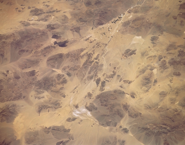
Image Caption: STS059-154-165 Mojave Desert, California, U.S.A. April 1994
Natural features overshadow human activity in the hostile Mojave Desert between the small desert towns of Baker and Barstow. The prominent brown talus cones fan out in concentric patterns around some of the mountain bases. A triangular alluvial fan created by repeated depositional cycles of the Mojave River is visible near the top of the photograph. The black circular features within the fan are irrigated, cultivated fields. Several features lie adjacent to the fan--two dark, irregular lava beds to the southeast and lighter, dry lakebeds, the largest of which is Soda Lake, to the northeast. The thin, dark lines are Interstate Highway 15, north of Soda Lake; Interstate Highway 40, south of the lake; and a railroad right-of-way.
Natural features overshadow human activity in the hostile Mojave Desert between the small desert towns of Baker and Barstow. The prominent brown talus cones fan out in concentric patterns around some of the mountain bases. A triangular alluvial fan created by repeated depositional cycles of the Mojave River is visible near the top of the photograph. The black circular features within the fan are irrigated, cultivated fields. Several features lie adjacent to the fan--two dark, irregular lava beds to the southeast and lighter, dry lakebeds, the largest of which is Soda Lake, to the northeast. The thin, dark lines are Interstate Highway 15, north of Soda Lake; Interstate Highway 40, south of the lake; and a railroad right-of-way.
