STS058-94-93
| NASA Photo ID | STS058-94-93 |
| Focal Length | 250mm |
| Date taken | 1993.10.22 |
| Time taken | 15:05:20 GMT |
Resolutions offered for this image:
3904 x 3904 pixels 639 x 639 pixels 5700 x 5900 pixels 500 x 518 pixels 640 x 480 pixels
3904 x 3904 pixels 639 x 639 pixels 5700 x 5900 pixels 500 x 518 pixels 640 x 480 pixels

Cloud masks available for this image:
Spacecraft nadir point: 31.8° N, 105.4° W
Photo center point: 32.0° N, 105.5° W
Photo center point by machine learning:
Photo center point: 32.0° N, 105.5° W
Photo center point by machine learning:
Nadir to Photo Center: North
Spacecraft Altitude: 154 nautical miles (285km)
Country or Geographic Name: | USA-TEXAS |
Features: | GUADALUPE MTS, AGRICULTURE |
| Features Found Using Machine Learning: | |
Cloud Cover Percentage: | 0 (no clouds present) |
Sun Elevation Angle: | 22° |
Sun Azimuth: | 120° |
Camera: | Hasselblad |
Focal Length: | 250mm |
Camera Tilt: | 5 degrees |
Format: | 5017: Kodak, natural color positive, Ektachrome, X Professional, ASA 64, standard base |
Film Exposure: | Normal |
| Additional Information | |
| Width | Height | Annotated | Cropped | Purpose | Links |
|---|---|---|---|---|---|
| 3904 pixels | 3904 pixels | No | No | Earth From Space collection | Download Image |
| 639 pixels | 639 pixels | No | No | Earth From Space collection | Download Image |
| 5700 pixels | 5900 pixels | No | No | Download Image | |
| 500 pixels | 518 pixels | No | No | Download Image | |
| 640 pixels | 480 pixels | No | No | Download Image |
Download Packaged File
Download a Google Earth KML for this Image
View photo footprint information
Download a GeoTIFF for this photo
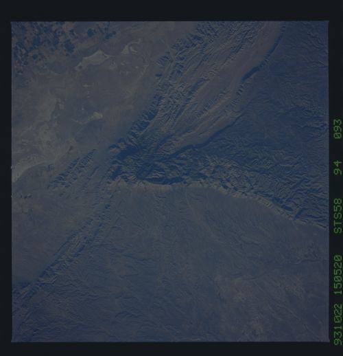
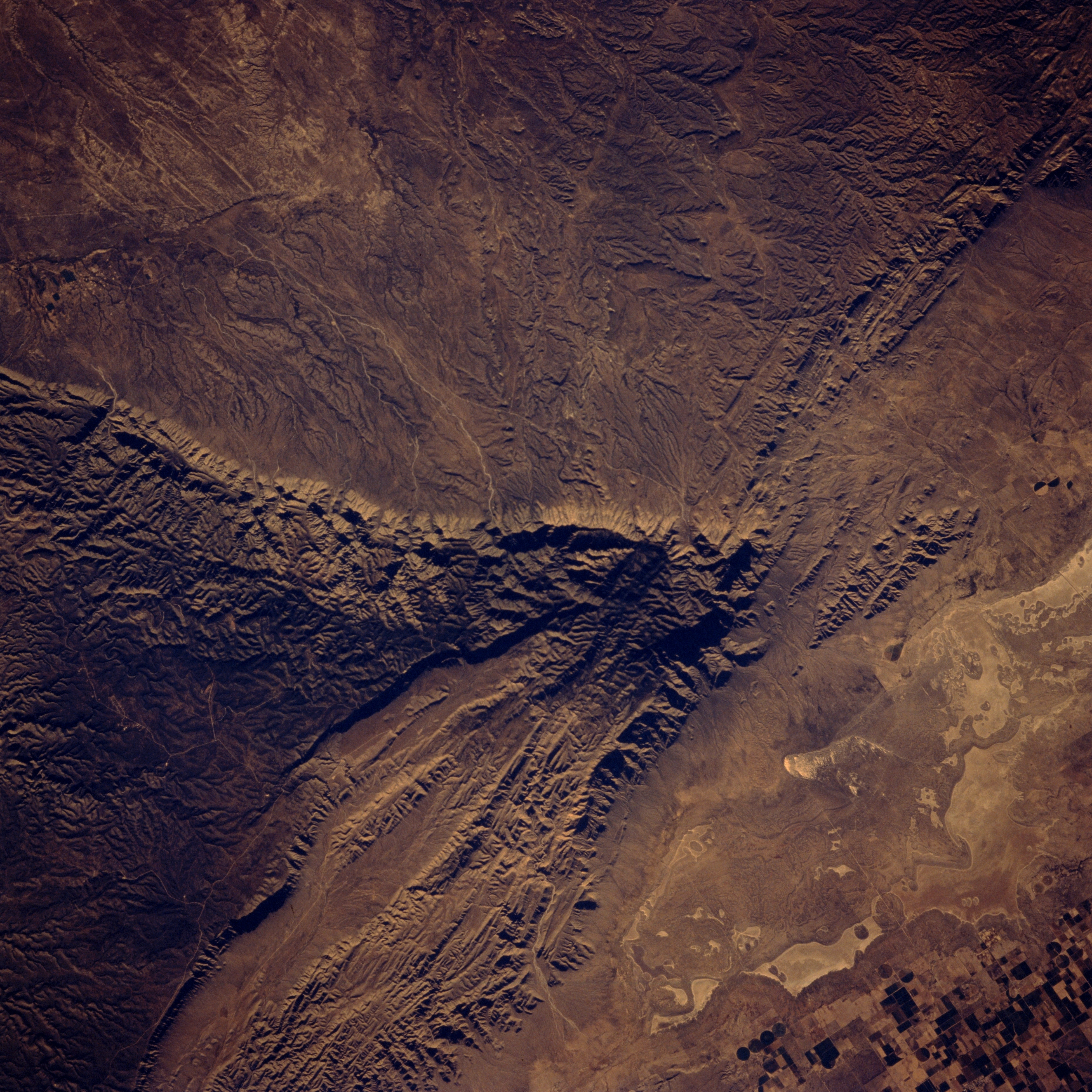
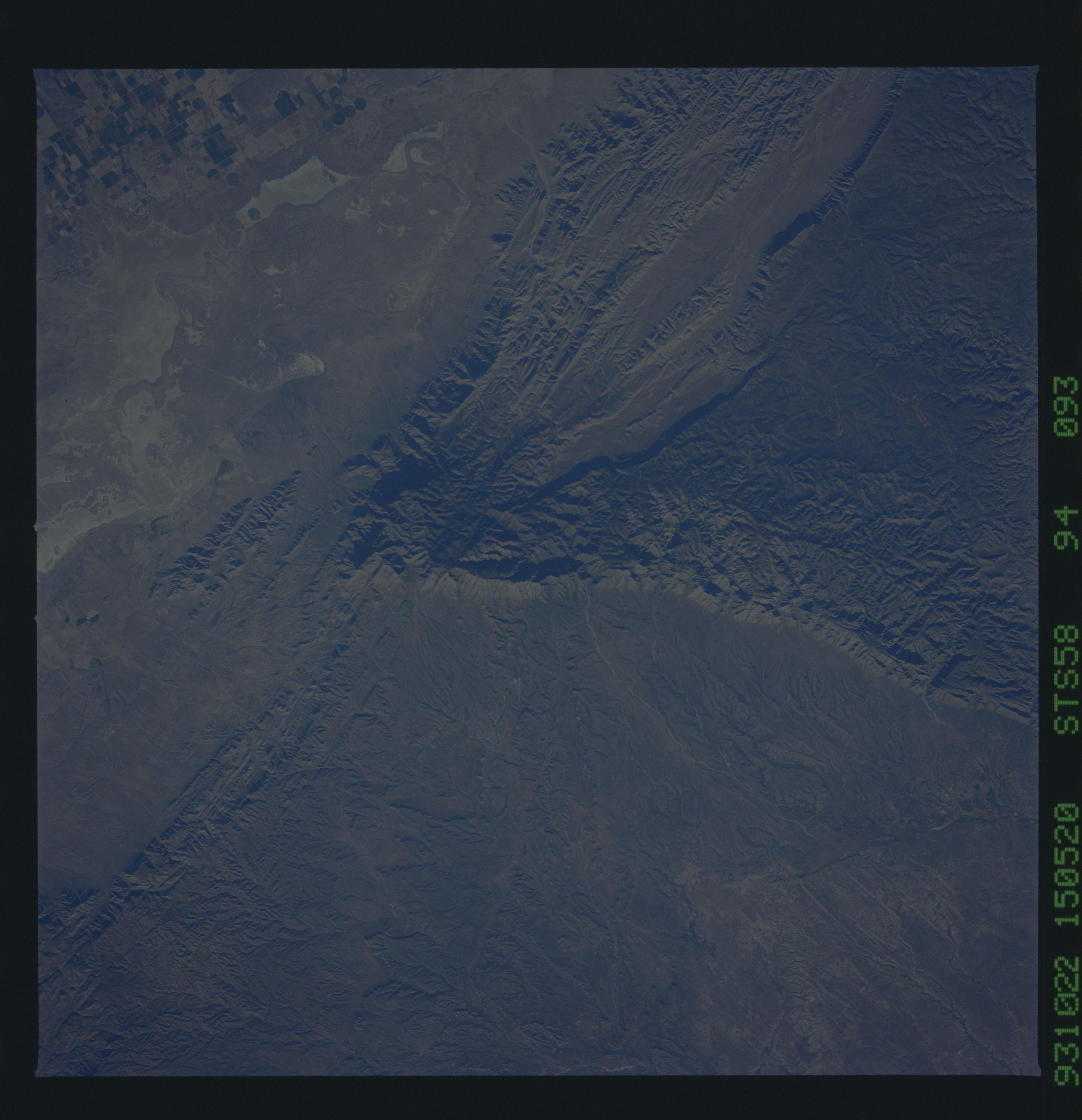
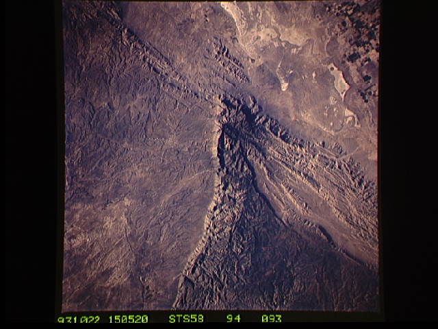
Image Caption: STS058-094-093 Guadalupe Mountains, Texas, U.S.A. October 1993
Featured in this photograph is the angular southern end of the Guadalupe Mountains of west Texas, the largest fossil reef in the world. Visible are the sheer southeastern slopes; El Capitan [8078 feet (2462 meters)]; and Guadalupe Peak [8751 feet (2667 meters)], the highest elevation in Texas. Within the region are reef rocks of limestone that form peaks in the Guadalupe Mountains, sandstone, and some shoal deposits. Guadalupe Mountains National Park was established in 1972. Arid Salt Basin, made up of numerous dry lakes, lies southwest of the Guadalupe Mountains. Rectangular and circular field patterns (lower right corner) indicate the presence of dryland farming and irrigated agriculture.
Featured in this photograph is the angular southern end of the Guadalupe Mountains of west Texas, the largest fossil reef in the world. Visible are the sheer southeastern slopes; El Capitan [8078 feet (2462 meters)]; and Guadalupe Peak [8751 feet (2667 meters)], the highest elevation in Texas. Within the region are reef rocks of limestone that form peaks in the Guadalupe Mountains, sandstone, and some shoal deposits. Guadalupe Mountains National Park was established in 1972. Arid Salt Basin, made up of numerous dry lakes, lies southwest of the Guadalupe Mountains. Rectangular and circular field patterns (lower right corner) indicate the presence of dryland farming and irrigated agriculture.
