STS058-92-68
| NASA Photo ID | STS058-92-68 |
| Focal Length | 50mm |
| Date taken | 1993.__.__ |
| Time taken | GMT |

Cloud masks available for this image:
Spacecraft nadir point:
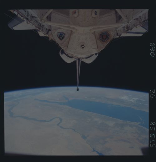
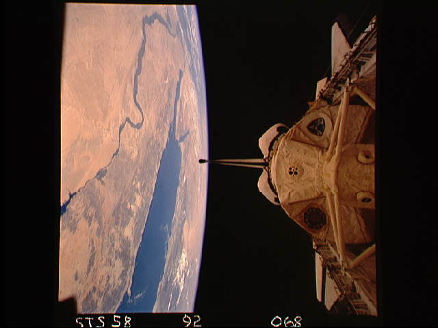
Photo center point: 28.0° N, 32.5° E
Photo center point by machine learning:
Photo center point: 28.0° N, 32.5° E
Photo center point by machine learning:
Nadir to Photo Center:
Spacecraft Altitude: nautical miles (0km)
Country or Geographic Name: | EGYPT |
Features: | PAN-NILE VALLEY, SINAI |
| Features Found Using Machine Learning: | |
Cloud Cover Percentage: | 5 (1-10)% |
Sun Elevation Angle: | ° |
Sun Azimuth: | ° |
Camera: | Hasselblad |
Focal Length: | 50mm |
Camera Tilt: | High Oblique |
Format: | 5017: Kodak, natural color positive, Ektachrome, X Professional, ASA 64, standard base |
Film Exposure: | Normal |
| Additional Information | |
| Width | Height | Annotated | Cropped | Purpose | Links |
|---|---|---|---|---|---|
| 5700 pixels | 5900 pixels | No | No | Download Image | |
| 500 pixels | 518 pixels | No | No | Download Image | |
| 640 pixels | 480 pixels | No | No | Download Image |
Download Packaged File
Download a Google Earth KML for this Image
View photo footprint information
Download a GeoTIFF for this photo
Image Caption:
Also could use STS58-92-068, a closer view of the Nile and
Sinai; the right-hand fork of the Red Sea Rift is the Gulf
of Aqaba and the Dead Sea Rift. Leads into STS58-96-041, the
heart of the Holy Land. Orient with the Mediteranean Sea to
the left, then north is to the top. Salt-evaporation ponds
are colorful at the southern end of the Dead Sea. Jeruselem
is west of the Dead Sea, just to the right of the cloud;
Amman, Jordan is the gray patch in the upper right corner.
