STS058-90-77
| NASA Photo ID | STS058-90-77 |
| Focal Length | 50mm |
| Date taken | 1993.10.22 |
| Time taken | 01:38:45 GMT |
Resolutions offered for this image:
4080 x 4080 pixels 640 x 640 pixels 5700 x 5900 pixels 500 x 518 pixels 640 x 480 pixels 524 x 517 pixels
4080 x 4080 pixels 640 x 640 pixels 5700 x 5900 pixels 500 x 518 pixels 640 x 480 pixels 524 x 517 pixels


Cloud masks available for this image:
Spacecraft nadir point: 37.0° N, 118.7° E
Photo center point: 38.5° N, 118.0° E
Photo center point by machine learning:
Photo center point: 38.5° N, 118.0° E
Photo center point by machine learning:
Nadir to Photo Center: North
Spacecraft Altitude: 155 nautical miles (287km)
Country or Geographic Name: | CHINA |
Features: | BOHAI BAY, YELLOW R DELTA |
| Features Found Using Machine Learning: | |
Cloud Cover Percentage: | 0 (no clouds present) |
Sun Elevation Angle: | 33° |
Sun Azimuth: | 141° |
Camera: | Hasselblad |
Focal Length: | 50mm |
Camera Tilt: | 33 degrees |
Format: | 5017: Kodak, natural color positive, Ektachrome, X Professional, ASA 64, standard base |
Film Exposure: | Normal |
| Additional Information | |
| Width | Height | Annotated | Cropped | Purpose | Links |
|---|---|---|---|---|---|
| 4080 pixels | 4080 pixels | No | No | Earth From Space collection | Download Image |
| 640 pixels | 640 pixels | No | No | Earth From Space collection | Download Image |
| 5700 pixels | 5900 pixels | No | No | Download Image | |
| 500 pixels | 518 pixels | No | No | Download Image | |
| 640 pixels | 480 pixels | No | No | Download Image | |
| 524 pixels | 517 pixels | Download Image |
Download Packaged File
Download a Google Earth KML for this Image
View photo footprint information
Download a GeoTIFF for this photo
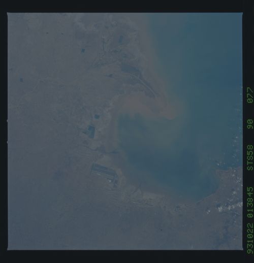
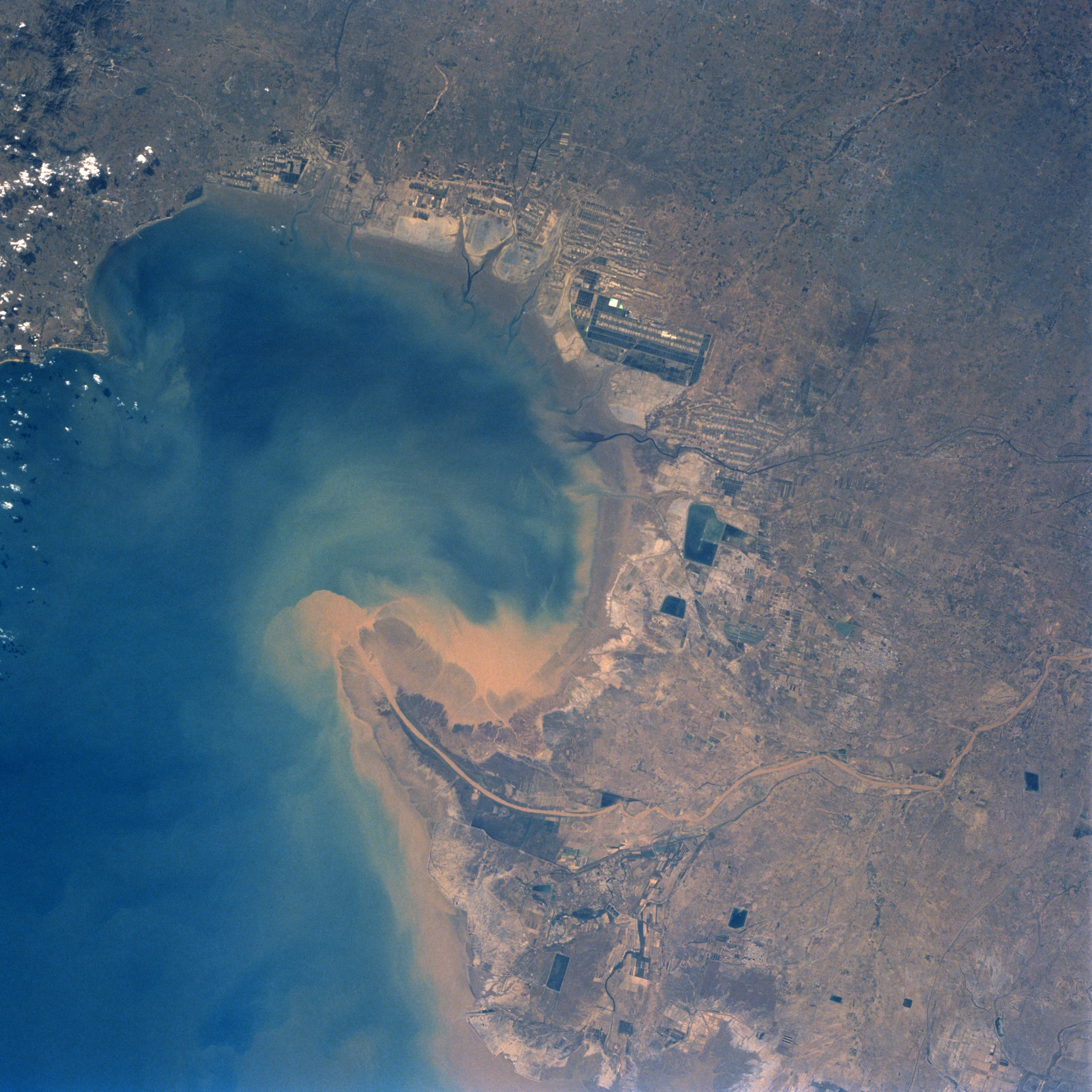
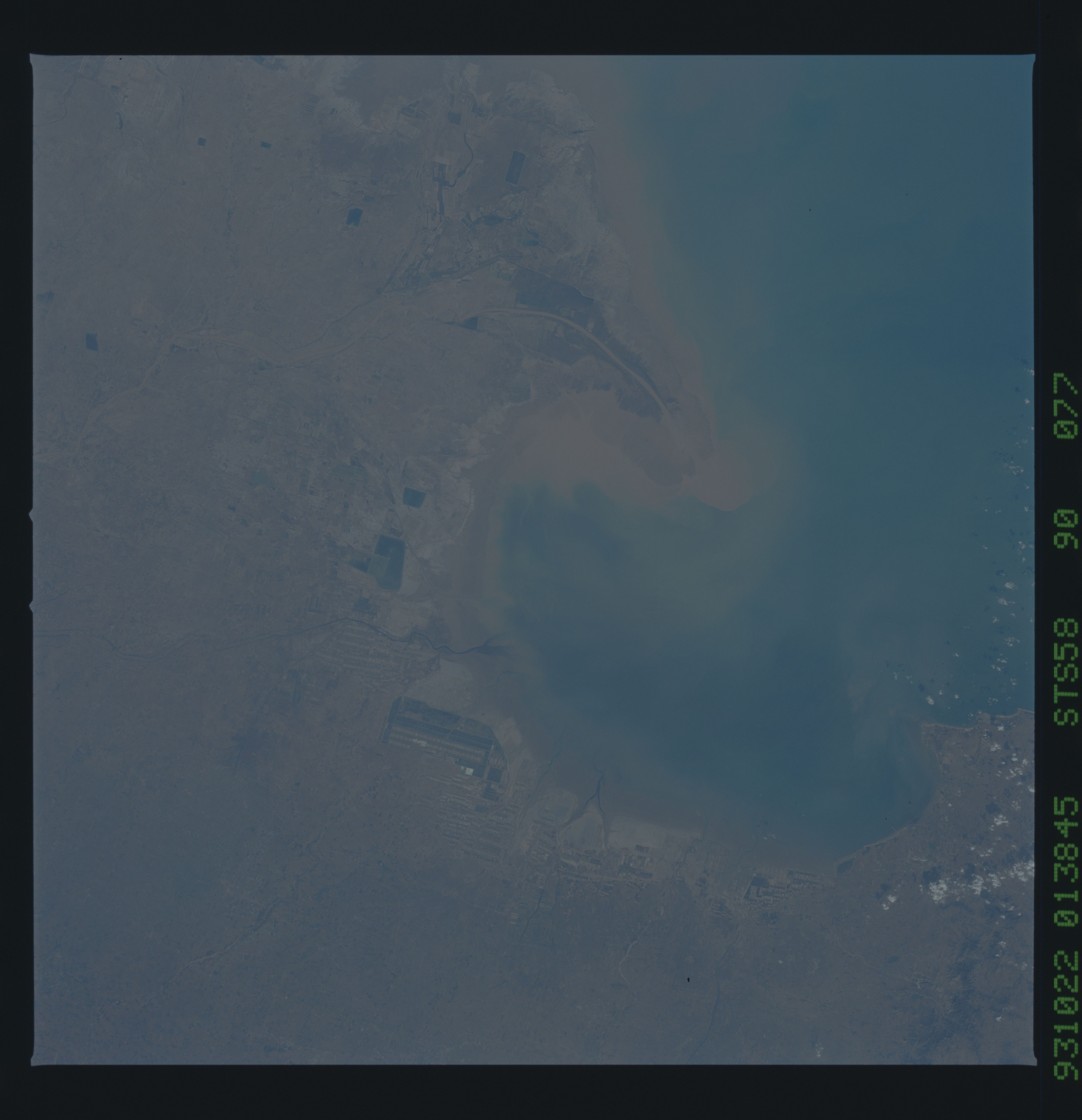
Image Caption: STS058-090-077 Yellow River Delta, China October 1993
The Yellow River, the second longest river in China, rises in the Kunlun Mountains of western China and flows generally eastward for 3000 miles (4830 km) before emptying into the Gulf of Bohai (left center, bottom center of the image). The Gulf of Bohai is an arm of the Yellow Sea. In this south-looking view the sediment plume from the Yellow River, considered to be one of the most silt-laden rivers in the world, can be seen entering the gulf. Each year, the Yellow River discharges over one billon tons of sediment into the gulf. The delta is being extended steadily at a rate of one mile (1.6 km) a year adding roughly 14 sq. miles (40 sq. km) of land in the process. Large-scale construction of dams and reservoir systems for flood control and power production was begun along the middle and lower courses of the river in 1955. Midway between the center and right center of the image is China's second largest oilfield, the Shengli Oilfield.
The Yellow River, the second longest river in China, rises in the Kunlun Mountains of western China and flows generally eastward for 3000 miles (4830 km) before emptying into the Gulf of Bohai (left center, bottom center of the image). The Gulf of Bohai is an arm of the Yellow Sea. In this south-looking view the sediment plume from the Yellow River, considered to be one of the most silt-laden rivers in the world, can be seen entering the gulf. Each year, the Yellow River discharges over one billon tons of sediment into the gulf. The delta is being extended steadily at a rate of one mile (1.6 km) a year adding roughly 14 sq. miles (40 sq. km) of land in the process. Large-scale construction of dams and reservoir systems for flood control and power production was begun along the middle and lower courses of the river in 1955. Midway between the center and right center of the image is China's second largest oilfield, the Shengli Oilfield.
