STS058-90-15
| NASA Photo ID | STS058-90-15 |
| Focal Length | 100mm |
| Date taken | 1993.10.21 |
| Time taken | 16:38:50 GMT |
Resolutions offered for this image:
3904 x 3904 pixels 639 x 639 pixels 5700 x 5900 pixels 500 x 518 pixels 640 x 480 pixels
3904 x 3904 pixels 639 x 639 pixels 5700 x 5900 pixels 500 x 518 pixels 640 x 480 pixels


Cloud masks available for this image:
Spacecraft nadir point: 37.4° N, 101.1° W
Photo center point: 37.5° N, 105.5° W
Photo center point by machine learning:
Photo center point: 37.5° N, 105.5° W
Photo center point by machine learning:
Nadir to Photo Center: West
Spacecraft Altitude: 155 nautical miles (287km)
Country or Geographic Name: | USA-COLORADO |
Features: | SAN LUIS VALLEY |
| Features Found Using Machine Learning: | |
Cloud Cover Percentage: | 0 (no clouds present) |
Sun Elevation Angle: | 35° |
Sun Azimuth: | 146° |
Camera: | Hasselblad |
Focal Length: | 100mm |
Camera Tilt: | Low Oblique |
Format: | 5017: Kodak, natural color positive, Ektachrome, X Professional, ASA 64, standard base |
Film Exposure: | Normal |
| Additional Information | |
| Width | Height | Annotated | Cropped | Purpose | Links |
|---|---|---|---|---|---|
| 3904 pixels | 3904 pixels | No | No | Earth From Space collection | Download Image |
| 639 pixels | 639 pixels | No | No | Earth From Space collection | Download Image |
| 5700 pixels | 5900 pixels | No | No | Download Image | |
| 500 pixels | 518 pixels | No | No | Download Image | |
| 640 pixels | 480 pixels | No | No | Download Image |
Download Packaged File
Download a Google Earth KML for this Image
View photo footprint information
Download a GeoTIFF for this photo
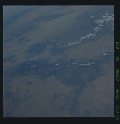
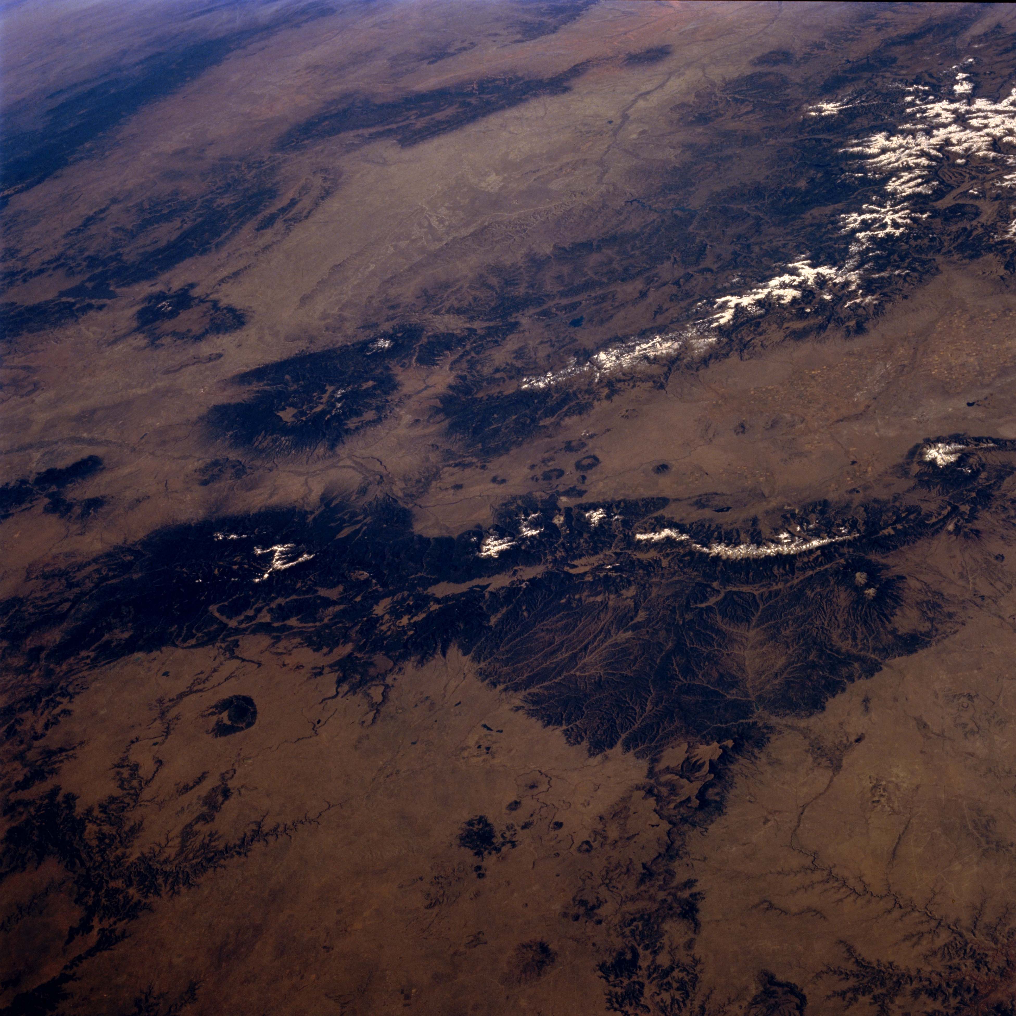
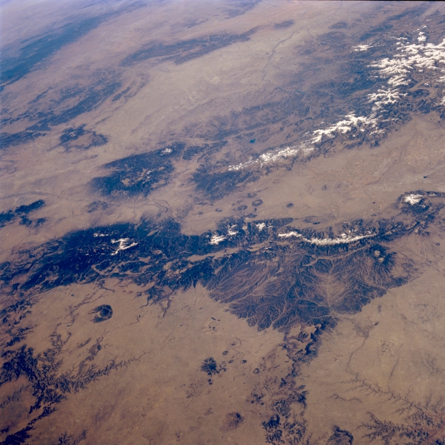
Image Caption: STS058-090-015 Rocky Mountains, North-Central New Mexico, U.S.A. October 1993
The forested mountains and dry intermontane valleys of this portion of the Rocky Mountains in north-central New Mexico are shown in this low-oblique, west-looking photograph. Apparent are the headwaters of the Purgatoire River and many tributary streams that originate in the massive, north-south-trending, forested Sangre de Cristo Mountains (lower right corner) and the Canadian River (lower left corner). The southern extension of the San Luis Valley, part of the Rio Grande Rift that extends north-south through New Mexico, separates the slopes of the Sangre de Cristo Mountains to the east from the San Juan Mountains to the west. West of the San Juan Mountains appears the large, dry San Juan River Basin, with the Chuska Mountains to its west. Most of the circular, dark features are volcanic remnants.
The forested mountains and dry intermontane valleys of this portion of the Rocky Mountains in north-central New Mexico are shown in this low-oblique, west-looking photograph. Apparent are the headwaters of the Purgatoire River and many tributary streams that originate in the massive, north-south-trending, forested Sangre de Cristo Mountains (lower right corner) and the Canadian River (lower left corner). The southern extension of the San Luis Valley, part of the Rio Grande Rift that extends north-south through New Mexico, separates the slopes of the Sangre de Cristo Mountains to the east from the San Juan Mountains to the west. West of the San Juan Mountains appears the large, dry San Juan River Basin, with the Chuska Mountains to its west. Most of the circular, dark features are volcanic remnants.
