STS058-89-97
| NASA Photo ID | STS058-89-97 |
| Focal Length | 250mm |
| Date taken | 1993.10.22 |
| Time taken | 10:43:00 GMT |
Resolutions offered for this image:
4056 x 4056 pixels 640 x 640 pixels 5700 x 5900 pixels 500 x 518 pixels 640 x 480 pixels
4056 x 4056 pixels 640 x 640 pixels 5700 x 5900 pixels 500 x 518 pixels 640 x 480 pixels

Cloud masks available for this image:
Spacecraft nadir point: 39.1° N, 0.0° E
Photo center point: 38.0° N, 0.5° W
Photo center point by machine learning:
Photo center point: 38.0° N, 0.5° W
Photo center point by machine learning:
Nadir to Photo Center: South
Spacecraft Altitude: 155 nautical miles (287km)
Country or Geographic Name: | SPAIN |
Features: | ALICANTE COASTAL AREA |
| Features Found Using Machine Learning: | |
Cloud Cover Percentage: | 5 (1-10)% |
Sun Elevation Angle: | 38° |
Sun Azimuth: | 161° |
Camera: | Hasselblad |
Focal Length: | 250mm |
Camera Tilt: | 25 degrees |
Format: | 5017: Kodak, natural color positive, Ektachrome, X Professional, ASA 64, standard base |
Film Exposure: | Normal |
| Additional Information | |
| Width | Height | Annotated | Cropped | Purpose | Links |
|---|---|---|---|---|---|
| 4056 pixels | 4056 pixels | No | No | Earth From Space collection | Download Image |
| 640 pixels | 640 pixels | No | No | Earth From Space collection | Download Image |
| 5700 pixels | 5900 pixels | No | No | Download Image | |
| 500 pixels | 518 pixels | No | No | Download Image | |
| 640 pixels | 480 pixels | No | No | Download Image |
Download Packaged File
Download a Google Earth KML for this Image
View photo footprint information
Download a GeoTIFF for this photo
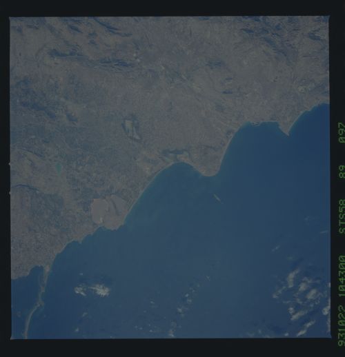
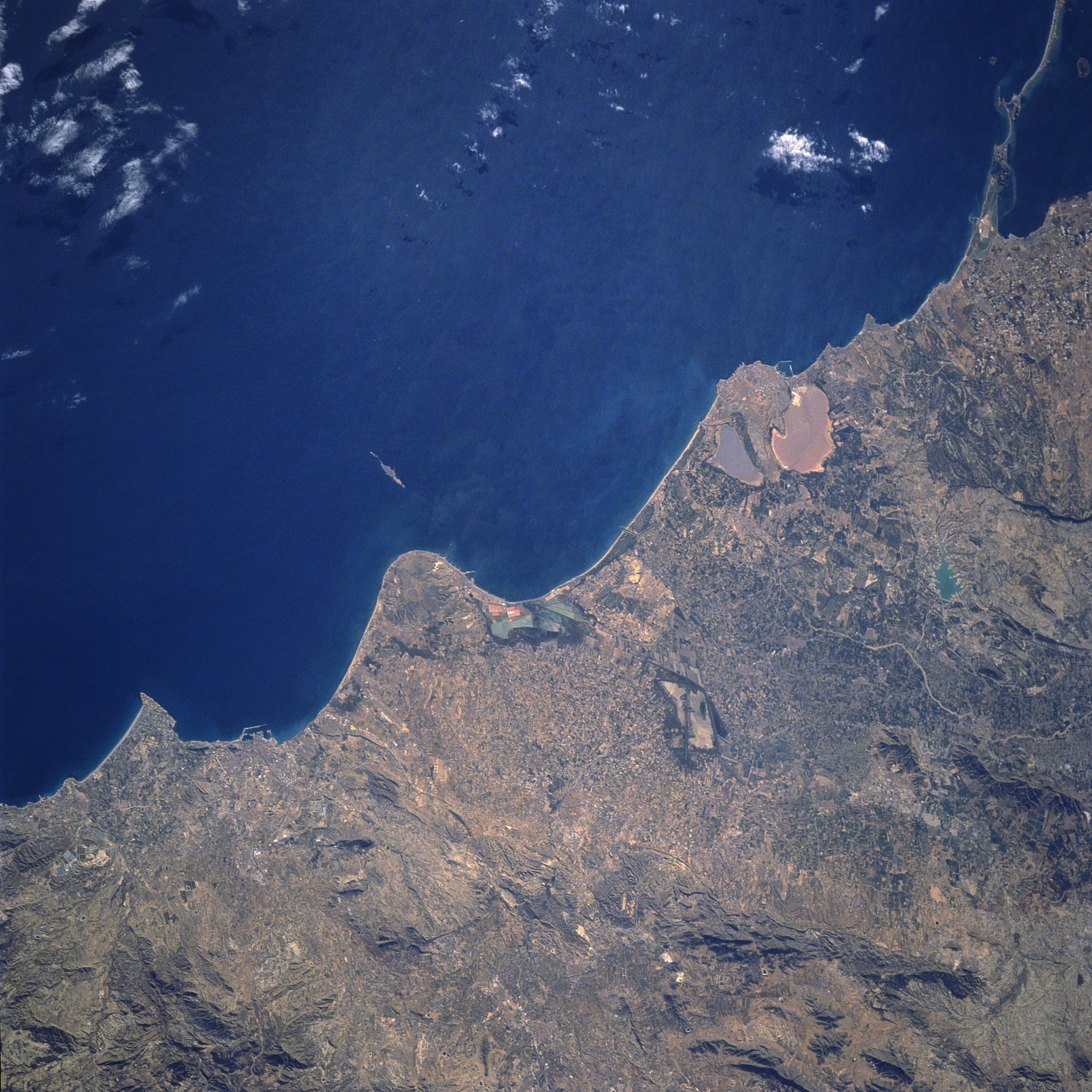
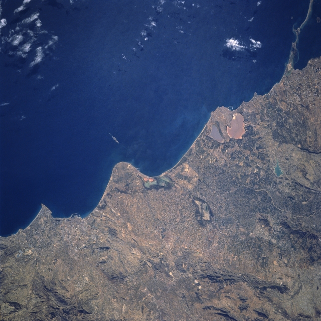
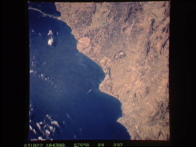
Image Caption: STS058-089-097 Alicante Area, Spain October 1993
Rainfall amounts along this east central coast of Spain are low, ranging between 12 and 16 inches (30-40 cm) per year. In spite of the meager rainfall amounts, the coastal basin supports substantial fruit gardens or orchards (called huertas). The huertas in the lowland areas between Alicante (harbor facilities are visible, lower left quadrant) and Cartegena (just off upper right corner) are famous for their extensive vegetation and subtropical crops. Practically anything can be raised, including cotton, sugar cane, and dates but the main emphasis is on citrus fruits and grapes. The coastal region, especially in the center of the image, is low-lying marshlands. Two ochre-colored salt marshes (Salinas de la Mata and Salinas de Torrevieja) are visible near the coast (right center). The north edge of Mar Menor (dark feature) is also visible in the upper right corner of the image. Several of the low mountains that are scattered throughout the scene cast shadows on their north facing slopes.
Rainfall amounts along this east central coast of Spain are low, ranging between 12 and 16 inches (30-40 cm) per year. In spite of the meager rainfall amounts, the coastal basin supports substantial fruit gardens or orchards (called huertas). The huertas in the lowland areas between Alicante (harbor facilities are visible, lower left quadrant) and Cartegena (just off upper right corner) are famous for their extensive vegetation and subtropical crops. Practically anything can be raised, including cotton, sugar cane, and dates but the main emphasis is on citrus fruits and grapes. The coastal region, especially in the center of the image, is low-lying marshlands. Two ochre-colored salt marshes (Salinas de la Mata and Salinas de Torrevieja) are visible near the coast (right center). The north edge of Mar Menor (dark feature) is also visible in the upper right corner of the image. Several of the low mountains that are scattered throughout the scene cast shadows on their north facing slopes.
