STS058-89-94
| NASA Photo ID | STS058-89-94 |
| Focal Length | 250mm |
| Date taken | 1993.10.22 |
| Time taken | 10:42:37 GMT |
Resolutions offered for this image:
4072 x 4072 pixels 639 x 639 pixels 5700 x 5900 pixels 500 x 518 pixels 640 x 480 pixels
4072 x 4072 pixels 639 x 639 pixels 5700 x 5900 pixels 500 x 518 pixels 640 x 480 pixels


Cloud masks available for this image:
Spacecraft nadir point: 39.1° N, 1.9° W
Photo center point: 37.5° N, 2.0° W
Photo center point by machine learning:
Photo center point: 37.5° N, 2.0° W
Photo center point by machine learning:
Nadir to Photo Center: South
Spacecraft Altitude: 155 nautical miles (287km)
Country or Geographic Name: | SPAIN |
Features: | LORCA AREA |
| Features Found Using Machine Learning: | |
Cloud Cover Percentage: | 0 (no clouds present) |
Sun Elevation Angle: | 37° |
Sun Azimuth: | 158° |
Camera: | Hasselblad |
Focal Length: | 250mm |
Camera Tilt: | 32 degrees |
Format: | 5017: Kodak, natural color positive, Ektachrome, X Professional, ASA 64, standard base |
Film Exposure: | Normal |
| Additional Information | |
| Width | Height | Annotated | Cropped | Purpose | Links |
|---|---|---|---|---|---|
| 4072 pixels | 4072 pixels | No | No | Earth From Space collection | Download Image |
| 639 pixels | 639 pixels | No | No | Earth From Space collection | Download Image |
| 5700 pixels | 5900 pixels | No | No | Download Image | |
| 500 pixels | 518 pixels | No | No | Download Image | |
| 640 pixels | 480 pixels | No | No | Download Image |
Download Packaged File
Download a Google Earth KML for this Image
View photo footprint information
Download a GeoTIFF for this photo
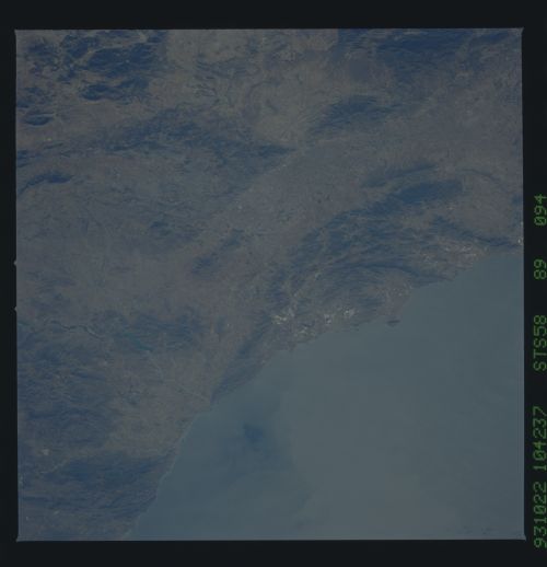
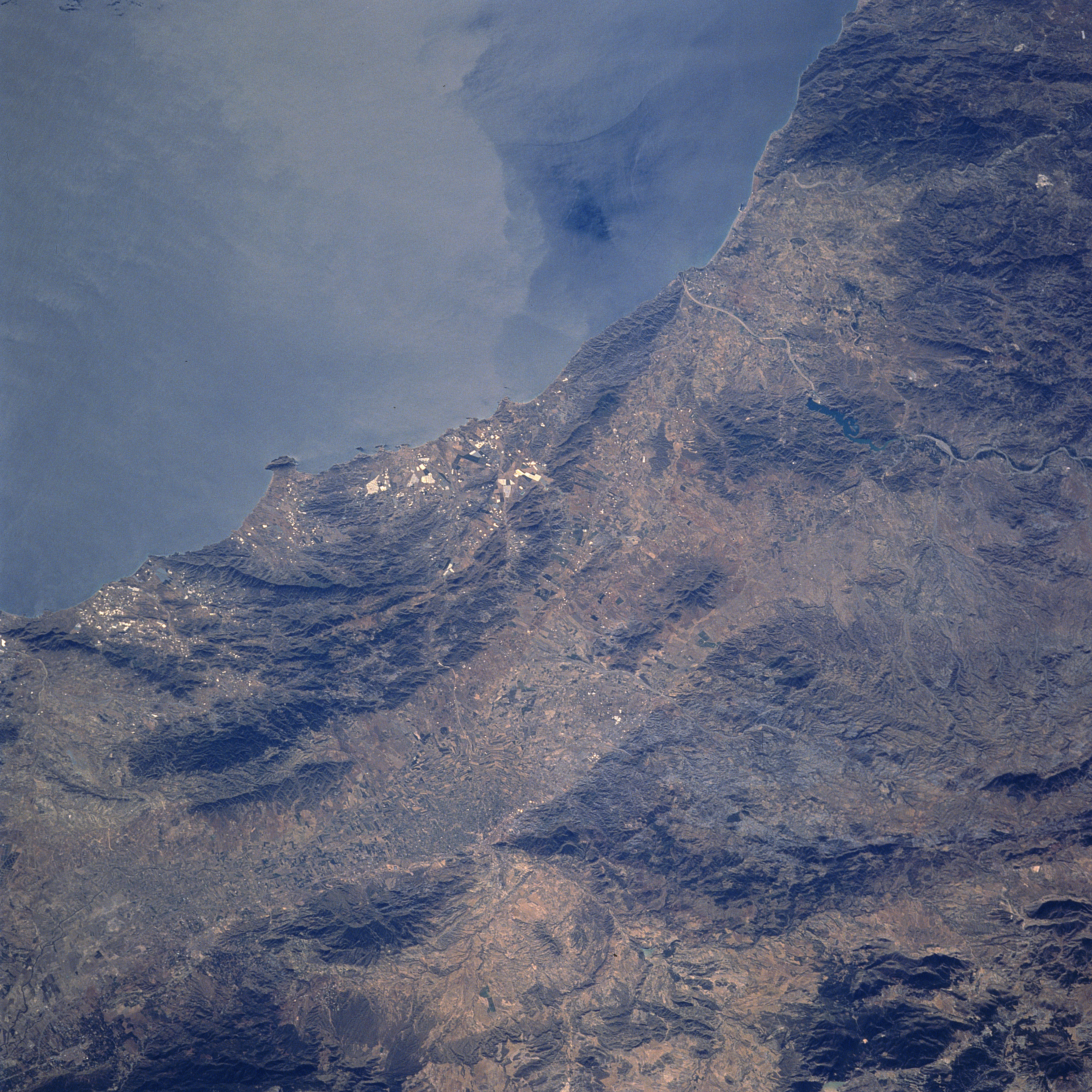
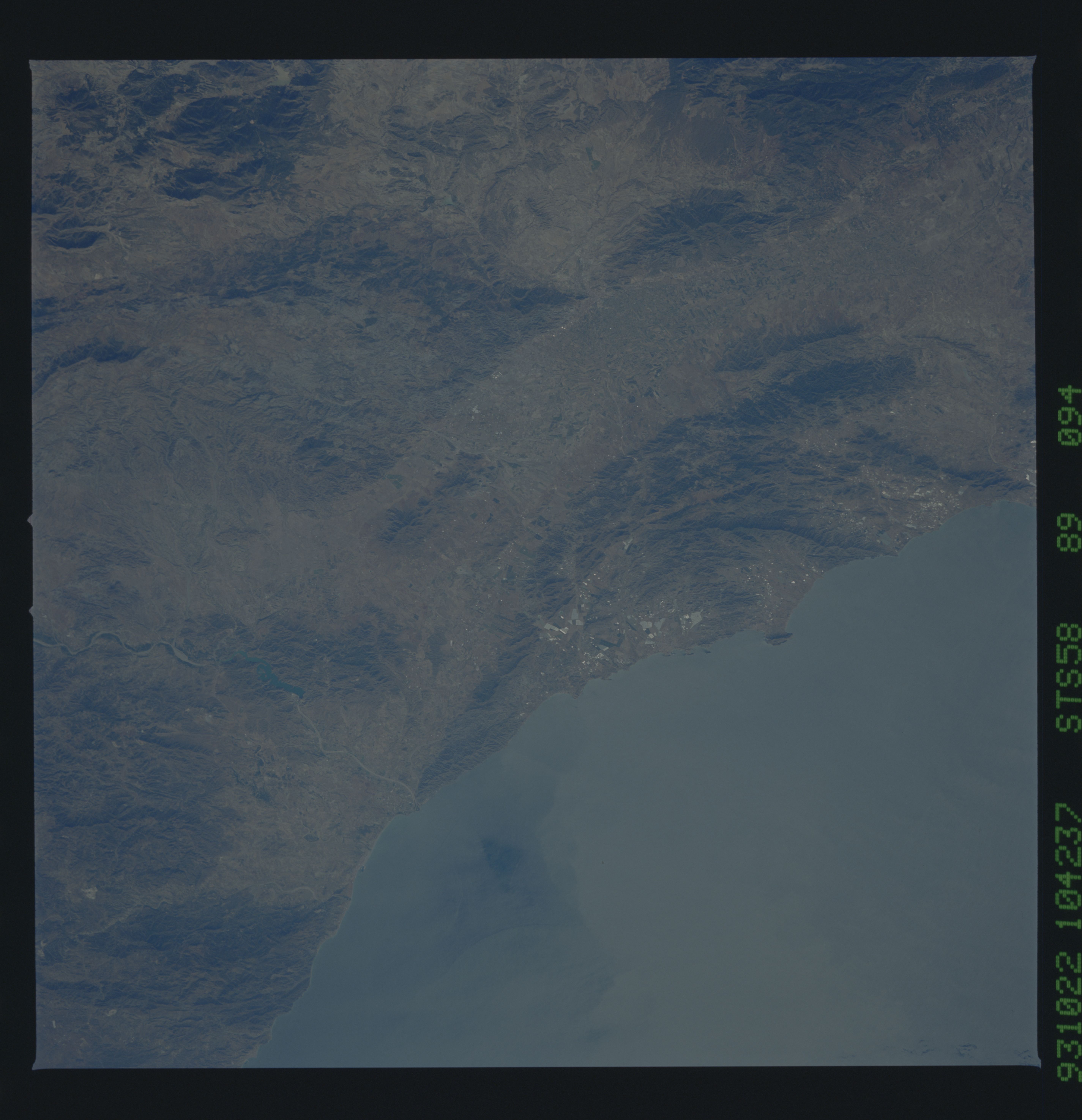
Image Caption: STS058-089-094 Sierra de Almenara, Spain October 1993
The coast southwest of Cartagena consists of rugged mountainous terrain (darker landscape) and agricultural valleys and plains (lighter-colored features). The Sierra de Almenara is identifiable as the mountain range with a gradual curve in the alignment that is adjacent to the Mediterranean Sea. The angular-looking field patterns (light and dark areas) on the coastal side of the mountains show an altered man made landscape, created by surface mining operations. Immediately inland from these mountains, a northeast-southwest trending corridor (valley) extends diagonally across the image. The winding channel (light-colored, linear feature) of the Almanzora River, interrupted by an elongated reservoir (dark surface), can be traced across this semiarid region of southeast Spain, as the river eventually empties into the Mediterranean Sea. Surface dynamics (color contrasts) are seen in the near coastal waters of the Mediterranean Sea (upper middle).
The coast southwest of Cartagena consists of rugged mountainous terrain (darker landscape) and agricultural valleys and plains (lighter-colored features). The Sierra de Almenara is identifiable as the mountain range with a gradual curve in the alignment that is adjacent to the Mediterranean Sea. The angular-looking field patterns (light and dark areas) on the coastal side of the mountains show an altered man made landscape, created by surface mining operations. Immediately inland from these mountains, a northeast-southwest trending corridor (valley) extends diagonally across the image. The winding channel (light-colored, linear feature) of the Almanzora River, interrupted by an elongated reservoir (dark surface), can be traced across this semiarid region of southeast Spain, as the river eventually empties into the Mediterranean Sea. Surface dynamics (color contrasts) are seen in the near coastal waters of the Mediterranean Sea (upper middle).
