STS058-88-95
| NASA Photo ID | STS058-88-95 |
| Focal Length | 250mm |
| Date taken | 1993.10.22 |
| Time taken | 16:46:44 GMT |
Resolutions offered for this image:
5255 x 5255 pixels 639 x 639 pixels 5700 x 5900 pixels 500 x 518 pixels 640 x 480 pixels
5255 x 5255 pixels 639 x 639 pixels 5700 x 5900 pixels 500 x 518 pixels 640 x 480 pixels


Cloud masks available for this image:
Spacecraft nadir point: 38.1° N, 75.2° W
Photo center point: 40.0° N, 76.5° W
Photo center point by machine learning:
Photo center point: 40.0° N, 76.5° W
Photo center point by machine learning:
Nadir to Photo Center: Northwest
Spacecraft Altitude: 155 nautical miles (287km)
Country or Geographic Name: | USA-PENNSYLVANIA |
Features: | SUSQUEHANNA RIVER |
| Features Found Using Machine Learning: | |
Cloud Cover Percentage: | 0 (no clouds present) |
Sun Elevation Angle: | 41° |
Sun Azimuth: | 180° |
Camera: | Hasselblad |
Focal Length: | 250mm |
Camera Tilt: | 42 degrees |
Format: | 5017: Kodak, natural color positive, Ektachrome, X Professional, ASA 64, standard base |
Film Exposure: | Normal |
| Additional Information | |
| Width | Height | Annotated | Cropped | Purpose | Links |
|---|---|---|---|---|---|
| 5255 pixels | 5255 pixels | No | No | Earth From Space collection | Download Image |
| 639 pixels | 639 pixels | No | No | Earth From Space collection | Download Image |
| 5700 pixels | 5900 pixels | No | No | Download Image | |
| 500 pixels | 518 pixels | No | No | Download Image | |
| 640 pixels | 480 pixels | No | No | Download Image |
Download Packaged File
Download a Google Earth KML for this Image
View photo footprint information
Download a GeoTIFF for this photo
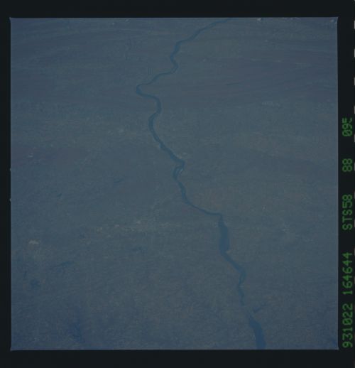
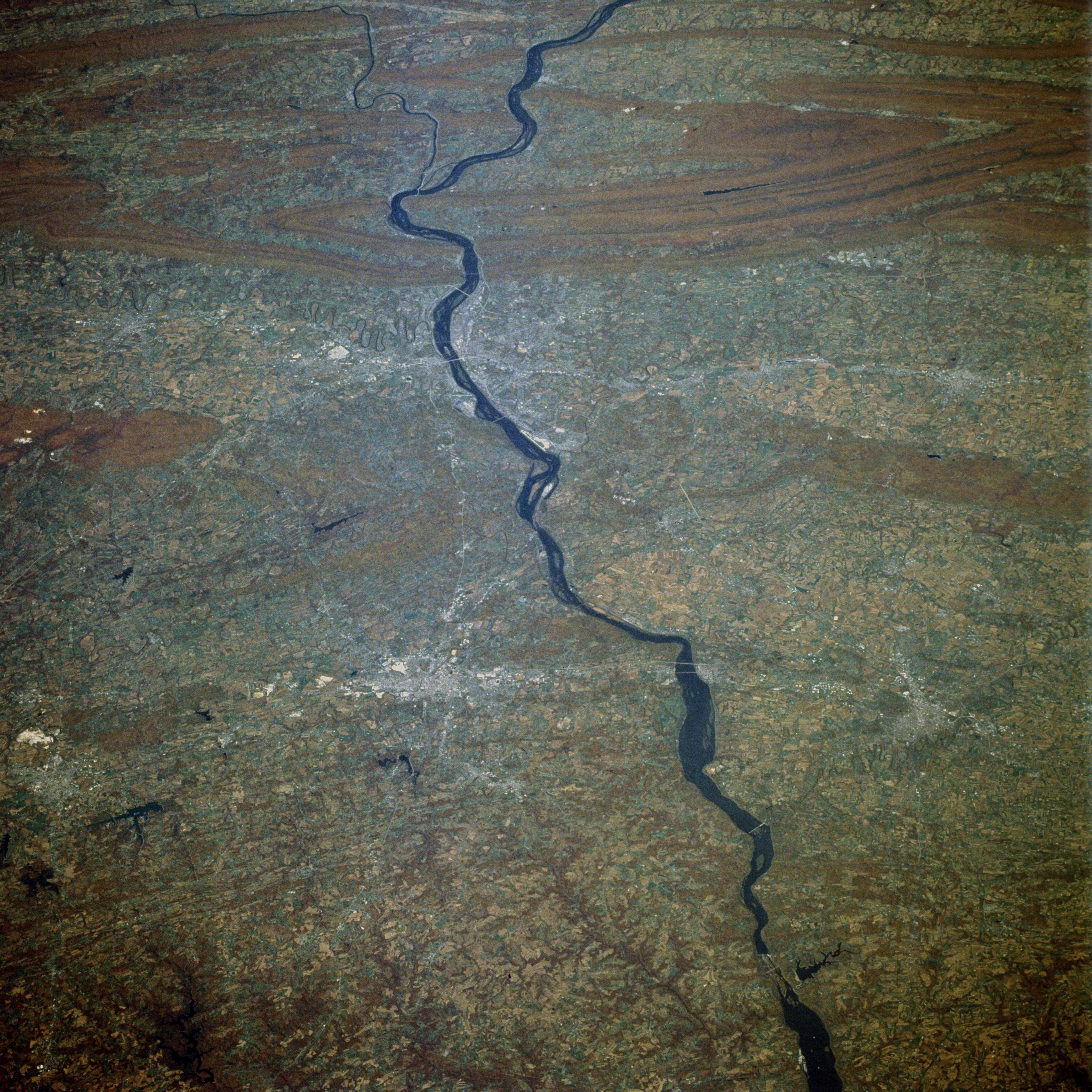
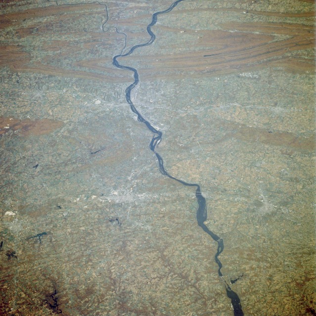
Image Caption: STS058-088-095 South-Central Pennsylvania (Susquehanna River), U.S.A. October 1993
The two most obvious features in this near-vertical photograph of south-central Pennsylvania are the northeast-southwest trending, folded Appalachian Mountains and the north-to-south flowing Susquehanna River. Farming predominates land use in the valleys and rolling hills--in particular, farming activities in the Lancaster area with the Amish communities known for their old-fashioned farming practices. A segment of the old Lincoln Highway (U.S. Highway 30) that connects Philadelphia and Pittsburgh is barely visible in the bottom third of the photograph. Major cities along this highway are Lancaster, York, and Hanover (east to west). This route was one of the major arteries that connected the more densely settled eastern seaboard with the western frontier in the 1800s and early 1900s. Near the center of the photograph, the highly reflective, linear feature along the eastern bank of the Susquehanna River is Harrisburg International Airport, which is located south of the state capital of Harrisburg. Part of Interstate Highway 83 (north-south) that connects York with Harrisburg is visible west of the river. Several water gaps can be seen where the Susquehanna River cuts through the Appalachian Mountains north of Harrisburg.
The two most obvious features in this near-vertical photograph of south-central Pennsylvania are the northeast-southwest trending, folded Appalachian Mountains and the north-to-south flowing Susquehanna River. Farming predominates land use in the valleys and rolling hills--in particular, farming activities in the Lancaster area with the Amish communities known for their old-fashioned farming practices. A segment of the old Lincoln Highway (U.S. Highway 30) that connects Philadelphia and Pittsburgh is barely visible in the bottom third of the photograph. Major cities along this highway are Lancaster, York, and Hanover (east to west). This route was one of the major arteries that connected the more densely settled eastern seaboard with the western frontier in the 1800s and early 1900s. Near the center of the photograph, the highly reflective, linear feature along the eastern bank of the Susquehanna River is Harrisburg International Airport, which is located south of the state capital of Harrisburg. Part of Interstate Highway 83 (north-south) that connects York with Harrisburg is visible west of the river. Several water gaps can be seen where the Susquehanna River cuts through the Appalachian Mountains north of Harrisburg.
