STS058-88-78

| NASA Photo ID | STS058-88-78 |
| Focal Length | 250mm |
| Date taken | 1993.10.22 |
| Time taken | 16:45:39 GMT |
Resolutions offered for this image:
3904 x 3904 pixels 639 x 639 pixels 5700 x 5900 pixels 500 x 518 pixels 640 x 480 pixels
3904 x 3904 pixels 639 x 639 pixels 5700 x 5900 pixels 500 x 518 pixels 640 x 480 pixels
Cloud masks available for this image:
Spacecraft nadir point: 38.7° N, 80.4° W
Photo center point: 39.5° N, 81.5° W
Photo center point by machine learning:
Photo center point: 39.5° N, 81.5° W
Photo center point by machine learning:
Nadir to Photo Center: Northwest
Spacecraft Altitude: 155 nautical miles (287km)
Country or Geographic Name: | USA-WEST VIRGINIA |
Features: | PARKERSBURG AREA, OHIO R |
| Features Found Using Machine Learning: | |
Cloud Cover Percentage: | 0 (no clouds present) |
Sun Elevation Angle: | 40° |
Sun Azimuth: | 173° |
Camera: | Hasselblad |
Focal Length: | 250mm |
Camera Tilt: | 28 degrees |
Format: | 5017: Kodak, natural color positive, Ektachrome, X Professional, ASA 64, standard base |
Film Exposure: | Out of Focus |
| Additional Information | |
| Width | Height | Annotated | Cropped | Purpose | Links |
|---|---|---|---|---|---|
| 3904 pixels | 3904 pixels | No | No | Earth From Space collection | Download Image |
| 639 pixels | 639 pixels | No | No | Earth From Space collection | Download Image |
| 5700 pixels | 5900 pixels | No | No | Download Image | |
| 500 pixels | 518 pixels | No | No | Download Image | |
| 640 pixels | 480 pixels | No | No | Download Image |
Download Packaged File
Download a Google Earth KML for this Image
View photo footprint information
Download a GeoTIFF for this photo
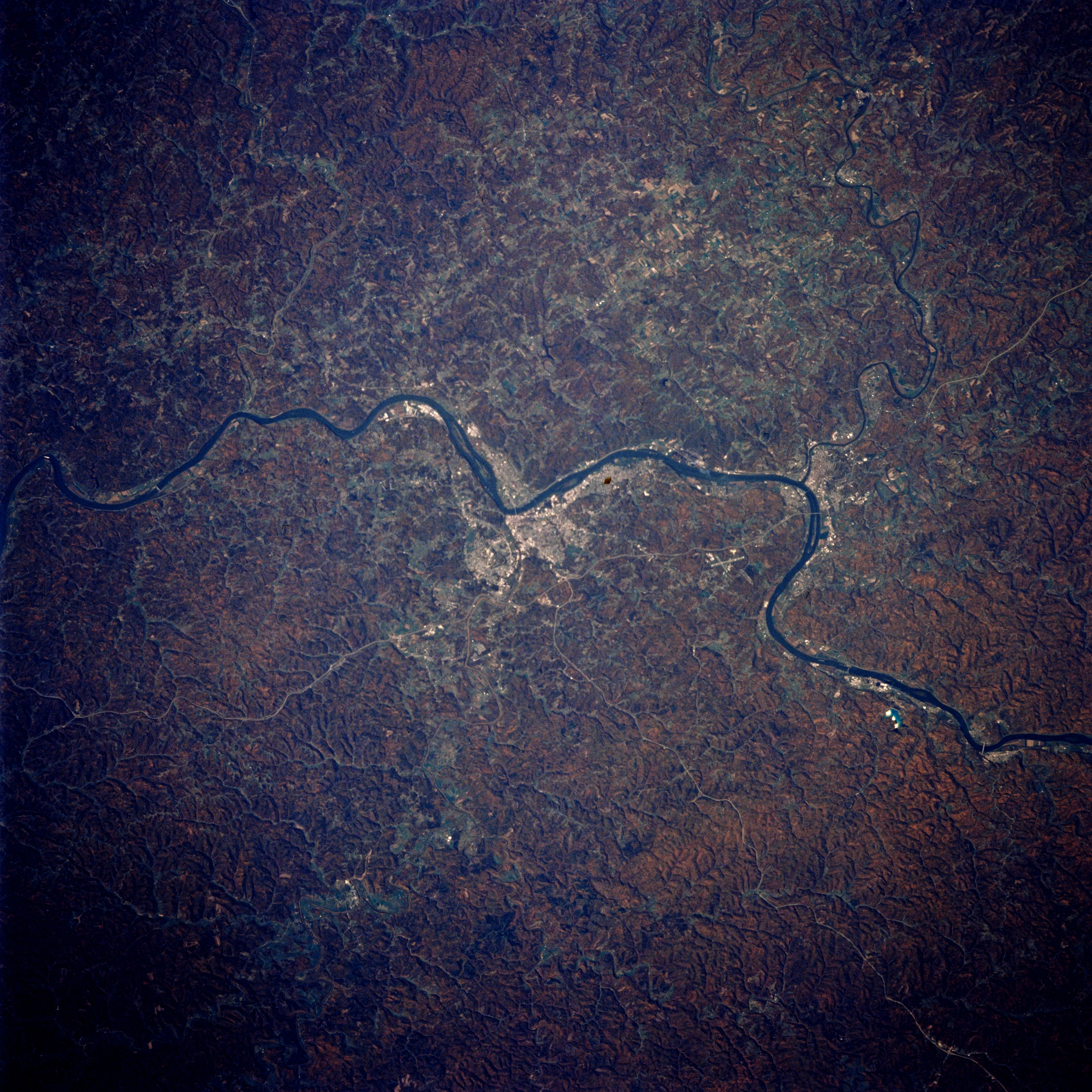
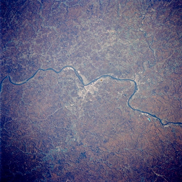
Image Caption: STS058-088-078 Ohio River, Parkersburg, West Virginia October 1993
The Ohio River community of Parkersburg (center of image) can be seen in this northwest-looking, low-oblique view. The Ohio River traverses the image from the right edge (northeast) to the left (southwest), separating the states of Ohio (upper portion of the image) from West Virginia (lower portion of the image). This region is part of the Appalachian Plateau, with low, forested hills cut by many narrow valleys. This area is an important coal-mining region, and Parkersburg is an industrial and shipping center for the region.
The Ohio River community of Parkersburg (center of image) can be seen in this northwest-looking, low-oblique view. The Ohio River traverses the image from the right edge (northeast) to the left (southwest), separating the states of Ohio (upper portion of the image) from West Virginia (lower portion of the image). This region is part of the Appalachian Plateau, with low, forested hills cut by many narrow valleys. This area is an important coal-mining region, and Parkersburg is an industrial and shipping center for the region.
