STS058-88-37
| NASA Photo ID | STS058-88-37 |
| Focal Length | 250mm |
| Date taken | 1993.10.22 |
| Time taken | 16:40:50 GMT |
Resolutions offered for this image:
3904 x 3904 pixels 639 x 639 pixels 5700 x 5900 pixels 500 x 518 pixels 640 x 480 pixels
3904 x 3904 pixels 639 x 639 pixels 5700 x 5900 pixels 500 x 518 pixels 640 x 480 pixels


Cloud masks available for this image:
Spacecraft nadir point: 38.2° N, 103.8° W
Photo center point: 38.0° N, 105.5° W
Photo center point by machine learning:
Photo center point: 38.0° N, 105.5° W
Photo center point by machine learning:
Nadir to Photo Center: West
Spacecraft Altitude: 155 nautical miles (287km)
Country or Geographic Name: | USA-COLORADO |
Features: | SAN LUIS VALLEY, DUNES |
| Features Found Using Machine Learning: | |
Cloud Cover Percentage: | 0 (no clouds present) |
Sun Elevation Angle: | 33° |
Sun Azimuth: | 144° |
Camera: | Hasselblad |
Focal Length: | 250mm |
Camera Tilt: | 34 degrees |
Format: | 5017: Kodak, natural color positive, Ektachrome, X Professional, ASA 64, standard base |
Film Exposure: | Normal |
| Additional Information | |
| Width | Height | Annotated | Cropped | Purpose | Links |
|---|---|---|---|---|---|
| 3904 pixels | 3904 pixels | No | No | Earth From Space collection | Download Image |
| 639 pixels | 639 pixels | No | No | Earth From Space collection | Download Image |
| 5700 pixels | 5900 pixels | No | No | Download Image | |
| 500 pixels | 518 pixels | No | No | Download Image | |
| 640 pixels | 480 pixels | No | No | Download Image |
Download Packaged File
Download a Google Earth KML for this Image
View photo footprint information
Download a GeoTIFF for this photo
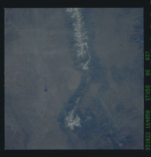
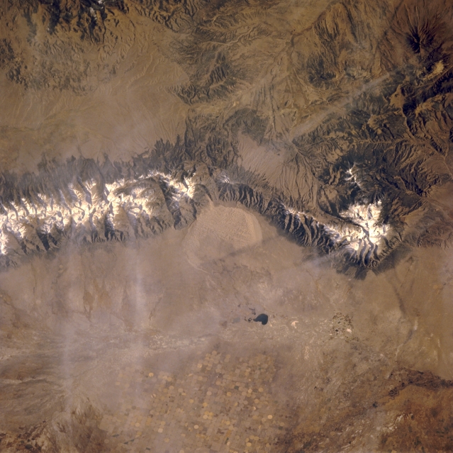
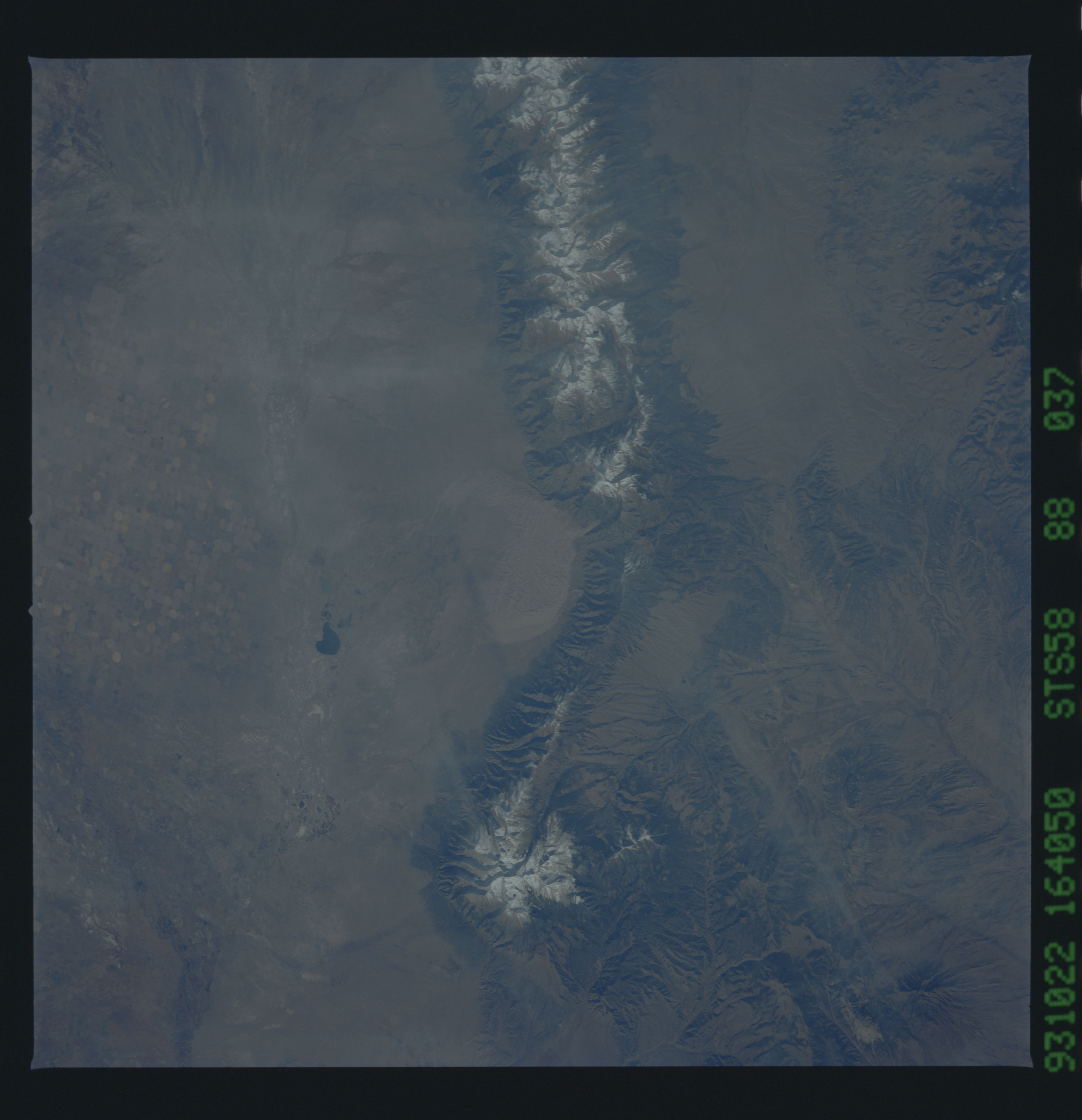
Image Caption: STS058-088-037 Sangre de Cristo Mountains, Colorado, U.S.A. October 1993
Featured in this near-vertical photograph of south-central Colorado is part of the generally north-south-trending Sangre de Cristo Mountains with a snow-covered ridge line at elevations above 10 000 feet (3048 meters). Apparent are the sharply faulted slopes of the western side of the mountain range and snow-covered Blanca Peak [14 345 feet (4372 meters)]. Center-pivot irrigation (circular field patterns) has allowed the arid San Luis Valley to become an intensive agriculture region. Intermittently flowing San Luis Creek, a tributary of the Rio Grande, is barely visible as it flows south to merge with the Rio Grande near Alamosa. Dark San Luis Lake, southwest of Great Sand Dunes National Monument, lies along the drainage path of San Luis Creek. Barely discernible are two jet aircraft contrails and their shadows.
Featured in this near-vertical photograph of south-central Colorado is part of the generally north-south-trending Sangre de Cristo Mountains with a snow-covered ridge line at elevations above 10 000 feet (3048 meters). Apparent are the sharply faulted slopes of the western side of the mountain range and snow-covered Blanca Peak [14 345 feet (4372 meters)]. Center-pivot irrigation (circular field patterns) has allowed the arid San Luis Valley to become an intensive agriculture region. Intermittently flowing San Luis Creek, a tributary of the Rio Grande, is barely visible as it flows south to merge with the Rio Grande near Alamosa. Dark San Luis Lake, southwest of Great Sand Dunes National Monument, lies along the drainage path of San Luis Creek. Barely discernible are two jet aircraft contrails and their shadows.
