STS058-85-91
| NASA Photo ID | STS058-85-91 |
| Focal Length | 100mm |
| Date taken | 1993.__.__ |
| Time taken | GMT |
Resolutions offered for this image:
3963 x 3933 pixels 640 x 635 pixels 5700 x 5900 pixels 500 x 518 pixels 640 x 480 pixels
3963 x 3933 pixels 640 x 635 pixels 5700 x 5900 pixels 500 x 518 pixels 640 x 480 pixels

Cloud masks available for this image:
Spacecraft nadir point:
Photo center point: 44.5° N, 110.5° W
Photo center point by machine learning:
Photo center point: 44.5° N, 110.5° W
Photo center point by machine learning:
Nadir to Photo Center:
Spacecraft Altitude: nautical miles (0km)
Country or Geographic Name: | USA-WYOMING |
Features: | YELLOWSTONE LAKE, MTS. |
| Features Found Using Machine Learning: | |
Cloud Cover Percentage: | 0 (no clouds present) |
Sun Elevation Angle: | ° |
Sun Azimuth: | ° |
Camera: | Hasselblad |
Focal Length: | 100mm |
Camera Tilt: | Low Oblique |
Format: | 5017: Kodak, natural color positive, Ektachrome, X Professional, ASA 64, standard base |
Film Exposure: | Normal |
| Additional Information | |
| Width | Height | Annotated | Cropped | Purpose | Links |
|---|---|---|---|---|---|
| 3963 pixels | 3933 pixels | No | No | Earth From Space collection | Download Image |
| 640 pixels | 635 pixels | No | No | Earth From Space collection | Download Image |
| 5700 pixels | 5900 pixels | No | No | Download Image | |
| 500 pixels | 518 pixels | No | No | Download Image | |
| 640 pixels | 480 pixels | No | No | Download Image |
Download Packaged File
Download a Google Earth KML for this Image
View photo footprint information
Download a GeoTIFF for this photo
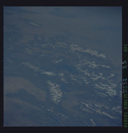
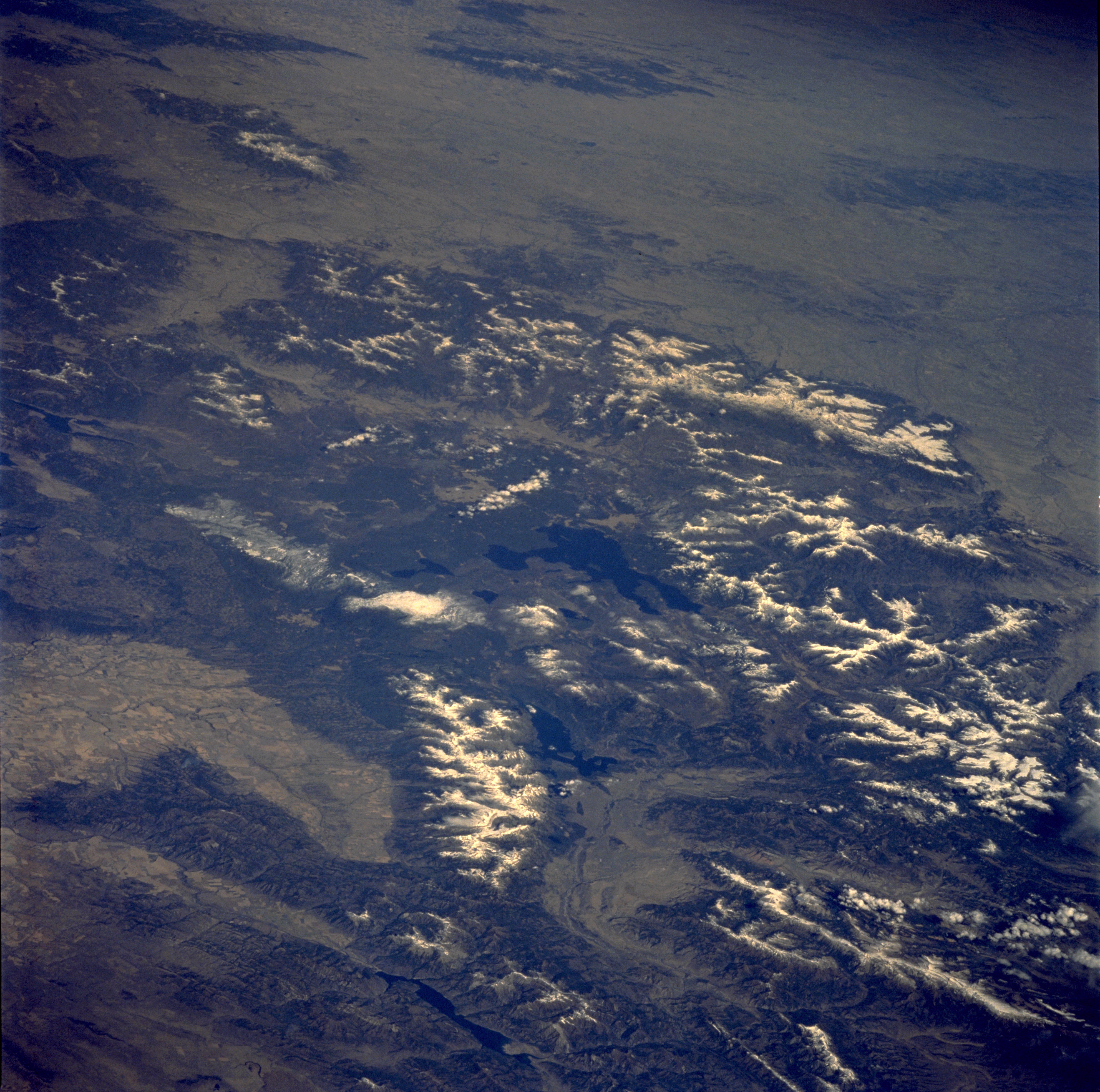
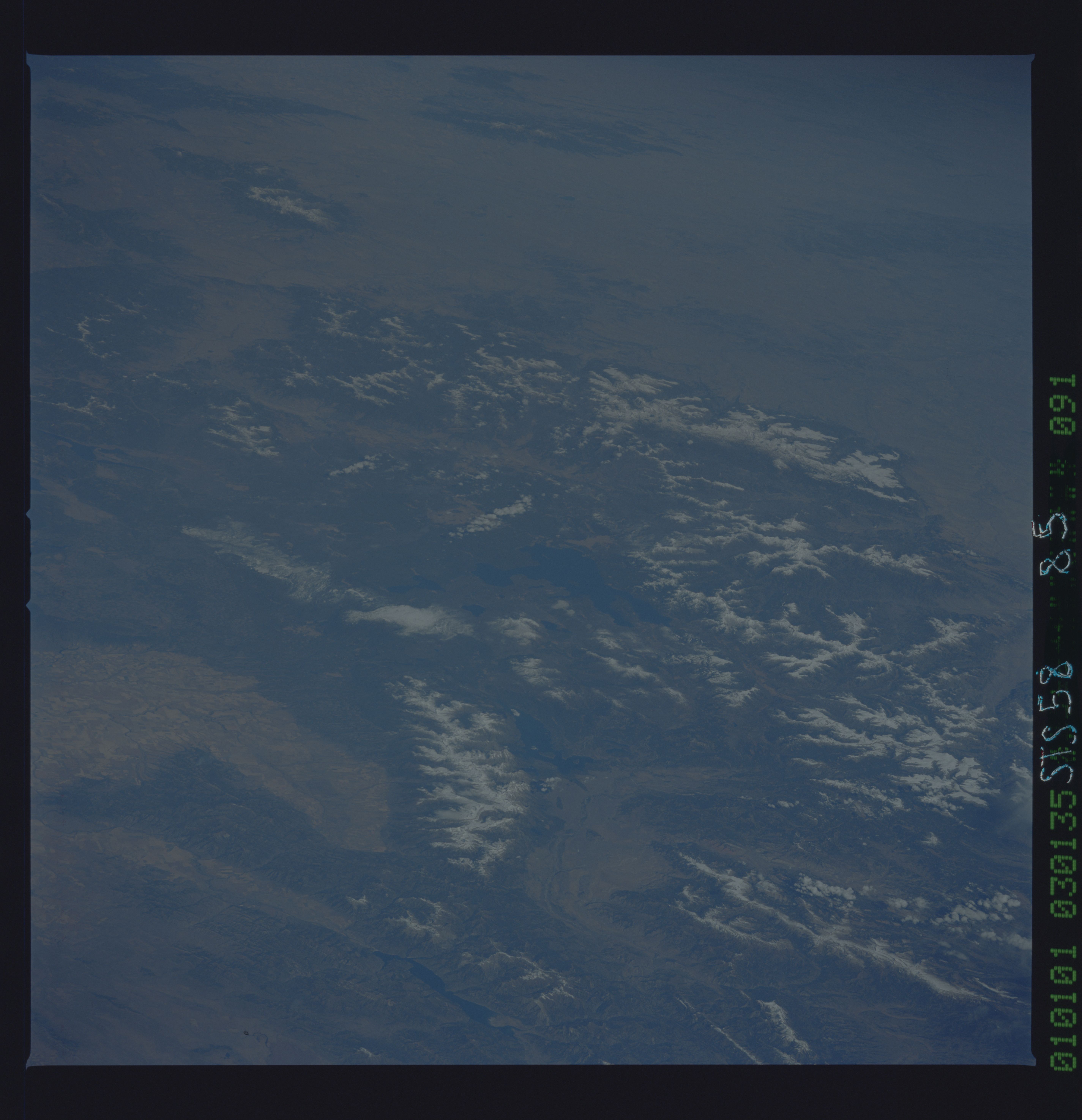
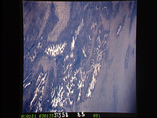
Image Caption: STS058-085-091 Teton Range and Yellowstone National Park, Idaho, Montana, and Wyoming, U.S.A. October 1993
This low-oblique, northeast-looking photograph of the majestic Grand Teton National Park and Yellowstone National Park region, together one of the world's largest wildlife sanctuaries, is one of the best photographs of this area obtained to date. Yellowstone, the oldest national park in the world, lies mainly on a broad plateau of the Rocky Mountains on the Continental Divide at 8000 feet (2440 meters) above sea level. Most of the plateau is formed from once molten lava. Volcanic activity is still evidenced by the nearly 10 000 hot springs, 200 geysers, and many vents and hot mud pots. The more prominent geysers, such as Old Faithful (not visible in the photograph), are unequaled in size, power, and variety of action. Even after the destructive fires of 1988, forests now cover nearly 85 percent of the Yellowstone region. Yellowstone Lake, pictured at the center of the photograph, covering an area of 139 square miles (360 square kilometers), is the largest high-altitude [7331 feet (2236 meters) above sea level] lake in North America. Using Yellowstone as the pivot, several mountain ranges are discernible--north, east, and southeast are the snow-covered Absaroka Mountains, north and northeast of which are the smaller Crazy Mountains and Big Snowy Mountains of southern Montana; south are the northern portions of the Wind River Range; farther to the southwest lies the awesome, snow-covered Teton Range, rugged fault-block mountains that rise more than 13 500 feet (4118 meters) above sea level, are 40 miles (65 kilometers) long, and are 10 to 15 miles (16 to 24 kilometers) wide. Paralleling the Tetons to the east are Jackson Lake and Jackson Hole, a depression 50 miles (80 kilometers) long and 6 to 8 miles (9 to 13 kilometers) wide. The blue water of the Palisade Reservoir and the valley of the Snake River with its many agricultural fields are visible south and west of the Teton Range, respectively.
Yellowstone Lake and the surrounding Plateau are centered in this scene of northwestern Wyoming, and adjacent Idaho and Montana. The view extends across the Absaroka Range to Billings, on the Yellowstone River at the upper right edge of the photograph. Jackson Lake, Jackson Hole (valley) and the Grand Tetons extend from the Yellowstone Plateau toward the camera.
