STS058-85-72

| NASA Photo ID | STS058-85-72 |
| Focal Length | 100mm |
| Date taken | 1993.__.__ |
| Time taken | GMT |
Resolutions offered for this image:
3904 x 3840 pixels 639 x 629 pixels 5700 x 5900 pixels 500 x 518 pixels 640 x 480 pixels
3904 x 3840 pixels 639 x 629 pixels 5700 x 5900 pixels 500 x 518 pixels 640 x 480 pixels


Cloud masks available for this image:
Spacecraft nadir point:
Photo center point: 40.5° N, 121.0° W
Photo center point by machine learning:
Photo center point: 40.5° N, 121.0° W
Photo center point by machine learning:
Nadir to Photo Center:
Spacecraft Altitude: nautical miles (0km)
Country or Geographic Name: | USA-CALIFORNIA |
Features: | L. ALMANOR, MOUNT LASSEN |
| Features Found Using Machine Learning: | |
Cloud Cover Percentage: | 0 (no clouds present) |
Sun Elevation Angle: | ° |
Sun Azimuth: | ° |
Camera: | Hasselblad |
Focal Length: | 100mm |
Camera Tilt: | Low Oblique |
Format: | 5017: Kodak, natural color positive, Ektachrome, X Professional, ASA 64, standard base |
Film Exposure: | Normal |
| Additional Information | |
| Width | Height | Annotated | Cropped | Purpose | Links |
|---|---|---|---|---|---|
| 3904 pixels | 3840 pixels | No | No | Earth From Space collection | Download Image |
| 639 pixels | 629 pixels | No | No | Earth From Space collection | Download Image |
| 5700 pixels | 5900 pixels | No | No | Download Image | |
| 500 pixels | 518 pixels | No | No | Download Image | |
| 640 pixels | 480 pixels | No | No | Download Image |
Download Packaged File
Download a Google Earth KML for this Image
View photo footprint information
Download a GeoTIFF for this photo
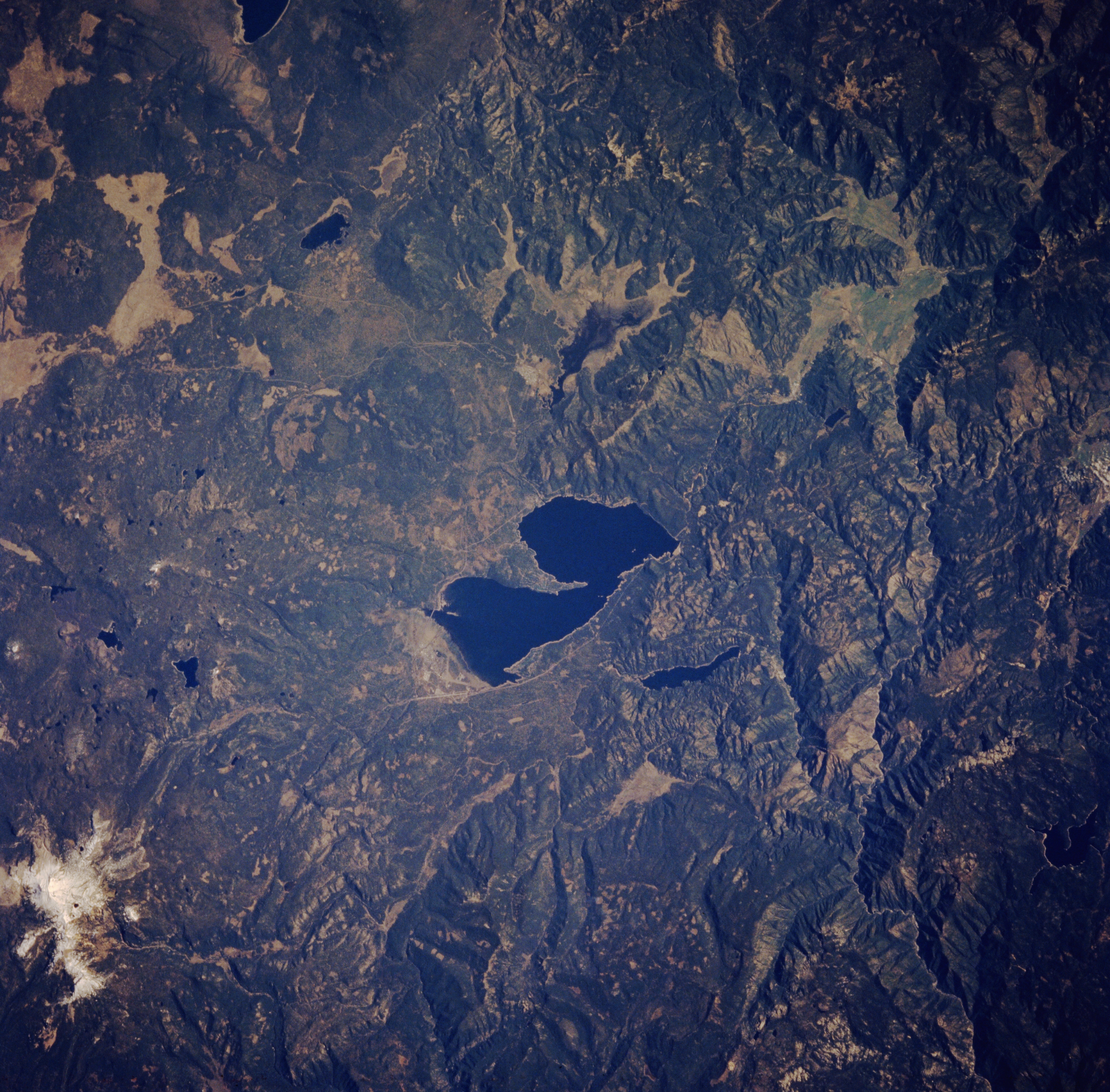
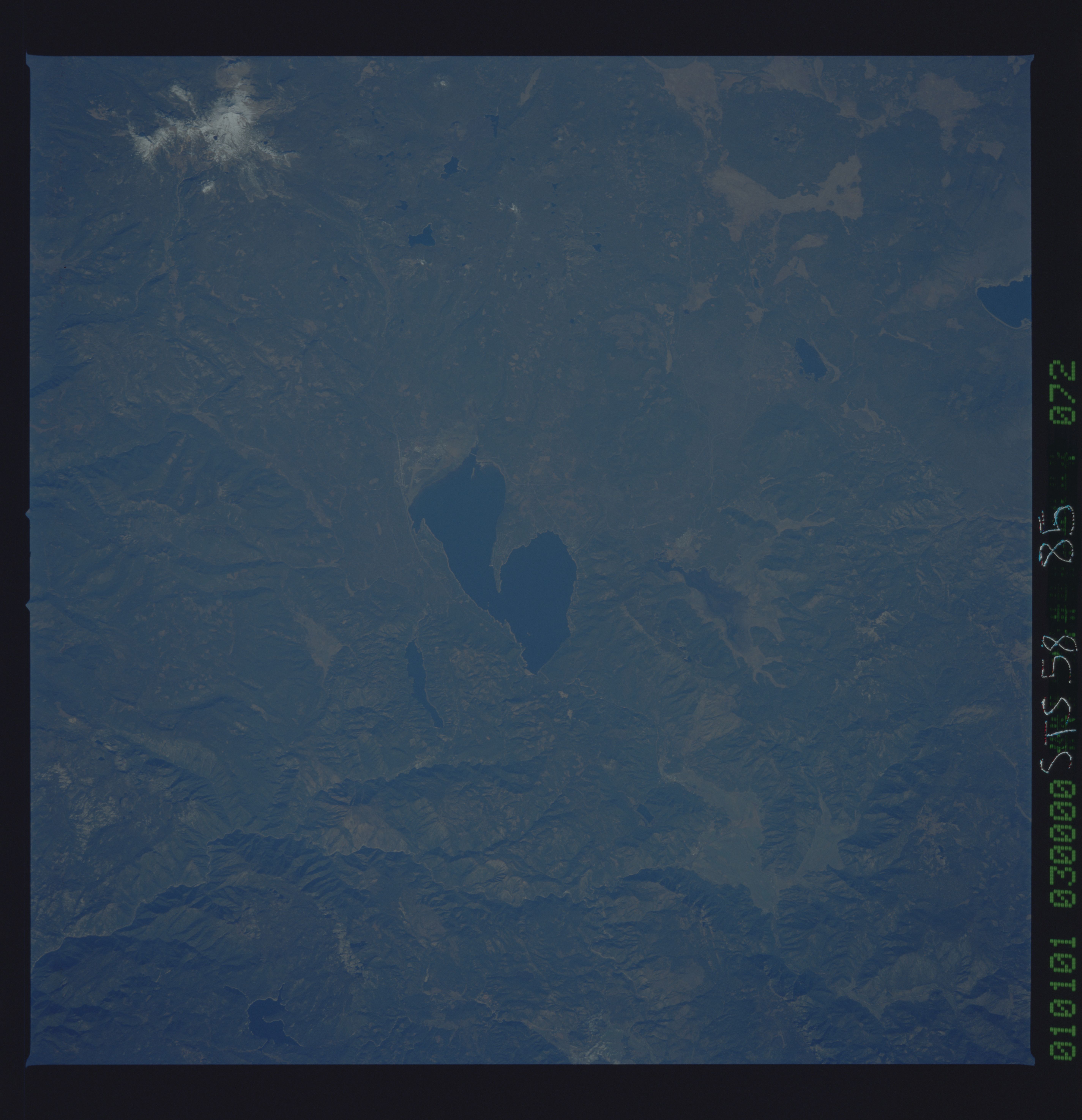
Image Caption: STS058-085-072 Lake Almanor and Lassen Peak Volcano, California, U.S.A. October 1993
This low-oblique, northwest-looking photograph features the dark blue waters of Lake Almanor. Impounded at the Big Meadows Dam across the north fork of the Feather River, Lake Almanor supplies water power to many industries and communities in the region. Visible near the top left of the photograph is the snowcapped stratovolcano Lassen Peak, which last erupted in 1915. Clear-cutting timber patterns appear as small rectangles in both Lassen National Forest northwest of Lake Almanor and Plumas National Forest to the south. Two small reservoirs--Mount Meadows Reservoir and Butte Valley Reservoir--are visible east and north, respectively, of Lake Almanor. The extreme western portion of Eagle Lake is visible near the top right of the photograph.
This low-oblique, northwest-looking photograph features the dark blue waters of Lake Almanor. Impounded at the Big Meadows Dam across the north fork of the Feather River, Lake Almanor supplies water power to many industries and communities in the region. Visible near the top left of the photograph is the snowcapped stratovolcano Lassen Peak, which last erupted in 1915. Clear-cutting timber patterns appear as small rectangles in both Lassen National Forest northwest of Lake Almanor and Plumas National Forest to the south. Two small reservoirs--Mount Meadows Reservoir and Butte Valley Reservoir--are visible east and north, respectively, of Lake Almanor. The extreme western portion of Eagle Lake is visible near the top right of the photograph.
