STS058-85-71
| NASA Photo ID | STS058-85-71 |
| Focal Length | 100mm |
| Date taken | 1993.__.__ |
| Time taken | GMT |
Resolutions offered for this image:
3904 x 3872 pixels 639 x 634 pixels 5700 x 5900 pixels 500 x 518 pixels 640 x 480 pixels
3904 x 3872 pixels 639 x 634 pixels 5700 x 5900 pixels 500 x 518 pixels 640 x 480 pixels

Cloud masks available for this image:
Spacecraft nadir point:
Photo center point: 40.5° N, 121.5° W
Photo center point by machine learning:
Photo center point: 40.5° N, 121.5° W
Photo center point by machine learning:
Nadir to Photo Center:
Spacecraft Altitude: nautical miles (0km)
Country or Geographic Name: | USA-CALIFORNIA |
Features: | MOUNT LASSEN, L. ALMANOR |
| Features Found Using Machine Learning: | |
Cloud Cover Percentage: | 5 (1-10)% |
Sun Elevation Angle: | ° |
Sun Azimuth: | ° |
Camera: | Hasselblad |
Focal Length: | 100mm |
Camera Tilt: | Low Oblique |
Format: | 5017: Kodak, natural color positive, Ektachrome, X Professional, ASA 64, standard base |
Film Exposure: | Normal |
| Additional Information | |
| Width | Height | Annotated | Cropped | Purpose | Links |
|---|---|---|---|---|---|
| 3904 pixels | 3872 pixels | No | No | Earth From Space collection | Download Image |
| 639 pixels | 634 pixels | No | No | Earth From Space collection | Download Image |
| 5700 pixels | 5900 pixels | No | No | Download Image | |
| 500 pixels | 518 pixels | No | No | Download Image | |
| 640 pixels | 480 pixels | No | No | Download Image |
Download Packaged File
Download a Google Earth KML for this Image
View photo footprint information
Download a GeoTIFF for this photo
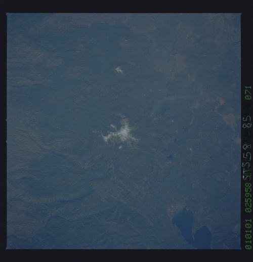
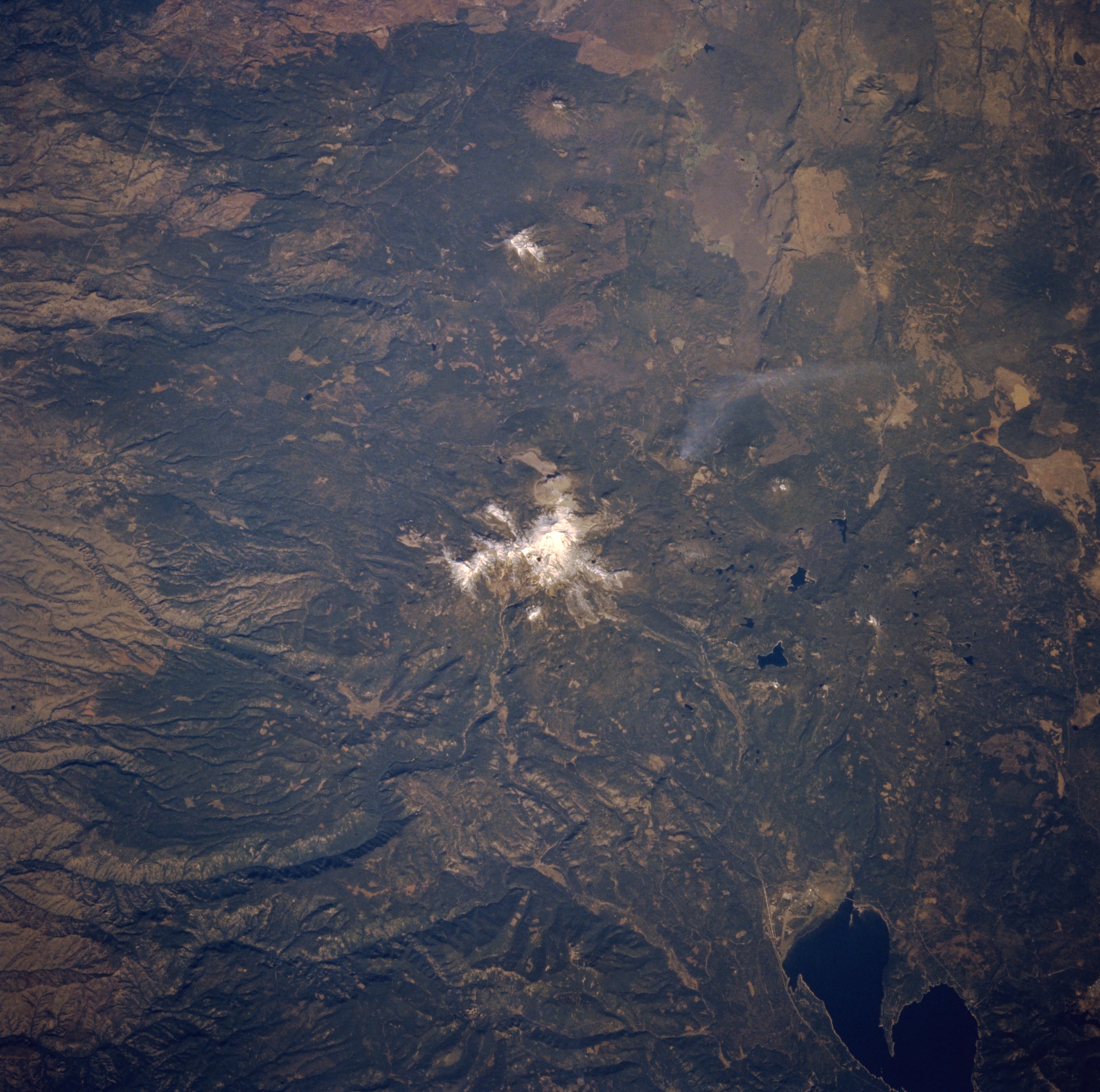
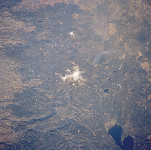
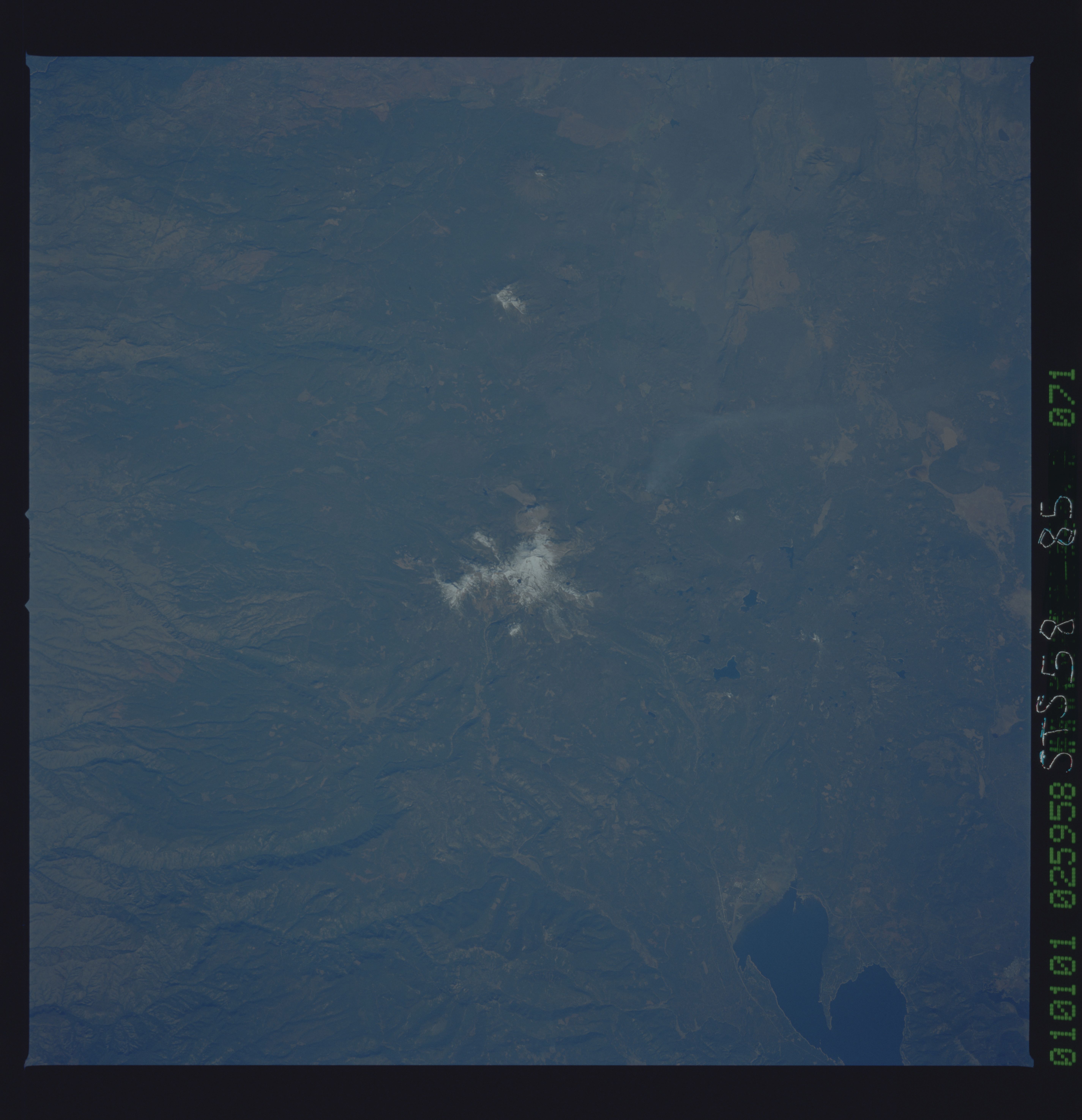
Image Caption: STS058-085-071 Lassen Peak Volcano, California, U.S.A. October 1993
This north-looking, low-oblique photograph features snowcapped Lassen Peak Volcano and the tree-covered mountains of the surrounding Lassen National Forest. A stratovolcano with a summit lava dome, the 10 457-foot (3189-meter) volcano last experienced eruptions between 1914 and 1921, with the most severe eruption occurring in May 1915 when a series of hot avalanches descended the mountain slopes. Until Mount Saint Helens in Washington erupted in 1980, Lassen Peak had recorded the only volcanic eruption in the 48 contiguous states in the 20th century. Rectangular cutting patterns created by timber companies are scattered throughout Lassen National Forest. Visible within the Lassen Volcanic National Park are Snag Lake and Juniper Lake, east and east-southeast, respectively, of the volcano, and the northern half of Lake Almanor.
This north-looking, low-oblique photograph features snowcapped Lassen Peak Volcano and the tree-covered mountains of the surrounding Lassen National Forest. A stratovolcano with a summit lava dome, the 10 457-foot (3189-meter) volcano last experienced eruptions between 1914 and 1921, with the most severe eruption occurring in May 1915 when a series of hot avalanches descended the mountain slopes. Until Mount Saint Helens in Washington erupted in 1980, Lassen Peak had recorded the only volcanic eruption in the 48 contiguous states in the 20th century. Rectangular cutting patterns created by timber companies are scattered throughout Lassen National Forest. Visible within the Lassen Volcanic National Park are Snag Lake and Juniper Lake, east and east-southeast, respectively, of the volcano, and the northern half of Lake Almanor.
