STS058-77-83
| NASA Photo ID | STS058-77-83 |
| Focal Length | 250mm |
| Date taken | 1993.10.31 |
| Time taken | 14:01:47 GMT |
Cloud masks available for this image:
Spacecraft nadir point: 33.2° S, 25.7° E
Photo center point: 33.5° S, 26.0° E
Photo center point by machine learning:
Photo center point: 33.5° S, 26.0° E
Photo center point by machine learning:
Nadir to Photo Center: Southeast
Spacecraft Altitude: 152 nautical miles (282km)
Country or Geographic Name: | REPUBLIC SOUTH AFRICA |
Features: | PAN-S COAST TO CAPETOWN |
| Features Found Using Machine Learning: | |
Cloud Cover Percentage: | 45 (26-50)% |
Sun Elevation Angle: | 33° |
Sun Azimuth: | 274° |
Camera: | Hasselblad |
Focal Length: | 250mm |
Camera Tilt: | High Oblique |
Format: | 5017: Kodak, natural color positive, Ektachrome, X Professional, ASA 64, standard base |
Film Exposure: | Normal |
| Additional Information | |
| Width | Height | Annotated | Cropped | Purpose | Links |
|---|---|---|---|---|---|
| 5700 pixels | 5900 pixels | No | No | Download Image | |
| 500 pixels | 518 pixels | No | No | Download Image | |
| 640 pixels | 480 pixels | No | No | Download Image |
Download Packaged File
Download a Google Earth KML for this Image
View photo footprint information
Download a GeoTIFF for this photo
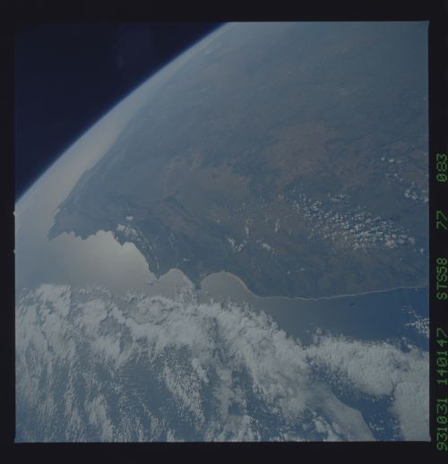
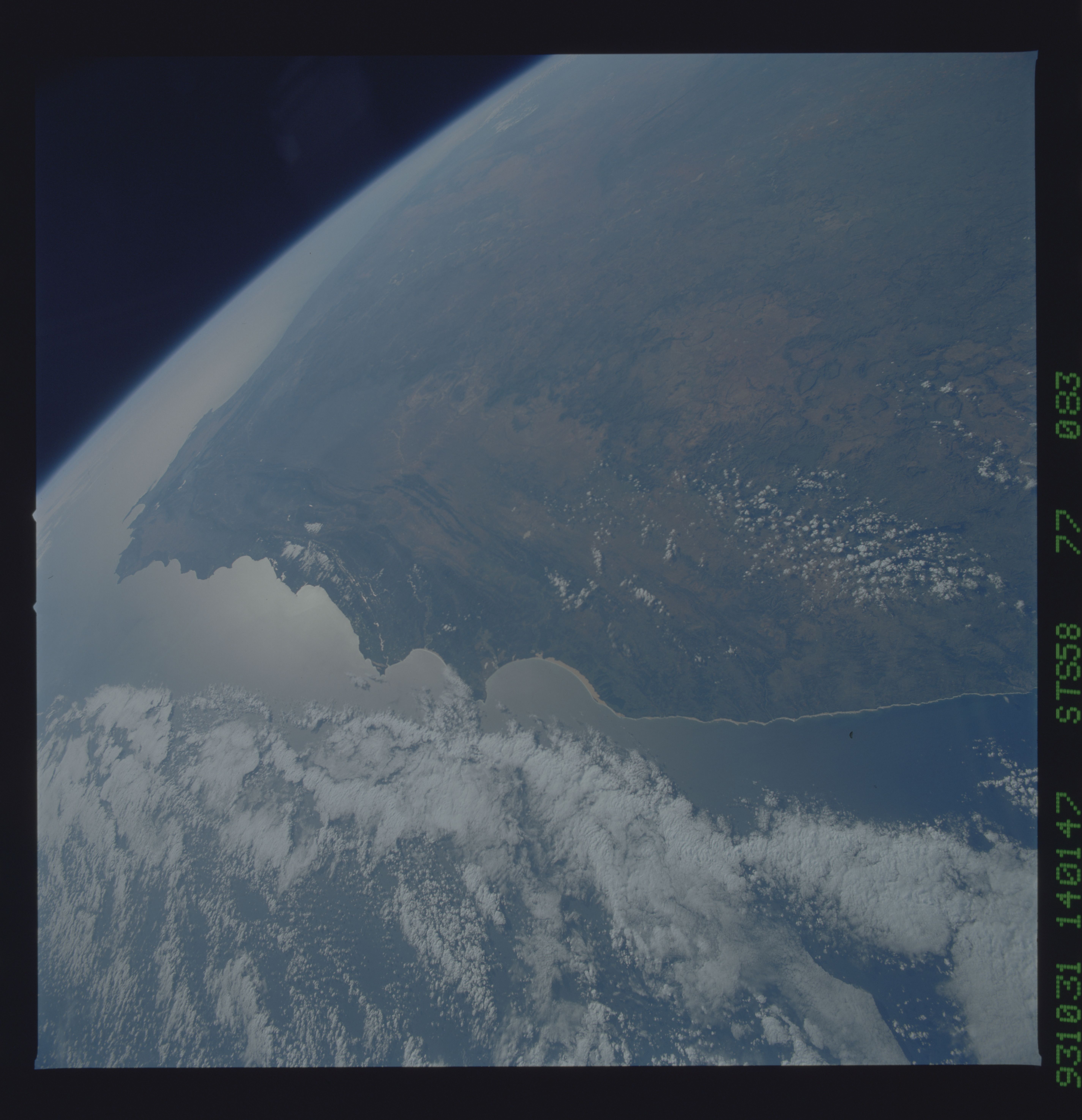
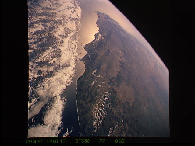
Image Caption: South coast, Cape Province, South Africa
In this scene of the south coast of Africa, Cape Aquihas, the southernmost point on the continent, appears as the leftmost cape. Viewed with the Earth's limb top left, clouds at bottom, the view direction is west and north top right. The Cape of Good Hope, with Cape Town nearby, is the thin spike beyond. The great bay in the foreground is Algoa Bay with the city of Port Elizabeth. The entire fold mountain belt of southern Africa is visible; these mountains appear as green (forested) wavy structures stretching west from the foregound, to the Cape of Good Hope, and then northwards some distance.
In this scene of the south coast of Africa, Cape Aquihas, the southernmost point on the continent, appears as the leftmost cape. Viewed with the Earth's limb top left, clouds at bottom, the view direction is west and north top right. The Cape of Good Hope, with Cape Town nearby, is the thin spike beyond. The great bay in the foreground is Algoa Bay with the city of Port Elizabeth. The entire fold mountain belt of southern Africa is visible; these mountains appear as green (forested) wavy structures stretching west from the foregound, to the Cape of Good Hope, and then northwards some distance.
