STS058-101-56
| NASA Photo ID | STS058-101-56 |
| Focal Length | 250mm |
| Date taken | 1993.10.23 |
| Time taken | 19:55:00 GMT |
Resolutions offered for this image:
3904 x 3904 pixels 639 x 639 pixels 5700 x 5900 pixels 500 x 518 pixels 640 x 480 pixels
3904 x 3904 pixels 639 x 639 pixels 5700 x 5900 pixels 500 x 518 pixels 640 x 480 pixels

Cloud masks available for this image:
Spacecraft nadir point: 28.3° N, 98.0° W
Photo center point: 28.5° N, 96.5° W
Photo center point by machine learning:
Photo center point: 28.5° N, 96.5° W
Photo center point by machine learning:
Nadir to Photo Center: East
Spacecraft Altitude: 152 nautical miles (282km)
Country or Geographic Name: | USA-TEXAS |
Features: | MATAGORDA BAY, PORT LAVACA |
| Features Found Using Machine Learning: | |
Cloud Cover Percentage: | 0 (no clouds present) |
Sun Elevation Angle: | 44° |
Sun Azimuth: | 214° |
Camera: | Hasselblad |
Focal Length: | 250mm |
Camera Tilt: | 31 degrees |
Format: | 5017: Kodak, natural color positive, Ektachrome, X Professional, ASA 64, standard base |
Film Exposure: | Normal |
| Additional Information | |
| Width | Height | Annotated | Cropped | Purpose | Links |
|---|---|---|---|---|---|
| 3904 pixels | 3904 pixels | No | No | Earth From Space collection | Download Image |
| 639 pixels | 639 pixels | No | No | Earth From Space collection | Download Image |
| 5700 pixels | 5900 pixels | No | No | Download Image | |
| 500 pixels | 518 pixels | No | No | Download Image | |
| 640 pixels | 480 pixels | No | No | Download Image |
Download Packaged File
Download a Google Earth KML for this Image
View photo footprint information
Download a GeoTIFF for this photo
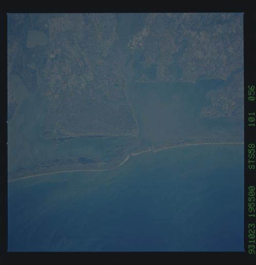
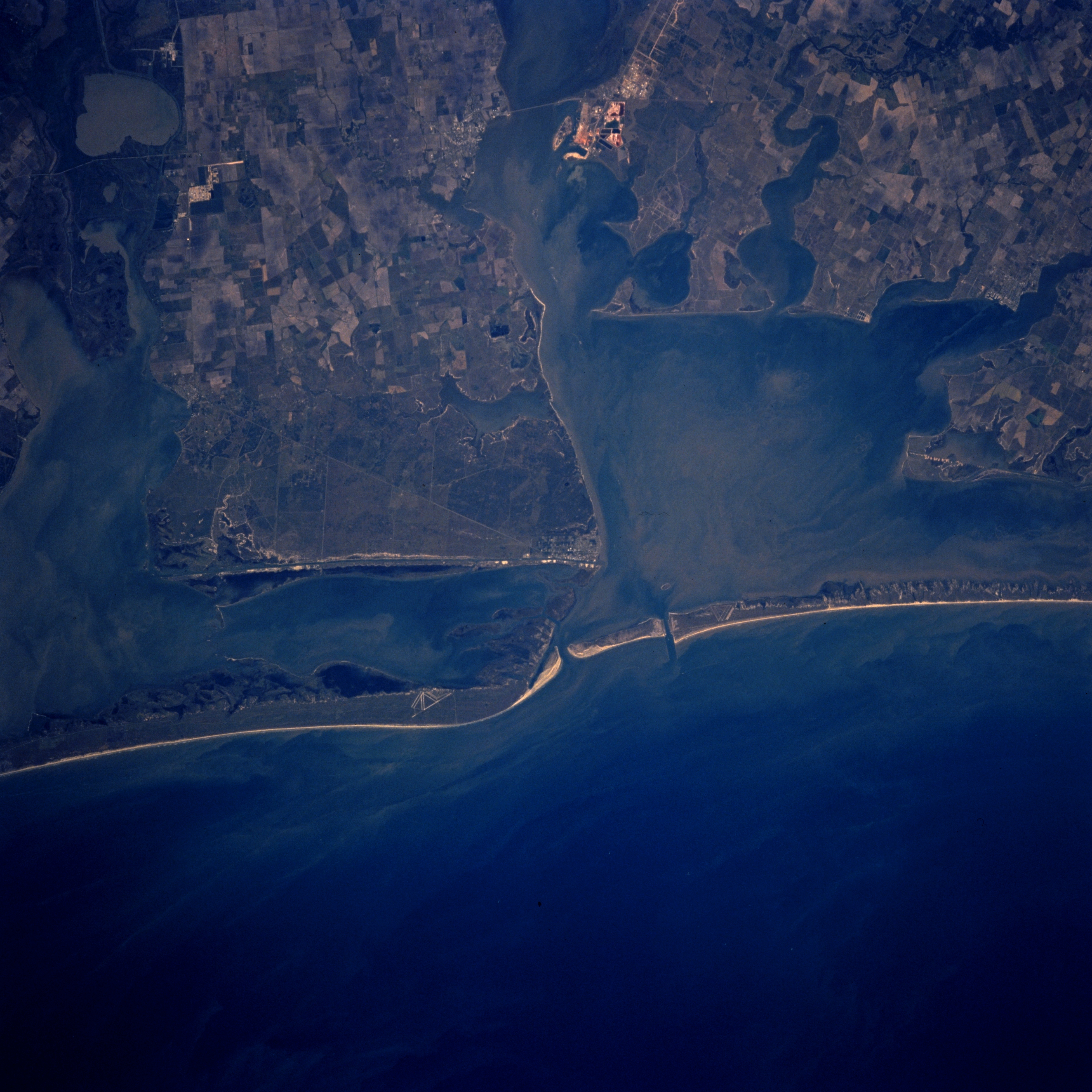
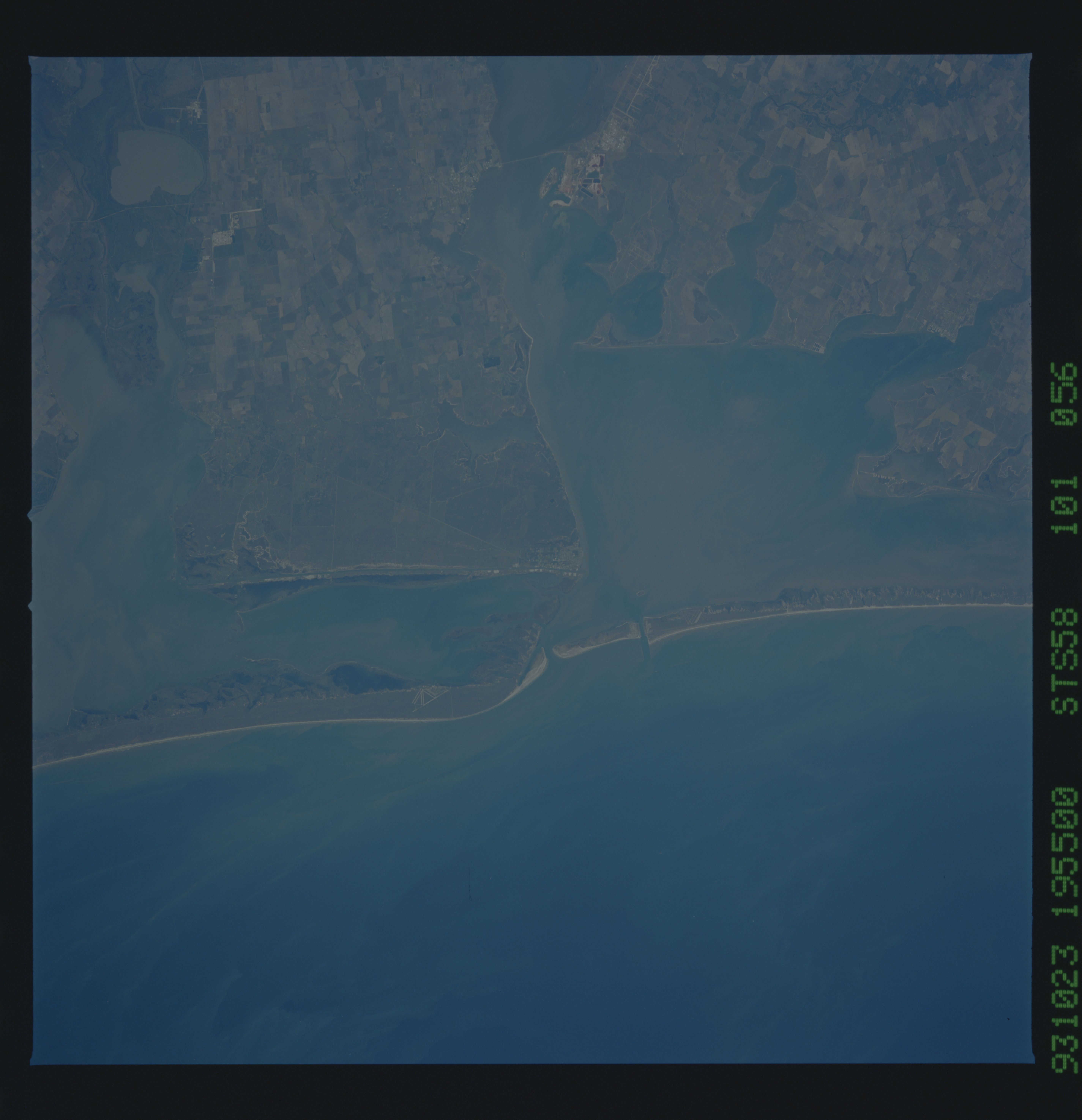
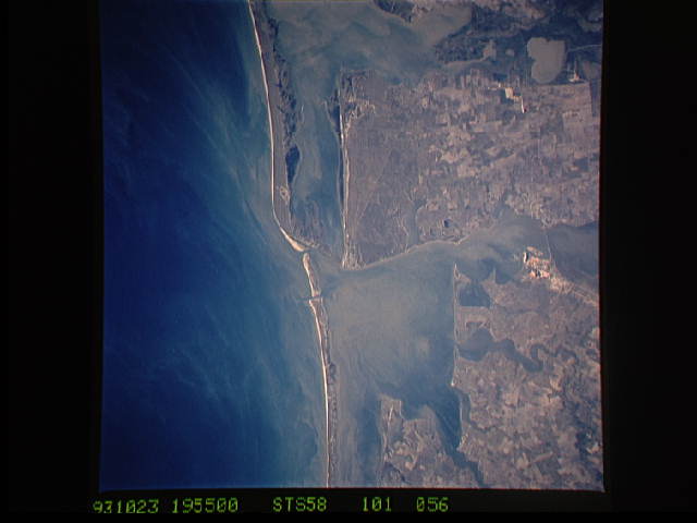
Image Caption: STS058-101-056 Matagorda Bay and San Antonio Bay, Texas, U.S.A. October 1993
Matagorda Bay and San Antonio Bay, two of the larger bays of central coastal Texas, are visible in this near-vertical photograph. Sandy barrier islands have created a series of estuaries that separate the Gulf of Mexico and the Intracoastal Waterway. Runways of an abandoned airstrip are barely visible near the northeast end of Matagorda Island, which lies south of Matagorda Peninsula, the sliver of barrier beach that extends southwest. Substantial suspended sediments are widespread throughout the estuaries and the shoreside waters of the gulf. Northwest of Matagorda Bay are Lavaca Bay and Port Lavaca, southwest of a bridge crossing the bay. Small Port O'Connor, southeast of Port Lavaca on the western edge of Matagorda Bay, is discernible on the northeastern point of land on the large peninsula that separates Matagorda Bay and San Antonio Bay. Some cultivated field patterns are apparent on the mainland.
Matagorda Bay and San Antonio Bay, two of the larger bays of central coastal Texas, are visible in this near-vertical photograph. Sandy barrier islands have created a series of estuaries that separate the Gulf of Mexico and the Intracoastal Waterway. Runways of an abandoned airstrip are barely visible near the northeast end of Matagorda Island, which lies south of Matagorda Peninsula, the sliver of barrier beach that extends southwest. Substantial suspended sediments are widespread throughout the estuaries and the shoreside waters of the gulf. Northwest of Matagorda Bay are Lavaca Bay and Port Lavaca, southwest of a bridge crossing the bay. Small Port O'Connor, southeast of Port Lavaca on the western edge of Matagorda Bay, is discernible on the northeastern point of land on the large peninsula that separates Matagorda Bay and San Antonio Bay. Some cultivated field patterns are apparent on the mainland.
