STS058-101-53
| NASA Photo ID | STS058-101-53 |
| Focal Length | 250mm |
| Date taken | 1993.10.23 |
| Time taken | 19:54:23 GMT |
Resolutions offered for this image:
3904 x 3904 pixels 639 x 639 pixels 5700 x 5900 pixels 500 x 518 pixels 640 x 480 pixels
3904 x 3904 pixels 639 x 639 pixels 5700 x 5900 pixels 500 x 518 pixels 640 x 480 pixels

Cloud masks available for this image:
Spacecraft nadir point: 29.5° N, 100.3° W
Photo center point: 29.5° N, 98.5° W
Photo center point by machine learning:
Photo center point: 29.5° N, 98.5° W
Photo center point by machine learning:
Nadir to Photo Center: East
Spacecraft Altitude: 152 nautical miles (282km)
Country or Geographic Name: | USA-TEXAS |
Features: | SAN ANTONIO, RIV., RES. |
| Features Found Using Machine Learning: | |
Cloud Cover Percentage: | 0 (no clouds present) |
Sun Elevation Angle: | 44° |
Sun Azimuth: | 211° |
Camera: | Hasselblad |
Focal Length: | 250mm |
Camera Tilt: | 35 degrees |
Format: | 5017: Kodak, natural color positive, Ektachrome, X Professional, ASA 64, standard base |
Film Exposure: | Normal |
| Additional Information | |
| Width | Height | Annotated | Cropped | Purpose | Links |
|---|---|---|---|---|---|
| 3904 pixels | 3904 pixels | No | No | Earth From Space collection | Download Image |
| 639 pixels | 639 pixels | No | No | Earth From Space collection | Download Image |
| 5700 pixels | 5900 pixels | No | No | Download Image | |
| 500 pixels | 518 pixels | No | No | Download Image | |
| 640 pixels | 480 pixels | No | No | Download Image |
Download Packaged File
Download a Google Earth KML for this Image
View photo footprint information
Download a GeoTIFF for this photo
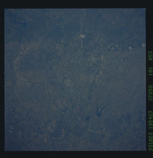
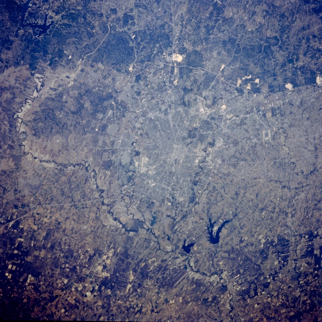
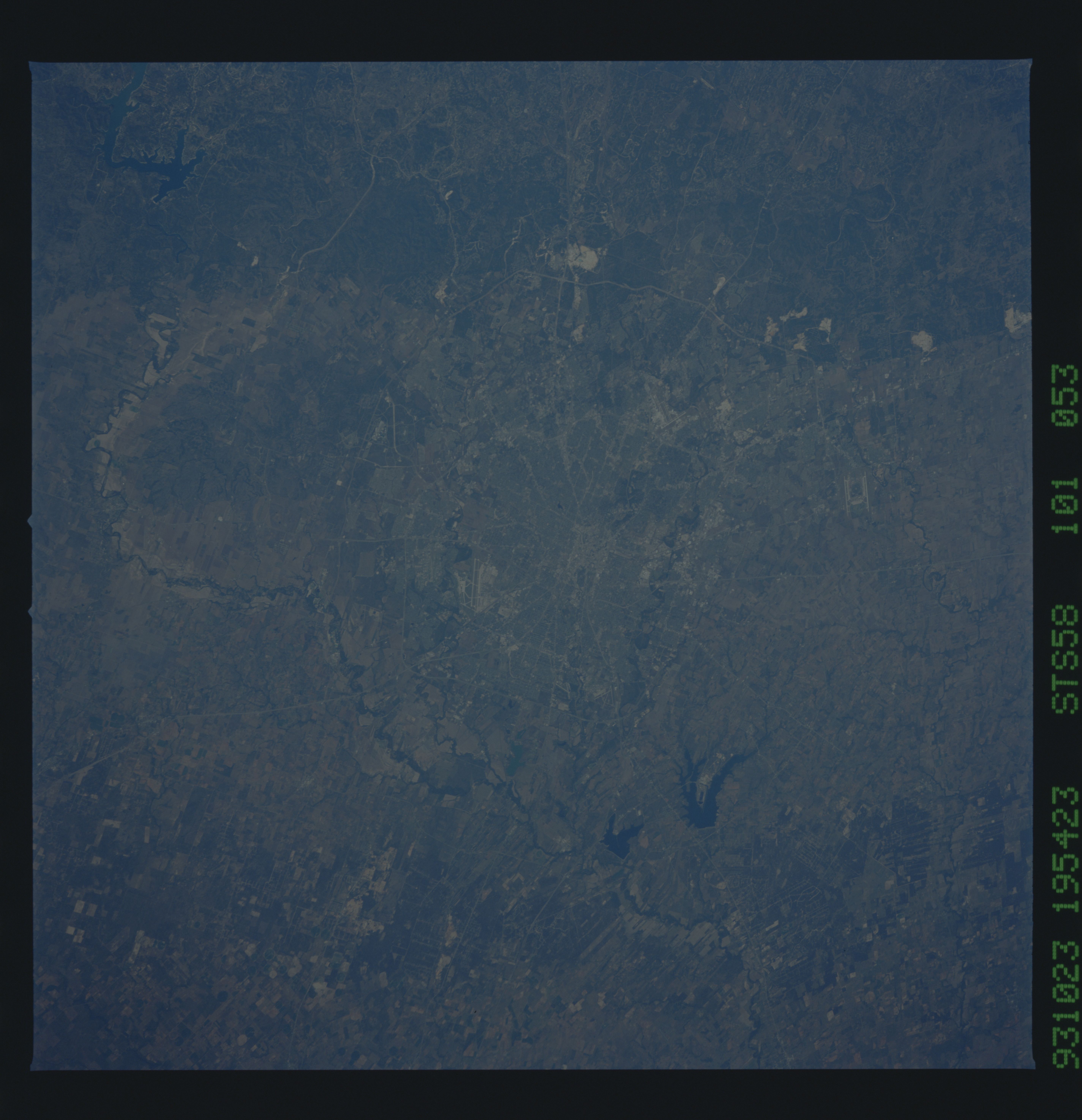
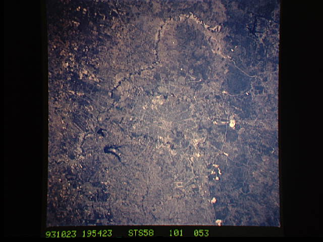
Image Caption: STS058-101-053 San Antonio, Texas, U.S.A. October 1993
Downtown San Antonio is the point of convergence of a major highway system (center of photograph). East and west of the central business district are curving north-south-oriented Salado Creek and Leon Creek, respectively, both of which flow into the Medina River south of the city. The meandering Medina River and its floodplain are prominent features as they loop around the west and south sides of the city. Visible are the runways of Kelly Air Force Base (southwest) and Randolph Air Force Base (northeast) and Calaveras Lake and smaller Braunig Lake to the southeast. An edge of the deeply dissected Edwards Plateau, known locally as the Texas Hill Country, is visible north of the city. Highly reflective limestone quarries appear within the uplifted sedimentary rocks along the Balcones fault system. The mined limestone is used to make cement and road gravel.
This sharp cloud-free photograph of San Antonio, Texas illustrates the classic pattern of western cities. The Hispanic heart of the city, an intertwining of streets along the San Antonio River and around the Alamo, surrounded by a late 19th century Anglo grid of small businesses and suburban homes. Transportation routes radiate to mid and late 20th century ring corridors separating the urban/suburban region from the surrounding agricultural countryside. Limestone quarries are conspicuous along the edge of the Balcones Escarpment, at the foot of which San Antonio was founded. Randolph Air Force Base is outside the city to the northeast, Fort Sam Houston is contained within the northeast quadrant of the city, Brooks Air Force Base lies at the southeastern corner, and Lackland and Kelly Air Force Bases are within the suburban fringe to the southwest. San Antonio International Airport can be seen at the foot of the escarpment in the northern part of the city.
