STS056-96-47
| NASA Photo ID | STS056-96-47 |
| Focal Length | 250mm |
| Date taken | 1993.04.15 |
| Time taken | 00:57:49 GMT |
Resolutions offered for this image:
3904 x 3907 pixels 639 x 640 pixels 5700 x 6000 pixels 500 x 526 pixels 640 x 480 pixels
3904 x 3907 pixels 639 x 640 pixels 5700 x 6000 pixels 500 x 526 pixels 640 x 480 pixels
Cloud masks available for this image:
Spacecraft nadir point: 19.0° S, 122.6° E
Photo center point: 17.5° S, 123.5° E
Photo center point by machine learning:
Photo center point: 17.5° S, 123.5° E
Photo center point by machine learning:
Nadir to Photo Center: Northeast
Spacecraft Altitude: 162 nautical miles (300km)
Country or Geographic Name: | AUSTRALIA-WA |
Features: | FITZROY RIVER, AIRPORT |
| Features Found Using Machine Learning: | |
Cloud Cover Percentage: | 0 (no clouds present) |
Sun Elevation Angle: | 39° |
Sun Azimuth: | 60° |
Camera: | Hasselblad |
Focal Length: | 250mm |
Camera Tilt: | 33 degrees |
Format: | 5017: Kodak, natural color positive, Ektachrome, X Professional, ASA 64, standard base |
Film Exposure: | Normal |
| Additional Information | |
| Width | Height | Annotated | Cropped | Purpose | Links |
|---|---|---|---|---|---|
| 3904 pixels | 3907 pixels | No | No | Earth From Space collection | Download Image |
| 639 pixels | 640 pixels | No | No | Earth From Space collection | Download Image |
| 5700 pixels | 6000 pixels | No | No | Download Image | |
| 500 pixels | 526 pixels | No | No | Download Image | |
| 640 pixels | 480 pixels | No | No | Download Image |
Download Packaged File
Download a Google Earth KML for this Image
View photo footprint information
Download a GeoTIFF for this photo
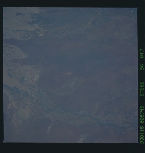
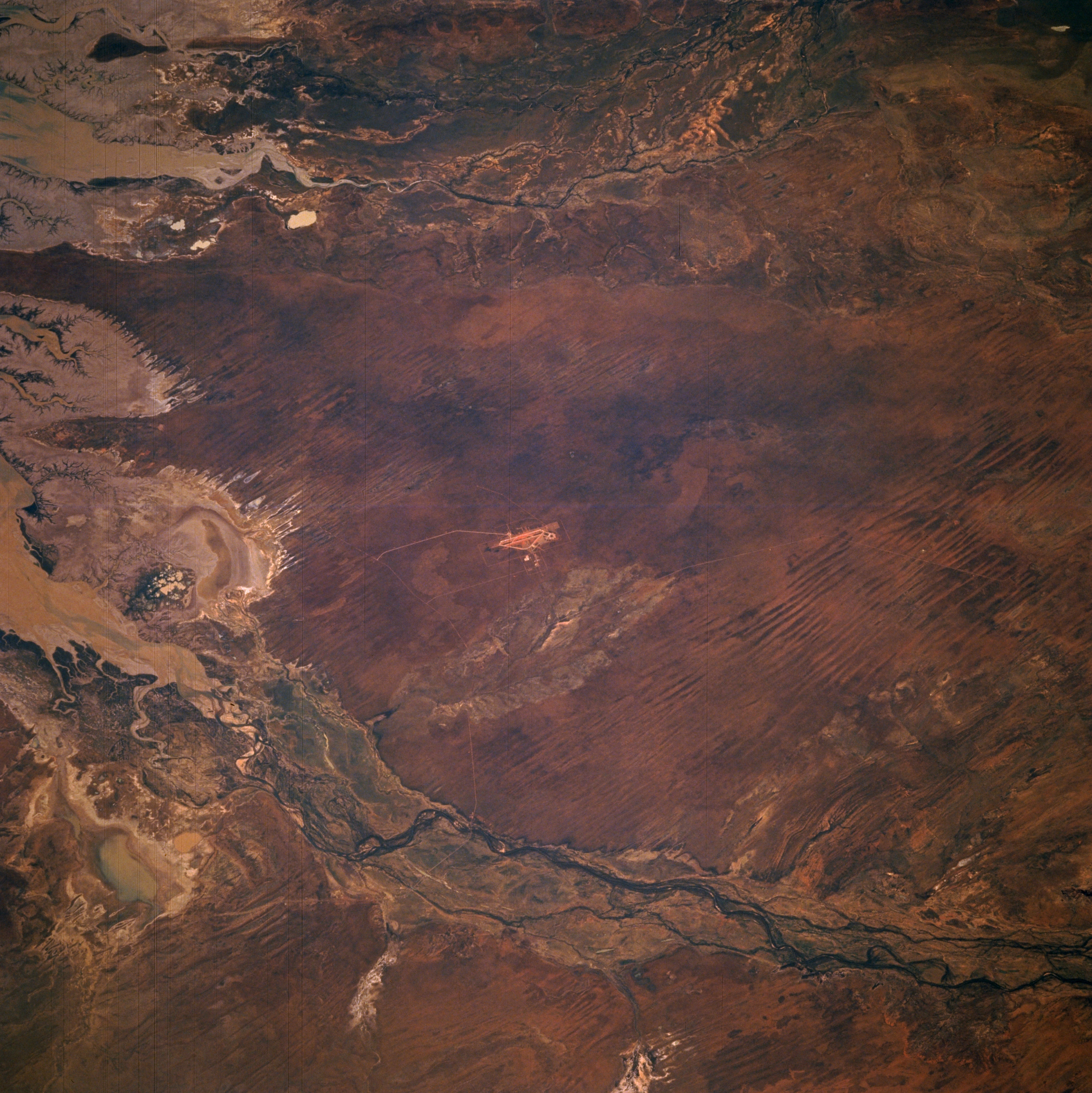
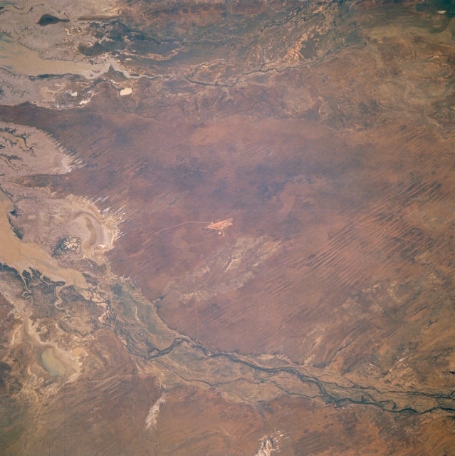
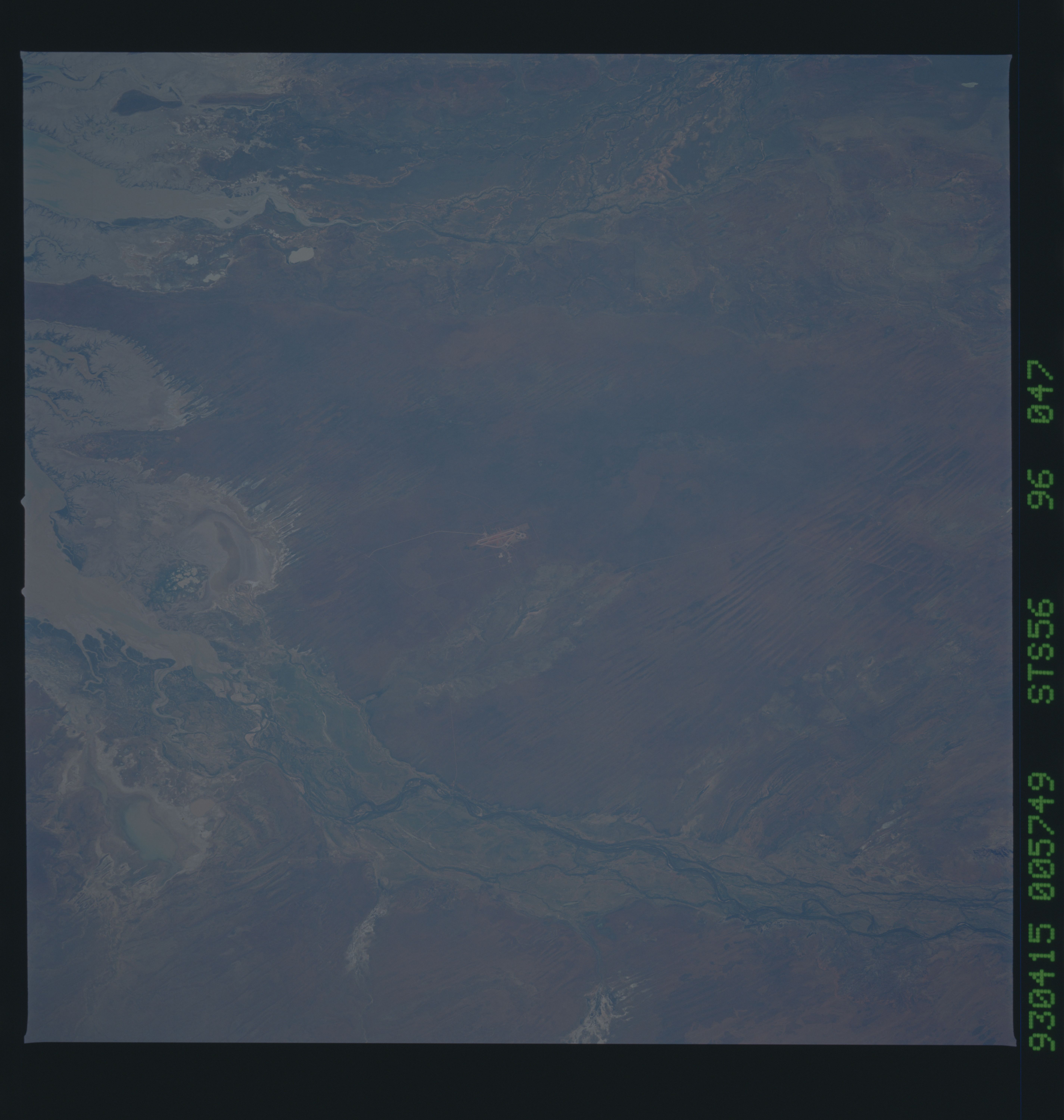
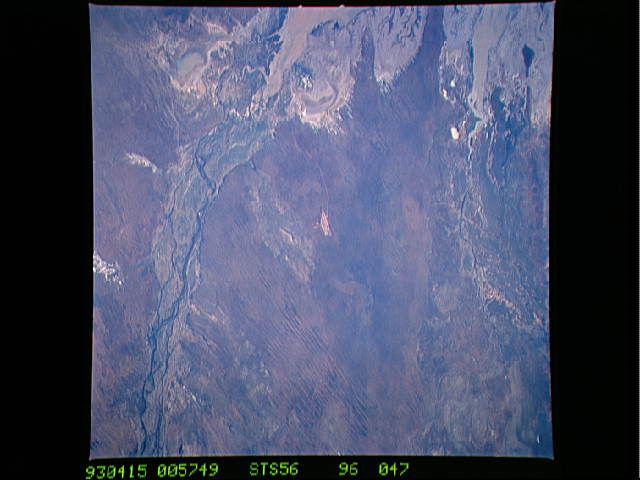
Image Caption: STS056-96-047 Fitzroy River, Western Australia, Australia April 1993
The Fitzroy River (bottom of image) and the May and Meda Rivers (top of picture) drain northward into the southern end of King Sound (left side of image) along the northern coast of Western Australia. A complex array of dynamic coastal features in King Sound, including sandy sediment and muddy tidal flats, show up as brownish-looking features. There are also significant stands of mangrove trees (thin dark green lines at the waters edge) along this tidally active shoreline. The floodplain of the Fitzroy River is wider and better defined in comparison to the two shorter flowing rivers to the northeast. The Fitzroy River is the largest river in the Kimberley Region of northern Western Australia. Like many of the rivers along the north coast of Australia, it is a monsoonal river that flows during the three months rainy season (December through February) and then dries out for the rest of the year. No dams currently have been built on the Fitzroy River, so it is one of the last remaining large wild rivers in Australia. The short, linear, paralleling features in the southern third of the scene shows numerous sand ridges that average 20 feet (6 meters) in height.
The Fitzroy River (bottom of image) and the May and Meda Rivers (top of picture) drain northward into the southern end of King Sound (left side of image) along the northern coast of Western Australia. A complex array of dynamic coastal features in King Sound, including sandy sediment and muddy tidal flats, show up as brownish-looking features. There are also significant stands of mangrove trees (thin dark green lines at the waters edge) along this tidally active shoreline. The floodplain of the Fitzroy River is wider and better defined in comparison to the two shorter flowing rivers to the northeast. The Fitzroy River is the largest river in the Kimberley Region of northern Western Australia. Like many of the rivers along the north coast of Australia, it is a monsoonal river that flows during the three months rainy season (December through February) and then dries out for the rest of the year. No dams currently have been built on the Fitzroy River, so it is one of the last remaining large wild rivers in Australia. The short, linear, paralleling features in the southern third of the scene shows numerous sand ridges that average 20 feet (6 meters) in height.
