STS056-96-43
| NASA Photo ID | STS056-96-43 |
| Focal Length | 250mm |
| Date taken | 1993.04.15 |
| Time taken | 00:57:26 GMT |
Resolutions offered for this image:
5700 x 6000 pixels 500 x 526 pixels 640 x 480 pixels 1296 x 1296 pixels 957 x 960 pixels 960 x 957 pixels
5700 x 6000 pixels 500 x 526 pixels 640 x 480 pixels 1296 x 1296 pixels 957 x 960 pixels 960 x 957 pixels

Cloud masks available for this image:
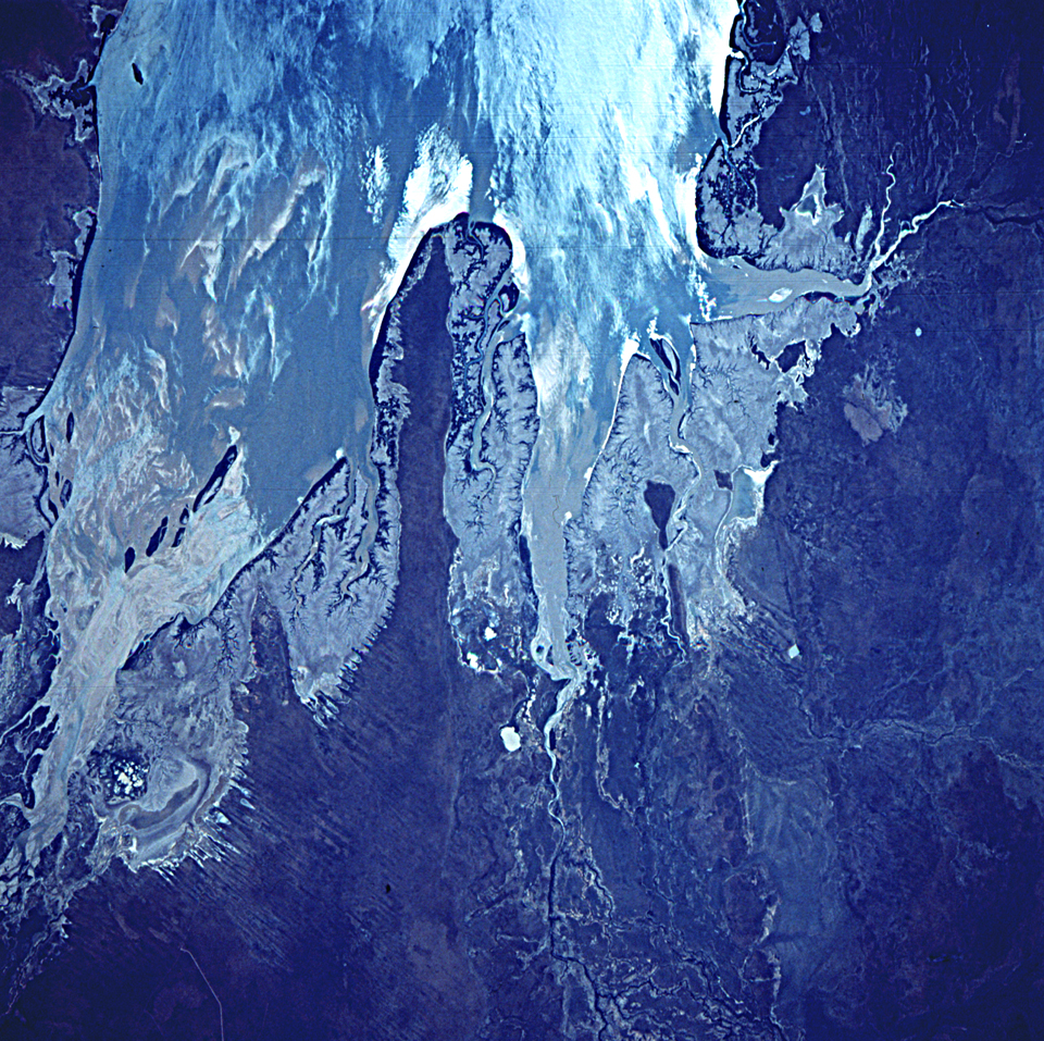
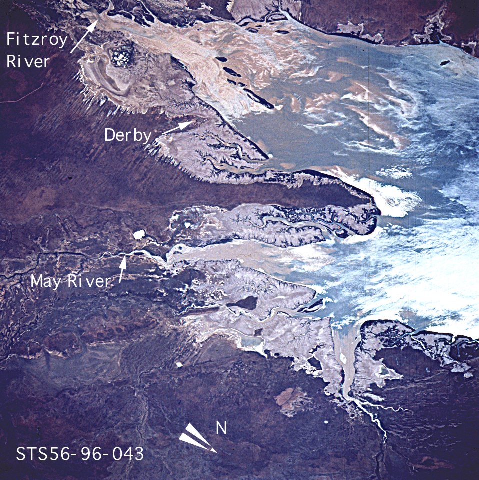
Spacecraft nadir point: 17.7° S, 121.7° E
Photo center point: 17.0° S, 123.5° E
Photo center point by machine learning:
Photo center point: 17.0° S, 123.5° E
Photo center point by machine learning:
Nadir to Photo Center: East
Spacecraft Altitude: 161 nautical miles (298km)
Country or Geographic Name: | AUSTRALIA-WA |
Features: | INTERIOR OF KING SOUND |
| Features Found Using Machine Learning: | |
Cloud Cover Percentage: | 0 (no clouds present) |
Sun Elevation Angle: | 39° |
Sun Azimuth: | 61° |
Camera: | Hasselblad |
Focal Length: | 250mm |
Camera Tilt: | 36 degrees |
Format: | 5017: Kodak, natural color positive, Ektachrome, X Professional, ASA 64, standard base |
Film Exposure: | Normal |
| Additional Information | |
| Width | Height | Annotated | Cropped | Purpose | Links |
|---|---|---|---|---|---|
| 5700 pixels | 6000 pixels | No | No | Download Image | |
| 500 pixels | 526 pixels | No | No | Download Image | |
| 640 pixels | 480 pixels | No | No | Download Image | |
| 1296 pixels | 1296 pixels | No | No | Download Image | |
| 957 pixels | 960 pixels | Yes | No | Download Image | |
| 960 pixels | 957 pixels | Download Image |
Download Packaged File
Download a Google Earth KML for this Image
View photo footprint information
Download a GeoTIFF for this photo
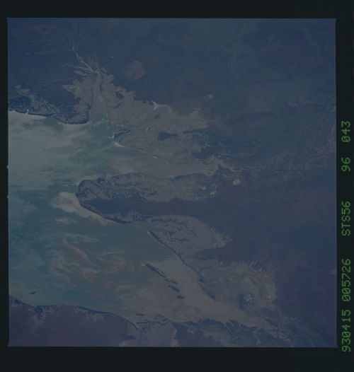
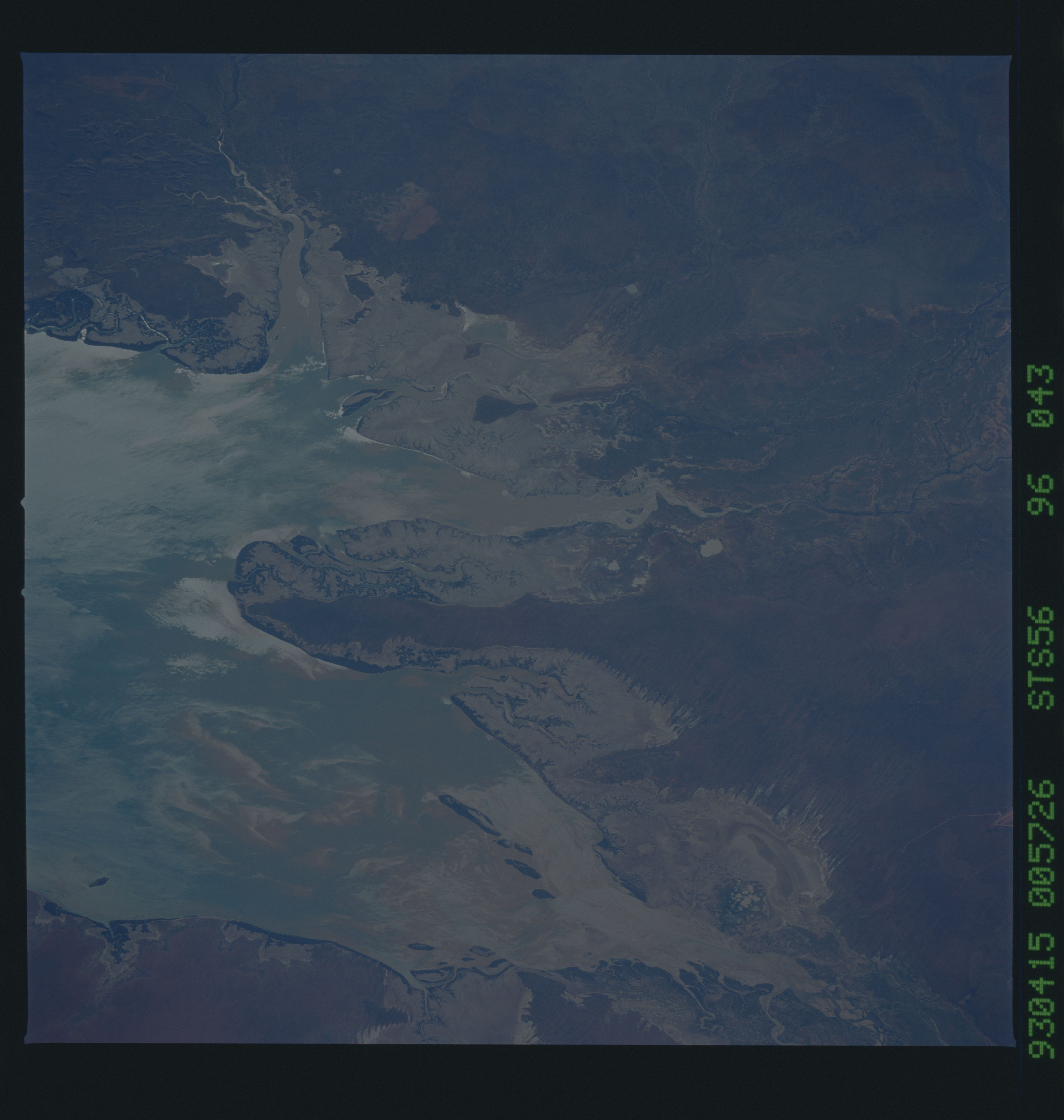
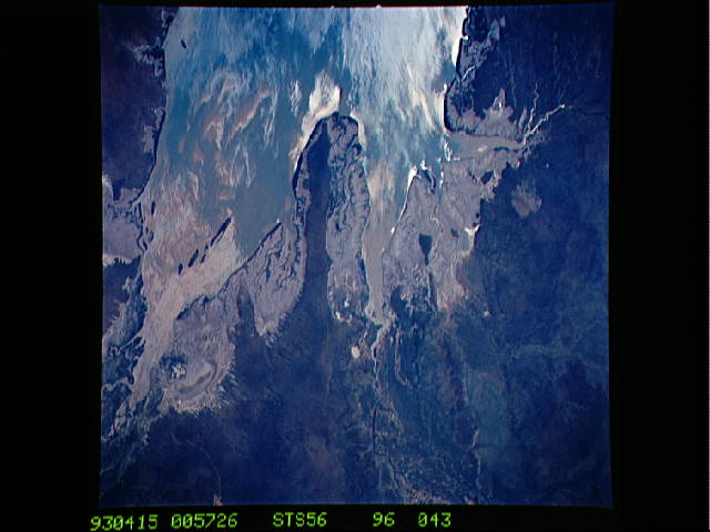
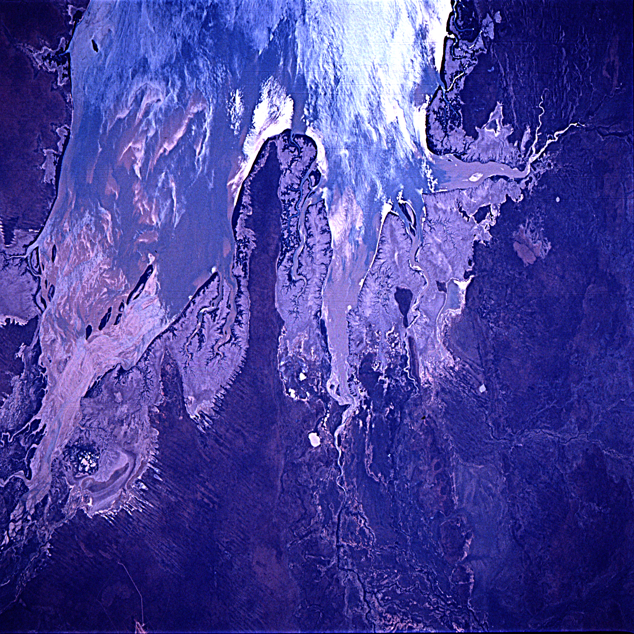
Image Caption: The southern end of King Sound, northern coast of Western Australia. Point Torment marks the northwestern end of a peninsula betwen the May River to the northeast and the Fitzroy river to the southwest; Derby lies on the east bank of the Fitzroy estuary. Within the sunglint a complex pattern of water texture is seen; outside the sunglint sediment-laden brackish water and clear marine water form an intricate mixture.
