STS056-153-70

| NASA Photo ID | STS056-153-70 |
| Focal Length | 90mm |
| Date taken | 1993.04.__ |
| Time taken | GMT |
Resolutions offered for this image:
5129 x 4044 pixels 640 x 504 pixels 640 x 480 pixels 576 x 510 pixels
5129 x 4044 pixels 640 x 504 pixels 640 x 480 pixels 576 x 510 pixels

Cloud masks available for this image:
Spacecraft nadir point:
Photo center point:
Photo center point by machine learning:
Photo center point:
Photo center point by machine learning:
Nadir to Photo Center:
Spacecraft Altitude: nautical miles (0km)
Camera: | Linhof |
Focal Length: | 90mm |
Camera Tilt: | High Oblique |
Format: | QX868: Kodak, natural color positive, Ektachrome QX868(5017 emulsion), ASA 64, thin base |
Film Exposure: | Normal |
| Additional Information | |
| Width | Height | Annotated | Cropped | Purpose | Links |
|---|---|---|---|---|---|
| 5129 pixels | 4044 pixels | No | No | Earth From Space collection | Download Image |
| 640 pixels | 504 pixels | No | No | Earth From Space collection | Download Image |
| 640 pixels | 480 pixels | No | No | ISD 1 | Download Image |
| 576 pixels | 510 pixels | Yes | No | Download Image |
Download Packaged File
Download a Google Earth KML for this Image
View photo footprint information
Download a GeoTIFF for this photo
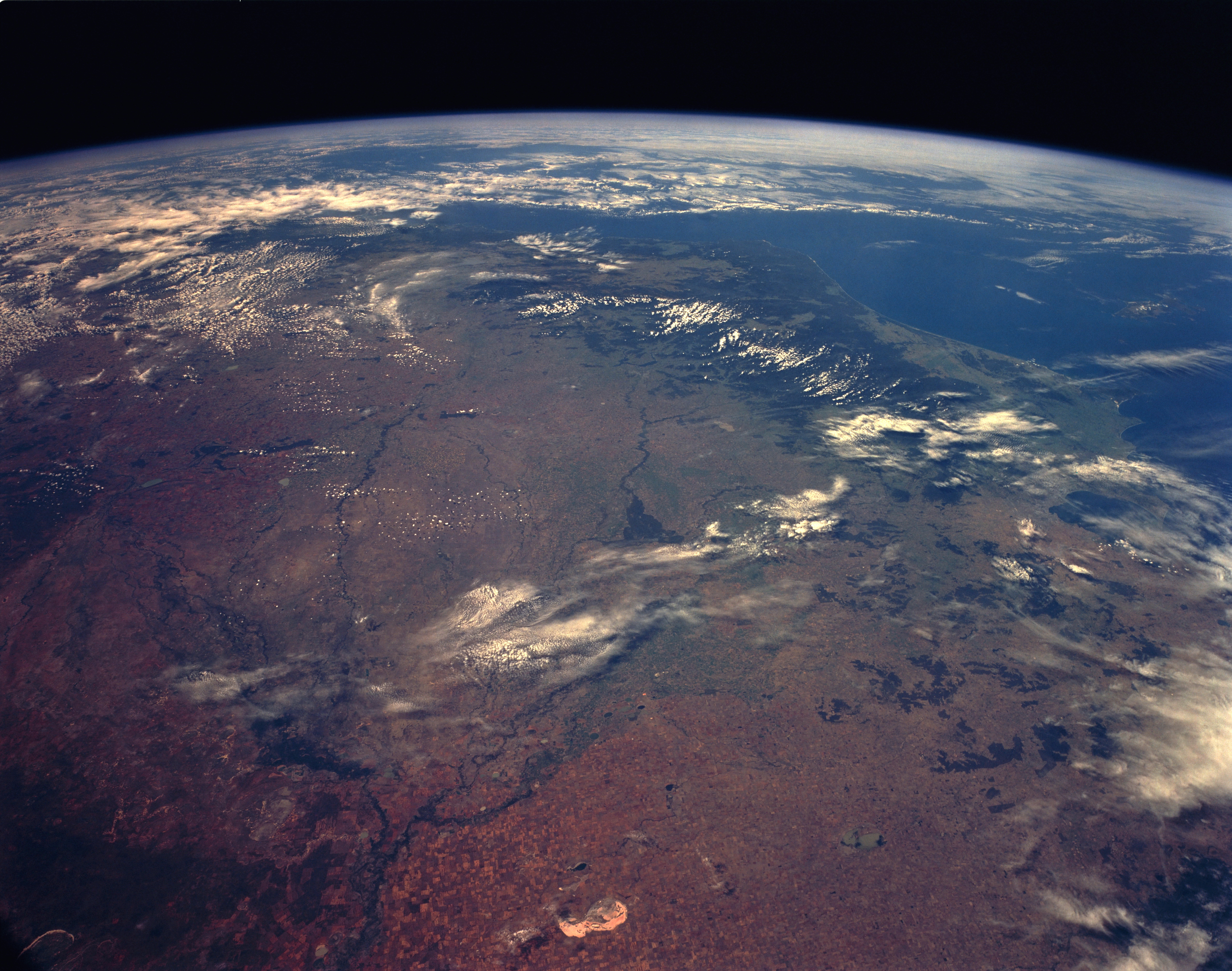
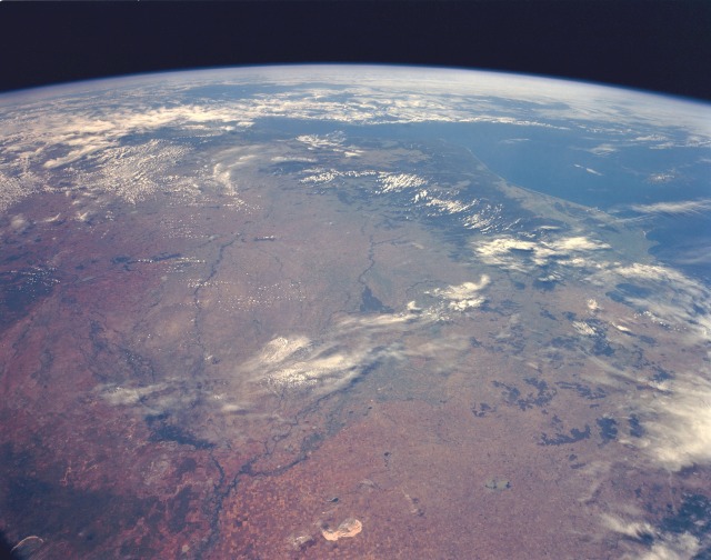
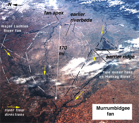
Image Caption: STS056-153-70 Murray River Basin, New South Wales and Victoria, Australia April 1993
In this high-oblique, south-southeast-looking photograph, the Murray River Basin and the southeast coastline of Australia are apparent. The dark green forested areas, inland from the coast and partially obscured by clouds, are the Australian Alps. The principal river of Australia, the Murray, is 1609 miles (2589 kilometers) long. Near the Murray's source in the Australian Alps is the Hume Reservoir (barely visible in the photograph), which helps regulate the river's flow and provides water for extensive pasturelands and areas where citrus fruits, vegetables, and vine products are grown. Extensive agricultural field patterns are scattered throughout the region. Near the center of the photograph is a large, green, delta-shaped region, which is the remnants of an old Murray River delta formed millions of years ago when the climate was much wetter. Northwest of the delta lies Lake Tyrrel, an almost dry lakebed. Northeast of Lake Tyrrel the waters of the Murrumbidgee River enter the Murray River.
In this high-oblique, south-southeast-looking photograph, the Murray River Basin and the southeast coastline of Australia are apparent. The dark green forested areas, inland from the coast and partially obscured by clouds, are the Australian Alps. The principal river of Australia, the Murray, is 1609 miles (2589 kilometers) long. Near the Murray's source in the Australian Alps is the Hume Reservoir (barely visible in the photograph), which helps regulate the river's flow and provides water for extensive pasturelands and areas where citrus fruits, vegetables, and vine products are grown. Extensive agricultural field patterns are scattered throughout the region. Near the center of the photograph is a large, green, delta-shaped region, which is the remnants of an old Murray River delta formed millions of years ago when the climate was much wetter. Northwest of the delta lies Lake Tyrrel, an almost dry lakebed. Northeast of Lake Tyrrel the waters of the Murrumbidgee River enter the Murray River.
