STS056-151-163
| NASA Photo ID | STS056-151-163 |
| Focal Length | 90mm |
| Date taken | 1993.04.__ |
| Time taken | GMT |
Cloud masks available for this image:
Spacecraft nadir point:
Photo center point: 40.0° N, 24.0° E
Photo center point by machine learning:
Photo center point: 40.0° N, 24.0° E
Photo center point by machine learning:
Nadir to Photo Center:
Spacecraft Altitude: nautical miles (0km)
Country or Geographic Name: | GREECE |
Features: | THESSALONIKI, AEGEAN SEA |
| Features Found Using Machine Learning: | |
Cloud Cover Percentage: | 5 (1-10)% |
Sun Elevation Angle: | ° |
Sun Azimuth: | ° |
Camera: | Linhof |
Focal Length: | 90mm |
Camera Tilt: | Low Oblique |
Format: | QX868: Kodak, natural color positive, Ektachrome QX868(5017 emulsion), ASA 64, thin base |
Film Exposure: | Normal |
| Additional Information | |
| Width | Height | Annotated | Cropped | Purpose | Links |
|---|---|---|---|---|---|
| 5248 pixels | 4096 pixels | No | No | Earth From Space collection | Download Image |
| 640 pixels | 499 pixels | No | No | Earth From Space collection | Download Image |
| 640 pixels | 480 pixels | No | No | ISD 1 | Download Image |
Download Packaged File
Download a Google Earth KML for this Image
View photo footprint information
Download a GeoTIFF for this photo
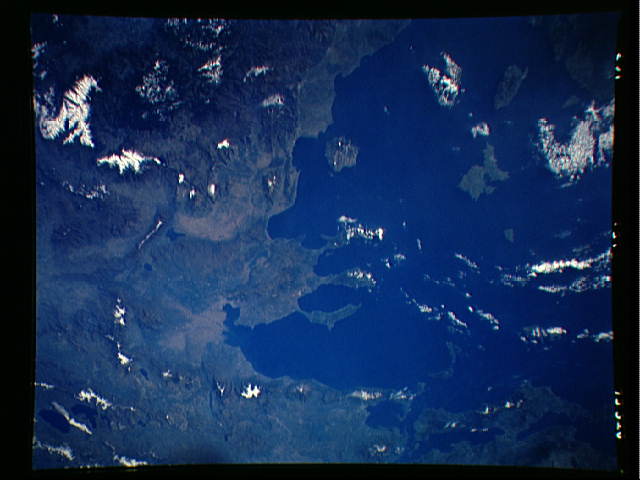
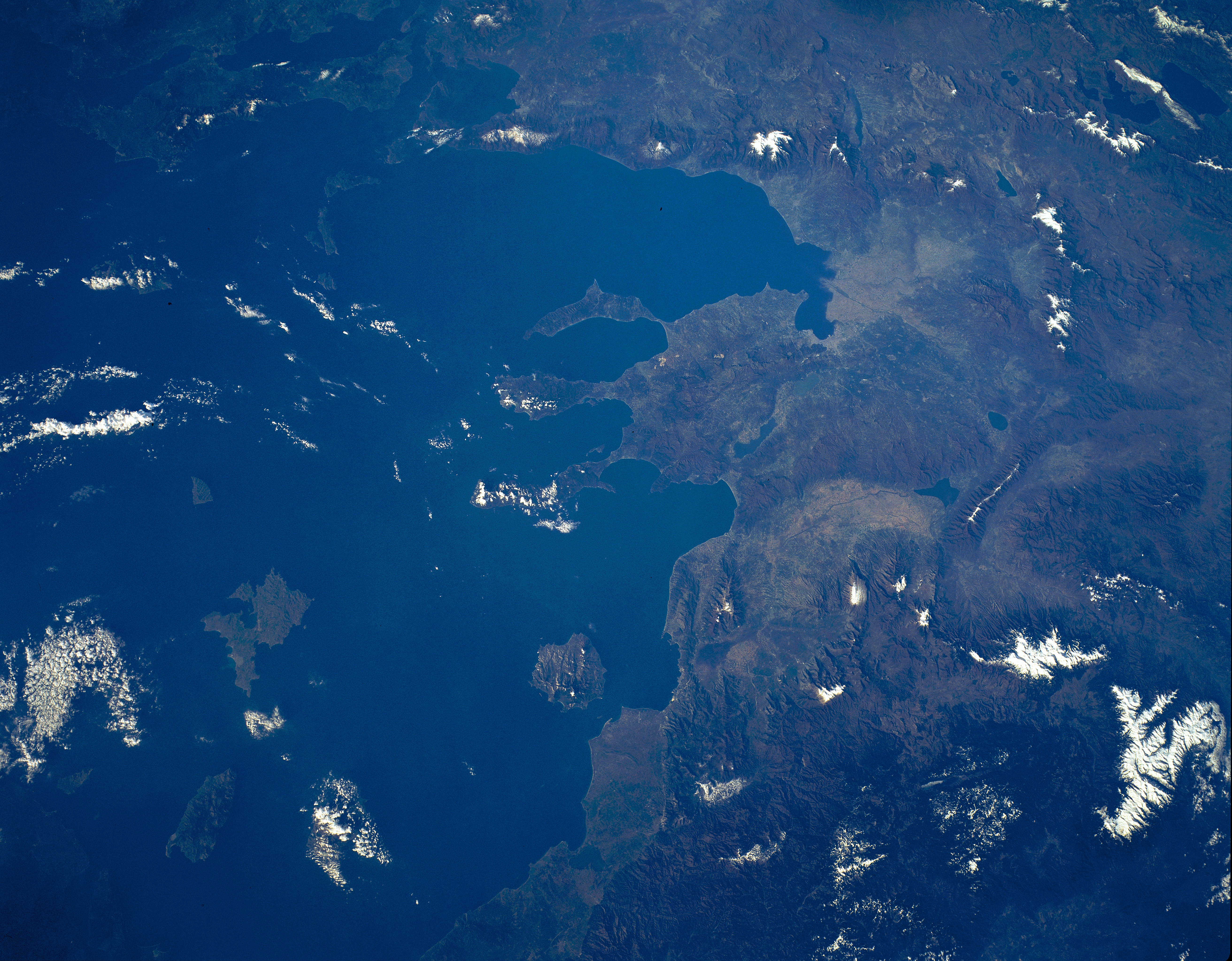
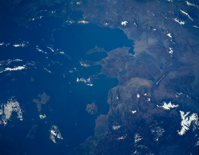
Image Caption: STS056-151-163 Rhodope Mountains, Struma River, Greece/Bulgaria April 1993
Covering the left portion of the image, the rugged, snow-capped Rhodope Mountains can be seen in this southeast-looking view. The Rhodope Mountains stretch northwest to southeast along the Bulgarian and Greek border 200 miles (320 km). They are forested and have very few passes. Just to the right (west) of the center of the image, the Struma River Valley is visible. The Struma River rises in the mountains of western Bulgaria (not visible in the image) and flows generally southeast for 216 miles (348 km) before emptying in the Strymonic Gulf (upper right), an arm of the Aegean Sea. Numerous canals have been constructed in the northern Struma River Valley (south of Kerkinis Lake) to support agriculture. To the right (west) of the river valley are the Pangaion Mountains, a low range of mountains that in ancient times were known for their gold and silver mines. West of the Pangaion Mountains is Voevi Lake.
Covering the left portion of the image, the rugged, snow-capped Rhodope Mountains can be seen in this southeast-looking view. The Rhodope Mountains stretch northwest to southeast along the Bulgarian and Greek border 200 miles (320 km). They are forested and have very few passes. Just to the right (west) of the center of the image, the Struma River Valley is visible. The Struma River rises in the mountains of western Bulgaria (not visible in the image) and flows generally southeast for 216 miles (348 km) before emptying in the Strymonic Gulf (upper right), an arm of the Aegean Sea. Numerous canals have been constructed in the northern Struma River Valley (south of Kerkinis Lake) to support agriculture. To the right (west) of the river valley are the Pangaion Mountains, a low range of mountains that in ancient times were known for their gold and silver mines. West of the Pangaion Mountains is Voevi Lake.
