STS056-110-81

| NASA Photo ID | STS056-110-81 |
| Focal Length | 250mm |
| Date taken | 1993.04.11 |
| Time taken | 02:10:48 GMT |
Resolutions offered for this image:
3904 x 3939 pixels 634 x 640 pixels 5700 x 6000 pixels 500 x 526 pixels 640 x 480 pixels
3904 x 3939 pixels 634 x 640 pixels 5700 x 6000 pixels 500 x 526 pixels 640 x 480 pixels
Cloud masks available for this image:
Spacecraft nadir point: 40.7° S, 147.5° E
Photo center point: 41.0° S, 147.5° E
Photo center point by machine learning:
Photo center point: 41.0° S, 147.5° E
Photo center point by machine learning:
Nadir to Photo Center: South
Spacecraft Altitude: 166 nautical miles (307km)
Country or Geographic Name: | AUSTRALIA-T |
Features: | ANDERSON BAY |
| Features Found Using Machine Learning: | |
Cloud Cover Percentage: | 5 (1-10)% |
Sun Elevation Angle: | 41° |
Sun Azimuth: | 0° |
Camera: | Hasselblad |
Focal Length: | 250mm |
Camera Tilt: | 6 degrees |
Format: | 2443: Kodak Aerochrome 2443, color IR, thin base, EA-5 process thru June 1999, E-6 process afterward |
Film Exposure: | Normal |
| Additional Information | |
| Width | Height | Annotated | Cropped | Purpose | Links |
|---|---|---|---|---|---|
| 3904 pixels | 3939 pixels | No | No | Earth From Space collection | Download Image |
| 634 pixels | 640 pixels | No | No | Earth From Space collection | Download Image |
| 5700 pixels | 6000 pixels | No | No | Download Image | |
| 500 pixels | 526 pixels | No | No | Download Image | |
| 640 pixels | 480 pixels | No | No | Download Image |
Download Packaged File
Download a Google Earth KML for this Image
View photo footprint information
Download a GeoTIFF for this photo
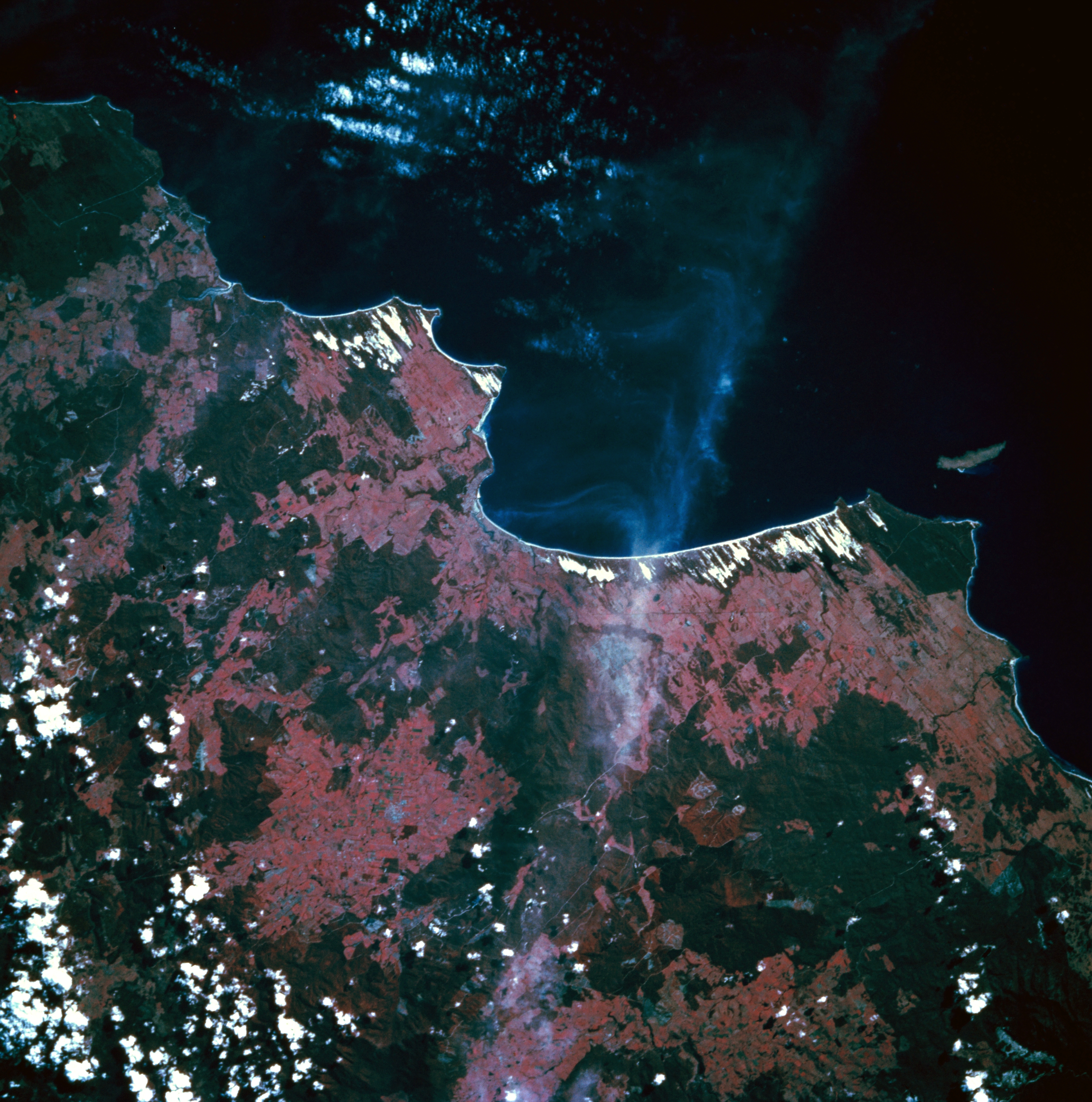
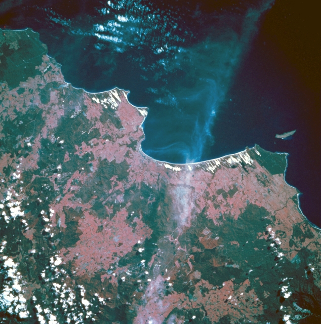
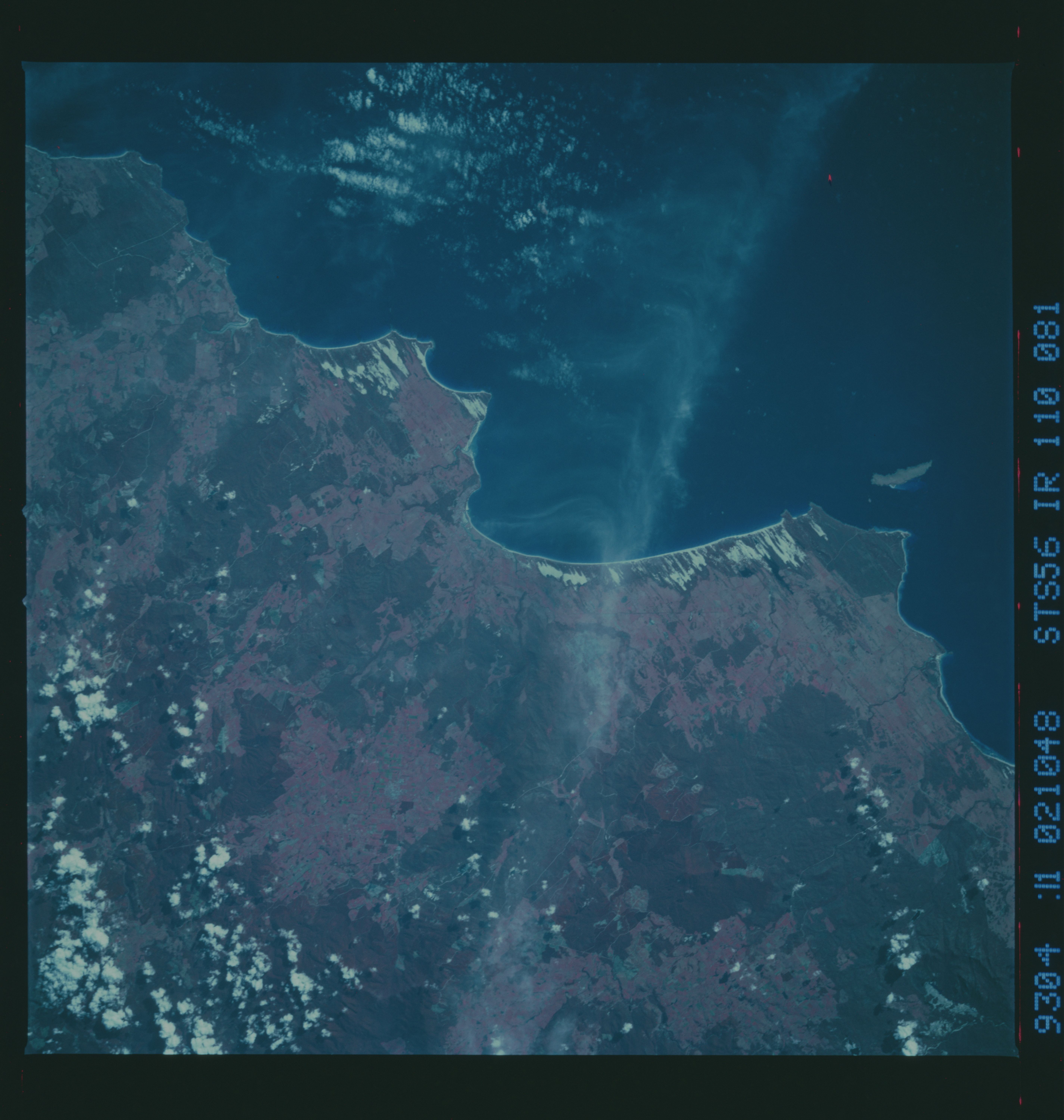
Image Caption: STS056-110-081 Anderson Bay, Tasmania, Australia April 1993
Although some clouds obscure parts of this color infrared image, Anderson Bay in northeast Tasmania is visible near the center of the picture. Notice the numerous, paralleling, linear white features along the east side of Anderson Bay coastline as well as the southeast shoreline of Noland Bay immediately west of Anderson Bay. These are sandy beaches and exposed sandy areas slightly inland from the beaches. The alignment of these sandy dunes indicates that the wind blows predominately from west to east across the landscape. The lighter, reddish terrain shows pastures and cultivated fields, while the darker, more uniformly colored areas are forested. Waterhouse Island is located northeast of Anderson Bay (right middle).
Although some clouds obscure parts of this color infrared image, Anderson Bay in northeast Tasmania is visible near the center of the picture. Notice the numerous, paralleling, linear white features along the east side of Anderson Bay coastline as well as the southeast shoreline of Noland Bay immediately west of Anderson Bay. These are sandy beaches and exposed sandy areas slightly inland from the beaches. The alignment of these sandy dunes indicates that the wind blows predominately from west to east across the landscape. The lighter, reddish terrain shows pastures and cultivated fields, while the darker, more uniformly colored areas are forested. Waterhouse Island is located northeast of Anderson Bay (right middle).
