STS056-109-27

| NASA Photo ID | STS056-109-27 |
| Focal Length | 250mm |
| Date taken | 1993.04.10 |
| Time taken | 15:16:12 GMT |
Resolutions offered for this image:
3904 x 3904 pixels 639 x 639 pixels 5700 x 6000 pixels 500 x 526 pixels 640 x 480 pixels
3904 x 3904 pixels 639 x 639 pixels 5700 x 6000 pixels 500 x 526 pixels 640 x 480 pixels

Cloud masks available for this image:
Spacecraft nadir point: 29.5° N, 101.6° W
Photo center point: 29.5° N, 101.0° W
Photo center point by machine learning:
Photo center point: 29.5° N, 101.0° W
Photo center point by machine learning:
Nadir to Photo Center: East
Spacecraft Altitude: 161 nautical miles (298km)
Country or Geographic Name: | USA-TEXAS |
Features: | AMISTAD RESERVOIR |
| Features Found Using Machine Learning: | |
Cloud Cover Percentage: | 0 (no clouds present) |
Sun Elevation Angle: | 36° |
Sun Azimuth: | 102° |
Camera: | Hasselblad |
Focal Length: | 250mm |
Camera Tilt: | 13 degrees |
Format: | 2443: Kodak Aerochrome 2443, color IR, thin base, EA-5 process thru June 1999, E-6 process afterward |
Film Exposure: | Normal |
| Additional Information | |
| Width | Height | Annotated | Cropped | Purpose | Links |
|---|---|---|---|---|---|
| 3904 pixels | 3904 pixels | No | No | Earth From Space collection | Download Image |
| 639 pixels | 639 pixels | No | No | Earth From Space collection | Download Image |
| 5700 pixels | 6000 pixels | No | No | Download Image | |
| 500 pixels | 526 pixels | No | No | Download Image | |
| 640 pixels | 480 pixels | No | No | Download Image |
Download Packaged File
Download a Google Earth KML for this Image
View photo footprint information
Download a GeoTIFF for this photo
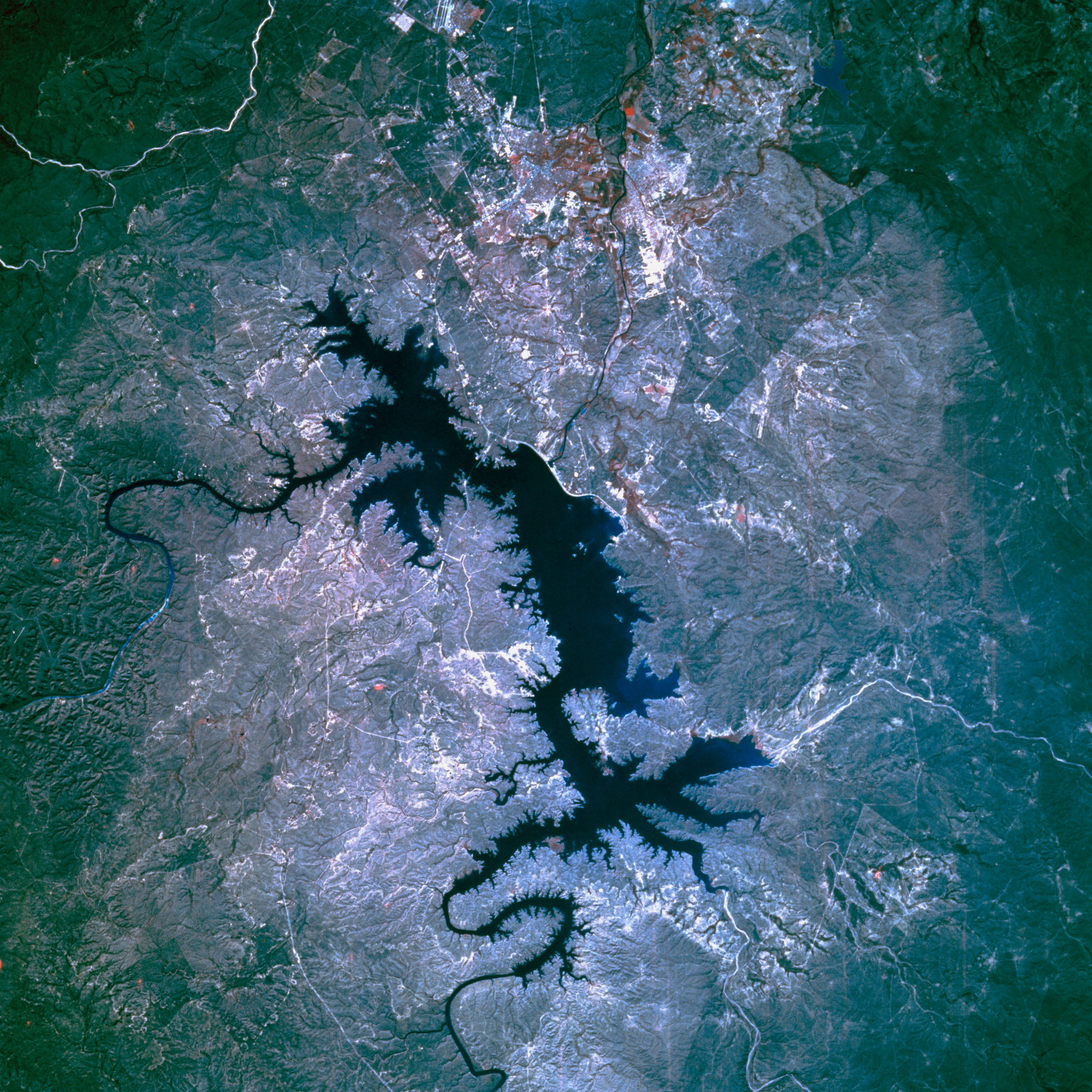
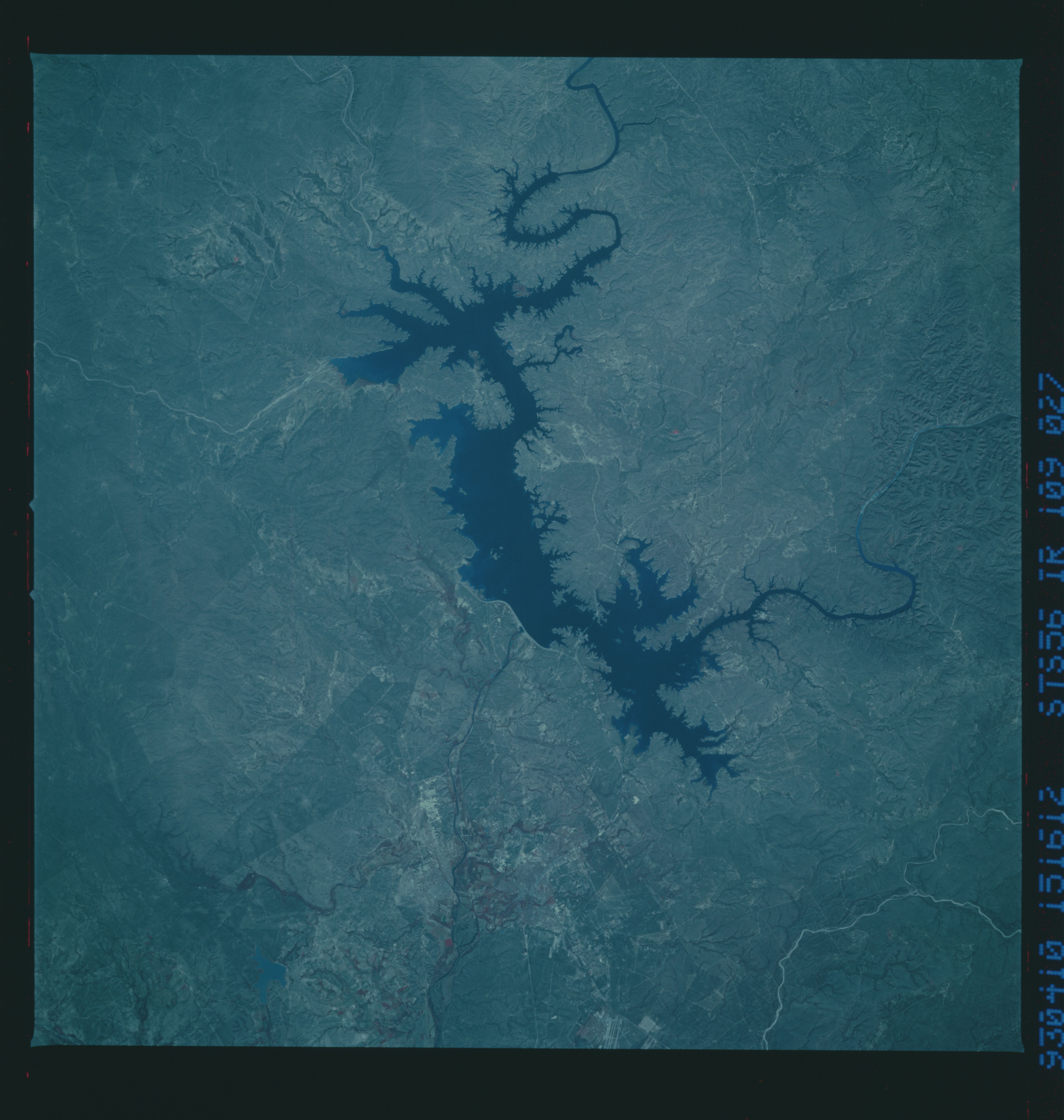
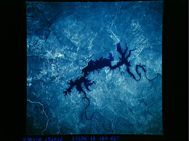
Image Caption: STS056-109-27 International Amistad Reservoir, Texas, U.S.A. April 1993
The color infrared film in this photograph is best used to map the land-water boundary around International Amistad Reservoir, a dammed section of the Rio Grande just northwest of Del Rio, whose infrastructure is not discernible. The Rio Grande enters the reservoir from the northwest, and Devils River flows into the northeast side. The dam is the thin, white feature south of the reservoir.
The color infrared film in this photograph is best used to map the land-water boundary around International Amistad Reservoir, a dammed section of the Rio Grande just northwest of Del Rio, whose infrastructure is not discernible. The Rio Grande enters the reservoir from the northwest, and Devils River flows into the northeast side. The dam is the thin, white feature south of the reservoir.
